National Register of Historic Places listings in Richland County, Wisconsin

Last updated

Location of Richland County in Wisconsin Map of Wisconsin highlighting Richland County.svg
Location of Richland County in Wisconsin

This is a list of the National Register of Historic Places listings in Richland County, Wisconsin. It is intended to provide a comprehensive listing of entries in the National Register of Historic Places that are located in Richland County, Wisconsin. The locations of National Register properties for which the latitude and longitude coordinates are included below may be seen in a map. [1]

Contents

There are 15 properties and districts listed on the National Register in the county.


    This National Park Service list is complete through NPS recent listings posted August 5, 2022. [2]

Map all coordinates using: OpenStreetMap  
Download coordinates as: KML

Current listings

[3] Name on the Register [4] ImageDate listed [5] Location City or townDescription
1 A. D. German Warehouse
A. D. German Warehouse A. D. German Warehouse Richland Center Wisconsin-born Frank Lloyd Wright.jpg
A. D. German Warehouse
December 31, 1974
(#74000122)
316 S. Church St.
43°20′00″N90°23′04″W / 43.333333°N 90.384444°W / 43.333333; -90.384444 (A. D. German Warehouse)
Richland Center Warehouse designed in Mayan Revival style in 1915 by Frank Lloyd Wright, native son of Richland Center. Alfred D. German was a wholesale distributor of cement, coal and grain. [6]
2 Bloyer Mound Group
Bloyer Mound Group Bloyer Mound Group.jpg
Bloyer Mound Group
September 18, 2006
(#06000873)
WI 60, 1,500 ft (460 m). SW of Cty Hwy 00
43°12′07″N90°24′36″W / 43.201944°N 90.41°W / 43.201944; -90.41 (Bloyer Mound Group)
Orion Well-preserved group of mounds built by ancient Native Americans near the Wisconsin River: 3 bird effigies, 2 lizards, 1 bear, eight linear mounds and 1 conical. A.k.a. Twin Lizard Mounds. On state land. [7] [8]
3 Julia B. and Fred P. Bowen House
Julia B. and Fred P. Bowen House Julia B and Fred P Bowen House.jpg
Julia B. and Fred P. Bowen House
July 5, 1996
(#96000729)
220 E. Union St.
43°20′15″N90°23′01″W / 43.3375°N 90.383611°W / 43.3375; -90.383611 (Julia B. and Fred P. Bowen House)
Richland Center Julia was the first president of Richland Center's Women's Club starting in 1882, and a pioneer for women's suffrage in Wisconsin. Fred built the house for her in 1869. Today it is a mix of Italianate and Colonial Revival styles. [9]
4 Clipped Wing Eagle Mound
Clipped Wing Eagle Mound Address restricted.PNG
Clipped Wing Eagle Mound
November 15, 2005
(#05001300)
Address Restricted
Eagle
5 Court Street Commercial Historic District
Court Street Commercial Historic District Court Street Commercial Historic District Richland Center.jpg
Court Street Commercial Historic District
November 13, 1989
(#89001955)
Roughly bounded by Mill, Church, Haseltine, and Main Sts.
43°20′09″N90°23′07″W / 43.335833°N 90.385278°W / 43.335833; -90.385278 (Court Street Commercial Historic District)
Richland Center The historic district in downtown Richland Center includes 50 commercial buildings in Late Victorian styles constructed from 1870 to 1938. [10]
6 Cunningham Lane Bridge
Cunningham Lane Bridge Cunningham Lane Bridge.JPG
Cunningham Lane Bridge
July 5, 1996
(#96000731)
Hansberry Lane, near Fancy Cr.
43°23′40″N90°24′45″W / 43.394444°N 90.4125°W / 43.394444; -90.4125 (Cunningham Lane Bridge)
Rockbridge Pratt full-slope pony truss bridge across the Pine River, built by the Chicago Bridge and Iron Company in 1895. One of the earliest remaining Pratt truss bridges in the state. [11]
7 Eagle Township Mound Group
Eagle Township Mound Group Address restricted.PNG
Eagle Township Mound Group
November 15, 2005
(#05001301)
Address Restricted
Eagle
8 Henry Fiedler House
Henry Fiedler House Henry Fiedler House.jpg
Henry Fiedler House
December 29, 1986
(#86003515)
Putnam and Washington Sts.
43°12′18″N90°25′32″W / 43.205°N 90.425556°W / 43.205; -90.425556 (Henry Fiedler House)
Orion 1860 house built of rough-coursed stone and barn built 1914. A.k.a. Ellen Hale House. [12]
9 Hunting Eagle Mound
Hunting Eagle Mound Address restricted.PNG
Hunting Eagle Mound
November 15, 2005
(#05001299)
Address Restricted
Eagle
10 Richland Center Archeological District
Richland Center Archeological District Address restricted.PNG
Richland Center Archeological District
September 30, 1993
(#93001006)
Address Restricted
Richland Center
11 Richland Center City Auditorium
Richland Center City Auditorium Richland Center City Auditorium.jpg
Richland Center City Auditorium
August 18, 1980
(#80000182)
182 N. Central Ave.
43°20′09″N90°23′08″W / 43.335833°N 90.385556°W / 43.335833; -90.385556 (Richland Center City Auditorium)
Richland Center The local Women's Club promoted a state law to allow municipalities to operate income-generating properties, and this was the first such property, built in 1912. Contains city offices, meeting rooms, and a 900-seat auditorium, which hosted minstrel shows, concerts, motion pictures, and lectures by William Jennings Bryan and William Howard Taft. [13]
12 Shadewald I Mound Group
Shadewald I Mound Group Address restricted.PNG
Shadewald I Mound Group
February 7, 2007
(#07000035)
north of Muscoda along 193
Eagle Township Well-preserved sequence of effigy mounds built by ancient Native Americans on a hilltop: possibly including beaver, bird, bison and coyote. A.k.a. Frank's Hill and Elder Group. [14] [15] (The first reference has great aerial photos online.)
13 Shadewald II Mound Group
Shadewald II Mound Group Address restricted.PNG
Shadewald II Mound Group
October 2, 2008
(#08000963)
north of Muscoda along 193
Eagle Township Well-preserved line of twelve conical mounds built by ancient Native Americans on a hilltop - possibly with some time-keeping purpose [14] (Summaries of I & II may be flipped in this list.)
14 Syttende Mai Site
Syttende Mai Site Address restricted.PNG
Syttende Mai Site
December 30, 1991
(#91001869)
Address Restricted
Richland
15 Tippesaukee Farm Rural Historic District
Tippesaukee Farm Rural Historic District Tippesaukee Farm Rural Historic District.jpg
Tippesaukee Farm Rural Historic District
January 4, 1996
(#92000827)
Jct. of WI Trunk Hwy. 60 and Co. Trunk Hwy. X, Town of Richwood
43°12′27″N90°34′36″W / 43.2075°N 90.576667°W / 43.2075; -90.576667 (Tippesaukee Farm Rural Historic District)
Port Andrew John Coumbe, the first settler in the county, built a log cabin here in 1838. He built the timbered barn in 1861 and the current farmhouse in 1863. Previously the site of a Ho-Chunk village named Tippesaukee. [16] This site was NRHP-listed as John Coumbe Farmstead on June 25, 1992, then subsumed by the larger historic district in 1996.

See also

Related Research Articles

National Register of Historic Places listings in Dane County, Wisconsin

This is a list of the National Register of Historic Places listings in Dane County, Wisconsin. It aims to provide a comprehensive listing of buildings, sites, structures, districts, and objects in Dane County, Wisconsin listed on the National Register of Historic Places.

National Register of Historic Places listings in Lake County, Illinois

This is a list of the National Register of Historic Places listings in Lake County, Illinois.

National Register of Historic Places listings in Clark County, Ohio

This is a list of the National Register of Historic Places listings in Clark County, Ohio.

National Register of Historic Places listings in Ashland County, Ohio

This is a list of the National Register of Historic Places listings in Ashland County, Ohio.

National Register of Historic Places listings in Sauk County, Wisconsin

This is a list of the National Register of Historic Places listings in Sauk County, Wisconsin. It is intended to provide a comprehensive listing of entries in the National Register of Historic Places that are located in Sauk County, Wisconsin. The locations of National Register properties for which the latitude and longitude coordinates are included below may be seen in a map.

National Register of Historic Places listings in Grant County, Wisconsin

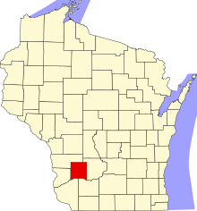
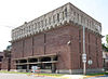
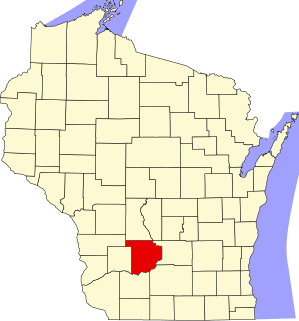
This is a list of the National Register of Historic Places listings in Grant County, Wisconsin. It is intended to provide a comprehensive listing of entries in the National Register of Historic Places that are located in Grant County, Wisconsin. The locations of National Register properties for which the latitude and longitude coordinates are included below may be seen in a map.

National Register of Historic Places listings in Crawford County, Wisconsin

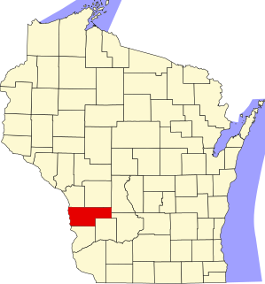
This is a list of the National Register of Historic Places listings in Crawford County, Wisconsin. It is intended to provide a comprehensive listing of entries in the National Register of Historic Places that are located in Crawford County, Wisconsin. The locations of National Register properties for which the latitude and longitude coordinates are included below may be seen in a map.

National Register of Historic Places listings in Allamakee County, Iowa

This is a list of the National Register of Historic Places listings in Allamakee County, Iowa.

National Register of Historic Places listings in Trempealeau County, Wisconsin

This is a list of the National Register of Historic Places listings in Trempealeau County, Wisconsin. It is intended to provide a comprehensive listing of entries in the National Register of Historic Places that are located in Trempealeau County, Wisconsin. The locations of National Register properties for which the latitude and longitude coordinates are included below may be seen in a map.

National Register of Historic Places listings in Douglas County, Wisconsin

This is a list of the National Register of Historic Places listings in Douglas County, Wisconsin. It is intended to provide a comprehensive listing of entries in the National Register of Historic Places that are located in Douglas County, Wisconsin. The locations of National Register properties for which the latitude and longitude coordinates are included below may be seen in a map.

National Register of Historic Places listings in Waushara County, Wisconsin

This is a list of the National Register of Historic Places listings in Waushara County, Wisconsin. It is intended to provide a comprehensive listing of entries in the National Register of Historic Places that are located in Waushara County, Wisconsin. The locations of National Register properties for which the latitude and longitude coordinates are included below may be seen in a map.

National Register of Historic Places listings in Vernon County, Wisconsin

This is a list of the National Register of Historic Places listings in Vernon County, Wisconsin, USA. It is intended to provide a comprehensive listing of entries in the National Register of Historic Places that are located in Vernon County, Wisconsin. The locations of National Register properties for which the latitude and longitude coordinates are included below may be seen in a map.

National Register of Historic Places listings in Oneida County, Wisconsin

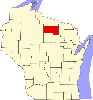
This is a list of the National Register of Historic Places listings in Oneida County, Wisconsin. It is intended to provide a comprehensive listing of entries in the National Register of Historic Places that are located in Oneida County, Wisconsin. The locations of National Register properties for which the latitude and longitude coordinates are included below may be seen in a map.

National Register of Historic Places listings in Calumet County, Wisconsin

This is a list of the National Register of Historic Places listings in Calumet County, Wisconsin. It is intended to provide a comprehensive listing of entries in the National Register of Historic Places that are located in Calumet County, Wisconsin. The locations of National Register properties for which the latitude and longitude coordinates are included below may be seen in a map.

National Register of Historic Places listings in Burnett County, Wisconsin

This is a list of the National Register of Historic Places listings in Burnett County, Wisconsin. It is intended to provide a comprehensive listing of entries in the National Register of Historic Places that are located in Burnett County, Wisconsin. The locations of National Register properties for which the latitude and longitude coordinates are included below may be seen in a map.

National Register of Historic Places listings in Dunn County, Wisconsin

This is a list of the National Register of Historic Places listings in Dunn County, Wisconsin. It is intended to provide a comprehensive listing of entries in the National Register of Historic Places that are located in Dunn County, Wisconsin. The locations of National Register properties for which the latitude and longitude coordinates are included below may be seen in a map.

National Register of Historic Places listings in Jackson County, Wisconsin

This is a list of the National Register of Historic Places listings in Jackson County, Wisconsin. It is intended to provide a comprehensive listing of entries in the National Register of Historic Places that are located in Jackson County, Wisconsin. The locations of National Register properties for which the latitude and longitude coordinates are included below may be seen in a map.

National Register of Historic Places listings in Juneau County, Wisconsin

This is a list of the National Register of Historic Places listings in Juneau County, Wisconsin. It is intended to provide a comprehensive listing of entries in the National Register of Historic Places that are located in Juneau County, Wisconsin. The locations of National Register properties for which the latitude and longitude coordinates are included below may be seen in a map.

National Register of Historic Places listings in Richland Parish, Louisiana

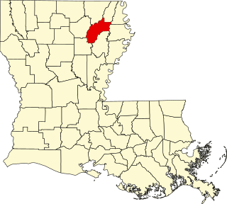
This is a list of the National Register of Historic Places listings in Richland Parish, Louisiana.

National Register of Historic Places listings in Madison, Wisconsin

This is a list of the National Register of Historic Places listings in Madison, Wisconsin.

References

  1. The latitude and longitude information provided is primarily from the National Register Information System, and has been found to be fairly accurate for about 99% of listings. For 1%, the location info may be way off. We seek to correct the coordinate information wherever it is found to be erroneous. Please leave a note in the Discussion page for this article if you believe any specific location is incorrect.
  2. National Park Service, United States Department of the Interior, "National Register of Historic Places: Weekly List Actions", retrieved August 5, 2022.
  3. Numbers represent an alphabetical ordering by significant words. Various colorings, defined here, differentiate National Historic Landmarks and historic districts from other NRHP buildings, structures, sites or objects.
  4. "National Register Information System". National Register of Historic Places . National Park Service. April 24, 2008.
  5. The eight-digit number below each date is the number assigned to each location in the National Register Information System database, which can be viewed by clicking the number.
  6. Sullivan, Mary Ann. "A. D. German Warehouse". Bluffton College. Retrieved 2013-01-07.
  7. "Twin Lizard Mound Group". WisconsinMounds.com. Retrieved 2013-01-07.
  8. "Orion Mussel Bed (No. 298)". Wisconsin State Natural Areas Program. Wisconsin Department of Natural Resources. Retrieved 2013-01-07.
  9. "Bowen, Julia B. and Fred P., House". Wisconsin Historical Society. Retrieved 2013-01-11.
  10. "Court Street Commercial Historic District". Wisconsin National Register of Historic Places. Wisconsin Historical Society. Retrieved 2013-01-11.
  11. "Fiedler, Henry and Louisa, House". Architecture and History Inventory. Wisconsin Historical Society. Retrieved 2014-09-02.
  12. "Richland Center City Auditorium". Wisconsin Historical Society. Retrieved 2013-01-10.
  13. 1 2 "Shadewald Mounds". WisconsinMounds.com. Retrieved 2013-01-07.
  14. Schoenebeck, Kevin (December 2012 – January 2013). "Frank's Hill is Tops". Our Wisconsin. Roy Reiman. 1 (1): 4–5.
  15. "John and Sara Coumbe Farmstead". Wisconsin Historical Society. Retrieved 2013-01-10.