Neunkirchen am Brand

Last updated
Neunkirchen am Brand
Neunkirchena-Brand-Kirchplatz.jpeg
Center of Neunkirchen with timbered houses and the old deanery near St.-Michaels Church (right side of the image)
DEU Neunkirchen am Brand COA.svg
Coat of arms
Location of Neunkirchen am Brand within Forchheim district
Neunkirchen am Brand in FO.svg
Germany adm location map.svg
Red pog.svg
Neunkirchen am Brand
Bavaria location map.svg
Red pog.svg
Neunkirchen am Brand
Coordinates: 49°37′N11°08′E / 49.617°N 11.133°E / 49.617; 11.133 Coordinates: 49°37′N11°08′E / 49.617°N 11.133°E / 49.617; 11.133
Country Germany
State Bavaria
Admin. region Oberfranken
District Forchheim
Government
   Mayor (202026) Martin Walz [1] (CSU)
Area
  Total26.37 km2 (10.18 sq mi)
Elevation
317 m (1,040 ft)
Population
 (2020-12-31) [2]
  Total8,181
  Density310/km2 (800/sq mi)
Time zone UTC+01:00 (CET)
  Summer (DST) UTC+02:00 (CEST)
Postal codes
91077
Dialling codes 09134
Vehicle registration FO
Website www.neunkirchen-am-brand.de

Neunkirchen am Brand is a municipality in the district of Forchheim in Bavaria in Germany.

Contents

History

Important dates are the founding of the Canons Regular of Saint Augustine monastery, Neunkirchen am Brand monastery, in 1314 and the conferment of the status as market town in 1410. In 1803 Neunkirchen along with the Prince-Bishopric of Bamberg became part of Bavaria. Between 1886 and 1963 Neunkirchen was located near a train route from Erlangen to Eschenau.

After the Second World War, refugees settled in Neunkirchen and after the establishment of Siemens AG in Erlangen the town experienced a dramatic increase in inhabitants. Numerous suburbs were built around the traditional center of the town.

Neunkirchen is also the home of a number of industrial and trade companies. The largest industrial employer is the axles factory, the Neunkirchener Achsenfabrik (NAF).

Districts

There are the following districts (pop. statistics as of December 31, 2006):

Furthermore, there the farms Vogelhof, Erleinhof and Saarmühle.

Sights and culture

The town is marked by well preserved gates, the former Neunkirchen am Brand Monastery, countless timbered houses and a Middle Age warehouse known as a Zehntscheune. In the district of Großenbuch, the Kugler family operates a restaurant that has existed in that location since the 1500s.

Buildings

In the district of Ermreuth, the former synagogue was restored as a venue for various events. Worth seeing in this districts are also the church and the castle.

Regular events

Twin towns

Related Research Articles

Wasserburg am Inn Place in Bavaria, Germany

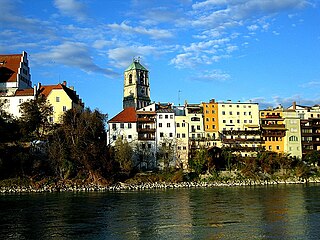
Wasserburg am Inn is a town in Rosenheim district in Upper Bavaria, Germany. The historic centre is a peninsula formed by the meandering river Inn. Many Medieval structures remain intact, giving the city a unique view.

Mühldorf Place in Bavaria, Germany

Mühldorf am Inn is a town in Bavaria, Germany, and the capital of the district Mühldorf on the river Inn. It is located at 48°14′30″N12°31′30″E, and had a population of about 17,808 in 2005.

Schäftlarn Place in Bavaria, Germany

Schäftlarn is a municipality in the district of Munich in Bavaria in Germany. It consists of the villages Ebenhausen, Hohenschäftlarn, Kloster Schäftlarn, Neufahrn and Zell. The river Isar runs through it. A human settlement with the name "Schäftlarn" does not exist.

Hilpoltstein Place in Bavaria, Germany

Hilpoltstein is a town in the district of Roth, in Bavaria, Germany. It is situated 10 km southeast of Roth bei Nürnberg and 30 km south of Nuremberg, close to the lake 'Rothsee.

Osterhofen Place in Bavaria, Germany

Osterhofen is a town in the district of Deggendorf, in Bavaria, Germany. It is situated on the right bank of the Danube, 16 km south of Deggendorf.

Baiersdorf Place in Bavaria, Germany

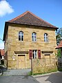
Baiersdorf is a town in the district of Erlangen-Höchstadt, in northern Bavaria, Germany.

Schlüsselfeld Place in Bavaria, Germany

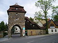
Schlüsselfeld is a town on the southwestern edge of the Upper Franconian district of Bamberg

Seßlach Place in Bavaria, Germany

Seßlach is a town in the district of Coburg, in northern Bavaria, Germany. It is situated 12 km southwest of Coburg and has a population close to 4,000.

Wallerstein, Bavaria Place in Bavaria, Germany

Wallerstein is a municipality and former principality in the district of Donau-Ries in Bavaria in Germany.

Bad Bocklet Place in Bavaria, Germany

Bad Bocklet is a municipality in the district of Bad Kissingen in Bavaria in Germany. It is a market town and a health spa.

Weidenberg Place in Bavaria, Germany

Weidenberg is a municipality in the district of Bayreuth in Bavaria in Germany. The Ölschnitz river discharges near Weidenberg-Neunkirchen into the Red Main.

Pastetten Place in Bavaria, Germany

Pastetten is a municipality in the district of Erding in Bavaria in Germany. It is a rural municipality in the south of the district. The town was founded about one thousand years ago along the road from Swabia to Erding.

Buckenhof Place in Bavaria, Germany

Buckenhof is a town in the district of Erlangen-Höchstadt, in Bavaria, Germany.

Uttenreuth Place in Bavaria, Germany

Uttenreuth is a town in the district of Erlangen-Höchstadt in Bavaria in Germany.

Dießen am Ammersee Place in Bavaria, Germany

Dießen am Ammersee is a municipality in the district of Landsberg in Bavaria in Germany. It is located on the shores of the Ammersee.

Neufahrn in Niederbayern Place in Bavaria, Germany

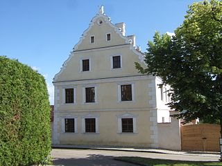
Neufahrn i. NB or Neufahrn in Niederbayern is a municipality in the district of Landshut in Bavaria in Germany. Its Bavarian name is Neifing.

Gmund am Tegernsee Place in Bavaria, Germany

Gmund am Tegernsee is a municipality in the district of Miesbach in Bavaria in Germany. The town is located on the north shore of the Tegernsee Lake, and near the source of River Mangfall. It is 46 kilometres (29 mi) from Munich and 15 kilometres (9.3 mi) from the district capital, the town of Miesbach.

Mitterfels Place in Bavaria, Germany

Mitterfels is a municipality in the district of Straubing-Bogen in Bavaria, Germany. It is the head of the Verwaltungsgemeinschaft Mitterfels.

Pleinfeld Place in Bavaria, Germany

Pleinfeld is a Franconian municipality and market town in the Weißenburg-Gunzenhausen district, in the German state of Bavaria. It is situated in the Metropolitan Area of Nuremberg and in the Franconian Lake District. Pleinfeld is a nationally recognized recreation area.

Neukirchen, Lower Bavaria Place in Bavaria, Germany

Neukirchen is a municipality in the district of Straubing-Bogen in Bavaria, Germany. It is located in the Donau-Wald region in the Bavarian Forest.

References

  1. Liste der ersten Bürgermeister/Oberbürgermeister in kreisangehörigen Gemeinden, Bayerisches Landesamt für Statistik, 15 July 2021.
  2. "Tabellenblatt "Daten 2", Statistischer Bericht A1200C 202041 Einwohnerzahlen der Gemeinden, Kreise und Regierungsbezirke". Bayerisches Landesamt für Statistik und Datenverarbeitung (in German). June 2021.