
The Banggai Regency is a regency located at the eastern end of Central Sulawesi Province of Indonesia. It makes up a re-established regency (kabupaten), created on 4 October 1999 by splitting the existing Banggai Regency into this smaller Banggai Regency situated on the mainland of Sulawesi and a new Banggai Islands Regency comprising the offshore islands to the southeast which are separated from mainland Sulawesi by the Peleng Straits. The residual Banggai Regency covers an area of 9,672.70 km2 and had a population of 323,626 at the 2010 census and 362,275 at the 2020 census; the official estimate as at mid 2023 was 373,693.

Gorontalo is a regency of Gorontalo Province, Indonesia, on the island of Sulawesi. It was established in 1959 under Law Number 29/1959, but has subsequently been reduced in area as additional regencies have been cut out of it. It now has an area of 2,189.08 km2 and had a population of 355,988 at the 2010 Census and 393,107 at the 2020 Census; the official estimate as at mid 2023 was 418,244. The administrative headquarters of the regency is in the town of Limboto.

North Bengkulu is a regency of Bengkulu Province, Indonesia, on the island of Sumatra. It originally covered much of the northern part of Bengkulu Province, but on 25 February 2003 the most northwesterly districts were split off to form a separate Mukomuko Regency, and on 24 June 2008 the most southeastern districts were likewise split off to create a new Central Bengkulu Regency. The residual regency now covers an area of 4,424.59 km2, and it had a population of 257,675 at the 2010 Census and 296,523 at the 2020 Census; the official estimate as at mid 2022 was 302,833. The administrative centre is at the town of Arga Makmur.
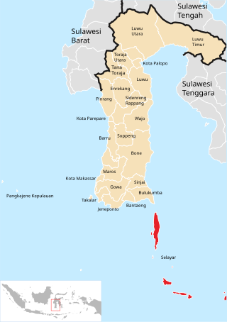
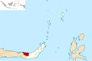
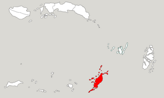
The Selayar Islands Regency is a regency of Indonesia in South Sulawesi province that covers the Selayar Islands, which lie southeast of the southern peninsula of Sulawesi. The archipelago consists of the group's main island, which is surrounded by 41 smaller islands around its coast; further to the southeast lies a widespread group of islands, including the smaller but still substantial islands of Pasimassunggu, Pasimarannu and Pasilambena in the far south, and the huge atoll of Takabonerate. The regency covers an area of 1,357.03 km2, and had a population of 103,596 at the 2000 Census, 122,055 at the Census of 2010 and 137,071 at that of 2020. The official estimate for mid 2023 was 142,100. The administrative centre is the town of Benteng on Selayar Island. The Selayar Straits separate the regency from Sulawesi island.

Aceh Singkil Regency is a regency in the Aceh province of Indonesia. It is situated largely on the island of Sumatra, but also includes the offshore Banyak Islands, the largest of which is Tuangku, with the principal town of Alaban. The regency was created on 20 April 1999 from the former southern districts of South Aceh Regency. Until 2007 it included the large town of Subulussalam, but on 2 January of that year that town was split off to become an autonomous city. The seat of the Aceh Singkil Regency government is at the port of Singkil on the Sumatra coast. The Regency now covers an area of 1,857.88 km2, and had a population of 102,509 at the 2010 Census, rising to 114,326 at the 2015 Census and to 126,514 at the 2020 Census; the official estimate as at mid 2023 was 135,435.

Boalemo is a regency of Gorontalo Province, Indonesia. It is located on the northern peninsula of the island of Sulawesi. It was established in 1999 under Law Number 50/1999. It has an area of 1,830.87 km2, and had a population of 129,253 at the 2010 Census and 145,868 at the 2020 census; the official estimate as at mid 2023 was 151,337. The seat of the regency administration is the town of Tilamuta.

Bone Bolango is a regency of Gorontalo Province, Indonesia, on the island of Sulawesi. It was established in 2003 under Law Number 6/2003from the former eastern districts of Gorontalo Regency. It has an area of 1,915.44 km2 and had a population of 141,915 at the 2010 Census and 162,778 at the 2020 Census; the official estimate as at mid 2023 was 172,301. The administrative centre of the regency is the town of Suwawa.

Pohuwato is a regency of Gorontalo Province, Indonesia. It is located on the northern peninsula of the island of Sulawesi. It was established on 25 February 2003 under Law Number 6/2003 by splitting off from the western part of Boalemo Regency. It has an area of 4,244.31 km2, and had a population of 128,748 at the 2010 Census and 146,432 at the 2020 Census; the official estimate as at mid 2023 was 160,187. The seat of the regency administration is in the town of Marisa.

Nias Regency is a regency in North Sumatra province, Indonesia; it lies on the east side of Nias Island. The regency originally covered the entire island, but was reduced to the northern half, with an area of 3,495.39 square kilometres, following the creation of the new regency of Nias Selatan on 25 February 2003. It was further reduced by the creation of the new regencies of Nias Utara and Nias Barat and the independent municipality of Gunungsitoli from other parts of Nias Regency on 29 October 2008. Since the separation of the new regencies and municipality, the reduced Regency now covers 853.44 km2 of land in the eastern part of the island, and had a population of 131,377 at the 2010 Census and 146,672 at the 2020 Census; the official estimate as at mid 2023 was 153,658. Its seat is the town of Gido.

North Padang Lawas is a landlocked regency in the North Sumatra province of Indonesia. It has an area of 3,918.05 km2, and had a population of 223,049 at the 2010 census and 260,720 at the 2020 census; the official estimate as of mid-2023 was 275,448. North Padang Lawas Regency was created on 17 July 2007 from the eastern parts of the South Tapanuli Regency. Its administrative seat is the town of Gunung Tua.

Supiori Regency is a regency in the Indonesian province of Papua. The Regency has an area of 634.24 km2 including the Aruri Islands group to the south, and had a population of 15,874 at the 2010 Census and 22,547 at the 2020 Census; the official estimate as at mid 2022 was 23,247 - comprising 12,056 males and 11,191 females. Until 8 January 2004, this area was part of the Biak Numfor Regency, from which it was split off in accordance with the Law dated 18 December 2003.

Manggarai Regency is a regency in East Nusa Tenggara province of Indonesia, situated on the island of Flores. Established in 1958 the regency was reduced in size and population by the separation of the more western districts to form West Manggarai Regency in 2003 and of the more eastern districts to form East Manggarai Regency in 2007. The area of the residual Manggarai Regency is 1,343.83 km2 and its population was 292,037 at the 2010 census and 312,855 at the 2020 census; the official estimate as at mid 2023 was 328,758. The capital of the regency is the town of Ruteng.

Kolaka Regency is a regency of Southeast Sulawesi Province, Indonesia. It covers an area of 2,960.73 km2 (1,143.14 sq mi) and had a population of 208,817 at the 2010 Census, rising to 237,587 at the 2020 Census; the official estimate as at mid 2023 was 247,680. The principal town lies at Kolaka.

North Konawe Regency is a regency of Southeast Sulawesi Province, Indonesia. It was formed on 2 January 2007 by splitting off seven of the northern districts of Konawe Regency to form a new North Konawe Regency. It is surrounded on all landward sides by the remaining area of the Konawe Regency, except in the northeast, where it borders on Sulawesi Tengah Province. It covers a land area of 5,101.76 km2. It had a population of 51,447 at the 2010 Census and 67,871 at the 2020 Census; the official estimate as at mid 2023 was 77,391 - comprising 39,823 males and 37,568 females. The principal town lies at Asera.
North Bolaang Mongondow Regency is a regency of North Sulawesi Province of Indonesia. It was created on 2 January 2007 by splitting off districts which were previously part of Bolaang Mongondow Regency. The regency covers an area of 1,672.61 km2 and had a population of 70,693 at the 2010 Census and 83,112 at the 2020 Census; the official estimate as at mid 2022 was 84,543. Bitauna is the only official town (kelurahan) in the regency, but the administrative centre is at Boroko.

North Minahasa Regency is a regency in North Sulawesi, Indonesia. Its capital is Airmadidi. It was originally part of the Minahasa Regency until it was split off and established as a separate regency on 20 November 2003. It covers an area of 1,059.24 km2, and had a population of 188,904 at the 2010 Census; this had risen to 224,993 at the 2020 Census, and the official estimate as at mid 2022 was 229,368. The Regency includes the offshore islands of Bangka and Talisei to the north of Sulawesi, and Mantenang and Naeng Besar to the northwest.

Southwest Maluku Regency is a regency of Maluku Province, Indonesia. Geographically it forms the most eastern portion of the Lesser Sunda Islands, although it has never been administratively included with them, and politically has always comprised a part of the Maluku Province. It comprises a number of islands and island groups in the south of the province, including Lirang Island, Wetar Island, Kisar Island, Romang Island, the Letti Islands, the Damer Islands, the Sermata Islands and the Babar Islands. The total land area is 4,581.06 km2, and the population was 70,714 at the 2010 Census and 81,928 at the 2020 Census; the official estimate as at mid 2023 was 93,766.
Tanimbar Islands Regency is a regency of Maluku province, Indonesia, consisting primarily of the Tanimbar Islands. The Regency covers a land area of 10,102 km2, and it had a population of 105,341 at the 2010 Census and 123,572 at the 2020 Census; the official estimate as at mid 2022 was 124,787. The principal town and administrative centre lies at Saumlaki in Tanimbar Selatan District.
North Morowali Regency is a regency in the province of Central Sulawesi, Indonesia. The regency was established on 12 April 2013, partitioned from the northwestern districts of Morowali Regency. It covers an area of 10,004.28 km2 and the component districts which were then in Morowali Regency had a combined population of 104,094 at the 2010 Census. The new regency had 120,789 inhabitants at the 2020 Census; the official estimate as at mid 2023 was 126,049. The principal town lies at Kolonodale.
West Muna Regency is a new regency of Southeast Sulawesi Province of Indonesia,and is situated in the northwest corner of Muna Island and smaller ilsands of its coast. It was established under Act No.14 of 2014, dated 23 July 2014 by separation from the Muna Regency. It covers an area of 906.28 km2, and the districts comprising it had a population of 71,632 at the 2010 Census; the 2020 Census resulted in a population of 84,590, and the official estimate as at mid 2022 was 85,706, comprising 42,242 males and 43,464 females. The administrative centre lies at Laworo in the Tiworo Islands District.

