
The Appalachian Mountains, often called the Appalachians, are a system of mountains in eastern to northeastern North America. The Appalachians first formed roughly 480 million years ago during the Ordovician Period. They once reached elevations similar to those of the Alps and the Rocky Mountains before experiencing natural erosion. The Appalachian chain is a barrier to east–west travel, as it forms a series of alternating ridgelines and valleys oriented in opposition to most highways and railroads running east–west.

Thurmond is a town in Fayette County, West Virginia, United States, on the New River. The population was five at the 2020 census. During the heyday of coal mining in the New River Gorge, Thurmond was a prosperous town with a number of businesses and facilities for the Chesapeake and Ohio Railway.

The Blue Ridge Mountains are a physiographic province of the larger Appalachian Mountains range. The mountain range is located in the Eastern United States, and extends 550 miles southwest from southern Pennsylvania through Maryland, West Virginia, Virginia, North Carolina, South Carolina, Tennessee, and Georgia. This province consists of northern and southern physiographic regions, which divide near the Roanoke River gap. To the west of the Blue Ridge, between it and the bulk of the Appalachians, lies the Great Appalachian Valley, bordered on the west by the Ridge and Valley province of the Appalachian range.

The New River is a river which flows through the U.S. states of North Carolina, Virginia, and West Virginia before joining with the Gauley River to form the Kanawha River at the town of Gauley Bridge, West Virginia. Part of the Ohio River watershed, it is about 360 miles (580 km) long.

State Route 120 is a state highway in the central part of California, connecting the San Joaquin Valley with the Sierra Nevada, Yosemite National Park, and the Mono Lake area. Its western terminus is at Interstate 5 in Lathrop, and its eastern terminus at U.S. Route 6 in Benton. While the route is signed as a contiguous route through Yosemite, the portion inside the park is federally maintained and is not included in the state route logs. The portion at Tioga Pass at Yosemite's eastern boundary is the highest paved through road in the California State Route system. This part is not maintained in the winter and is usually closed during the winter season.

Kirby is an unincorporated community in Hampshire County in the U.S. state of West Virginia situated along Grassy Lick Run, a tributary of North River. Kirby is located south of Romney at the crossroads of Grassy Lick Road and Rock Oak Road.

A bateau or batteau is a shallow-draft, flat-bottomed boat which was used extensively across North America, especially in the colonial period and in the fur trade. It was traditionally pointed at both ends but came in a wide variety of sizes. The name derives from the French word, bateau, which is simply the word for boat and the plural, bateaux, follows the French, an unusual construction for an English plural. In the southern United States, the term is still used to refer to flat-bottomed boats, including those elsewhere called jon boats.
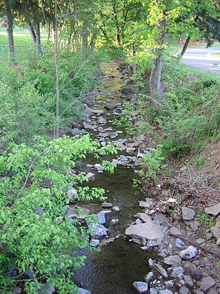
Big Run is a 4.4-mile-long (7.1 km) tributary stream of the South Branch Potomac River, belonging to the Potomac River and Chesapeake Bay watersheds. Big Run flows through the city of Romney and the campus of the West Virginia Schools for the Deaf and Blind in Hampshire County, West Virginia. The stream is known by local residents as Town Run and Town Creek.

North Fork Mountain is a quartzite-capped mountain ridge in the Ridge and Valley physiographic province of the Allegheny Mountains, also known as the High Alleghenies or Potomac Highlands, of eastern West Virginia. Kile Knob, at 4,588 feet, is the mountain's highest point, and Panther Knob and Pike Knob are nearly as high.

Center Branch Wildlife Management Area is located on 975 acres (395 ha) in Harrison County near Stonewood, West Virginia. The WMA is located on a former strip mine site, and contains several flat benches and high walls. Second growth oak-hickory and mixed hardwoods forests cover much of the land.
Garrett State Forest is a state forest located in the state of Maryland northwest of Oakland.

U.S. Route 19 (US 19) runs south to north up through central West Virginia. The route runs from the Virginia state line at Bluefield, north to the Pennsylvania state line south of Mount Morris, Pennsylvania.
Flat Top is an unincorporated community in Mercer County, West Virginia, United States. Flat Top is located on U.S. Route 19, 19 miles (31 km) south of Beckley.

Spruce Mountain, located in eastern West Virginia, is the highest ridge of the Allegheny Mountains. The whale-backed ridge extends for only 16 miles (26 km) from northeast to southwest, but several of its peaks exceed 4,500 feet (1,400 m) in elevation. The summit, Spruce Knob, is the highest Allegheny Mountain point both in the state and the entire range, which spans four states.

Burke Centre is a planned residential community located west of Burke in Fairfax County, Virginia, United States. Burke Centre is a planned community managed by the Burke Centre Conservancy homeowners' association (HOA).

Fair Oaks is a census-designated place in Fairfax County, Virginia, United States. The population as of the 2010 census was 30,223. It encompasses a large area west of the city of Fairfax, centered on Fair Oaks Mall. Suburban neighborhoods and office parks occupy most of Fair Oaks, largely developed since the 1980s.

Flat Top Mountain is a mountain ridge within the Allegheny Mountains in Southern West Virginia, United States.


