Odell, Oregon

Last updated

Odell, Oregon
Odell Oregon.jpg
Odell with the Mount Hood Railroad
Hood River County Oregon Incorporated and Unincorporated areas Odell Highlighted.svg
Location of Odell, Oregon
Coordinates: 45°37′47″N121°32′44″W / 45.62972°N 121.54556°W / 45.62972; -121.54556
Country United States
State Oregon
County Hood River
Area
[1]
  Total2.02 sq mi (5.23 km2)
  Land2.02 sq mi (5.23 km2)
  Water0.00 sq mi (0.00 km2)
Elevation
722 ft (220 m)
Population
 (2020) [2]
  Total2,328
  Density1,153.05/sq mi (445.27/km2)
Time zone UTC-8 (Pacific (PST))
  Summer (DST) UTC-7 (PDT)
ZIP code
97044
Area code 541
FIPS code 41-54550 [3]
GNIS feature ID1147153 [4]

Odell is an unincorporated community and census-designated place (CDP) in Hood River County, Oregon, United States. [5] Odell was named for an early pioneer, William Odell, a native of Tennessee by way of California, who settled in the area in 1861. The population was 2,255 as of the 2010 census. [6]

Contents

Geography

Odell is in northeastern Hood River County, in the valley of Odell Creek, a tributary of the Hood River. It is 7 miles (11 km) south of the city of Hood River, the county seat. According to the United States Census Bureau, the CDP has a total area of 2.0 square miles (5.2 km2), all land. [7]

Climate

This region experiences warm (but not hot) and dry summers, with no average monthly temperatures above 71.6 °F. According to the Köppen Climate Classification system, Odell has a warm-summer Mediterranean climate, abbreviated "Csb" on climate maps. [8]

Demographics

Historical population
CensusPop.Note
2020 2,328
U.S. Decennial Census [9] [2]

As of the census [3] of 2000, there were 1,849 people, 573 households, and 468 families residing in this unincorporated community. The population density was 923.2 inhabitants per square mile (356.4/km2). There were 594 housing units at an average density of 296.6 per square mile (114.5/km2). The racial makeup of this unincorporated community was 66.47% White, 0.49% Black or African American, 0.87% Native American, 0.43% Asian, 29.58% from other races, and 2.16% from two or more races. Hispanic or Latino of any race were 40.02% of the population.

There were 573 households, out of which 45.2% had children under the age of 18 living with them, 68.4% were married couples living together, 8.4% had a female householder with no husband present, and 18.2% were non-families. 14.1% of all households were made up of individuals, and 7.2% had someone living alone who was 65 years of age or older. The average household size was 3.19 and the average family size was 3.51.

In this unincorporated community the population was spread out, with 33.9% under the age of 18, 8.7% from 18 to 24, 29.9% from 25 to 44, 18.0% from 45 to 64, and 9.6% who were 65 years of age or older. The median age was 30 years. For every 100 females, there were 97.5 males. For every 100 females age 18 and over, there were 97.7 males.

The median income for a household in this unincorporated community was $36,991, and the median income for a family was $37,065. Males had a median income of $30,300 versus $16,983 for females. The per capita income for this unincorporated community was $18,023. About 11.1% of families and 12.9% of the population were below the poverty line, including 14.6% of those under age 18 and none of those age 65 or over.

Notable people

Baseball player and evangelist Billy Sunday owned a fruit orchard in the Odell area. [10]

Related Research Articles

<span class="mw-page-title-main">Cherryland, California</span> Unincorporated Community in California, United States

Cherryland is an unincorporated community and census-designated place (CDP) in Alameda County, California, United States. Cherryland is located between Ashland to the north and the city of Hayward to the south. The population was 15,808 at the 2020 census.

Westwood is a census-designated place in Boyd County, Kentucky, United States. The population was 4,387at the 2020 census. A suburb of Ashland, the two cities are closely affiliated, sharing a ZIP code and bus system. Westwood is located on a flat to hilly elevation just west of the Ohio River. The flat hilltop is unusual to eastern Kentucky and was created by the preglacial Teays River which existed in ancient times and flowed in the opposite direction of the Ohio River. Westwood is part of the Huntington–Ashland metropolitan area.

<span class="mw-page-title-main">Clancy, Montana</span> Census-designated place in Montana, United States

Clancy is an unincorporated community and census-designated place (CDP) in Jefferson County, Montana, United States. The population was 1,661 at the 2010 census, up from 1,406 in 2000. It is part of the Helena Micropolitan Statistical Area.

<span class="mw-page-title-main">Dover Beaches North, New Jersey</span> Populated place in Ocean County, New Jersey, US

Dover Beaches North is an unincorporated community and census-designated place (CDP) located within Toms River, in Ocean County, in the U.S. state of New Jersey. As of the 2010 United States Census, the CDP's population was 1,239. The CDP includes the communities of Ocean Beaches 1, 2 and 3, Chadwick Beach, Chadwick Island, Seacrest Beach, Monterey Beach, Silver Beach, Normandy Shores and half of Normandy Beach. Dover Beaches North is situated on the Barnegat Peninsula, a long, narrow barrier peninsula that separates Barnegat Bay from the Atlantic Ocean.

<span class="mw-page-title-main">Mount Hood Village, Oregon</span> Unincorporated community in the state of Oregon, United States

Mount Hood Village is the name of a census-designated place (CDP) within the Mount Hood Corridor in Clackamas County, Oregon, United States. As of the 2010 census, the CDP had a population of 4,864. The Villages at Mount Hood is the name of the combined government of several of the communities encompassed by the CDP and is a separate entity.

<span class="mw-page-title-main">Oak Grove, Oregon</span> Unincorporated community in the state of Oregon, United States

Oak Grove is an unincorporated community in Clackamas County, Oregon, United States, in the Portland metropolitan area. For statistical purposes, the United States Census Bureau has defined Oak Grove as a census-designated place (CDP). The census definition of the area may not precisely correspond to local understanding of the area with the same name. The population was 16,629 at the 2010 census.

<span class="mw-page-title-main">Oatfield, Oregon</span> Unincorporated community in the state of Oregon, United States

Oatfield is an unincorporated community and census-designated place in Clackamas County, Oregon, United States. It is in the Portland metropolitan area. As of the 2010 census, the population of the CDP was 13,415.

<span class="mw-page-title-main">Harbor, Oregon</span> Unincorporated community in the state of Oregon, United States

Harbor is an unincorporated community in Curry County, Oregon, United States. It is located across the Chetco River from the city of Brookings. For statistical purposes, the United States Census Bureau has defined Harbor as a census-designated place (CDP). The census definition of the area may not precisely correspond to local understanding of the area with the same name. The population of the CDP was 2,391 at the 2010 census.

<span class="mw-page-title-main">Terrebonne, Oregon</span> Unincorporated community in the state of Oregon, United States

Terrebonne is an unincorporated community and census-designated place (CDP) in Deschutes County, Oregon, United States. It is part of the Bend, Oregon Metropolitan Statistical Area. The population was 1,257 at the 2010 census.

<span class="mw-page-title-main">Winchester Bay, Oregon</span> Unincorporated community in the state of Oregon, United States

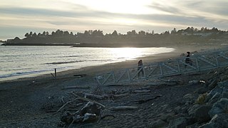
Winchester Bay, formerly Umpqua City, is an unincorporated community in Douglas County, Oregon, United States. For statistical purposes, the United States Census Bureau has defined Winchester Bay as a census-designated place (CDP). The census definition of the area may not precisely correspond to local understanding of the area with the same name. The population of the CDP was 382 at the 2010 census. The community of Umpqua City was established in 1850.

<span class="mw-page-title-main">Parkdale, Oregon</span> Unincorporated community in the state of Oregon, United States

Parkdale is an unincorporated community and census-designated place (CDP) in Hood River County, Oregon, United States. As of the 2010 census, the population was 311, up from 266 at the 2000 census.

<span class="mw-page-title-main">White City, Oregon</span> Unincorporated community in the state of Oregon, United States

White City is an unincorporated community and census-designated place (CDP) in Jackson County, Oregon, United States. The population was 7,975 at the 2010 census, up from 5,466 at the 2000 census. White City is about 9 miles (14 km) north of the center of Medford and 4 miles (6 km) south of Eagle Point.

<span class="mw-page-title-main">Warm Springs, Oregon</span> Unincorporated community in the state of Oregon, United States

Warm Springs is a census-designated place (CDP) and an unincorporated community in Jefferson County, Oregon, United States. Located on the Warm Springs Indian Reservation, the community is also known as the "Warm Springs Agency". The population was 2,945 at the 2010 census, up from 2,431 at the 2000 census.

<span class="mw-page-title-main">Mehama, Oregon</span> Unincorporated community in the state of Oregon, United States

Mehama is an unincorporated community in Marion County, Oregon, United States, located on Oregon Route 22 and the North Santiam River. For statistical purposes, the United States Census Bureau has defined Mehama as a census-designated place (CDP). The census definition of the area may not precisely correspond to local understanding of the area with the same name. The population was 317 at the 2020 census. It is part of the Salem Metropolitan Statistical Area.

<span class="mw-page-title-main">Cape Meares, Oregon</span> Unincorporated community in the state of Oregon, United States

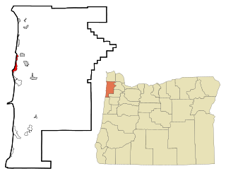
Cape Meares is a census-designated place (CDP) and unincorporated community in Tillamook County, Oregon, United States. The population was 110 at the 2000 census.

<span class="mw-page-title-main">Cloverdale, Oregon</span> Census-designated place in Oregon, United States

Cloverdale is an unincorporated community in Tillamook County, Oregon, United States. For statistical purposes, the United States Census Bureau has defined Cloverdale as a census-designated place (CDP). The census definition of the area may not precisely correspond to local understanding of the area with the same name. The population was 242 at the 2000 census.

<span class="mw-page-title-main">Cayuse, Oregon</span> Unincorporated community in the state of Oregon, United States

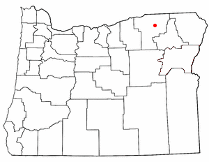
Cayuse is a census-designated place (CDP) and unincorporated community in Umatilla County, Oregon, United States, located 11 miles (18 km) east of Pendleton on the Umatilla Indian Reservation. The population was 59 at the 2000 census. It is part of the Pendleton–Hermiston Micropolitan Statistical Area.

<span class="mw-page-title-main">Wamic, Oregon</span> Unincorporated community in the state of Oregon, United States

Wamic is a census-designated place (CDP) and unincorporated community in Wasco County, Oregon, United States. Wamic was named for the Womack family, which settled the area. A post office was established at Wamic in 1884 and it closed in 1958. The population was 36 at the 2000 census.

<span class="mw-page-title-main">Brinnon, Washington</span> Census-designated place in Washington, United States

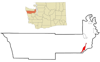
Brinnon is a census-designated place (CDP) in Jefferson County, Washington, United States. The population was 797 at the 2010 census. The community is named for Ewell P. Brinnon, who in 1860 took a donation land claim at the mouth of the Duckabush River. Its known landmarks include Dosewallips State Park and Black Point Marina. Camp Parsons, founded in 1919 and the oldest Boy Scout camp west of the Mississippi River, sits just outside the north end of the CDP.

<span class="mw-page-title-main">Roosevelt, Washington</span> Census-designated place in Washington, United States

Roosevelt is an unincorporated community and census-designated place (CDP) in Klickitat County, Washington, United States. The population was 156 at the 2010 census, up from 79 at the 2000 census. The Roosevelt Regional Landfill, one of the largest landfills in the United States, is located at Roosevelt.

References

  1. "ArcGIS REST Services Directory". United States Census Bureau. Retrieved October 12, 2022.
  2. 1 2 "Census Population API". United States Census Bureau. Retrieved October 12, 2022.
  3. 1 2 "U.S. Census website". United States Census Bureau . Retrieved January 31, 2008.
  4. "US Board on Geographic Names". United States Geological Survey. October 25, 2007. Retrieved January 31, 2008.
  5. The census definition of the area may not precisely correspond to local understanding of the area with the same name.
  6. "Geographic Identifiers: 2010 Census Summary File 1 (G001): Odell CDP, Oregon". American Factfinder. U.S. Census Bureau. Archived from the original on February 13, 2020. Retrieved January 17, 2018.
  7. "US Gazetteer files: 2010, 2000, and 1990". United States Census Bureau. February 12, 2011. Retrieved April 23, 2011.
  8. Climate Summary for Odell, Oregon
  9. "Census of Population and Housing". Census.gov. Retrieved June 4, 2016.
  10. Friedman, Ralph (1990). In Search of Western Oregon (2nd ed.). Caldwell, Idaho: The Caxton Printers, Ltd. p. 329. ISBN   0-87004-332-3.