
Harlem is a neighborhood in Upper Manhattan, New York City. It is bounded roughly by the Hudson River on the west; the Harlem River and 155th Street on the north; Fifth Avenue on the east; and Central Park North on the south. The greater Harlem area encompasses several other neighborhoods and extends west and north to 155th Street, east to the East River, and south to Martin Luther King Jr. Boulevard, Central Park, and East 96th Street.

Little Italy is a neighborhood in Lower Manhattan in New York City, known for its Italian population. It is bounded on the west by Tribeca and Soho, on the south by Chinatown, on the east by the Bowery and Lower East Side, and on the north by Nolita.

East Harlem, also known as Spanish Harlem or El Barrio, is a neighborhood of Upper Manhattan in New York City, north of the Upper East Side and bounded by 96th Street to the south, Fifth Avenue to the west, and the East and Harlem Rivers to the east and north. Despite its name, it is generally not considered to be a part of Harlem proper, but it is one of the neighborhoods included in Greater Harlem.

Avenue C is a north-south avenue located in the Alphabet City area of the East Village neighborhood of Manhattan in New York City, east of Avenue B and west of Avenue D. It is also known as Loisaida Avenue. It starts at South Street, proceeding north as Montgomery Street and Pitt Street, before intersecting East Houston Street and assuming its proper name. Avenue C ends at 23rd Street, running nearly underneath the FDR Drive from 18th Street. North of 14th Street, the road forms the eastern boundary of Stuyvesant Town and Peter Cooper Village.

Avenue D is the easternmost named avenue in the East Village neighborhood of Manhattan, New York City, east of Avenue C and west of the FDR Drive. It runs through East 13th and Houston Streets, and continues south of Houston Street as Columbia Street until Delancey Street and Abraham E. Kazan Street until its end at Grand Street. Avenues A, B, C and D are the origin of the name of the section of the East Village neighborhood through which they run, Alphabet City.
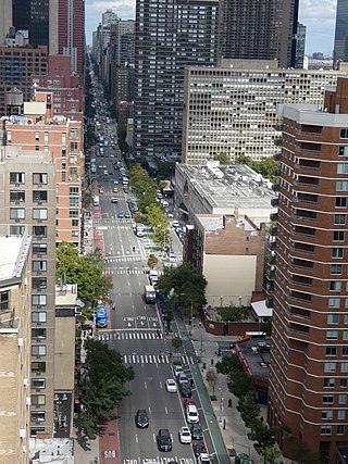
Second Avenue is located on the East Side of the New York City borough of Manhattan extending from Houston Street at its south end to the Harlem River Drive at 128th Street at its north end. A one-way street, vehicular traffic on Second Avenue runs southbound (downtown) only, except for a one-block segment of the avenue in Harlem. South of Houston Street, the roadway continues as Chrystie Street south to Canal Street.
Rao's is an Italian-American restaurant founded in 1896. It is located at 455 East 114th Street, on the corner of Pleasant Avenue in East Harlem, New York City. Rao's has a sister restaurant in Los Angeles.
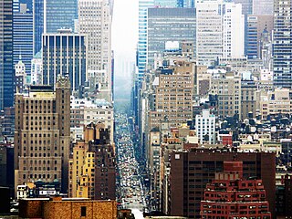
Seventh Avenue—co-named Fashion Avenue in the Garment District and known as Adam Clayton Powell Jr. Boulevard north of Central Park—is a thoroughfare on the West Side of the borough of Manhattan in New York City. It is southbound below the park and a two-way street north of it.
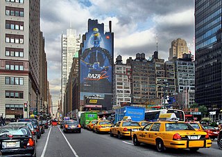
Eighth Avenue is a major north–south avenue on the west side of Manhattan in New York City, carrying northbound traffic below 59th Street. It is one of the original avenues of the Commissioners' Plan of 1811 to run the length of Manhattan, though today the name changes twice: At 59th Street/Columbus Circle, it becomes Central Park West, where it forms the western boundary of Central Park, and north of 110th Street/Frederick Douglass Circle, it is known as Frederick Douglass Boulevard before merging onto Harlem River Drive north of 155th Street.

First Avenue is a north-south thoroughfare on the East Side of the New York City borough of Manhattan, running from Houston Street northbound to 127th Street. At 125th Street, most traffic continues onto the Willis Avenue Bridge over the Harlem River, which continues into the Bronx. South of Houston Street, the roadway continues as Allen Street south to Division Street. Traffic on First Avenue runs northbound (uptown) only.
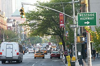
Ninth Avenue, known as Columbus Avenue between West 59th and 110th Streets, is a thoroughfare on the West Side of Manhattan in New York City, United States. Traffic runs downtown (southbound) from the Upper West Side to Chelsea. Two short sections of Ninth Avenue also exist in the Inwood neighborhood, carrying two-way traffic.

Avenue A is a north–south avenue located in Manhattan, New York City, east of First Avenue and west of Avenue B. It runs from Houston Street to 14th Street, where it continues into a loop road in Stuyvesant Town, connecting to Avenue B. Below Houston Street, Avenue A continues as Essex Street.

New York State Route 9X (NY 9X) was a 1.83-mile-long (2.95 km) state highway located within New York City. It served as an alternate route of U.S. Route 9 (US 9) through Manhattan and the Bronx. The southern terminus of the route was in the Manhattan neighborhood of Inwood; its northern terminus was in the Bronx neighborhood of Kingsbridge. NY 9X was assigned in April 1935; however, the road had been signed as a numbered highway since 1934. The designation was removed entirely in the 1940s.
The 116th Street Crew, also known as the Uptown Crew, is a group of Italian-American mobsters within the Genovese crime family. In the early 1960s, Anthony Salerno became one of the most powerful capos in the family. Salerno based the crew in the Palma Boys Social Club located at 416 East 115th Street in East Harlem, Manhattan. By the late 1970s and early 1980s, the 116th Street Crew had absorbed and initiated many former members of the vicious East Harlem Purple Gang, an Italian-American murder for hire and drug trafficking gang operating in 1970s Italian Harlem and acting generally independently of the Mafia.
The East Harlem Purple Gang was a gang or organized crime group consisting of Italian-American hit-men and heroin dealers who were semi-independent from the Italian-American Mafia and, according to federal prosecutors, dominated heroin distribution in East Harlem, Italian Harlem, and the Bronx during the 1970s and early 1980s in New York City. Though mostly independent of the Italian-American Mafia and not an official Mafia crew, the gang was originally affiliated with and worked with the Lucchese crime family and later with the Bonanno crime family and Genovese crime family. It developed its "closest ties" with the Genovese family, and its remnants or former members are now part of the Genovese family's 116th Street Crew.

Founded in the 17th century as a Dutch outpost, Harlem developed into a farming village, a revolutionary battlefield, a resort town, a commuter town, a center of African-American culture, a ghetto, and a gentrified neighborhood.
New York City has the largest population of Italian Americans in the United States as well as North America, many of whom inhabit ethnic enclaves in Brooklyn, the Bronx, Manhattan, Queens, and Staten Island. New York is home to the third largest Italian population outside of Italy, behind Buenos Aires, Argentina (first) and São Paulo, Brazil (second). Over 2.6 million Italians and Italian-Americans live in the greater New York metro area, with about 800,000 living within one of the five New York City boroughs. This makes Italian Americans the largest ethnic group in the New York metro area.

The Church of Our Lady of Mount Carmel is a Roman Catholic parish church under the authority of the Archdiocese of New York, located in East Harlem, Manhattan, New York City, United States. The church's formal address is 448 East 116th Street, although the entrance to the church building is on East 115th Street, just off Pleasant Avenue. The parish enshrines a vested statue of the Blessed Virgin Mary under the title of Our Lady of Mount Carmel, widely venerated by its devotees.
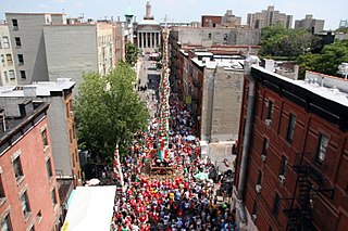
Giglio Society of East Harlem is a non profit Italian-American society located in East Harlem, Manhattan, New York City, that sponsors an annual feast honoring their patron saint, Saint Anthony.


