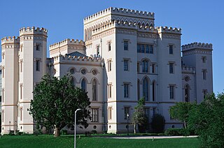
Baton Rouge is the capital city of the U.S. state of Louisiana. Located on the eastern bank of the Mississippi River, it had a population of 227,470 as of 2020; it is the seat of Louisiana's most populous parish (county-equivalent), East Baton Rouge Parish, and the center of Louisiana's second-largest metropolitan area, Greater Baton Rouge.

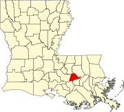
East Baton Rouge Parish is the most populous parish in the U.S. state of Louisiana. Its population was 456,781 at the 2020 census. The parish seat is Baton Rouge, Louisiana's state capital. East Baton Rouge Parish is located within the Greater Baton Rouge area.

Ascension Parish is a parish located in the U.S. state of Louisiana. As of the 2020 census, the population was 126,500. Its parish seat is Donaldsonville. The parish was created in 1807. Ascension Parish is part of the Baton Rouge metropolitan statistical area.

Merrydale is an unincorporated area and census-designated place (CDP) in East Baton Rouge Parish, Louisiana, United States. The population was 9,772 at the 2010 census, down from 10,427 in 2000. It is part of the Baton Rouge Metropolitan Statistical Area.

Monticello is a census-designated place (CDP) in East Baton Rouge Parish, Louisiana, United States. The population was 5,172 at the 2010 census, up from 4,763 in 2000. It is part of the Baton Rouge Metropolitan Statistical Area.
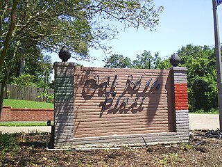
Oak Hills Place is a census-designated place (CDP) in East Baton Rouge Parish, Louisiana, United States. The population was 8,195 at the 2010 census. It is part of the Baton Rouge Metropolitan Statistical Area, and one of the most affluent suburbs of Baton Rouge.

Shenandoah is an unincorporated area and census-designated place (CDP) in East Baton Rouge Parish, Louisiana, United States. It is part of the Baton Rouge Metropolitan Statistical Area. The population was 18,399 at the 2010 census, up from 17,070 in 2000. Shenandoah consists of a number of residential subdivisions, including Shenandoah Estates, Shenandoah Park, White Oak Landing, White Oak Estates, The Woods and The Lake at White Oak.

Village St. George is a census-designated place (CDP) in East Baton Rouge Parish, Louisiana, United States. The population was 7,104 at the 2010 census. It is part of the Baton Rouge Metropolitan Statistical Area.

St. Gabriel is a city in Iberville Parish, Louisiana, United States. The city of St. Gabriel includes the Carville neighborhood and portions of Sunchine. Part of the Baton Rouge metropolitan statistical area, it had a population of 6,677 at the 2010 U.S. census, and 6,433 at the 2020 census.

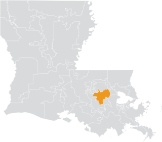
The Baton Rouge metropolitan statistical area, as defined by the United States Office of Management and Budget, or simply the Baton Rouge metropolitan area or Greater Baton Rouge, is a sprawling metropolitan statistical area surrounding the city of Baton Rouge. Including the western edge of the Florida Parishes regions, it is known as "Plantation Country", the "Capital Region", and "The 225". At the 2010 U.S. census, the metropolitan area had a population of 802,484, up from 705,973 in 2000. At the 2020 census, its population increased to 870,569, up from 2020 estimates at 858,571.

The River Parishes are those parishes in Louisiana between New Orleans and Baton Rouge that span both banks of the Mississippi River, and are part of the larger Acadiana region. Traditionally they are considered to be St. Charles Parish, St. James Parish, and St. John the Baptist Parish. These parishes also made up a historical area once referred to as the German Coast of Louisiana. The River Road runs through the parishes.
Glen Oaks High School (GOHS) is located in Merrydale, unincorporated East Baton Rouge Parish, Louisiana, United States, near the city of Baton Rouge. The school, opened in 1960, is part of East Baton Rouge Parish Public Schools. The current principal is Edward Hunter.
Galvez is an unincorporated community in Ascension Parish, Louisiana, United States, ten miles (16 km) southeast of Baton Rouge. It is surrounded by the larger unincorporated community of Prairieville, with which it shares the 70769 ZIP code.

Louisiana Highway 30 (LA 30) is a state highway located in southeastern Louisiana. It runs 28.10 miles (45.22 km) in a northwest to southeast direction from LA 73 in Baton Rouge to the junction of U.S. Highway 61 (US 61) and LA 431 east of Gonzales.
Ascension Parish School Board is a school district headquartered in Donaldsonville, Louisiana, United States.
Geismar is an unincorporated community in Ascension Parish, Louisiana, United States and is at the heart of Louisiana's chemical corridor. The community is part of the Baton Rouge metropolitan statistical area. Geismar is south of Prairieville and west of Gonzales. The community has two schools, Dutchtown Primary/ Middle School and Dutchtown High School, which are ranked among the top schools in the state of Louisiana. The Mississippi River flows to the southeast along the southwest side of the community. The area is vulnerable to hurricanes and tropical systems due to its low elevation and its proximity to the coast of southeast Louisiana.

Louisiana Highway 74 (LA 74) is a state highway located in southeastern Louisiana. It runs 10.67 miles (17.17 km) in an east–west direction from LA 75 in St. Gabriel to U.S. Highway 61 (US 61) north of Gonzales.
Louisiana's 18th State Senate district is one of 39 districts in the Louisiana State Senate. It has been represented by Republican Eddie Lambert since 2016.