The Sultanate of Mataram was the last major independent Javanese kingdom on the island of Java before it was colonised by the Dutch. It was the dominant political force radiating from the interior of Central Java from the late 16th century until the beginning of the 18th century.

Garut Regency is a Regency in the West Java province of Indonesia. It covers an area of 3,065.19 km2 (1,186.91 mi2). Geographically, it lies between 6°57′34″ – 7°44′57″ South latitude and 107°24′34″ – 108°7′34″ East longitude. The population at the 2010 census was 2,404,121, and at the 2020 census was 2,585,607; the official estimate as at mid 2022 was 2,627,220. South Tarogong is the regency seat.
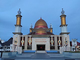
Sukabumi is a landlocked city surrounded by the regency of the same name in the southern foothills of Mount Gede, in West Java, Indonesia, about 100 km (62 mi) south of the national capital, Jakarta.

Sultan Anyakrakusuma is known as Sultan Agung was the third Sultan of Mataram in Central Java ruling from 1613 to 1645. He was a skilled soldier who conquered neighbouring states and expanded and consolidated his kingdom to its greatest territorial and military power.

Pemalang Regency is a regency on the north coast of Central Java province in Indonesia. Its capital is the town of Pemalang. The regency is bordered by the Java Sea in the north, in the east by Pekalongan Regency, by Purbalingga Regency in the south, and by Tegal Regency in the west. It covers an area of 1,115.30 km2, and it had a population of 1,261,353 at the 2010 Census and 1,471,489 at the 2020 Census; the official estimate as at mid 2022 was 1,500,754.

Ciamis is a district and a town; it is the location of the regency seat of Ciamis Regency in West Java, Indonesia. It covers an area of 33.85 km2 and had a population of 93,744 at the 2010 Census and 98,610 at the 2020 Census; the official estimate as of mid-2022 was 99,750.

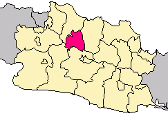
Sukabumi Regency is a regency (kabupaten) in southwestern Java, as part of West Java province of Indonesia. The regency seat is located in Palabuhan Ratu, a coastal district facing the Indian Ocean. The regency fully encircles the administratively separated city of Sukabumi. Covering an area of 4,145.70 km2, the regency is the largest regency in West Java and the second largest regency on Java after the Banyuwangi Regency in East Java. The regency had a population of 2,341,409 at the 2010 census and 2,725,450 at the 2020 census; the official estimate as at mid 2022 was 2,806,664, with a large part of it living in the northeastern part of the regency that encircles Sukabumi City, south of Mount Gede. A plan to create a new regency, the North Sukabumi Regency is currently waiting for the approval of the central government.
Tasikmalaya Regency is a regency in the province of West Java, Indonesia. With an area of 2,708.82 km2 (1,046 sq mi), it is the biggest and most important in the southeast region of East Preanger. Tasikmalaya Regency had a population of 1,687,776 at the 2010 census and 1,865,203 at the 2020 census; the mid-2022 official estimate was 1,906,288.

Subang Regency is a regency (kabupaten) in West Java province, Indonesia. The Regency is bordered by the Java Sea in the north, Indramayu Regency in the east, Sumedang Regency in the southeast, West Bandung Regency in the south, and Purwakarta Regency and Karawang Regency in the west. It has an area of 2,165.55 km2 and its population was 1,465,157 at the 2010 census and 1,595,320 at the 2020 census; the official estimate as at mid 2022 was 1,624,386. Its administrative seat is in the town of Subang.

Karawang Regency is a regency (kabupaten) of West Java, Indonesia. The town of Karawang is its administrative centre. The regency covers an area of 1,911.09 km2 and had a population of 2,127,791 people at the 2010 Census, which grew to 2,361,019 at the 2020 Census. The official estimate for mid 2022 was 2,505,247 for a density of 1,310.9 people per km2. The regency borders Bekasi and Bogor regencies in the west, the Java Sea in the north, Subang Regency in the east, Purwakarta Regency in the southeast, and Cianjur Regency in the south. The regency lies on the eastern outskirts of Metropolitan Jakarta, just outside the Jabodetabek region, and is the site of industrial activity.

Indramayu, named after the God Indra, is a town and district which serves as the capital of Indramayu Regency in the West Java province of Indonesia, and is located in the northern coastal area of West Java, east from Jakarta, north-east from the city of Bandung, and north-west of the city of Cirebon. Most of its land are situated below sea level, which makes the district vulnerable to high tide in stormy conditions. The district is only protected by some dunes and barrages at the seaside.

Kediri is an Indonesian city, located near the Brantas River in the province of East Java on the island of Java. It covers an area of 67.20 km2 and had a population of 268,950 at the 2010 Census and 286,796 at the 2020 Census; the official estimate as at mid 2022 was 289,418. It is one of two 'Daerah Tingkat II' that have the name 'Kediri'. The city is administratively separated from the Regency, of which it was formerly the capital.

Malang Regency is the second largest regency in East Java, Indonesia, with a total area of 3,530.65 km (2,193.84 mi). It is rich in potential for agriculture, medicinal plants and tourism.

Blora is a regency in the northeastern part of Central Java province in Indonesia. Its capital is the town of Blora. The regency is located in the easternmost part of Central Java, and borders the Bengawan Solo River and the East Java province. It covers an area of 1,955.82 km2 and it had a population of 829,728 at the 2010 Census and 884,333 at the 2020 Census; the official estimate as at mid 2022 was 888,224, comprising 444,257 males and 443,967 females.

Demak is a regency located in the Indonesian province of Central Java, on the northern coast of the island. It is bordered by Jepara Regency and the Java Sea to the north, Kudus and Grobogan Regencies to the east, Grobogan and Semarang Regencies to the south, while to the west are Semarang Regency and the city of Semarang, to which the districts of Mranggen and Sayung within Demak Regency are essentially suburban. The regency covers an area of 995.32 km2 (384.30 sq mi) and had a population of 1,055,579 at the 2010 Census and 1,203,956 at the 2020 Census; the official estimate as at mid 2022 was 1,223,217. It was originally the centre of the Demak Sultanate, once a dominant power in the region. Due to its strong relation with the spread of Islam in Java and the Wali Sanga, it is sometimes referred to with the nickname Kota Wali.

Kendal is a regency in the northern part of Central Java province in Indonesia, west of Semarang. The regency is bordered by the Java Sea in the north, Semarang City and Semarang Regency in the east, Temanggung Regency in the south, and Batang Regency in the west. Kendal Regency was established on 28 July 1605. Its capital is the town of Kendal, which is also known as the City of Santri because there are thousands of Ponpes, especially in Kaliwungu District and it is also known as the City of Arts and Culture. The regency covers an area of 1,002.23 km2 and had a population of 900,313 at the 2010 census and 1,018,505 at the 2020 census;</ref> the official estimate as at mnid 2022 was 1,053,440, consisting of 531,754 (50.48%) males and 521,646 (49.52%) females.

The Sultanate of Cirebon was an Islamic sultanate in West Java founded in the 15th century. It is said to have been founded by Sunan Gunungjati, as marked by his letter proclaiming Cirebon's independence from Pajajaran in 1482, although the settlement and the polity had been established earlier, in 1445. Sunan Gunungjati also established the Sultanate of Banten. It was one of the earliest Islamic states established in Java, along with the Sultanate of Demak.

The Bandung Metropolitan Area, officially called the Bandung Basin or Greater Bandung, is a metropolitan area surrounding the city of Bandung, West Java, Indonesia. It was home to about nine million people in mid 2022 and is composed of regencies and cities previously part of the Dutch East Indies era "Central Priangan Residency" administration.

Parahyangan or Priangan is a cultural and mountainous region in West Java province on the Indonesian island of Java. Covering a little less than one sixth of Java, it is the heartland of Sundanese people and their culture. It is bordered to the West by Banten province, to the North by the northern coast region of Subang, Cirebon and Indramayu, to the east by Central Java province, and to the south by the Indian Ocean.

Sumedang Larang is an Islamic Kingdom based in Sumedang, West Java. Its territory consisted of the Parahyangan region, before becoming a vassal state under the Mataram Sultanate.