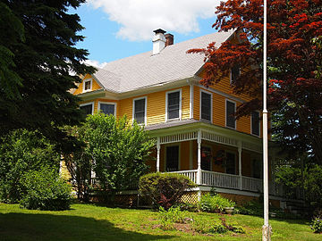
Quaker Hill is a village or neighborhood in the town of Waterford, in the southeastern part of Connecticut, USA.
The Old Dauphin Way Historic District is a historic district in the city of Mobile, Alabama, United States. It was named for Dauphin Way, now known as Dauphin Street, which bisects the center of the district from east to west. The district is roughly bounded by Broad Street on the east, Springhill Avenue on the north, Government Street on the south, and Houston Avenue on the west. Covering 766 acres (3.10 km2) and containing 1466 contributing buildings, Old Dauphin Way is the largest historic district in Mobile.

The Colchester Village Historic District encompasses most of the historic village center of Colchester, Connecticut. It is located at the junction of Route 16, Route 85, and Norwich Avenue. Roughly, the district extends to the northwest along Broadway Street as far as Jaffe Terrace; east along Norwich Avenue to just short of Pleasant Street; south along South Main Street to just north of Hall Hill Road; west along Linwood Avenue to just east of Kmick Lane. The historic district was listed on the National Register of Historic Places (NRHP) in 1994.

Jordan is a village in the town of Waterford, Connecticut, and the historic center of the town. It was named from the Jordan River. The village was listed on the National Register of Historic Places as Jordan Village Historic District in 1990.
Preston City is a village and the original town center of the town of Preston, Connecticut. The core of the village around the junction of Old Northwest Road and Route 164 is designated as the Preston City Historic District, a historic district that is listed on the National Register of Historic Places. The district is located along Old Shetucket and Amos Roads, which, prior to the 1930s, were major thoroughfares.
The Sterling Hill Historic District encompasses a well-preserved early 19th-century rural village center on western edge of the town of Sterling, Connecticut. Centered at the junction of Plainfield Pike and Sterling Hill Road, it consists of a cluster of 19th and early 19th-century houses, and a church. Unlike other period villages, it has largely been unaffected by later development. It was listed on the National Register of Historic Places in 1986.

The Quaker Farms Historic District is a historic district in the town of Oxford, Connecticut, United States. It encompasses a small rural village on Quaker Farms Road anchored by the Christ Church Episcopal, an 1812 wood-frame church with Federal and Gothic styling, located at 470 Quaker Farms Road. The district also includes eleven houses, built between the mid-18th and mid-19th centuries. The oldest houses date to the 1720s, and the church has a particularly well-preserved early 19th-century interior, albeit with some alterations. One house was built about 1800 as a carriage manufactory. The district was listed on the National Register of Historic Places in 1991.

The Bradstreet Historic District encompasses the rural 19th-century village of Bradstreet in Hatfield, Massachusetts. It is centered at the junction of Depot Road and Main Street, and includes properties lining those two streets and Old Farm Road. Most of the buildings in the area date to the second half of the 19th century, featuring architectural styles typical of the period, including Queen Anne, Second Empire, Italianate, and Colonial Revival. The village grew on land that was originally granted to colonial governor Simon Bradstreet and divided in 1682, and has remained largely agricultural since then. The district was listed on the National Register of Historic Places in 1997.

Norwichtown is a historic neighborhood in the city of Norwich, Connecticut. It is generally the area immediately north of the Yantic River between I-395 and Route 169.

The Bean Hill Historic District is a historic district in Norwich, Connecticut that was listed on the National Register of Historic Places in 1982. It consists of a well-preserved collection of buildings focused on the Bean Hill Green, which capture the 19th-century period when Bean Hill was a local center for manufacturing and commercial activity. The district is located in the vicinity of West Town Street between I-395 and Connecticut Avenue, and also extends northeast along Huntington Avenue to include properties further beyond Bean Hill Plain. The district is about 22 acres (8.9 ha) in size, with 23 contributing buildings.
The North Stonington Village Historic District is a 105-acre (42 ha) historic district encompassing the historic center of the main village of North Stonington, Connecticut. The district includes a well-preserved small industrial village, which flourished in the years before the American Civil War, and declined afterward. The district was listed on the National Register of Historic Places in 1983.

The Hillside Historic District in Waterbury, Connecticut is a 106-acre (43 ha) historic district that was listed on the National Register of Historic Places (NRHP) in 1987. It encompasses a residential area north of the city's central business district, and is bounded on the south by West Main Street, the west by Willow Avenue and Cliff and Frederick Streets, on the north by Buckingham Street and Woodland Terrace, and on the east by Cooke Street. Developed principally over an 80-year period between 1840 and 1920, it includes a cross-section of architectural styles of the 19th and early 20th centuries. The area was a desirable neighborhood of the city for much of this time, and was home to a number of the city's elite. In 1987, it included 395 buildings deemed to contribute to the historic character of the area, and one other contributing structure. It includes the Wilby High School and the Benedict-Miller House, which are both separately listed. 32 Hillside Road, a several acre property that includes the Benedict Miller House, was the original site of The University of Connecticut's Waterbury Branch until 2003.
The East Weatogue Historic District is a 490-acre (200 ha) historic district in the town of Simsbury, Connecticut that was listed on the National Register of Historic Places in 1990. It then included 102 contributing buildings, 10 contributing sites, 11 contributing structures, and one other contributing object. The district encompasses a largely agrarian rural village centered at the junction of Hartford Road and East Weatogue Street, whose early development dates to the late 17th century, with the oldest surviving buildings dating to 1730. Most of the properties in the district are Colonial, Federal, or Greek Revival in character, with only a few later Victorian houses. In the early 20th century Colonial Revival houses sympathetic to the earlier buildings.

The Spring Hill Historic District encompasses a rural 19th-century village stretching along Storrs Road in Mansfield, Connecticut. Spring Hill developed as a rural waystation on an early 19th-century turnpike, and has seen only modest development since the late 19th century. The district was listed on the National Register of Historic Places in 1979.

Ravenswood "Old Town" Historic District is a national historic district located at Ravenswood, Jackson County, West Virginia. It encompasses 313 contributing buildings and two contributing structures, the Ohio River Rail Road Steel Pratt-through truss Bridge and Concrete bridge on State Route 68 over Sandy Creek. It includes the commercial and civic core of the town, and surrounding residential buildings. It includes example of popular architectural styles of the mid- to late-19th and early-20th century, including Greek Revival, Gothic Revival, Queen Anne, Colonial Revival, Italianate, Craftsman, and Bungalow. Notable buildings include the McIntosh Building, First Baptist Church, Randolph Building/Caldwell Building (1907), the Grace Episcopal Church ; Our Savior Evangelical Lutheran Church, Ravenswood Community Center (1938), and McIntosh House.

The Town Center Historic District encompasses the historic village center of South Hampton, New Hampshire. Centered around the Barnard Green, the town common, on New Hampshire Route 107A, it includes architectural reminders of the town's growth and change over time. The district was listed on the National Register of Historic Places in 1983.
Snow Hill Historic District is a national historic district located at Snow Hill, Greene County, North Carolina. The district encompasses 229 contributing buildings, a contributing site, two contributing structures, and a contributing object in the central business district and surrounding residential sections of Snow Hill. The buildings are in a variety of popular 19th and early-20th century architectural styles including Greek Revival, Gothic Revival, Colonial Revival, and, Bungalow / American Craftsman. Located in the district are the separately listed Greene County Courthouse and St. Barnabas Episcopal Church. Other notable buildings include J. Exum & Co. Grocery building, Harper Drugstore, Sugg-Harper House, Williams-Exum Housem, Murphrey-Morrill House (1885), Josiah Exum House (1887-1888), Alfred Warren House (1912-1915), Calvary Memorial Methodist Church (1928), Snow Hill Presbyterian Church (1935), and former First Baptist Church.

The Putney Village Historic District encompasses most of the main village and town center of Putney, Vermont. Settled in the 1760s, the village saw its major growth in the late 18th and early 19th century, and includes a cohesive collection with Federal and Greek Revival buildings, with a more modest number of important later additions, including the Italianate town hall. The district was listed on the National Register of Historic Places in 1986.

The Central Vinton Residential Historic District is a nationally recognized historic district located in Vinton, Iowa, United States. It was listed on the National Register of Historic Places in 2012. At the time of its nomination it contained 266 resources, which included 184 contributing buildings, one contributing structure, and 81 non-contributing buildings. Most of the contributing buildings are houses, and outbuildings. Second Avenue retains its brick paving and it is the contributing structure. Vinton is the county seat of Benton County, and this is one of its most affluent neighborhoods. Because the town is a center of commerce and government, it started to grow in the mid-to-late-nineteenth century.
The Elm Street Historic District encompasses a colonial-era roadway layout and a cross-section of historical residential architecture styles in Rocky Hill, Connecticut. Elm Street between Silas Deane Highway and Grimes Road is an old colonial road, laid out in the late 17th century, and has retained an unusually wide right-of-way, typical for the period but rarely preserved. The houses lining it date from 1769 to the 1930s. The district was listed on the National Register of Historic Places in 1998.