River Raisin National Battlefield Park

Last updated
River Raisin Battlefield Site (20MR227)
River Raisin National Battlefield Park.jpg
USA Michigan location map.svg
Red pog.svg
Location within the state of Michigan
Usa edcp location map.svg
Red pog.svg
River Raisin National Battlefield Park (the United States)
Location Monroe, Michigan
Coordinates 41°54′49″N83°22′42″W / 41.91361°N 83.37833°W / 41.91361; -83.37833
Website River Raisin National Battlefield Park
NRHP reference No. 82000542 [1]  (original)
100003658 [2]  (increase)
Significant dates
Added to NRHPDecember 10, 1982
Boundary increaseApril 17, 2019
Designated NBPMarch 30, 2009
Designated MSHSFebruary 18, 1956 [3]

The River Raisin National Battlefield Park preserves the site of the Battle of Frenchtown as the only national battlefield marking a site of the War of 1812. It was established as the 393rd unit of the United States National Park Service under Title VII of the Omnibus Public Land Management Act, which was signed into law on March 30, 2009. The park is located in the city of Monroe in Monroe County, Michigan. It was designated as a Michigan Historic Site on February 18, 1956 [3] and was added to the National Register of Historic Places on December 10, 1982. [1] The house at 1403 East Elm Avenue was added to the National Register listing in 2019. [2] It officially began operation as a national park unit on October 22, 2010. [4]

Contents

Background

The area was the site of the costly Battle of Frenchtown, in which 397 Americans were killed and 547 taken prisoner after surrender to the British Army and Native American coalition during the War of 1812. [5] The fighting took place from January 18–23, 1813. The first engagement, sometimes referred to as the First Battle of the River Raisin, was a success for the American forces. Angered by their forced retreat, the British and Native Americans counterattacked the American forces four days later, on January 22, at the same location along the River Raisin. Many of the Americans were inexperienced troops from Kentucky; they were ill-prepared and unable to retreat. [5]

During the Battle of Frenchtown, American brigadier general James Winchester reported that only 33 of his approximate 1,000 men escaped the battlefield. 397 were killed, and 547 were taken prisoner, which marked the deadliest conflict ever on Michigan soil and the worst single defeat the Americans suffered in the entire War of 1812. [6] The day after the battle, dozens of captured Americans too wounded to walk were killed by the Native Americans, mostly Potawatomi, in apparent reprisal for atrocities the Kentuckians had committed against them. [7] This is referred to as the River Raisin Massacre. Prisoners who could walk were marched toward Detroit.

Recent history

The former River Raisin Battlefield Visitor Center River Raisin Battlefield Visitors Center.jpg
The former River Raisin Battlefield Visitor Center

The River Raisin Battlefield Site was listed as a Michigan Historic Site on February 18, 1956, although the exact date at which the park was first organized is unknown. The location of the site is bounded by North Dixie Highway, the River Raisin, Detroit Avenue, and Mason Run Creek. [3] [8] The Battle of Frenchtown is so named because it took place in and surrounding the Frenchtown Settlement (1784), on the River Raisin's north bank and within the present-day city limits of Monroe. [9] The area of conflict extended during the three days of battle several miles to the north and south of the current park site. After the battles, Frenchtown was gradually abandoned and the present-day city of Monroe developed from its downtown site 1.5 miles west and on the opposite bank of the River Raisin. The current park area encompasses some 40 acres (16 ha) of undeveloped land on Monroe's east side approximately one-quarter mile (0.4 km) west of Interstate 75. The area contains houses on the outer fringe along East Elm Avenue, and much of the area is occupied by urban development. The River Raisin Paper Company built a large paper mill on the site around 1911, which operated under multiple owners until 1995. [10]

The site was recognized nationally when it was added to the National Register of Historic Places on December 10, 1982. It was officially listed as the River Raisin Battlefield Site (20MR227). [1] In July 1990, the Monroe County Historic Commission and the Monroe County Historic Society opened the River Raisin Battlefield Visitor Center within the site at 1403 East Elm Avenue. The museum contains a few relics from the original battle that were discovered during archeological investigations. The park holds a memorial service every January to commemorate all the soldiers who fought in the Battle of Frenchtown, including the British and Indian soldiers who were allied against the Americans. [11]

Expansion to the present-day park boundaries commenced in 1995 with closure of the paper mill, at which time the City of Monroe organized efforts to restore the entire battlefield site. The city, Historical Society, and property owner negotiated, acquired and facilitated clean up the former paper mill property and adjacent landfill area for future donation to the park service. In addition they transferred a large expanse of wetlands marsh to the State of Michigan for expansion of the adjacent Sterling State Park. Acquisitions were complete by 2006, the paper mill was demolished by 2009, the cleanup finished in 2010, and land transfers were completed in 2011. [10] [12]

Promotion to the National Park System

Much of the landscape within the site has not been restored to battlefield-era conditions. Frenchtown1812Battlefield.jpg
Much of the landscape within the site has not been restored to battlefield-era conditions.
Public access to certain parts of the park is currently prohibited. River Raisin National Battlefield Park2.jpg
Public access to certain parts of the park is currently prohibited.

The River Raisin Battlefield Site was chosen to be included as a unit of the National Park System. The River Raisin National Battlefield Act (H.R. 401.IH), which was passed by the House of Representatives of the 111th Congress on January 9, 2009, said that the future national battlefield site would include land in both Monroe and Wayne counties that has been deemed significant to the Battle of Frenchtown. [13]

The passing of the Omnibus Public Land Management Act on March 30, 2009, allocated the funding necessary to promote the site to the status of a National Battlefield Park. The park had been authorized as such but was not officially established until this bill was passed. It was included in the bill thanks to the work of Michigan natives and United States senators Carl Levin and Debbie Stabenow, as well as Congressman John Dingell, a history enthusiast. [14] [15] [16] The site is only the fourth National Battlefield Park in the United States National Park System and is the only one commemorating the War of 1812. [17] Battlefields, however, have been designated using various terms, even within the national park system. These include National Battlefield (without "Park" in the name), National Military Park, National Battlefield Site, National Historical Park, National Monument, and National Historic Site. River Raisin is the fifth national park unit in Michigan. Others include Isle Royale National Park, Keweenaw National Historical Park, Pictured Rocks National Lakeshore, and Sleeping Bear Dunes National Lakeshore; Father Marquette National Memorial is an affiliated unit.

The park is still being developed to meet National Park Service standards, with elements dependent on additional funding. [10] The construction of and promotion of a national park typically takes eight years, which includes a variety of steps, such as land acquisition, funding, a management plan, and development of tourism facilities. However, since the county has already preserved and managed the battlefield site, this process took considerably less time. [18] Some areas have yet to be restored to landscapes of the era of the battle.

The battlefield site is expected to generate a positive economic effect in tourism. [10] Projected attendance to the park upon its completion was estimated to range from 20,000 to 25,000 visitors a year, [18] but during FY 2012, the battlefield was visited by 52,027 people. [19] The other three National Battlefield Parks, which all relate to the Civil War, receive more visitors, based on attendance figures from 2005: Kennesaw Mountain National Battlefield Park (1,005,510), Manassas National Battlefield Park (715,622), and Richmond National Battlefield Park (68,438).

In 2010 the battlefield park was connected to the nearby Sterling State Park through a newly completed nature trail, which is expected to increase the number of visitors in both parks. [20] [21] The president of the Monroe County Historical Society, William Braunlich, hoped to complete elements in the park before the bicentennial celebration of the Battle of Frenchtown on January 22, 2013. [12] The site began operations as a national park unit on October 22, 2010.

In 2014, the park expanded by adding a disconnected coastal parcel that includes a historic corduroy road, a remnant of Hull's Trace, a military road that connected Fort Detroit to Ohio. [22] The Hull's Trace Unit at the beginning of West Jefferson Avenue in Brownstown Township, about 13 miles northeast of the battlefield park, had been managed by Wayne County Parks, and is now cooperatively managed by the National Park Service, the county, U.S. Silica, and the Michigan Departments of Natural Resources and Environmental Quality. It is an unstaffed site.

Spurred in part by planned construction of the Gordie Howe International Bridge between Detroit and Windsor, historic Fort Wayne in Detroit was studied in 2017 and 2018 as a possible addition to the national park system, including as a unit of River Raisin National Battlefield Park. [23] The National Park Service had previously assisted in identifying ways to preserve Fort Wayne and draw visitors.

Historic markers

Related Research Articles

<span class="mw-page-title-main">Monroe County, Michigan</span> County in Michigan, United States

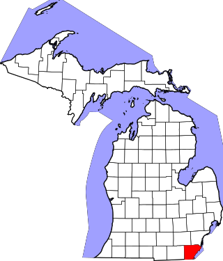
Monroe County is a county in the U.S. state of Michigan. As of the 2020 Census, the population was 154,809. The largest city and county seat is Monroe. The county was established as the second county in the Michigan Territory in 1817 and was named for then-President James Monroe.

<span class="mw-page-title-main">Frenchtown Charter Township, Michigan</span> Charter township in Michigan, United States

Frenchtown Charter Township is a charter township within Monroe County in the U.S. state of Michigan. The population was 21,609 as per the 2020 census.

<span class="mw-page-title-main">Monroe, Michigan</span> City in Michigan, United States

Monroe is the largest city and county seat of Monroe County, Michigan, United States. The population was 20,462 as of the 2020 census. The city is bordered on the south by Monroe Charter Township, but the two are administered autonomously. Monroe is the core city in the Monroe metropolitan area, which is coterminous with Monroe County and had a population of 154,809 in 2020. Located on the western shores of Lake Erie approximately 20 miles (32 km) northeast of Toledo, Ohio, and 40 miles (64 km) southwest of Detroit, the city is part of the Detroit–Ann Arbor–Flint combined statistical area.

<span class="mw-page-title-main">River Raisin</span> River in southeastern Michigan, United States

The River Raisin is a river in southeastern Michigan, United States, that flows through glacial sediments into Lake Erie. The area today is an agricultural and industrial center of Michigan. The river flows for almost 139 miles (224 km), draining an area of 1,072 square miles (2,780 km2) in the Michigan counties of Lenawee, Washtenaw, Jackson, Hillsdale, and Monroe County, where its mouth at Lake Erie is located. French settlers named it as La Rivière aux Raisins because of the wild grapes growing along its banks, the French word for grape being raisin. The French term for "raisin" is raisin sec.

<span class="mw-page-title-main">Battle of Frenchtown</span> Battle in the War of 1812

The Battles of Frenchtown, also known as the Battle of the River Raisin and the River Raisin Massacre, were a series of conflicts in Michigan Territory that took place from January 18–23, 1813, during the War of 1812. It was fought between the United States of America and a joint force of British and Native Americans near the River Raisin in Frenchtown.

<span class="mw-page-title-main">Sandy Creek (Michigan)</span> River in Michigan, United States

Sandy Creek is an 18.5-mile-long (29.8 km) creek located entirely within Monroe County in the U.S. state of Michigan. The creek rises in London Township in the north-central portion of the county and flows southeast into Lake Erie in Frenchtown Charter Township at Sterling State Park.

<span class="mw-page-title-main">National Register of Historic Places listings in Monroe County, Michigan</span>

This is a list of the National Register of Historic Places listings in Monroe County, Michigan.

<span class="mw-page-title-main">Sterling State Park</span> Park in Michigan, USA

William C. Sterling State Park is a public recreation area located in Frenchtown Charter Township with a small portion lying within the city limits of Monroe, Michigan. It is the only Michigan state park located on Lake Erie. The park encompasses 1,300 acres (530 ha) of mostly man-made lagoons and beachfront near the mouth of Sandy Creek. The main attractions at the park include a 256-site campground, beach area, boat launch, and shore fishing lagoons. There are over seven miles (11 km) of biking and hiking trails within the park.

The Army of the Northwest was a U.S. Army unit formed at the outset of the War of 1812 and charged with control of the state of Ohio, the Indiana Territory, Michigan Territory and Illinois Territory.

<span class="mw-page-title-main">Paschal Hickman</span>

Paschal Hickman was an American military officer who was killed in the Massacre of the River Raisin, an important event in the War of 1812. Hickman County, Kentucky is named for him.

<span class="mw-page-title-main">Sawyer House (Monroe, Michigan)</span> Historic house in Michigan, United States

The Sawyer House, also known as the Sawyer Homestead and in its previous incarnation as the Navarre House, is a city-owned house located at 320 East Front Street in Monroe, Michigan. It was listed as a Michigan Historic Site on June 19, 1975. The house was listed on the National Register of Historic Places on November 23, 1977, and is also part of the larger Old Village Historic District.

<span class="mw-page-title-main">Navarre–Anderson Trading Post</span> United States historic place

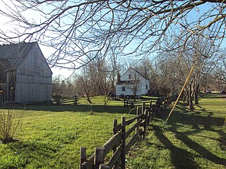
The Navarre–Anderson Trading Post is a former trading post complex located at 3775 North Custer Road in Frenchtown Charter Township along the River Raisin in Monroe County, Michigan. It was listed as a Michigan Historic Site on June 16, 1972 and also listed on the National Register of Historic Places on July 31, 1972.

Roundhead, also known as Bark Carrier, Round Head, Stayeghtha, and Stiahta, was an American Indian chief of the Wyandot tribe. He was a strong member of Tecumseh's confederacy against the United States during the War of 1812. He died of unknown natural causes about a month or two before Tecumseh was killed at the Battle of the Thames.

<span class="mw-page-title-main">Hull's Trace North Huron River Corduroy Segment</span> United States historic place

The Hull's Trace North Huron River Corduroy Segment is a portion of Hull's Trace, a military road running from Urbana, Ohio, to Detroit. Hull's Trace was one of the first federal and military roads in the United States. This segment, the only known extant portion of the Trace, contains the remains of a corduroy road, and is located at approximately 36000 W Jefferson Avenue in Brownstown Charter Township, Michigan. The North Huron River Corduroy Segment of Hull's Trace was listed on the National Register of Historic Places in 2010. As of 2014 it has been preserved and made accessible to the public as the Hulls Trace Unit of the River Raisin National Battlefield Park.

Nathaniel Gray Smith Hart was a Lexington, Kentucky lawyer and businessman, who served with the state's volunteer militia during the War of 1812. As Captain of the Lexington Light Infantry from Kentucky, Hart and many of his men were killed in the River Raisin Massacre of January 23, 1813, after being taken prisoner the day before following the Battle of Frenchtown in Michigan Territory.

Benjamin Franklin Graves (1771–1813) was a politician and military leader in early 19th-century Kentucky. During the War of 1812, Graves served as a major in the 2nd Battalion, 5th Kentucky Volunteer regiment. Together with other officers, he commanded Kentucky troops in the Battle of Frenchtown on January 22, 1813, in Michigan Territory. This was part of an effort by Americans to take the British-controlled fort at Detroit, Fort Shelby. This battle had the highest number of American fatalities in the war: of 1,000 American troops, nearly 400 were killed in the conflict, and 547 were taken prisoner. The next day an estimated 30-100 Americans were killed by Native Americans after having surrendered.

The Muskrat French are a cultural group and dialect found in southeastern Michigan along the Detroit River and Lake St. Clair, the western and southern shores of Lake Erie from Monroe County, Michigan to Sandusky, Ohio, and in southwestern Ontario. Their name comes from their tradition of eating muskrat during Lenten Fridays.

Laurent Durocher was an American judge and politician in the U.S. state of Michigan. He was involved in the formation of Monroe County, Michigan, and held numerous official posts during the first decades of its existence, and was also a member of both the Michigan House of Representatives and Michigan Senate.

<span class="mw-page-title-main">Hubert Lacroix (American politician)</span> American soldier and politician

Hubert Lacroix or Le Croix was an American soldier, trader, and politician who fought in the War of 1812. He was captured by the British following the surrender of Detroit and saved from charges of treason by his friend, the Shawnee chief Tecumseh. Lacroix later served two terms as a member of the Michigan Territorial Council.

William Atherton was an American soldier, rifleman and veteran of the War of 1812 from Shelbyville, Kentucky. He was a private in Captain John Simpson's company of the 1st Rifle Regiment. He served under William Henry Harrison. Atherton wrote a journal that detailed his war service within the Kentucky militia, including their defeat and subsequent massacre at River Raisin by opposing forces, and his subsequent capture and imprisonment.

References

  1. 1 2 3 "National Register Information System". National Register of Historic Places. National Park Service. November 11, 2009. Archived from the original on July 25, 2008. Retrieved July 30, 2010.
  2. 1 2 "Weekly List 20190419". national Park Service. Retrieved April 29, 2019.
  3. 1 2 3 State Historic Preservation Office (2009). "River Raisin Battlefield Site". Historic Sites Online. Michigan State Housing Development Authority. Archived from the original on May 5, 2012. Retrieved July 15, 2010.
  4. "The Journey to Becoming a National Park". National Park Service. Retrieved 2023-06-24.
  5. 1 2 Staff (2010). "Our Nation's "Newest" National Park". River Raisin Battlefield. Retrieved July 15, 2010.
  6. Eaton, John H. (2000). Returns of Killed and Wounded in Battles or Engagements with Indians and British and Mexican Troops, 1790-1848, Compiled by Lt. Col J. H. Eaton. Washington, D.C.: National Archives and Records Administration. p. 7.
  7. "The War of 1812's Forgotten Battle Cry".
  8. Google (July 15, 2010). "The River Raisin Battlefield Site" (Map). Google Maps . Google. Retrieved July 15, 2010.
  9. Map of the City of Monroe (PDF) (Map). City of Monroe. 2009. Retrieved July 15, 2010.
  10. 1 2 3 4 Bak, Richard (June 2009). "River Raisin's Bloody Banks". Hour Detroit. Retrieved July 15, 2010.
  11. Staff (2010). "Visitor Center". River Raisin Battlefield. Retrieved July 16, 2010.
  12. 1 2 Reiter, Mark (December 2, 2009). "River Raisin National Battlefield Park boundaries to be revealed". The Blade . Toledo, OH. Retrieved July 16, 2010.
  13. US Congress (2010). "Bill Text: 111th Congress (2009-2010): H.R.401". Library of Congress. Archived from the original on December 7, 2010. Retrieved July 15, 2010.
  14. Staff (March 31, 2009). "Battlefield bill signing celebrated". Monroe Evening News. Retrieved April 3, 2009.
  15. Staff (March 30, 2009). "Summary of H. R. 146 as of becoming Public Law No. 111-11". Congressional Research Service . Retrieved April 3, 2009.[ permanent dead link ]
  16. Benson, Adam (January 15, 2009). "Senate Vote Moves River Raisin Battlefield National Park Closer to Reality" (Press release). Office of John Dingell. Archived from the original on August 8, 2010. Retrieved July 16, 2010.
  17. See List of National Battlefield Parks in the National Park System of the United States.
  18. 1 2 Janiskee, Bob (December 10, 2009). "The New River Raisin National Battlefield Park Highlights One of the Bloodiest Conflicts of a Seldom Mentioned War". National Parks Traveler. Retrieved July 16, 2010.
  19. 2012 Annual Report
  20. Woodruff, Betsy (June 22, 2010). "Jeff Corwin helps celebrate River Raisin Trail opening". Toledo Free Press . Retrieved July 15, 2010.
  21. Verkennes, Joe (June 25, 2010). "River Raisin Heritage Trail Dedicated" (PDF) (Press release). Monroe County Community College. Archived from the original (PDF) on July 20, 2011. Retrieved July 16, 2010.
  22. Harrison, Daniel; Holley, Mark (October 30, 2009). NAS Part II Survey: Corduroy Road Remnant near Brownstown, Michigan (PDF). Archived from the original (PDF) on December 5, 2010. Retrieved December 30, 2010.
  23. Michigan leaders want to make crumbling Detroit fort into national park, Bridge Magazine, Detroit, May 3, 2018