Detroit River International Wildlife Refuge

Last updated
Detroit River
International Wildlife Refuge
IUCN category IV (habitat/species management area)
John D. Dingell Jr Visitor Center.jpg
John D. Dingell Jr. Visitor Center in Trenton
Relief map of USA Michigan.png
Red pog.svg
Location within the state of Michigan
Usa edcp relief location map.png
Red pog.svg
Location within the United States
Location Detroit River / West Lake Erie
Coordinates 42°13′N83°08′W / 42.217°N 83.133°W / 42.217; -83.133 Coordinates: 42°13′N83°08′W / 42.217°N 83.133°W / 42.217; -83.133
Area5,868 acres (23.75 km2) [1]
EstablishedDecember 21, 2001
Governing body Flag of the United States.svg U.S. Fish and Wildlife Service
Flag of Canada.svg Canadian Wildlife Service
Website Official website
North Maumee Bay Archeological District NMaumeeBay.jpg
North Maumee Bay Archeological District

The Detroit River International Wildlife Refuge is the only international wildlife refuge in North America. [2] Established in 2001 and managed jointly by the United States Fish and Wildlife Service and the Canadian Wildlife Service, it is located in a major metropolitan area. The Detroit River International Wildlife Refuge is one of over 540 National Wildlife Refuges managed by the U.S. Fish and Wildlife Service within the Department of the Interior. It occupies 7.88 square miles (20.41 km2) of scattered property but has drawn boundaries for further expansion. [3]

Contents

The Detroit River International Wildlife Refuge consists primarily of coastal wetlands, several islands in the Detroit River, and waterfront parks. The refuge includes islands, marshes, shoals, and waterfront lands along 48 miles (77 km) of the Detroit River and Western Lake Erie shoreline. It also includes Humbug Marsh, a wetland in southeastern Wayne County, which is classified as a wetland of international importance.

History

Much of the land surrounding the Detroit River is urbanized and, in some places, heavily industrialized. This has resulted in excessive water pollution from the unregulated dumping of chemicals and industrial waste for many decades. Much of the garbage and sewage from Detroit's rapid industrialization found its way into the river. Much of the Detroit River and its shoreline were heavily polluted and unsafe for recreational use. Large quantities of this pollution collected around the mouth of the Detroit River at Lake Erie. The pollutants were so high after the spring thaw that thousands of migrating birds were killed by oil slicks and contaminated water every year. Oxygen levels in the river were depleted to the point where fish were unable to inhabit its waters. Because much of this pollution drained into and affected Lake Erie, portions of the lake itself were considered "dead" and unable to support aquatic life. Swimming in the water or consuming any of its remaining fish were considered health risks. [4] [5]

In 1961, the Wyandotte National Wildlife Refuge was founded by congressional order thanks in part to Michigan politician John Lesinski, Jr., who was Michigan's 16th congressional district representative from 1951 to 1965. The refuge paved the way for tighter restrictions on industries and allocated much needed government funding to clean up the river. However, there was little support from Detroit businesses toward cleaning up the river, because it would negatively affect Detroit's industrialism and economy. In 1970, the entire fishing industry in the St. Clair River, Lake St. Clair, the Detroit River, and Lake Erie had to be temporarily closed due to toxic levels of mercury found in the water. This caused the fishing industry and all those related to lose substantial amounts of money. This, in turn, spurred a massive conservation effort aimed at cleaning up the Detroit River. [4] For years before, conservation efforts were halted by the enormous multimillion-dollar cost of removing pollutants from the river. In addition to that, industries, which had significant political influence, detested the regulations necessary to lessen the amount of pollutants in the river. [5] The Wyandotte National Wildlife Refuge was very small though and only occupied the area surrounding Grassy Island, and the refuge's existence could not prevent Grassy Island from becoming highly contaminated from toxic soil dredged from the nearby River Rouge. [6]

In 2001, the Wyandotte National Wildlife Refuge was absorbed into the much larger Detroit River International Wildlife Refuge, which was largely advocated by veteran Michigan representative John Dingell. [7] The refuge was officially signed into law as the Detroit River International Wildlife Refuge Establishment Act (H.R. 1230) by President George W. Bush on December 21, 2001. [8] [9] The Congressional Budget Office originally estimated that the creation of the Detroit River International Wildlife Refuge would cost between $13–21 million over the first five years, in which the majority of the money spent would be through land acquisitions. [9]

Millions of dollars so far have been used for land acquisitions and to improve the environment around the river. The recent cleaning up and restoration of the Detroit River is remarkable, although other problems are still at hand. [4] Today, many species of native animals—some endangered species—are returning to the area after being driven out by human development. The Detroit River is home to a growing number of bird species, such as eagles (including reintroduced bald eagles), ospreys, and peregrine falcons. Fish species in abundance in the area include lake whitefish, sturgeon, salmon, perch, and walleye. Numerous mammal species also occupy the coastline throughout the refuge. The area serves as a vital migratory route and resting place for countless species of birds. [5] Over 30 species of waterfowl, 17 species of raptors, 31 species of shorebirds, 160 species of songbirds, and 117 species of fish live along or regularly migrate through the Detroit River. [4] [5] [7]

Current area

Mud Island in Ecorse, Michigan is the northernmost portion of the refuge. Mud Island in DRIWR.jpg
Mud Island in Ecorse, Michigan is the northernmost portion of the refuge.

At its inception, the Detroit River International Wildlife Refuge included only areas that were part of the former Wyandotte National Wildlife Refuge. This included only 304 acres (123 hectares) surrounding Grassy Island and Mamajuda Island just north of Grosse Ile in the Detroit River. Soon after, Mud Island just north of Grassy Island was donated to the refuge by the National Steel Corporation. The refuge continued to expand through land acquisitions to include Calf Island in 2002. In 2003, the U.S. Fish and Wildlife Service stuck a cooperative agreement with DTE Energy to include portions of their properties into the refuge, including the Lagoona Beach Unit and Brancheau Unit of the Enrico Fermi Nuclear Generating Station. This was the refuge's first expansion into Monroe County along the coast of Lake Erie. Other areas in Lake Erie extending as far south as the Michigan–Ohio border were eventually included into the Detroit River International Wildlife Refuge. Many of these lands were through cooperative management acquisitions, where the property would be included into the refuge but not owned directly by the U.S. Fish and Wildlife Service.

View of a muskrat lodge through permanent viewing telescope in Gibraltar Bay Unit on Grosse Ile. Telescope view of muskrat lodge, Gibraltar Bay, Detroit River International Wildlife Refuge.jpg
View of a muskrat lodge through permanent viewing telescope in Gibraltar Bay Unit on Grosse Ile.

In 2004, the refuge grew to include Humbug Marsh, which is in Gibraltar and Trenton and also includes Humbug Island. At the same time, the refuge acquired the U.S. Army Corps of Engineers Strong Unit just north of Estral Beach. In 2005, the refuge acquired joint management over the 243-acre (98 ha) Eagle Island Marsh in Monroe, Michigan. This land is at the mouth of the River Raisin in between the Monroe Power Plant and Sterling State Park. This section, which was once very polluted, is owned by Automotive Components Holdings and is the location of a large Ford factory. In 2006, the refuge grew to include the 780-acre (315 ha) Lake Erie Metropark in Brownstown Charter Township. With the acquisition of the Erie Marsh in 2006, the refuge doubled its size to include the southern wetlands of Erie Township near the Ohio border, including Gard Island in the North Maumee Bay Archeological District. This was a major milestone for the Detroit River International Wildlife Refuge. [10] The refuge grew from its original 304 acres (123 hectares) in 2001 to 5,047 acres (2,042 hectares) by 2007. [3] The last of these acquisitions was an area referred to as Howard Fix at 65 acres (26 hectares). It is near the Enrico Fermi Nuclear Generating Station, but little has been published about this property. [11]

The Refuge also owns the shoals around these islands and has entered into cooperative agreements with the U.S. Army Corps of Engineers and Detroit Edison, a local electricity company, to manage hundreds of acres of habitat on Lake Erie. Within the authorized boundaries of the Refuge are several existing parks including Elizabeth Park, Sterling State Park, Lake Erie Metropark, as well as Pointe Mouillee State Game Area and Erie State Game Area.

The headquarters of the Detroit River International Wildlife Refuge are in Grosse Ile Township, which is not officially listed as part of the refuge. In Canada, the Detroit River International Wildlife Refuge does not have any formal boundaries, and no Canadian portions of the Detroit River or Lake Erie are officially included into the refuge. [12] All properties and potential future land acquisition sites are within the United States and governed by the U.S. Fish and Wildlife Service.

Proposed expansion

The Pointe Mouillee State Game Area Pointe Mouillee.jpg
The Pointe Mouillee State Game Area

While the boundaries of the Detroit River International Wildlife Refuge encompass only 7.88 square miles (20.42 km2) of property scattered along the west coast of the Detroit River and Lake Erie, the Department of the Interior has approved of future land acquisitions by the U.S. Fish and Wildlife Service totaling 18.75 square miles (48.56 km2) of land and water. [3] Expanding the territory through land acquisitions is a top priority for the refuge. [8] The expansion of the refuge is limited due to finances and the fact that most areas within the proposed range are privately owned. Most of the land within the Detroit River International Wildlife Refuge is jointly operated by individual landowners and the federal government. The expansion could also include areas of significant permanent populations, such as the islands of Grosse Ile Township, the riverfronts of several Downriver communities, Berlin and Frenchtown charter townships, and Monroe.

The proposed range stretches for 48 miles from the southern border of Detroit at Zug Island in the city of River Rouge south all the way to the Michigan–Ohio border. [3] [8] The expansion would not include any areas within the city limits of Detroit. Potential areas within this realm include Zug Island, Grosse Ile, Elizabeth Park, Pointe Mouillee State Game Area, Sterling State Park, and Turtle Island. Potential Canadian additions to the Detroit River International Wildlife Refuge include the large Fighting Island, which has already undergone major recovery after serving as an industrial dumping ground for decades, Grass Island, Turkey Island, Crystal Island, and Bois Blanc Island. [13]

Related Research Articles

<span class="mw-page-title-main">Detroit River</span> River connecting Lake Huron with Lake Erie

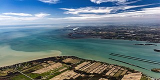
The Detroit River flows west and south for 24 nautical miles from Lake St. Clair to Lake Erie as a strait in the Great Lakes system. The river divides the metropolitan areas of Detroit, Michigan, and Windsor, Ontario—an area collectively referred to as Detroit–Windsor—and forms part of the border between Canada and the United States. The Ambassador Bridge, the Detroit–Windsor Tunnel, and the Michigan Central Railway Tunnel connect the cities.

<span class="mw-page-title-main">River Raisin</span> River in southeastern Michigan, United States

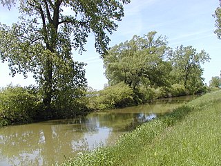
The River Raisin is a river in southeastern Michigan, United States, that flows through glacial sediments into Lake Erie. The area today is an agricultural and industrial center of Michigan. The river flows for almost 139 miles (224 km), draining an area of 1,072 square miles (2,780 km2) in the Michigan counties of Lenawee, Washtenaw, Jackson, Hillsdale, and Monroe County, where its mouth at Lake Erie is located. French settlers named it as La Rivière aux Raisins because of the wild grapes growing along its banks, the French word for grape being raisin. The French term for "raisin" is raisin sec.

Montezuma National Wildlife Refuge is a wildlife preserve operated by the United States Fish and Wildlife Service, encompassing part of the Montezuma Swamp at the north end of Cayuga Lake. The 10,004-acre (40.48 km2) preserve is composed of swamps, pools and channels and is a stopping point for migratory birds.

<span class="mw-page-title-main">Shiawassee National Wildlife Refuge</span>

The Shiawassee National Wildlife Refuge is a 9,870.35 acres (39.9439 km2) National Wildlife Refuge in Saginaw County managed by the United States Fish and Wildlife Service. It is located in the central portion of the lower peninsula of the U.S. state of Michigan, approximately 25 miles (40 km) south of the Saginaw Bay in Lake Huron and five miles (8 km) south of the city of Saginaw in the county's Spaulding and James townships. It was established in 1953 to provide habitat for migratory waterfowl.

<span class="mw-page-title-main">Missisquoi National Wildlife Refuge</span>

Missisquoi National Wildlife Refuge is a National Wildlife Refuge located in the eastern shore of Lake Champlain in the U.S. state of Vermont. The refuge is in Franklin County in the northwest corner of the state near the International Boundary with Canada. It is the only National Wildlife Refuge located entirely in Vermont, and is administered by the United States Fish and Wildlife Service.

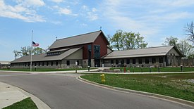
The protected areas of Michigan come in an array of different types and levels of protection. Michigan has five units of the National Park Service system. There are 14 federal wilderness areas; the majority of these are also tribal-designated wildernesses. It has one of the largest state forest systems as well having four national forests. The state maintains a large state park system and there are also regional parks, and county, township and city parks. Still other parks on land and in the Great Lakes are maintained by other governmental bodies. Private protected areas also exist in the state, mainly lands owned by land conservancies.

<span class="mw-page-title-main">Sterling State Park</span> Park in Michigan, USA

William C. Sterling State Park is a public recreation area located in Frenchtown Charter Township with a small portion lying within the city limits of Monroe, Michigan. It is the only Michigan state park located on Lake Erie. The park encompasses 1,300 acres (530 ha) of mostly man-made lagoons and beachfront near the mouth of Sandy Creek. The main attractions at the park include a 256-site campground, beach area, boat launch, and shore fishing lagoons. There are over seven miles (11 km) of biking and hiking trails within the park.

<span class="mw-page-title-main">Detroit Island</span>

Detroit Island is an island in Lake Michigan in the southern part of the town of Washington in Door County, Wisconsin, United States. The island has a land area of 2.578 km², out of which 27.6% is open to the public. The northern end of the island borders the waters of Detroit Harbor.

<span class="mw-page-title-main">Pointe Mouillee State Game Area</span> Protected area in Michigan, U.S.

Pointe Mouillee State Game Area is a state game area in the U.S. state of Michigan. It encompasses 7,483 acres (30.3 km2) of hunting, recreational, and protected wildlife and wetland areas at the mouth of the Huron River at Lake Erie, as well as smaller outlying areas within the Detroit River. Pointe Mouillee State Game Area was established in 1945 and is administered by the Michigan Department of Natural Resources.

<span class="mw-page-title-main">Grassy Island</span>

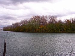
Grassy Island is a small, uninhabited 72-acre (29 ha) American island in the Detroit River. It is located just north of Grosse Ile and west of Fighting Island, about 600 feet (180 m) west of the Canada–United States border. The island is part of the city of Wyandotte, in Wayne County. The island is part of the Detroit River International Wildlife Refuge. Grassy Island should not be confused with Grass Island, which is an island of Ontario on the exact opposite side of the Detroit River.

<span class="mw-page-title-main">Mamajuda Island</span> Canadian island

Mamajuda Island, sometimes identified as Mama Juda Island, was an American island in the Detroit River. It is located just east of the northern tip of Grosse Ile and about 500 feet west of the Canada–United States border. The island is part of Grosse Ile Township in Wayne County, Michigan. It is the smallest of all charted islands in the Detroit River.

<span class="mw-page-title-main">Cedar Point National Wildlife Refuge</span>

Cedar Point National Wildlife Refuge was established in 1964 when the owners of the Cedar Point Shooting Club donated the land to the United States Fish and Wildlife Service. The refuge is now about 2,630 acres (10.6 km2) of marsh that is divided into three pools. The largest one is almost 2,000 acres (8.1 km2), it is the largest contiguous marsh in Ohio’s Lake Erie marshes.

<span class="mw-page-title-main">North Maumee Bay Archeological District</span> Archaeological site in Michigan, United States

The North Maumee Bay Archeological District is a historic district containing archeological sites located in the southeasternmost corner of Erie Township in Monroe County, Michigan. It was added to the National Register of Historic Places on December 5, 1980.

<span class="mw-page-title-main">Calf Island (Michigan)</span>

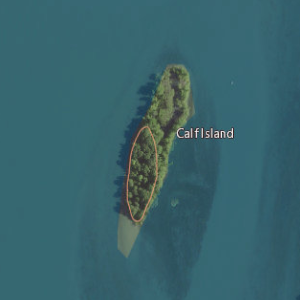
Calf Island is an island in the Detroit River, in Michigan. It has a surface elevation of 571 feet. It is located in the Trenton Channel about 1,000 feet west of the southern tip of Grosse Ile and Swan Island, and Hamburg Island is just to the northwest. The 7-acre island is administered locally by Grosse Ile Township.

<span class="mw-page-title-main">Summer Lake Wildlife Area</span> Wildlife refuge in Oregon

The Summer Lake Wildlife Area is a 29.6-square-mile (77 km2) wildlife refuge located on the northwestern edge of the Great Basin drainage in south-central Oregon. It is administered by the Oregon Department of Fish and Wildlife. The refuge is an important stop for waterfowl traveling along the Pacific Flyway during their spring and fall migrations. The Summer Lake Wildlife Area also provides habitat for shorebirds and other bird species as well as wide variety of mammals and several fish species. The Ana River supplies the water for the refuge wetlands.

Humbug Marsh, a 1.88 square kilometres (0.73 sq mi) wetland in southeastern Wayne County, Michigan, is a constituent element of the Detroit River International Wildlife Refuge. It is listed as a Ramsar wetland of international importance.

<span class="mw-page-title-main">Stony Island (Michigan)</span> Island in the Detroit River, Michigan

Stony Island is an island in the Detroit River, in southeast Michigan. It has been used for hunting and fishing as long as humans have inhabited the region; from the mid-19th century to the mid-20th century, it was the site of a small settlement and served as a central location for the construction of the Livingstone Channel, as well as various civil engineering projects involving the Detroit River. By the 1990s, it had become completely uninhabited; it is now open to the public and administered by the Michigan Department of Natural Resources.

References

  1. "National Wildlife Refuges - Acres by State and Unit" (PDF). US Fish and Wildlife Service. Retrieved 6 September 2016.
  2. "Detroit River International Wildlife Refuge". U.S. Fish and Wildlife Service. 2010. Retrieved March 17, 2010.
  3. 1 2 3 4 "Detroit River-Western Lake Erie Basin Indicator Project". U.S. Environmental Protection Agency. 2009. Retrieved March 17, 2010.
  4. 1 2 3 4 Hartig, John (17 Jul 2007). "The Detroit River's amazing comeback" . Retrieved June 16, 2009.
  5. 1 2 3 4 Swan, James (19 Mar 2009). "Return of the Detroit River's Charismatic Megafauna". Archived from the original on September 22, 2009. Retrieved June 16, 2009.
  6. Millsap, Stephanie (23 Jul 2009). "Grassy Island Disposal Facility". Archived from the original on April 10, 2010. Retrieved March 17, 2010.
  7. 1 2 "Detroit River International Wildlife Refuge". Midwest Natural Resources Group. 2005. Archived from the original on 2009-08-12. Retrieved March 17, 2010.
  8. 1 2 3 U.S. Fish and Wildlife Service (2010). Detroit River International Wildlife Refuge: Overview Archived 2009-06-30 at the Wayback Machine . Retrieved March 17, 2010.
  9. 1 2 "H.R. 1230 – Detroit River International Wildlife Refuge Establishment Act". Congressional Budget Office. 12 Sep 2001. Retrieved March 17, 2010.
  10. "Erie Marsh Preserve". The Nature Conservancy. 2010. Retrieved March 17, 2010.
  11. Ingels, Mike (Apr 2007). "Do Not Enter: The Detroit River IWR". Archived from the original on 2012-03-01. Retrieved March 17, 2010.
  12. "Detroit River International Wildlife Refuge brochure" (PDF). U.S. Fish and Wildlife Service. 2010. Retrieved March 17, 2010.
  13. "A Conservation Vision for the Lower Detroit River Ecosystem" (PDF). Metropolitan Affairs Coalition. Oct 2001. Archived from the original (PDF) on 2011-07-27. Retrieved March 17, 2010.