River Ribble

Last updated

River Ribble
The River Ribble - geograph.org.uk - 3958976.jpg
River Ribble at Preston
Location
CountryEngland
Physical characteristics
Source 
  locationConfluence of Gayle Beck and Cam Beck, Selside, Ribblehead
  elevation807 ft (246 m)
Mouth  
  location
Irish Sea at Lytham
Length75 mi (121 km)
Basin features
Conservation Ribble Rivers Trust

The River Ribble runs through North Yorkshire and Lancashire in Northern England. It starts close to the Ribblehead Viaduct in North Yorkshire, and is one of the few that start in the Yorkshire Dales and flow westwards towards the Irish Sea (the Dee in Dentdale and the Twiss in Kingsdale being notable others).

Contents

Etymology

The name Ribble may be a Brittonic compound-formation. [1] The second element is the noun *pol, with connotations including "puddle, pond, upland-stream" (Welsh pwll). [1] The first is rö-, an intensive prefix, with nouns meaning "great" (Welsh rhy-, Cornish re-). [1]

Ribble may once have been known as *Bremetonā-, underlying the name Bremetenacum, the Roman fort at Ribchester. [1] Involved here is the Brittonic root *breμ–, meaning "roaring" (c.f. Welsh brefu), [1] as observed at the river-names Breamish in Northumberland, [1] Braan in Scotland and Brefi in Wales. [1]

History

Neolithic to Saxon finds from along the River Ribble during the creation of the Preston Docks and others revealed man has been in the area for a long time. The River Ribble looked completely different then and the coastline is likely to have been much further inland than it is at present where land has been reclaimed and the marsh extended out into the River Ribble due to sedimentation.

The Ribble would appear to have been known in Roman times as the Belisama, [2] possibly giving its name to Samlesbury. Ptolemy's "Belisama aest." seems to represent the estuary of the Ribble. Bremetennacum was a Roman fort that guarded a crossing-point of the river at Ribchester. Remains of another Roman site were discovered at Walton-le-Dale in the mid-19th century.

The Cuerdale Hoard, the largest Viking silver hoard ever found outside Russia was discovered in 1840 on the southern bank of a bend of the river, at Cuerdale near Preston. [3] Whilst the medieval silver Mitton Hoard was found near where this river joins the River Hodder in 2009. [4]

At one time the Ribble marked the northernmost extent of the ancient kingdom of Mercia. [5] At the time of the Domesday Book, the river formed the northern boundary of an area of land (known as Inter Ripam et Mersam) that was included in the Domesday information for Cheshire, [6] though it was probably not formally part of the county of Cheshire. [7] [8] [9]

Sawley Abbey was founded by Cistercian monks in 1147, at a bend in the river. It is thought that the monks built a weir to supply a mill race that powered a corn mill within the abbey precinct. [10]

Brungerley Weir near Waddow Hall. Weir at Waddow Hall on the River Ribble - geograph.org.uk - 2224722.jpg
Brungerley Weir near Waddow Hall.

After his defeat in the Battle of Hexham in 1464 (during the Wars of the Roses), King Henry VI went into hiding at a number of houses belonging to his supporters. A little over a year later he was at Waddington Hall in Waddington. On 13 July 1465, a group of Yorkists, including the property-owner's brother, arrived at the hall to arrest him. Escaping into nearby woods, Henry was captured soon after crossing the river at the old stepping stones at Brungerley. [11]

Around 1785, a large weir was constructed across the river, slightly downstream at Waddow Hall, to supply water to a cotton mill at Low Moor. The site relied on water power right up to closure around 1930, although the water wheels gradually gave way to water turbines and were augmented by steam engines. [12]

During 2009, an Archimedean screw type hydropower station was constructed at Settle weir near Bridge End Mill. Built for a community-owned company, Settle Hydro, the site became operational by the end of the year. As of February 2024, the generator has produced 1.2 million kWh of electricity. [13]

Geography

Stainforth Force Stainforth Force - geograph.org.uk - 433067.jpg
Stainforth Force
Tidal bore on the Ribble, between the River Douglas and Preston River Ribble bore.jpg
Tidal bore on the Ribble, between the River Douglas and Preston

The Ribble begins at the confluence of the Gayle Beck and Batty Wife Beck near the viaduct at Ribblehead, in the shadow of the Yorkshire three peaks. It is the only major river rising in Yorkshire which flows westward. [14] It flows through Settle, Clitheroe, Ribchester and Preston, before emptying into the Irish Sea between Lytham St. Annes and Southport, a length of 75 miles (121 km). [15] Its main tributaries are the Hodder and Calder which join the river near Great Mitton, the River Darwen which joins at Walton-le-Dale and the River Douglas which joins near Hesketh Bank.

Above Hellifield the valley of the river is known as Ribblesdale.

The Ribble Way is a long-distance footpath which follows the river for much of its course. The river is connected to both the Leeds and Liverpool Canal and the Lancaster Canal (via the Ribble Link). The river downstream of Preston was actively dredged when Preston was an active port; this is no longer done and silt from the river is now spreading more widely over the (sand) beaches around Fairhaven and St. Annes.

Its 10-mile-wide (16 km) estuary forms part of the Ribble and Alt Estuaries Special Protection Area for wildlife. An average of 340,000 water birds over-winter in the estuary making it the most important wetland site in Britain. The Ribble is also a key breeding ground for the endangered Atlantic salmon. [5]

1.25 million people live in the Ribble's catchment area. [5]

The Normal Tidal Limit (NTL) of the river is at Fishwick Bottoms, between Preston and Walton-le-Dale, 11 miles (18 km) from the sea. [5]

The River Ribble has the third-largest tides in England, with tides that run at 4 knots (5 mph; 7 km/h) and a tidal range at the mouth of the river of 30 feet (9 m) during spring tides. Since River Ribble dredging ceased, the estuary is filling up with sand and is developing a meandering path, depending on the tides and river runoff. In addition, many tributaries flow into the main channel including the Savick Brook/Ribble Link, while the River Douglas, has a significant influence both on sediment transport and hydrodynamics of the estuary. [16]

Crossings

There was a bridge at Edisford, Clitheroe in 1339. The age of the present sandstone bridge is not known, but parts contain features indicating they may date to the late medieval period. [17] The current Ribchester Bridge dates from 1774. It replaced one built in 1669, which also had a predecessor of unknown age. [18]

Evidence of a bridge between Preston and Walton-le-Dale occurs in a deed in the early 13th century. A stone bridge was built in the early 1400s, possibly just west of the present Walton Bridge which was completed in 1781. Until 1755 this was the only bridge over the Ribble at Preston. [19] The original attempt to build a bridge directly to Penwortham was completed in 1755, only to collapse the following year. The Penwortham Old Bridge opened in 1759 to replace it. [20] In 1802 the Lancaster Canal Company completed a timber trestle bridge to facilitate a temporary tramroad to connect the two isolated sections of the canal. The missing section was never completed and, although heavily modified, the disused Old Tramroad Bridge still stands today. [21]

Ferries (historic)

Several ferry crossings were marked along the lower part of the river, on the first Ordnance Survey map of Lancashire, published in the 1840s. The Hacking Ferry near Hacking Hall and Trowers Ferry near Dinckley Hall. Another, downstream of Osbaldeston Hall and the Balderstone Hall Ferry. Also at Samlesbury Church as well as an old boat house, upstream of Penwortham Old Bridge. [22]

It is uncertain when these services began. A 1354 charter assigned some land for the use of the ferryman near Ribchester, possibly referring to the crossing near Osbaldeston Hall. [23] The Hacking Ferry seems to have been funded by the Shireburn family of Stonyhurst, and established during the 1600s. It continued operating as a regular toll service until 1938, but continued occasionally afterward until it finally ceased operation in 1955. In later years it operated two johnboat-type rowing boats. The older boat could carry twelve passengers and a newer boat had a capacity of 19. The former is now in the collection at Clitheroe Castle Museum. [24]

Estuary crossing proposals
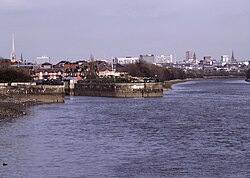
Ribble estuary 04 Ribble estuary, Lytham St Annes, Lancashire, UK.jpg
Ribble estuary

A Ribble estuary fixed crossing has been proposed on several occasions, to provide a quicker route between the seaside resorts of Southport and Blackpool. Two routes for a tramroad were proposed; the first in 1899 outlined a route between Crossens and Lytham, then between 1900 and 1906 as a route from Crossens to Warton via Hesketh Bank. [25] A railway tunnel was proposed in 1907, between Hesketh Bank and Warton. [26] A bridge was proposed between 1938 and 1947. [27] A road link was campaigned for in 2007, envisaging a development similar to the Rance Tidal Power Station in Brittany. [28] In 2011, an April fools' joke suggested a 9-mile-long (14 km) road tunnel from Marshside to Lytham St Annes. [29]

Ecology

The River Ribble catchment is covered by the Ribble Rivers Trust, a UK based charity working to improve, protect and promote the River Ribble for both people and wildlife. The Ribble Estuary is an Internationally important Ramsar Wetland site, [30] a Special Protection Area (SPA) under the Joint Nature Conservation Committee, [31] a Marine Conservation Zone up to Samlesbury, [32] [33] [34] Site of Special Scientific Interest (SSSI), [35] a National Nature Reserve, [36] [34] and is under development as a Coast & Wetlands Regional Park. [37]

Preston City Council published plans to build a barrage across the River Ribble, in their 'Riverworks' proposals (2006). [38] The aim of these proposals was to build a barrage and a water sports park on a section of the Ribble, coupled with over 4,000 units of housing and businesses in the river's flood plain. Some local residents opposed these plans, arguing that they endanger wildlife, increase flood risk to local housing and damage greenbelt areas. These residents set up the Save The Ribble campaign, and their two-year information campaign successfully overturned Preston City Council's proposals, and South Ribble Borough Council announced the alternative creation of a Country Park. Parts of the river are a County Biological Heritage Site.

Settlements

North Yorkshire

Lancashire

Main tributaries

The confluence with the River Hodder. Rivers Ribble and Hodder meet - geograph.org.uk - 5485346.jpg
The confluence with the River Hodder.

Name

The River Ribble gives its name to the local government boroughs of Ribble Valley and South Ribble, and the Ribble Valley parliamentary constituency. The Ribble Bus Company once operated throughout North West England. The Ribble also lends its name to the Ribble Steam Railway.[ citation needed ]

See also

Related Research Articles

<span class="mw-page-title-main">Lancashire</span> County of England

Lancashire is a ceremonial county in North West England. It is bordered by Cumbria to the north, North Yorkshire and West Yorkshire to the east, Greater Manchester and Merseyside to the south, and the Irish Sea to the west. The largest settlement is Blackpool, and Preston is the administrative centre.

<span class="mw-page-title-main">South Ribble</span> Borough and non-metropolitan district in England

South Ribble is a local government district with borough status in Lancashire, England. Its council is based in Leyland. The borough also includes the towns and villages of Penwortham, Leyland, Farington, Hutton, Longton, Walmer Bridge, Salmesbury, Lostock Hall, Walton le Dale and Bamber Bridge. Many of the built-up areas in the borough form part of the wider Preston built-up area.

<span class="mw-page-title-main">Ribble Valley</span> Borough and non-metropolitan district in England

Ribble Valley is a local government district with borough status in Lancashire, England. Its council is based in Clitheroe, the largest town. The borough also includes the town of Longridge and numerous villages and surrounding rural areas. It is named after the River Ribble. Much of the district lies within the Forest of Bowland, a designated Area of Outstanding Natural Beauty.

<span class="mw-page-title-main">Blackburn Hundred</span> Former sub-division of Lancashire, UK

Blackburn Hundred is a historic sub-division of the county of Lancashire, in northern England. Its chief town was Blackburn, in the southwest of the hundred. It covered an area similar to modern East Lancashire, including the current districts of Ribble Valley, Pendle, Burnley, Rossendale, Hyndburn, Blackburn with Darwen, and South Ribble.

<span class="mw-page-title-main">Amounderness Hundred</span> Subdivision of the historic county of Lancashire

The Amounderness Hundred is one of the six subdivisions of the historic county of Lancashire in North West England, but the name is older than the system of hundreds first recorded in the 13th century and might best be described as the name of a Norse wapentake. In the Domesday Book of 1086, it was used for some territories north of the River Ribble included together with parts of Yorkshire. The area eventually became part of Lancashire, sitting geographically between the Rivers Lune and Ribble, in the strip of coast between the Irish Sea and Bowland Forest.

<span class="mw-page-title-main">River Darwen</span> River in Lancashire, England

The River Darwen runs through Darwen and Blackburn in Lancashire, England, eventually joining the River Ribble at Walton le Dale south of Preston on its way to the Ribble Estuary.

<span class="mw-page-title-main">Ribble Valley (UK Parliament constituency)</span> Parliamentary constituency in the United Kingdom, 1983 onwards

Ribble Valley is a constituency in Lancashire represented in the House of Commons of the UK Parliament since 1992 by Nigel Evans, a Conservative. Evans has served as a Deputy Speaker of the House of Commons and Second Deputy Chairman of Ways and Means since January 2020; he previously served as First Deputy Chairman of Ways and Means from 2010 to 2013.

<span class="mw-page-title-main">Penwortham</span> Human settlement in England

Penwortham is a town and civil parish in South Ribble, Lancashire, England, on the south bank of the River Ribble facing the city of Preston. The town is at the most westerly crossing point of the river, with major road and rail links crossing it here. The population of the town at the 2011 census was 23,047.

<span class="mw-page-title-main">Diocese of Blackburn</span> Diocese of the Church of England

The diocese of Blackburn is diocese of the Church of England in North West England. Its boundaries correspond to northern Lancashire with the exception of the eastern part of the Forest of Bowland, which is part of the diocese of Leeds. The diocese contains 211 parishes and 280 churches. Blackburn Cathedral is the seat of the bishop of Blackburn, currently Philip North, and the diocesan offices are also located in Blackburn.

The Ribble way is a long-distance walk between the Lancashire coast and the Yorkshire Dales National Park largely following the course of the River Ribble.

<span class="mw-page-title-main">Gisburn</span> Human settlement in England

Gisburn is a village and civil parish within the Ribble Valley borough of Lancashire, England. Historically within the West Riding of Yorkshire, it lies 8 miles (13 km) northeast of Clitheroe and 11 miles (18 km) west of Skipton. The civil parish had a population of 506, recorded in the 2001 census, increasing to 521 at the 2011 Census.

<span class="mw-page-title-main">Higher Walton, Lancashire</span> Human settlement in England

Higher Walton is a village in South Ribble, Lancashire, England. It is on the old road between Blackburn and Preston where it crosses the River Darwen. The road, at this point, is now part of the A675. Nearby places include Walton-le-Dale, Coupe Green, and Bamber Bridge.

<span class="mw-page-title-main">West Bradford, Lancashire</span> Human settlement in England

West Bradford is a village and civil parish in Lancashire, England, 2.5 miles (4 km) north of Clitheroe. The population at the 2011 census was 788. It covers some 2000 acres of the Forest of Bowland. In Domesday, it is recorded as Bradeford and in the thirteenth century, Braford in Bouland. It was part of the West Riding of Yorkshire until 1974. "West Bradford" was introduced in the nineteenth century at the start of postal services to distinguish the village from the city of the same name.

<span class="mw-page-title-main">Listed buildings in Lancashire</span>

There are a number of listed buildings in Lancashire. The term "listed building", in the United Kingdom, refers to a building or structure designated as being of special architectural, historical, or cultural significance. Details of all the listed buildings are contained in the National Heritage List for England. They are categorised in three grades: Grade I consists of buildings of outstanding architectural or historical interest, Grade II* includes significant buildings of more than local interest and Grade II consists of buildings of special architectural or historical interest. Buildings in England are listed by the Secretary of State for Culture, Media and Sport on recommendations provided by English Heritage, which also determines the grading.

<span class="mw-page-title-main">Transport in Preston</span>

Preston is a city in Lancashire, around 50 kilometres (31 mi) north-west of Manchester.

<span class="mw-page-title-main">Lancashire Domesday Book tenants-in-chief</span> List of Lancashire land owners in the Domesday Book

The Domesday Book of 1086 AD identifies King William the Conqueror's tenants-in-chief for historic Lancashire within Cestrescire (Cheshire) and Eurvicscire (Yorkshire). At the time of the Norman Conquest of England, the County of Cheshire included Inter Ripam et Mersam which became South Lancashire, while the West Riding of the County of Yorkshire included what became North Lancashire.

References

Notes

  1. 1 2 3 4 5 6 7 James, Alan. "A Guide to the Place-Name Evidence" (PDF). SPNS – The Brittonic Language in the Old North. Retrieved 13 October 2019.
  2. Hutton, p. 218
  3. Historic England. "Monument No. 42457". Research records (formerly PastScape).
  4. Coin hoard BM-193206, Finds.org.uk, Retrieved 16 September 2015
  5. 1 2 3 4 "River Ribble Factsheet (pdf file)" (PDF). Mersey Basin Campaign Official Website. Retrieved 15 August 2015.
  6. Morgan (1978); pp. 269c–301c,d.
  7. Harris and Thacker (1987). write on page 252:
    Certainly there were links between Cheshire and south Lancashire before 1000, when Wulfric Spot held lands in both territories. Wulfric's estates remained grouped together after his death, when they were left to his brother Aelfhelm, and indeed there still seems to have been some kind of connexion in 1086, when south Lancashire was surveyed together with Cheshire by the Domesday commissioners. Nevertheless, the two territories do seem to have been distinguished from one another in some way and it is not certain that the shire-moot and the reeves referred to in the south Lancashire section of Domesday were the Cheshire ones.
  8. Phillips and Phillips (2002). pp. 26–31.
  9. Crosby, A. (1996). writes on page 31:
    The Domesday Survey (1086) included south Lancashire with Cheshire for convenience, but the Mersey, the name of which means 'boundary river' is known to have divided the kingdoms of Northumbria and Mercia and there is no doubt that this was the real boundary.
  10. Abby Hunt (2005), Sawley Abbey, Sawley, Lancashire: a Cistercian monastic precinct and post-medieval landscape. Survey Report, English Heritage, p. 35
  11. Abram, William Alexander (1877). Parish of Blackburn, County of Lancaster: A History of Blackburn, Town and Parish. Blackburn: J. G. & J. Toulmin. p. 57. Retrieved 3 October 2021.
  12. Owen Ashmore (1963–1964). "Low Moor, Clitheroe: A Nineteenth-Century Factory Community". Transactions of the Lancashire and Cheshire Antiquarian Society. 73–74. Manchester: 125–128, 132–133, 138.
  13. "Settle Hydro - A pioneering, community-owned, hydroelectric scheme". Settle Hydro Limited.
  14. Chrystal, Paul (2017). The place names of Yorkshire; cities, towns, rivers and dales. Catrine: Stenlake. p. 104. ISBN   9781840337532.
  15. Clayton, Phil (2012). Headwaters: Walking to British River Sources (First ed.). London: Frances Lincoln Limited. p. 157. ISBN   9780711233638.
  16. "A Vertically Resolving Model Of Sediment And Radionuclide Transport For The Ribble Estuary". 18 October 2007. Archived from the original on 18 October 2007. Retrieved 2 April 2018.{{cite web}}: CS1 maint: bot: original URL status unknown (link)
  17. Historic England. "Edisford Bridge (44715)". Research records (formerly PastScape). Retrieved 2 October 2021.
  18. Historic England. "Monument No. 43617". Research records (formerly PastScape). Retrieved 2 October 2021.
  19. Historic England. "Monument No. 42467". Research records (formerly PastScape). Retrieved 25 October 2021.
  20. Historic England. "Old Penwortham Bridge (1279848)". National Heritage List for England. Retrieved 25 October 2021.
  21. Faulkner, Paul (21 February 2021). "REVEALED: The cost of replacing Preston's old tram bridge – and why there is no sign of it happening". Lancashire Evening Post. JPIMedia Publishing Ltd. Retrieved 2 October 2021.
  22. Lancashire and Furness (Map) (1st ed.). 1:10,560. County Series. Ordnance Survey. 1848.
  23. Whitaker, Thomas Dunham (1876). An history of the original Parish of Whalley, and honor of Clitheroe... 4th ed. Vol. 2. George Routledge. OCLC   697798990.
  24. Jo Hayward (24 May 2018). "The long lost ferry boat that evokes happy memories of rural Lancashire". museumcrush.org.
  25. Naylor, Callum (4 August 2020). "Plans For Cross Ribble Links From Lytham To Southport (Pity They Are More Than A Century Old!)". Lythamstannes.news. Retrieved 18 March 2021.
  26. "Ribble Tunnel Scheme 1907". Lytham Times. 22 March 1907. Retrieved 18 March 2021.
  27. "Proposed bridge over River Ribble estuary (including other schemes for crossing river)". The National Archives. Retrieved 19 March 2021.
  28. Gee, Chris (5 July 2007). "A bridge too far for Lytham link". The Westmoreland Gazette. Retrieved 18 March 2021.
  29. Sinister, David (1 April 2011). "Exclusive: Report recommends Ribble tunnel to link Southport and Blackpool". Champion. Archived from the original on 28 August 2016. Retrieved 18 March 2021.
  30. "Ribble & Alt Estuaries | Ramsar Sites Information Service". rsis.ramsar.org. Retrieved 23 May 2023.
  31. "List of UK SPAs". jncc.gov.uk. Retrieved 23 May 2023.
  32. "Marine Conservation Zones: Ribble Estuary". GOV.UK. Retrieved 23 May 2023.
  33. "Ribble Estuary". Living Seas North West. Retrieved 23 May 2023.
  34. 1 2 "Biodiversity in South Ribble". South Ribble Borough Council. Retrieved 23 May 2023.
  35. "Ribble Estuary SSSI / Ribble & Alt SPA Intertidal sediments condition monitoring – IPENS022". Natural England – Access to Evidence. Retrieved 23 May 2023.
  36. "The Ribble Estuary National Nature Reserve Conservation". The RSPB. Retrieved 23 May 2023.
  37. "Welcome to the Ribble Coast and Wetlands". Ribble Coast and Wetlands. Retrieved 23 May 2023.
  38. Carter, Helen (6 December 2006). "Ripples of discontent on the Ribble". The Guardian. Retrieved 22 May 2023.

Bibliography

Further reading

53°45′N2°46′W / 53.750°N 2.767°W / 53.750; -2.767