An ice shelf is a large floating platform of ice that forms where a glacier or ice sheet flows down to a coastline and onto the ocean surface. Ice shelves are found in Antarctica and the Arctic. The boundary between the floating ice shelf and the anchor ice that feeds it is the grounding line. The thickness of ice shelves can range from about 100 m (330 ft) to 1,000 m (3,300 ft). The world's largest ice shelves are the Ross Ice Shelf and the Filchner-Ronne Ice Shelf in Antarctica. When a large piece of an ice shelf breaks off, this can lead to the formation of an iceberg. This process is also called ice calving.

The Byrd Polar and Climate Research Center (BPCRC) is a polar, alpine, and climate research center at The Ohio State University founded in 1960.

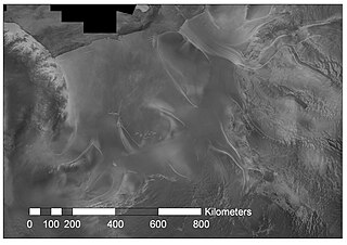
The Recovery Glacier is a glacier flowing west along the southern side of the Shackleton Range in Antarctica. First seen from the air and examined from the ground by the Commonwealth Trans-Antarctic Expedition in 1957, it was so named because of the recovery of the expedition's vehicles which repeatedly broke into bridged crevasses on this glacier during the early stages of the crossing of Antarctica. It is at least 100 km (60 mi) long and 64 km (40 mi) wide at its mouth.

The Antarctic ice sheet is one of two ice sheets on Earth and covers about 98% of the Antarctic continent. It is the largest single mass of ice on Earth, with an average thickness of over 2 kilometres (1.2 mi). It is distinct from the Antarctic sea ice. The Antarctic ice sheet covers an area of almost 14 million square kilometres and contains 26.5 million cubic kilometres of ice. The other ice sheet on Earth is the Greenland ice sheet.

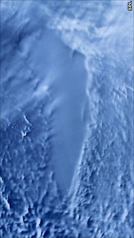
A subglacial lake is a lake that is found under a glacier, typically beneath an ice cap or ice sheet. Subglacial lakes form at the boundary between ice and the underlying bedrock, where gravitational pressure decreases the pressure melting point of ice. Over time, the overlying ice gradually melts at a rate of a few millimeters per year. Meltwater flows from regions of high to low hydraulic pressure under the ice and pools, creating a body of liquid water that can be isolated from the external environment for millions of years.
The Evans Ice Stream is a large ice stream draining from Ellsworth Land, between Cape Zumberge and Fowler Ice Rise, into the western part of the Ronne Ice Shelf. Mills Glacier flows adjacently into the ice stream from the southwest side. The feature was recorded on February 5, 1974, in Landsat imagery. It was named by the UK Antarctic Place-Names Committee for Stanley Evans, a British physicist who, starting in 1961, developed apparatus for radio echo sounding of icecaps and glaciers from aircraft; he carried out upper atmosphere research at Brunt Ice Shelf, 1956–57.

Pine Island Glacier (PIG) is a large ice stream, and the fastest melting glacier in Antarctica, responsible for about 25% of Antarctica's ice loss. The glacier ice streams flow west-northwest along the south side of the Hudson Mountains into Pine Island Bay, Amundsen Sea, Antarctica. It was mapped by the United States Geological Survey (USGS) from surveys and United States Navy (USN) air photos, 1960–66, and named by the Advisory Committee on Antarctic Names (US-ACAN) in association with Pine Island Bay.

Thwaites Glacier is an unusually broad and vast Antarctic glacier located east of Mount Murphy, on the Walgreen Coast of Marie Byrd Land. It was initially sighted by polar researchers in 1940, mapped in 1959–1966 and officially named in 1967, after the late American glaciologist Fredrik T. Thwaites. The glacier flows into Pine Island Bay, part of the Amundsen Sea, at surface speeds which exceed 2 kilometres (1.2 mi) per year near its grounding line. Its fastest-flowing grounded ice is centered between 50 and 100 kilometres east of Mount Murphy. Like many other parts of the cryosphere, it has been adversely affected by climate change, and provides one of the more notable examples of the retreat of glaciers since 1850.
Radioglaciology is the study of glaciers, ice sheets, ice caps and icy moons using ice penetrating radar. It employs a geophysical method similar to ground-penetrating radar and typically operates at frequencies in the MF, HF, VHF and UHF portions of the radio spectrum. This technique is also commonly referred to as "Ice Penetrating Radar (IPR)" or "Radio Echo Sounding (RES)".

Eric J. Rignot is the Donald Bren, Distinguished and Chancellor Professor of Earth system science at the University of California, Irvine, and a Senior Research Scientist for the Radar Science and Engineering Section at NASA's Jet Propulsion Laboratory. He studies the interaction of the polar ice sheets in Greenland and Antarctica with global climate using a combination of satellite remote sensing, airborne remote sensing, understanding of physical processes controlling glacier flow and ice melt in the ocean, field methods, and climate modeling. He was elected at the National_Academy_of_Sciences in 2018.
Bindschadler Ice Stream is an ice stream between Siple Dome and MacAyeal Ice Stream. It is one of several major ice streams draining from Marie Byrd Land into the Ross Ice Shelf. The ice streams were investigated and mapped by U.S. Antarctic Research Program personnel in a number of field seasons from 1983 to 1984 and named Ice Stream A, B, C, etc., according to their position from south to north.

Rutford Ice Stream is a major Antarctic ice stream, about 290 kilometres (180 mi) long and over 24 kilometres (15 mi) wide, which drains southeastward between the Sentinel Range, Ellsworth Mountains and Fletcher Ice Rise into the southwest part of Ronne Ice Shelf. Named by US-ACAN for geologist Robert Hoxie Rutford, a member of several USARP expeditions to Antarctica; leader of the University of Minnesota Ellsworth Mountains Party, 1963-1964. Rutford served as Director of the Division of Polar Programs, National Science Foundation, 1975-1977.

CryoSat-1, also known as just CryoSat, was a European Space Agency satellite which was lost in a launch failure in 2005. The satellite was launched as part of the European Space Agency's CryoSat mission, which aims to monitor ice in the high latitudes. The second mission satellite, CryoSat-2, was successfully launched in April 2010.

Operation IceBridge (OIB) was a NASA mission to monitor changes in polar ice. It is an airborne follow-on mission to the ICESat satellite, until after the ICESat-2 mission was launched in September 2018. OIB ended in 2019.
ICESat-2, part of NASA's Earth Observing System, is a satellite mission for measuring ice sheet elevation and sea ice thickness, as well as land topography, vegetation characteristics, and clouds. ICESat-2, a follow-on to the ICESat mission, was launched on 15 September 2018 onboard Delta II as the final flight from Vandenberg Air Force Base in California, into a near-circular, near-polar orbit with an altitude of approximately 496 km (308 mi). It was designed to operate for three years and carry enough propellant for seven years. The satellite orbits Earth at a speed of 6.9 kilometers per second (4.3 mi/s).
Helen Amanda Fricker is a glaciologist and professor at Scripps Institution of Oceanography at the University of California, San Diego where she is a director of the Scripps Polar Center. She won the 2010 Martha T. Muse Prize for Science and Policy in Antarctica.
The Ice Sheet Mass Balance Inter-comparison Exercise (IMBIE) is an international scientific collaboration attempting to improve estimates of the Antarctic and Greenland ice sheet contribution to sea level rise and to publish data and analyses concerning these subjects. IMBIE was founded in 2011 and is a collaboration between the European Space Agency (ESA) and the National Aeronautics and Space Administration (NASA) of the United States, and contributes to assessment reports of the Intergovernmental Panel on Climate Change (IPCC). IMBIE has led to improved confidence in the measurement of ice sheet mass balance and the associated global sea-level contribution. The improvements were achieved through combination of ice sheet imbalance estimates developed from the independent satellite techniques of altimetry, gravimetry and the input-output method. Going forwards, IMBIE provides a framework for assessing ice sheet mass balance, and has an explicit aim to widen participation to enable the entire scientific community to become involved.
Mercer Subglacial Lake is a subglacial lake in Antarctica covered by a sheet of ice 1,067 m (3,501 ft) thick; the water below is hydraulically active, with water replacement times on the order of a decade from the Ross Sea. Studies suggest that Mercer Subglacial Lake as well as other subglacial lakes appear to be linked, with drainage events in one reservoir causing filling and follow-on drainage in adjacent lakes.

Guðfinna 'Tollý' Aðalgeirsdóttir is professor in Geophysics at the Faculty of Earth Sciences, University of Iceland.


