Rushville, Nebraska

Last updated

Rushville, Nebraska
Rushville, Nebraska N Main 1.jpg
Downtown Rushville: west side of north Main Street, April 2011
Sheridan County Nebraska Incorporated and Unincorporated areas Rushville Highlighted.svg
Location of Rushville within county and state
Coordinates: 42°42′48″N102°28′00″W / 42.71333°N 102.46667°W / 42.71333; -102.46667
Country United States
State Nebraska
County Sheridan
Area
[1]
  Total1.15 sq mi (2.98 km2)
  Land1.15 sq mi (2.98 km2)
  Water0.00 sq mi (0.00 km2)
Elevation
[2]
3,740 ft (1,140 m)
Population
 (2020)
  Total816
  Density709.57/sq mi (273.89/km2)
Time zone UTC-7 (Mountain (MST))
  Summer (DST) UTC-6 (MDT)
ZIP code
69360
Area code 308
FIPS code 31-42775 [3]
GNIS feature ID2396454 [2]
Website rushvillene.com

Rushville is a city in and county seat of Sheridan County, Nebraska, United States, in the remote Sandhills Region. Its population was 890 at the 2010 census. [4] It is the seat of government of Sheridan County. [5]

Contents

Description

Rushville was named from Rush Creek. [6] In the Lakota language, Rushville is known as Owátȟokšu or Iwátȟokšu Otȟúŋwahe, meaning "Place where things are transported" or "Transportation City". [7]

History

Rushville was platted in 1885 when the Fremont, Elkhorn, and Missouri Valley Railway was extended to that point. [8] Rushville was incorporated in October 1885. [9]

Geography

According to the United States Census Bureau, the city has a total area of 1.15 square miles (2.98 km2), all land. [10]

Demographics

Historical population
CensusPop.Note
1890 484
1900 483−0.2%
1910 63331.1%
1920 95550.9%
1930 1,0065.3%
1940 1,12511.8%
1950 1,26612.5%
1960 1,228−3.0%
1970 1,137−7.4%
1980 1,2177.0%
1990 1,127−7.4%
2000 999−11.4%
2010 890−10.9%
2020 816−8.3%
U.S. Decennial Census [11]

2010 census

As of the census [12] of 2010, there were 890 people, 399 households, and 226 families living in the city. The population density was 773.9 inhabitants per square mile (298.8/km2). There were 498 housing units at an average density of 433.0 per square mile (167.2/km2). The racial makeup of the city was 73.8% White, 0.6% African American, 21.9% Native American, 0.1% Asian, 0.6% from other races, and 3.0% from two or more races. Hispanic or Latino residents of any race were 6.1% of the population.

There were 399 households, of which 30.8% had children under the age of 18 living with them, 39.1% were married couples living together, 13.5% had a female householder with no husband present, 4.0% had a male householder with no wife present, and 43.4% were non-families. 40.4% of all households were made up of individuals, and 20.3% had someone living alone who was 65 years of age or older. The average household size was 2.21 and the average family size was 2.96.

The median age in the city was 39.3 years. 28.5% of residents were under the age of 18; 4.5% were between the ages of 18 and 24; 21.5% were from 25 to 44; 25.4% were from 45 to 64; and 20% were 65 years of age or older. The gender makeup of the city was 43.8% male and 56.2% female.

2000 census

As of the census [3] of 2000, there were 999 people, 419 households, and 266 families living in the city. The population density was 857.2 inhabitants per square mile (331.0/km2). There were 518 housing units at an average density of 444.5 per square mile (171.6/km2). The racial makeup of the city was 77.68% White, 0.10% African American, 18.32% Native American, 0.30% from other races, and 3.60% from two or more races. Hispanic or Latino residents of any race were 2.30% of the population.

There were 419 households, out of which 28.9% had children under the age of 18 living with them, 47.5% were married couples living together, 11.7% had a female householder with no husband present, and 36.3% were non-families. 33.7% of all households were made up of individuals, and 16.5% had someone living alone who was 65 years of age or older. The average household size was 2.30 and the average family size was 2.90.

In the city, 25.5% of the population was under the age of 18, 5.9% was from 18 to 24, 25.3% from 25 to 44, 22.3% from 45 to 64, and 20.9% was 65 years of age or older. The median age was 41 years. For every 100 females, there were 88.1 males. For every 100 females age 18 and over, there were 86.5 males.

As of 2000 the median income for a household in the city was $27,361, and the median income for a family was $36,100. Males had a median income of $23,750 versus $20,536 for females. The per capita income for the city was $14,586. About 13.5% of families and 16.4% of the population were below the poverty line, including 28.7% of those under age 18 and 7.0% of those age 65 or over.

Notable people

See also

Related Research Articles

<span class="mw-page-title-main">Oglala Lakota County, South Dakota</span> County in South Dakota, United States

Oglala Lakota County is a county in southwestern South Dakota, United States. As of the 2020 census, the population was 13,672. Oglala Lakota County does not have a functioning county seat; Hot Springs in neighboring Fall River County serves as its administrative center. The county was created as a part of the Dakota Territory in 1875, although it remains unorganized. Its largest community is Pine Ridge.

<span class="mw-page-title-main">Sheridan County, Nebraska</span> County in Nebraska, United States

Sheridan County is a county in the U.S. state of Nebraska. As of the 2020 United States Census, the population was 5,127. Its county seat is Rushville. The county was formed in 1885, and was named for General Philip H. Sheridan.

<span class="mw-page-title-main">Rushville, Illinois</span> City in Illinois, United States

Rushville is a city in Schuyler County, Illinois, United States. The population was 3,005 at the 2020 census. It is the county seat of Schuyler County. It was first settled by Euro-Americans in 1823.

<span class="mw-page-title-main">Rushville, Missouri</span> Village in Missouri, United States

Rushville is a village in western Buchanan County, Missouri, United States. The population was 225 at the 2020 census. It is part of the St. Joseph, MO–KS Metropolitan Statistical Area.

<span class="mw-page-title-main">Alliance, Nebraska</span> City in Nebraska, United States

Alliance is a city and the county seat of Box Butte County, in the western part of the state of Nebraska, in the Great Plains region of the United States. Its population was 8,151 at the 2020 census.

<span class="mw-page-title-main">Chadron, Nebraska</span> City in and county seat of Dawes County, Nebraska, United States

Chadron is a city and the county seat of Dawes County, Nebraska, United States, in the Great Plains region. The population was 5,206 at the 2020 census.

<span class="mw-page-title-main">Broadwater, Nebraska</span> Village in Nebraska, United States

Broadwater is a village in Morrill County, Nebraska, United States. The population was 128 at the 2010 census.

<span class="mw-page-title-main">Auburn, Nebraska</span> City in Nebraska, United States

Auburn is a city in Nemaha County, Nebraska, United States, and its county seat. The population was 3,470 at the 2020 census.

<span class="mw-page-title-main">Bassett, Nebraska</span> City in and county seat of Rock County, Nebraska, United States

Bassett is a city in Rock County, Nebraska, United States. The population was 538 at the 2020 census. It is the county seat of Rock County.

<span class="mw-page-title-main">Gordon, Nebraska</span> City in Sheridan County, Nebraska, United States

Gordon is a city in Sheridan County, Nebraska, United States, in the Great Plains region. Its population was 1,612 at the 2010 census.

<span class="mw-page-title-main">Hay Springs, Nebraska</span> City in Nebraska, United States

Hay Springs is a city in Sheridan County in the state of Nebraska, in the Great Plains region of the United States. The population was 570 at the 2010 census.

<span class="mw-page-title-main">Blair, Nebraska</span> City in and county seat of Washington County, Nebraska, United States

Blair is a city in and the county seat of Washington County, Nebraska, United States. The population was 7,990 at the 2010 census. Blair is a part of the Omaha-Council Bluffs Metropolitan Statistical Area.

<span class="mw-page-title-main">Fort Calhoun, Nebraska</span> City in Washington County, Nebraska, United States

Fort Calhoun is a city in Washington County, Nebraska, United States. The population was 1,108 at the 2020 census. The city includes Fort Atkinson, the first fort built west of the Missouri River.

<span class="mw-page-title-main">Red Cloud, Nebraska</span> City in and county seat of Webster County, Nebraska, United States

Red Cloud is a city in and the county seat of Webster County, Nebraska, United States. The population was 962 at the 2020 census.

<span class="mw-page-title-main">Lakota, North Dakota</span> City in North Dakota, United States

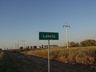
Lakota is a city in Nelson County, North Dakota, United States. It is the county seat of Nelson County Lakota is located 63 miles west of Grand Forks and 27 miles east of Devils Lake. The population was 683 at the 2020 census, making Lakota the 75th-largest city in North Dakota.

<span class="mw-page-title-main">Rushville, Ohio</span> Village in Ohio, United States

Rushville is a village in Fairfield County, Ohio, United States. The population was 304 at the 2020 census. Much of the village is listed on the National Register of Historic Places as the Rushville Historic District.

<span class="mw-page-title-main">West Rushville, Ohio</span> Village in Ohio, United States

West Rushville is a village in Fairfield County, Ohio, United States. The population was 166 at the 2020 census.

<span class="mw-page-title-main">Martin, South Dakota</span> City in South Dakota, United States

Martin is a city and the county seat of Bennett County, South Dakota, United States. The population was 938 at the 2020 census.

<span class="mw-page-title-main">White River, South Dakota</span> City in South Dakota, United States

White River is a city in and the county seat of Mellette County. South Dakota, United States. The population was 533 at the 2020 census.

<span class="mw-page-title-main">New Underwood, South Dakota</span> City in South Dakota, United States

New Underwood is a city in Pennington County, South Dakota, United States. The population was 590 at the 2020 Census.

References

  1. "ArcGIS REST Services Directory". United States Census Bureau. Retrieved September 18, 2022.
  2. 1 2 U.S. Geological Survey Geographic Names Information System: Rushville, Nebraska
  3. 1 2 "U.S. Census website". United States Census Bureau . Retrieved January 31, 2008.
  4. "Chadron, county show growth".
  5. "Find a County". National Association of Counties. Retrieved June 7, 2011.
  6. Exploring Nebraska Highways: Trip Trivia. Exploring America's Highway. 2007. p. 118. ISBN   978-0-9744358-7-9.
  7. Ullrich, Jan F. (2014). New Lakota Dictionary (2nd ed.). Bloomington, IN: Lakota Language Consortium. ISBN   978-0-9761082-9-0.
  8. "Rushville, Sheridan County". Center for Advanced Land Management Information Technologies. University of Nebraska. Retrieved August 23, 2014.
  9. Shumway, Grant Lee (1921). History of Western Nebraska and Its People. Western publishing & engraving Company. p. 424.
  10. "US Gazetteer files 2010". United States Census Bureau. Archived from the original on January 25, 2012. Retrieved June 24, 2012.
  11. "Census of Population and Housing". Census.gov. Retrieved June 4, 2015.
  12. "U.S. Census website". United States Census Bureau . Retrieved June 24, 2012.

Commons-logo.svg Media related to Rushville, Nebraska at Wikimedia Commons