A standard-gauge railway is a railway with a track gauge of 1,435 mm. The standard gauge is also called Stephenson gauge, international gauge, UIC gauge, uniform gauge, normal gauge and European gauge in Europe, and SGR in East Africa. It is the most widely used track gauge around the world, with about 55% of the lines in the world using it.

A tire or tyre is a ring-shaped component that surrounds a wheel's rim to transfer a vehicle's load from the axle through the wheel to the ground and to provide traction on the surface over which the wheel travels. Most tires, such as those for automobiles and bicycles, are pneumatically inflated structures, providing a flexible cushion that absorbs shock as the tire rolls over rough features on the surface. Tires provide a footprint, called a contact patch, designed to match the vehicle's weight and the bearing on the surface that it rolls over by exerting a pressure that will avoid deforming the surface.

Highway engineering is a professional engineering discipline branching from the civil engineering subdiscipline of transportation engineering that involves the planning, design, construction, operation, and maintenance of roads, highways, streets, bridges, and tunnels to ensure safe and effective transportation of people and goods. Highway engineering became prominent towards the latter half of the 20th century after World War II. Standards of highway engineering are continuously being improved. Highway engineers must take into account future traffic flows, design of highway intersections/interchanges, geometric alignment and design, highway pavement materials and design, structural design of pavement thickness, and pavement maintenance.

A road surface or pavement is the durable surface material laid down on an area intended to sustain vehicular or foot traffic, such as a road or walkway. In the past, gravel road surfaces, macadam, hoggin, cobblestone and granite setts were extensively used, but these have mostly been replaced by asphalt or concrete laid on a compacted base course. Asphalt mixtures have been used in pavement construction since the beginning of the 20th century and are of two types: metalled (hard-surfaced) and unmetalled roads. Metalled roadways are made to sustain vehicular load and so are usually made on frequently used roads. Unmetalled roads, also known as gravel roads or dirt roads, are rough and can sustain less weight. Road surfaces are frequently marked to guide traffic.

Asphalt concrete is a composite material commonly used to surface roads, parking lots, airports, and the core of embankment dams. Asphalt mixtures have been used in pavement construction since the beginning of the twentieth century. It consists of mineral aggregate bound together with bitumen, laid in layers, and compacted.

In transport engineering, subgrade is the native material underneath a constructed road, pavement or railway track. It is also called formation level.

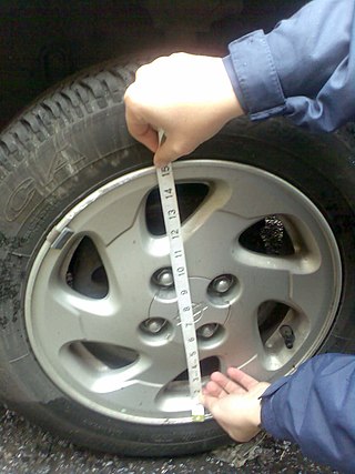
The wheel size for a motor vehicle or similar wheel has a number of parameters.

Aquaplaning or hydroplaning by the tires of a road vehicle, aircraft or other wheeled vehicle occurs when a layer of water builds between the wheels of the vehicle and the road surface, leading to a loss of traction that prevents the vehicle from responding to control inputs. If it occurs to all wheels simultaneously, the vehicle becomes, in effect, an uncontrolled sled. Aquaplaning is a different phenomenon from when water on the surface of the roadway merely acts as a lubricant. Traction is diminished on wet pavement even when aquaplaning is not occurring.

A gravel road is a type of unpaved road surfaced with gravel that has been brought to the site from a quarry or stream bed. Gravel roads are common in less-developed nations, and also in the rural areas of developed nations such as Canada and the United States. In New Zealand, and other Commonwealth countries, they may be known as metal roads. They may be referred to as "dirt roads" in common speech, but that term is used more for unimproved roads with no surface material added. If well constructed and maintained, a gravel road is an all-weather road.
Tramway track is used on tramways or light rail operations. As with standard rail tracks, tram tracks have two parallel steel rails, the distance between the heads of the rails being the track gauge. When there is no need for pedestrians or road vehicles to traverse the track, conventional flat-bottom rail is used. However, when such traffic exists, such as in urban streets, grooved rails are used.

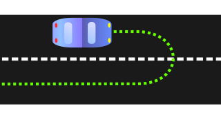
The turning radius of a vehicle defines the minimum dimension of available space required for that vehicle to make a semi-circular U-turn without skidding. The Oxford English Dictionary describes turning circle as "the smallest circle within which a ship, motor vehicle, etc., can be turned round completely". The term thus refers to a theoretical minimal circle in which for example an aeroplane, a ground vehicle or a watercraft can be turned around.

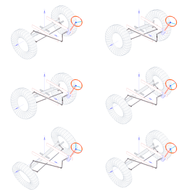
Bump steer is the term for the tendency of the wheel of a car to steer itself as it moves through the suspension stroke.

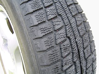
Snow tires, also known as winter tires, are tires designed for use on snow and ice. Snow tires have a tread design with larger gaps than those on conventional tires, increasing traction on snow and ice. Such tires that have passed specific winter traction performance tests are entitled to display a 3PMSF and/or a IMP symbols on their sidewalls. Tires designed for winter conditions are optimized to drive at temperatures below 7 °C (45 °F). Studded tires are a type of snow tires which have metal or ceramic studs that protrude from the tire to increase traction on hard-packed snow or ice. Studs abrade dry pavement, causing dust and creating wear in the wheel path. Regulations that require the use of snow tires or permit the use of studs vary by country in Asia and Europe, and by state or province in North America.

Tire balance, also called tire unbalance or tire imbalance, describes the distribution of mass within an automobile tire or the entire wheel on which it is mounted.
Road surface textures are deviations from a planar and smooth surface, affecting the vehicle/tyre interaction. Pavement texture is divided into: microtexture with wavelengths from 0 mm to 0.5 millimetres (0.020 in), macrotexture with wavelengths from 0.5 millimetres (0.020 in) to 50 millimetres (2.0 in) and megatexture with wavelengths from 50 millimetres (2.0 in) to 500 millimetres (20 in).

Crocodile cracking is a common type of distress in asphalt pavement. The following is more closely related to fatigue cracking which is characterized by interconnecting or interlaced cracking in the asphalt layer resembling the hide of a crocodile. Cell sizes can vary in size up to 300 millimetres (12 in) across, but are typically less than 150 millimetres (5.9 in) across. Fatigue cracking is generally a loading failure, but numerous factors can contribute to it. It is often a sign of sub-base failure, poor drainage, or repeated over-loadings. It is important to prevent fatigue cracking, and repair as soon as possible, as advanced cases can be very costly to repair and can lead to formation of potholes or premature pavement failure.

The international roughness index (IRI) is the roughness index most commonly obtained from measured longitudinal road profiles. It is calculated using a quarter-car vehicle math model, whose response is accumulated to yield a roughness index with units of slope. Although a universal term, IRI is calculated per wheelpath, but can be expanded to a Mean Roughness Index (MRI) when both wheelpath profiles are collected. This performance measure has less stochasticity and subjectivity in comparison to other pavement performance indicators, such as PCI, but it is not completely devoid of randomness. The sources of variability in IRI data include the difference among the readings of different runs of the test vehicle and the difference between the readings of the right and left wheel paths. Despite these facts, since its introduction in 1986, the IRI has become the road roughness index most commonly used worldwide for evaluating and managing road systems.
A railway or railroad is a track where the vehicle travels over two parallel steel bars, called rails. The rails support and guide the wheels of the vehicles, which are traditionally either trains or trams. Modern light rail is a relatively new innovation which combines aspects of those two modes of transport. However fundamental differences in the track and wheel design are important, especially where trams or light railways and trains have to share a section of track, as sometimes happens in congested areas.
Diamond grinding is a pavement preservation technique that corrects a variety of surface imperfections on both concrete and asphalt concrete pavements. Most often utilized on concrete pavement, diamond grinding is typically performed in conjunction with other concrete pavement preservation (CPP) techniques such as road slab stabilization, full- and partial-depth repair, dowel bar retrofit, cross stitching longitudinal cracks or joints and joint and crack resealing. Diamond grinding restores rideability by removing surface irregularities caused during construction or through repeated traffic loading over time. The immediate effect of diamond grinding is a significant improvement in the smoothness of a pavement. Another important effect of diamond grinding is the considerable increase in surface macrotexture and consequent improvement in skid resistance, noise reduction and safety.

Pavement performance modeling or pavement deterioration modeling is the study of pavement deterioration throughout its life-cycle. The health of pavement is assessed using different performance indicators. Some of the most well-known performance indicators are Pavement Condition Index (PCI), International Roughness Index (IRI) and Present Serviceability Index (PSI), but sometimes a single distress such as rutting or the extent of crack is used. Among the most frequently used methods for pavement performance modeling are mechanistic models, mechanistic-empirical models, survival curves and Markov models. Recently, machine learning algorithms have been used for this purpose as well. Most studies on pavement performance modeling are based on IRI.


