Lee County is located in southwestern Florida, United States, on the Gulf Coast. As of the 2020 census, its population was 760,822. In 2022, the population was 822,453, making it the eighth-most populous county in the state. The county seat is Fort Myers, with a population of 86,395 as of the 2020 census, and the largest city is Cape Coral, with an estimated 2020 population of 194,016.

Marco Island is a city and barrier island in Collier County, Florida, 20 miles (32 km) south of Naples on the Gulf Coast of the United States. It is the largest barrier island in Southwest Florida's Ten Thousand Islands area, which extends southerly to Cape Sable. Marco Island is home to an affluent beach community with resort amenities.

A bridge to nowhere is a bridge where one or both ends are broken, incomplete, or unconnected to any roads. If it is an overpass or an interchange, the term overpass to nowhere or interchange to nowhere may be used respectively.

A swing bridge is a movable bridge that can be rotated horizontally around a vertical axis. It has as its primary structural support a vertical locating pin and support ring, usually at or near to its center of gravity, about which the swing span can then pivot horizontally as shown in the animated illustration to the right.

The 14th Street bridges refers to the three bridges near each other that cross the Potomac River, connecting Arlington, Virginia and Washington, D.C. Sometimes the two nearby rail bridges are included as part of the 14th Street bridge complex. A major gateway for automotive, bicycle and rail traffic, the bridge complex is named for 14th Street, which feeds automotive traffic into it on the D.C. end.

The Sunshine Skyway Bridge, sometimes referred to as the Bob Graham Sunshine Skyway Bridge, the Sunshine Skyway, or simply "the Skyway", is a pair of long beam bridges with a central tall cable-stayed bridge that spans Lower Tampa Bay to connect Pinellas County to Manatee County. The current Sunshine Skyway opened in 1987 and is the second bridge of that name on the site. It was designed by the Figg & Muller Engineering Group and built by the American Bridge Company. The bridge is considered the flagship bridge of Florida and serves as a gateway to Tampa Bay. The four-lane bridge carries Interstate 275 and U.S. Route 19, passing through Pinellas County, Hillsborough County and Manatee County. It is a toll bridge, with a toll assessed on two-axle vehicles traveling in either direction at a rate of $1.75 cash or $1.16 with the state's SunPass system.

The Seven Mile Bridge is a bridge in the Florida Keys, in Monroe County, Florida, United States. It connects Knight's Key in the Middle Keys to Little Duck Key in the Lower Keys. Among the longest bridges in existence when it was built, it is part of the Overseas Highway in the Keys, which is part of the 2,369-mile (3,813 km) U.S. Route 1.

The Fuller Warren Bridge is the prestressed-concrete girder bridge that carries Interstate 95 (I-95) across the St. Johns River in Jacksonville, Florida. The current structure was finished in October 2002, replacing the original bascule-bridge span, finished in 1954.

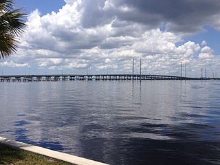
The Cape Coral Bridge is a bridge located in Southwest Florida. It spans the Caloosahatchee River connecting McGregor and Cape Coral. It is made up of two parallel fixed spans, each 3,400 feet (1,000 m) long.

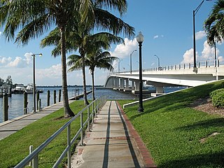
The Sanibel Causeway is a causeway in Southwest Florida that spans San Carlos Bay, connecting Sanibel Island with the Florida mainland in Punta Rassa. The causeway consists of three separate two-lane bridge spans, and two-man-made causeway islands between them. The entire causeway facility is owned by Lee County and operated by the Lee County Department of Transportation. The entire causeway is 3 miles (5 km) long from end to end, and currently has a $6 toll in effect for island-bound vehicles only. The bridges are not individually named, and are simply referred to as bridges A, B, and C. The islands are also named A and B. Both series begin from the mainland side.

The W. Howard Frankland Bridge is the central fixed-link bridge spanning Old Tampa Bay from St. Petersburg, Florida to Tampa, Florida. It is one of three bridges connecting Hillsborough County and Pinellas County; the others being Gandy Bridge and Courtney Campbell Causeway. The bridge carries Interstate 275 and is by far the most traveled of the bay's bridges.

Gandy Bridge is the southernmost bridge spanning Old Tampa Bay from St. Petersburg, Florida to Tampa, Florida. The original 1924 span was dismantled in 1975. The second bridge, constructed in 1956 was used for vehicular traffic until 1997, when it was converted to recreational use by non-motorized traffic. It became known as the Friendship Trail Bridge and was demolished in 2016, after closing in 2008 due to hazardous conditions and several failed efforts to preserve the span. The third (1975) and fourth (1997) spans of the Gandy Bridge are currently being used for vehicle traffic.

State Road 951 (SR 951), locally known as Collier Boulevard, is a 7-mile-long (11 km) north–south divided highway that extends from the south end of the Judge S.S. Jolley Bridge in Marco Island to Tamiami Trail near Naples Manor, along with a short 1⁄2 mile (0.80 km) piece between SR 84 and Interstate 75 (I-75). The highway once extended over 24 miles (39 km) long, traveling between Marco Island and SR 846 near Golden Gate. Portions of the former state highway are now part of County Road 951 (CR 951).

The Matanzas Pass Bridge is a bridge located in Fort Myers Beach, Florida. It carries State Road 865 between the Florida mainland and Estero Island, which is a major tourist destination. The bridge is one of the island's two connections to the mainland. The other is the Bonita Beach Causeway on the south end of the island.
The Edison Bridge is a set of two one-way bridges located in Fort Myers, Florida. Named after inventor Thomas Alva Edison, the two bridges carry each direction of U.S. Highway 41 Business over the Caloosahatchee River, connecting downtown Fort Myers with North Fort Myers.
The Barron Collier Bridge is a bridge in Charlotte County, Florida that crosses the Peace River connecting Punta Gorda, Florida and Port Charlotte, Florida. It is 45 feet tall and carries two northbound lanes of U.S. Route 41. The southbound lanes cross the river on the adjacent Gilchrist Bridge. It was named for Barron G. Collier, a wealthy Southwest Florida land owner and entrepreneur.

The Long Key Bridge, officially known as the Dante B. Fascell Bridge, is a bridge in the Florida Keys connecting Long Key and Conch Key, roughly halfway between Miami and Key West. At a length of nearly two and a half miles, it is the second longest bridge on the Overseas Highway after the Seven Mile Bridge. The current bridge opened in 1982, replacing the parallel Long Key Viaduct, which carried the Overseas Railroad from 1907 to 1935 and was repurposed for highway use shortly after.
The Atlantic Coast Line Railroad's Lakeland—Fort Myers Line was one of the railroad company's secondary main lines in Central and Southwest Florida. It was built incrementally in the late 1800s and early 1900s. Parts of the line are still active today.
The Stan Gober Memorial Bridge is a bridge near Goodland, Florida connecting the east side of Marco Island with main land Collier County. The bridge is one of two bridges connecting Marco Island with the main land, with the other being the S.S. Jolley Bridge further west. The is 55 feet tall and carries two lanes of County Road 92 over the Marco Channel.
