The Louisiade Archipelago is a string of ten larger volcanic islands frequently fringed by coral reefs, and 90 smaller coral islands in Papua New Guinea.

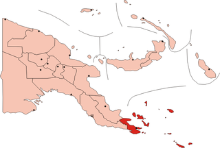
Milne Bay is a province of Papua New Guinea. Its capital is Alotau. The province covers 14,345 km² of land and 252,990 km² of sea, within the province there are more than 600 islands, about 160 of which are inhabited. The province has about 276,000 inhabitants, speaking about 48 languages, most of which belong to the Eastern Malayo-Polynesian branch of the Austronesian language family. Economically the province is dependent upon tourism, oil palm, and gold mining on Misima Island; in addition to these larger industries there are many small-scale village projects in cocoa and copra cultivation. The World War II Battle of Milne Bay took place in the province.

Samarai is an island and former administrative capital in Milne Bay Province, Papua New Guinea.
Pocklington Reef is a coral reef and a mostly submerged atoll in the far southeast of Papua New Guinea.
Tuyam Island is an island on the southern side of East Channel, Milne Bay Province, Papua New Guinea.
Logea Island is a large island separating West Channel, East Channel and China Strait, just south of Milne Bay, in Milne Bay Province, Papua New Guinea.
Deka Deka Island is a small island off the SE end of Logea Island, in East Channel, Milne Bay Province, Papua New Guinea.
Bonarua Hili Hili Island is a small island just north of Logea Island, in China Strait, Milne Bay Province, Papua New Guinea.
Kwato Island an island in China Strait, Milne Bay Province, Papua New Guinea.
Galahi Island is an island off the northeast coast of Sariba, in Milne Bay Province, Papua New Guinea.
Lesimano Island is an island off the north coast of Sariba, in Milne Bay Province, Papua New Guinea.
Igwali Island is an island north of Sariba Island, and on the eastern side of China Strait, in Milne Bay Province, Papua New Guinea.
Mekinley Island is an island north of Sariba Island, and on the eastern side of China Strait, in Milne Bay Province, Papua New Guinea.
Ito Island is an island between Sariba and Sideia, on the eastern side of China Strait, in Milne Bay Province, Papua New Guinea.
Populai Island is an island in the Louisiade Archipelago in Milne Bay Province, Papua New Guinea.
Kitai Bai Island is an islet in the Louisiade Archipelago, off the east coast of Basilaki Island, Milne Bay Province, Papua New Guinea.
Kitai Katoa Island is an island in the Louisiade Archipelago, off the east coast of Basilaki Island, Milne Bay Province, Papua New Guinea.
Kitai Lilivea Island is an island in the Louisiade Archipelago, off the east coast of Basilaki Island, Milne Bay Province, Papua New Guinea.
Kitai Bona Bona Island is an island in the Louisiade Archipelago, off the east coast of Basilaki Island, Milne Bay Province, Papua New Guinea.

The Samarai Islands archipelago, part of the larger Louisiade Archipelago, is located 50 kilometres (31 mi) southeast of mainland New Guinea island, within the nation of Papua New Guinea.
