
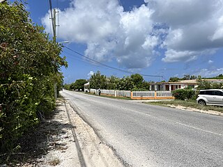
Anguilla is a British Overseas Territory in the Caribbean. It is one of the most northerly of the Leeward Islands in the Lesser Antilles, lying east of Puerto Rico and the Virgin Islands and directly north of Saint Martin. The territory consists of the main island of Anguilla, approximately 16 miles long by 3 miles (5 km) wide at its widest point, together with a number of much smaller islands and cays with no permanent population. The territory's capital is The Valley. The total land area of the territory is 35 square miles (91 km2), with a population of approximately 15,753 (2021).

Anguilla is an island in the Leeward Islands. It has numerous bays, including Barnes, Little, Rendezvous, Shoal, and Road Bays.

Anguilla is a town in Sharkey County, Mississippi, United States. The population was 496 at the 2020 census, down from 726 at the 2010 census.
Area code 264 is the telephone area code of Anguilla in the North American Numbering Plan (NANP). The area code was created in a split of the original numbering plan area with area code 809. Permissive dialing started 31 March 1997 and ended on 30 September 1997. The area code is also represented on the telephone dial by the letter sequence ANG.
Ronald Webster Park is a sports venue in The Valley, Anguilla. It is currently used mostly for football matches, although most years the Leeward Islands cricket team play one of their matches in the Regional Four Day Competition on this ground. The stadium holds 4,000.

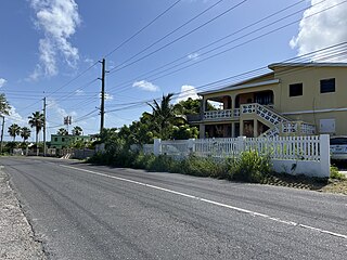
Blowing Point is a village and one of the fourteen Districts of Anguilla, located on the southern coast. It is home to Anguilla's ferry terminal.
East End is one of the fourteen Districts of Anguilla. Its population at the 2011 census was 671.
George Hill is one of the fourteen Districts of Anguilla. Its population at the 2011 census was 879.

Island Harbour is one of the fourteen Districts of Anguilla. Its population at the 2011 census was 988.
North Hill is one of the fourteen Districts of Anguilla. Its population at the 2011 census was 464.
North Side is one of the fourteen Districts of Anguilla. Its population at the 2011 census was 1,980.

South Hill is one of the fourteen Districts of Anguilla. Its population at the 2011 census was 1,722.
Stoney Ground is one of the fourteen Districts of Anguilla. Its population at the 2011 census was 1,549.
West End is one of the fourteen Districts of Anguilla. Its population at the 2011 census was 813.
The Quarter is one of the fourteen Districts of Anguilla. Its population at the 2011 census was 959.
The Farrington is one of the fourteen Districts of Anguilla. Its population at the 2011 census was 624.

The Republic of Anguilla was a short-lived, unrecognised independent state on the island of Anguilla. It lasted from 11 July 1967 until 19 March 1969, when British control was re-established.
The Attack on Saint Martin was a failed attempt by the Dutch Republic to recapture the island and former base of the Dutch West India Company (WIC) from the Spanish. In 1633 the Spanish had invaded Saint-Martin and Anguilla, driving off the French and Dutch inhabitants. The French and Dutch banded together to repel the Spanish and it was during a 1644 sea battle that the Dutch commander Peter Stuyvesant, later the governor of New Amsterdam, unsuccessfully besieged Fort Amsterdam and was forced to retreat with the loss of hundreds of men. A stray Spanish cannonball shattered his leg, which had to be amputated. But luck was on the Dutch side, and when the Eighty Years' War between Spain and the Netherlands ended, the Spanish no longer needed a Caribbean base and just sailed away in 1648.

Cap Juluca, A Belmond Hotel, is a five-star resort located on Maundays Bay in Anguilla. Cap Juluca is named for the rainbow spirit of the Arawak, Anguilla's earliest inhabitants. According to local lore, "Juluca" was a mystical being covered with fine colorful feathers who brought luck to fishermen. The original hotel was located in a white stucco building, with Moorish arches and domes.
Government House is the official residence of the governor of Anguilla, located in Old Ta in Anguilla.

