Wilsonville is a city primarily in Clackamas County, Oregon, United States. A portion of the northern section of the city is in Washington County. It was founded as Boones Landing because of the Boones Ferry which crossed the Willamette River at the location; the community became Wilsonville in 1880. The city was incorporated in 1969 with a population of approximately 1,000. The population was 13,991 at the 2000 census, and grew to 19,509 as of 2010. Slightly more than 90% of residents at the 2000 census were white, with Hispanics comprising the largest minority group.

The Tualatin River is a tributary of the Willamette River in Oregon in the United States. The river is about 83 miles (134 km) long, and it drains a fertile farming region called the Tualatin Valley southwest and west of Portland at the northwest corner of the Willamette Valley. There are approximately 500,000 people residing on 15 percent of the land in the river's watershed.

The Tualatin Valley is a farming and suburban region southwest of Portland, Oregon. The valley is formed by the meandering Tualatin River, a tributary of the Willamette River at the northwest corner of the Willamette Valley, east of the Northern Oregon Coast Range. Most of the valley is located within Washington County, separated from Portland by the Tualatin Mountains. Communities in the Tualatin Valley include Banks, Forest Grove, Cornelius, Hillsboro, Aloha, Beaverton, Sherwood, Tigard, and Tualatin.

Oregon Route 210 is a state highway which runs between the community of Scholls, Oregon and the Raleigh Hills neighborhood west of Portland, terminating at the Sylvan overpass on Highway 26. It has become an important route for both commuters and agriculture through Washington County. Oregon Route 210 is signed from east-to-west; though in actuality it runs in a northeast-to-southwest direction.

Oregon Route 219 is an Oregon state highway which runs between the cities of Hillsboro and Woodburn, Oregon, in the United States. The Hillsboro-Silverton Highway continues further south to Silverton, signed as OR 214. The highway mainly serves local residents and agricultural traffic; despite its proximity to the Portland area it lies outside the Portland Urban Growth Boundary and so maintains its character as a country road.

Oregon Route 141, known as the Beaverton–Tualatin Highway No. 141, is an Oregon state highway which runs from the city of Wilsonville to the southern edge of Beaverton. The highway is 10.46 miles (16.83 km) long.
Cooper Mountain Vineyards is an American winery located in Beaverton, Oregon, United States. Started in 1978, the certified organic wine maker produces Pinot noir, Pinot gris, Chardonnay, and Pinot blanc. Located in the Portland metropolitan area, the vineyard is sited on the western slopes of Cooper Mountain, an extinct volcano.

The Tualatin River National Wildlife Refuge is a 1,856 acres (751 ha) wetlands and lowlands sanctuary in the northwestern part of the U.S. state of Oregon. Established in 1992 and opened to the public in 2006, it is managed by the United States Fish and Wildlife Service. Located in southeastern Washington County, 15 miles (24 km) southwest of Portland, the refuge is bordered by Sherwood, Tualatin and Tigard. A newer area, extending into northern Yamhill County, is located further west near the city of Gaston surrounding the former Wapato Lake.

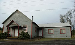
Kinton is an unincorporated community in Washington County, Oregon, United States. It is located near the northern shore of the Tualatin River, near the intersection of Oregon Route 210 and River Road, a major county arterial that runs northwest towards Hillsboro. Kinton is located approximately eight miles north of Newberg, six miles southwest of Beaverton, and seven miles southeast of Hillsboro. The community was once the site of a ferry crossing the Tualatin River between Kinton and nearby Scholls. While the ferry has long since been replaced with a bridge, OR 210 is still known locally as Scholls Ferry Road. Kinton is in Oregon's wine country, with several notable wineries in the area.
The state of Oregon in the United States has established an international reputation for its production of wine, ranking fourth in the country behind California, Washington, and New York. Oregon has several different growing regions within the state's borders that are well-suited to the cultivation of grapes; additional regions straddle the border between Oregon and the states of Washington and Idaho. Wine making dates back to pioneer times in the 1840s, with commercial production beginning in the 1960s.

The Willamette Valley AVA is an American Viticultural Area which lies in the Willamette Valley of Oregon. The AVA is the wine growing region which encompasses the drainage basin of the Willamette River. It stretches from the Columbia River in the north to just south of Eugene in the south, where the Willamette Valley ends; and from the Oregon Coast Range in the west to the Cascade Mountains in the east. At 5,360 square miles (13,900 km2), it is the largest AVA in the state, and contains most of the state's wineries; approximately 908 as of 2021.

Willamette Valley Vineyards is an American winery located in Turner, Oregon. Named after Oregon's Willamette Valley, the winery is the leading producer of Willamette Valley-appellated Pinot Noir in Oregon, and also produces Chardonnay and Pinot Gris. In 2016, the winery was the largest producer of Riesling wine in the Willamette Valley.
Historic ferries in Oregon are water transport ferries that operated in Oregon Country, Oregon Territory, and the state of Oregon, United States. These ferries allowed people to cross bodies of water, mainly rivers such as the Willamette in the Willamette Valley, and the Columbia, in order to transport goods, move people, and further communications until permanent bridges were built to allow faster crossing of the water. The early ferries were used by wagons and pedestrians, while later ones transported trains and then automobiles. Oregon has a few automobile ferries still in operation.

Oak Knoll Winery is a privately held winery located in the Tualatin Valley near Hillsboro, Oregon, United States. Established in 1970, it is the oldest winery in Washington County, and produces Pinot noir, Pinot gris, and Chardonnay. The winery also known for producing Frambosia, a red raspberry wine.

The Eola-Amity Hills AVA is an American Viticultural Area located in Polk County and Yamhill County, Oregon. It is entirely contained within the Willamette Valley AVA, and stretches from the city of Amity in the north to Salem in the south. The Eola and Amity hills cover an area west of the Willamette River approximately 15 miles (24 km) long by 6 miles (10 km) wide. The Eola-Amity Hills area benefits from steady winds off the Pacific Ocean that reach the Willamette Valley through the Van Duzer Corridor, a gap in the Oregon Coast Range, moderating the summer temperatures. The Eola Hills were named after the community of Eola, whose name was derived from Aeolus, the Greek god of the winds.

King Estate Winery is a family owned, Biodynamic(r) winery located southwest of Eugene, Oregon, United States near the community of Lorane. Matt Kramer of The Oregonian considers King Estate the benchmark producer of Pinot gris in the country. While the winery also makes Pinot noir and limited amounts of Chardonnay, it is mainly credited with bringing the Pinot gris grape varietal into national consciousness.

The Willamette Valley is a 150-mile (240 km) long valley in Oregon, in the Pacific Northwest region of the United States. The Willamette River flows the entire length of the valley and is surrounded by mountains on three sides: the Cascade Range to the east, the Oregon Coast Range to the west, and the Calapooya Mountains to the south.

Sokol Blosser Winery is a vineyard, tasting room and winery facility located northeast of Dayton, Oregon in the Red Hills of Dundee in Yamhill County. It was founded by Bill Blosser and Susan Sokol Blosser in 1971 in what is now known as the Dundee Hills AVA. Sokol Blosser Winery is family owned and operated by second-generation co-presidents, siblings Alex and Alison Sokol Blosser, and is the 6th largest wine producer in Oregon. Sokol Blosser is considered to be “synonymous with sustainability,” and produces Pinot Noir, Pinot Gris, Chardonnay, proprietary blends Evolution White and Evolution Red, a range of other Evolution wines, and small quantities of single block Pinot Noirs, Rosé of Pinot Noir, White Riesling dessert wine, and sparkling wine.
Laurelwood District is an American Viticultural Area (AVA) located west of the city of Portland and lies entirely within the northern end of Willamette Valley AVA with the Chehalem Mountains AVA covering its northern slopes including the towns of Cornelius, Scholls and Sherwood in Washington County. The district was established on May 13, 2020, by the Alcohol and Tobacco Tax and Trade Bureau (TTB) after reviewing the petition submitted by Luisa Ponzi, president of Ponzi Vineyards, Maria Ponzi, winemaker of Ponzi Vineyards, and Kevin Johnson, winemaker of Dion Vineyards, on behalf of themselves and other local grape growers and vintners, proposing the establishment of the “Laurelwood” AVA. However, at the request of TTB, the petitioners agreed to add the word “District” to the proposed name, in order to avoid a potential impact on current label holders who are using “Laurelwood” as a brand name or fanciful name on their wine labels. Its coverage is approximately 33,600 acres (53 sq mi) and contains 25 wineries and approximately 70 commercially-producing vineyards that plant approximately 975 acres (395 ha). The distinguishing feature of the Laurelwood District is the predominance of the Laurelwood soil that predominates in the area. The district contains the highest concentration of the namesake soil in Oregon.
Lower Long Tom is an American Viticultural Area (AVA) located in Oregon's southern Willamette Valley in Lane and Benton Counties, near the towns of Junction City and Monroe. The district was established on December 10, 2021, by the Alcohol and Tobacco Tax and Trade Bureau. Its coverage is approximately 25,000 acres (10,117 ha) and contains 12 wineries and 24 commercially-producing vineyards that plant approximately 575 acres (233 ha). It lies entirely within the Willamette Valley AVA. The region is primarily known for its Pinot noir and Pinot gris.