Sentinel-3

Last updated
Sentinel-3
Sentinel-3 spacecraft model.svg
Manufacturer Thales Alenia Space [1]
Operator EUMETSAT
Applications Earth observation
Specifications
Spacecraft typeSatellite
Bus Prima
Series2
Launch mass1,250 kg (2,756 lb) [2]
Dimensions3.710 × 2.202 × 2.207 m (12.2 × 7.2 × 7.2 ft) [2]
Power2,100 W [2]
Design life7 years [2]
Production
StatusActive
On order2 [3]
Built2
Launched2
Operational2
Maiden launch Sentinel-3A
16 February 2016
Last launch Sentinel-3D
≥ 2021 [3]
  Sentinel-2 Sentinel-4

Sentinel-3 is an Earth observation heavy satellite series developed by the European Space Agency as part of the Copernicus Programme. [4] [5] [6] As of 2024, it consists of 2 satellites: Sentinel-3A and Sentinel-3B. After initial commissioning, each satellite was handed over to EUMETSAT for the routine operations phase of the mission. Two recurrent satellites, Sentinel-3C and Sentinel-3D, will follow in approximately 2025 and 2028 respectively to ensure continuity of the Sentinel-3 mission. [7]

Contents

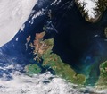
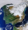
Each Sentinel-3 satellite is designed to operate for seven years in a sun-synchronous low-Earth orbit. The satellites use multiple sensors to measure topography, temperature, marine ecosystems, water quality, pollution, and other features for ocean forecasting and environmental monitoring.

Overview

The Sentinel-3 satellites travel in a sun-synchronous orbit at an altitude of approximately 814 km (506 mi), with an inclination of 98.6° and orbit cycle of approximately 100 minutes. The local time of descending node is 10:00 a.m. and nominal duration is 7.5 years.

A pair of Sentinel-3 satellites enables a short revisit time, allowing the earth to be imaged at least once every two days by the OLCI instrument, and at least once per day by the SLSTR instrument at the equator. This is achieved using both Sentinel-3A and Sentinel-3B satellites in conjunction. [8] The satellite orbit provides a 27-day repeat for the topography package, with a 4-day sub-cycle. [6]

Pre-launch

On 14 April 2008, the European Space Agency and Thales Alenia Space signed a €305 million contract to build the first GMES Sentinel-3 in its Cannes Mandelieu Space Center. [9] Bruno Berruti led the team that was responsible for delivering the Copernicus Sentinel-3 satellites from the drawing board into orbit. [10] The satellite platform was delivered to France for final integration in 2013. [11] The communications systems were completed by Thales Alenia Space España in early 2014. [12]

Launch

Sentinel-3A was subsequently launched on 16 February 2016 on a Rokot vehicle from the Plesetsk Cosmodrome, located near Arkhangelsk, Russia. [8] [13] This first launch was followed by the launch of Sentinel-3B on 25 April 2018, also aboard a Rokot. [14] Each satellite is designed to operate for 7 years. [15]

Objectives

The Sentinel-3 mission's main objectives are to measure sea-surface topography, land- and sea-surface temperature, land- and ocean-surface colour with accuracy in support of ocean forecasting systems, and for environmental and climate monitoring. [4] [6] [5] Sentinel-3 builds directly on the heritage pioneered by ERS-2 and Envisat satellites. Near-real time data will be provided for ocean forecasting, sea-ice charting, and maritime safety services on the state of the ocean surface, including surface temperature, marine ecosystems, water quality, and pollution monitoring. [6]

Further objectives of the mission include: [4] [6]

Instruments

Sentinel-3 makes use of multiple sensing instruments: [4] [6]

SLSTR

A Sentinel-3 image shows true colour (left) and land temperature (right) during the 2021 Eurasia winter heat wave Record-setting heatwave in Europe, February 2021.jpg
A Sentinel-3 image shows true colour (left) and land temperature (right) during the 2021 Eurasia winter heat wave

SLSTR (Sea and Land Surface Temperature Radiometer) determines global sea-surface temperatures to an accuracy of better than 0.3  K (0.3 °C; 0.5 °F). It measures in nine spectral channels and two additional bands optimised for fire monitoring. The first six spectral bands cover the visible and near-infrared (VNIR) spectrum as well as the short-wave infrared (SWIR) spectrum; VNIR for bands 1 to 3, and SWIR for bands 4 to 6. [16] These 6 bands have a spatial resolution of 500 m (1,600 ft), while bands 7 to 9 as well as the two additional bands have a spatial resolution of 1 km (0.6 mi). [16] For the SLSTR instrument on Sentinel-3, calibration on-board is one of the most important features for the thermal and infrared channels. This instrument has two black body targets used for calibration, one at similar temperature to the optics (about 260 K or −13 °C), and one at a higher temperature (302 K or 29 °C), such that the temperature range corresponds to ocean surface temperatures measured by the instrument. [17] [18]

OLCI

Ireland viewed by Sentinel-3 during January, 2024 Ireland from the Copernicus Sentinel-3 mission 01.tif
Ireland viewed by Sentinel-3 during January, 2024

OLCI (Ocean and Land Colour Instrument) is a medium-resolution imaging spectrometer that uses five cameras to provide a wide field of view. The OLCI is an along-track or "push broom" scanner, meaning that the sensor array is arranged perpendicular to the path of flight. [19] This method essentially eliminates the scale distortion near the edge of an image that is common with across-track or "whisk broom" scanners. OLCI has 21 spectral bands with wavelengths ranging from the optical to the near-infrared. [20] Bands vary in width from 400 nm to 1020 nm, and serve a variety of different purposes, including measuring water vapour absorption, aerosol levels, and chlorophyll absorption. [20] SLSTR and OLCI are optical instruments with an overlap of their swath path, allowing for new combined applications.

Due to climate changing factors, inland coastal regions have become an increased area of concern, and from 2002 to 2012 the Medium Resolution Imaging Spectrometer (MERIS) provided quality observations for analysis. The OLCI improves upon the MERIS in that it was built with six additional spectral bands, higher-end signal-to-noise ratio (SNR), reduced solar glar, a maximum of 300 m spatial resolution, and increased ground coverage allowing it to sense cyanobacteria levels within inland coastal ecosystems. [21] OLCI is currently the only sensor in space able to detect cyanobacteria. [1]

SRAL

A map of sea-level anomaly measurements from March and April 2016, acquired by the SRAL instrument on the Sentinel-3A satellite Sea-level variations from Sentinel-3A ESA359994.jpg
A map of sea-level anomaly measurements from March and April 2016, acquired by the SRAL instrument on the Sentinel-3A satellite

SRAL (Synthetic Aperture Radar Altimeter) is the main topographic instrument to provide accurate topography measurements over sea ice, ice sheets, rivers, and lakes. It uses dual-frequency Ku and C band and is supported by a microwave radiometer (MWR) for atmospheric correction and a DORIS receiver for orbit positioning. This allows the instrument, which is based on legacy missions such as CryoSat and the Jason missions, [22] to provide a 300-meter resolution and a total range error of 3 cm. [23] The instrument operates its pulse repetition frequency at 1.9 kHz (low-resolution mode - LRM, real aperture radar) and 17.8 kHz (synthetic aperture radar - SAR). [23]

DORIS

DORIS (Doppler Orbitography and Radiopositioning Integrated by Satellite) is a receiver for orbit positioning.

MWR

MWR (MicroWave Radiometer) measures water vapour, cloud water content, and the thermal radiation emitted by the Earth. The MWR sensor has a radiometric accuracy of 3.0 K (3.0 °C; 5.4 °F). [24]

LRR

LRR (Laser retroreflector) accurately locates the satellite in orbit using a laser ranging system. When used in combination with SRAL, DORIS, MWR, they will acquire detailed topographic measurements of the ocean and in-land water.

GNSS

GNSS (Global Navigation Satellite System) provides precise orbit determination and can track multiple satellites simultaneously.

Satellite operation and data flow

Sentinel-3 is operated by the European Space Operations Centre (ESA) and Eumetsat. The in-orbit operations for Sentinel-3 are coordinated by Eumetsat in Darmstadt, Germany. This includes monitoring the health of the satellite and the instruments, and coordinates housekeeping telemetry and commands at the main flight control center in Darmstadt, Germany. ESA maintains a backup flight control center at a ground station in Kiruna, Sweden. In addition, the ESA operates an x-band core station in Svalbard, Norway. This station is responsible for receiving the data collected by Sentinel-3. [25] The data is then analysed by the Sentinel Collaborative Ground Segment and compiled into the Copernicus Space Component (CSC). The CSC is an earth observation program run by the ESA with the objective of providing high quality continuous monitoring of the earth. [6]

Applications

Land temperature of Eureka, Nunavut and its surroundings measured by the SLSTR instrument on August 11, 2020 Extreme temperatures in Eureka ESA22181121.jpeg
Land temperature of Eureka, Nunavut and its surroundings measured by the SLSTR instrument on August 11, 2020

The applications of Sentinel-3 are diverse. Using the collection of sensors on-board Sentinel-3 is able to detect ocean and land temperature and colour change. The Ocean and Land Color Instrument (OLCI) has a 300 m (980 ft) resolution with 21 distinct bands allowing global coverage in less than four days. This sensor can then be used to by researches to do water quality and land-monitoring research. [26] The satellite also has the ability to monitor the temperature of the sea, land and ice through the Sea and Land Surface Temperature Radiometer (SLSTR). Sentinel-3 also has the ability to detect changes in sea-surface height and sea-ice using the synthetic aperture radar altimeter and the microwave radiometer, two of the most complex sensors on the satellite. [26]

The observations acquired by the mission will be used to in conjunction with other ocean-observing missions to contribute to the Global Ocean Observing System (GOOS) which aims to create a permanent system of ocean observation. [26]

Related Research Articles

<span class="mw-page-title-main">Envisat</span> ESA Earth observation satellite (2002–2012)

Envisat is a large Earth-observing satellite which has been inactive since 2012. It is still in orbit and considered space debris. Operated by the European Space Agency (ESA), it was the world's largest civilian Earth observation satellite.

<span class="mw-page-title-main">Weather satellite</span> Type of satellite designed to record the state of the Earths atmosphere

A weather satellite or meteorological satellite is a type of Earth observation satellite that is primarily used to monitor the weather and climate of the Earth. Satellites can be polar orbiting, or geostationary.

<span class="mw-page-title-main">EUMETSAT</span> European intergovernmental organisation

The European Organisation for the Exploitation of Meteorological Satellites (EUMETSAT) is an intergovernmental organisation created through an international convention agreed by a current total of 30 European Member States.

<span class="mw-page-title-main">Meteosat</span> Series of european weather satellites

The Meteosat series of satellites are geostationary meteorological satellites operated by EUMETSAT under the Meteosat Transition Programme (MTP) and the Meteosat Second Generation (MSG) program.

<span class="mw-page-title-main">Jason-1</span> Satellite oceanography mission

Jason-1 was a satellite altimeter oceanography mission. It sought to monitor global ocean circulation, study the ties between the ocean and the atmosphere, improve global climate forecasts and predictions, and monitor events such as El Niño and ocean eddies. Jason-1 was launched in 2001 and it was followed by OSTM/Jason-2 in 2008, and Jason-3 in 2016 – the Jason satellite series. Jason-1 was launched alongside the TIMED spacecraft.

<span class="mw-page-title-main">Space-based radar</span> Use of radar systems mounted on satellites

Space-based radar or spaceborne radar is a radar operating in outer space; orbiting radar is a radar in orbit and Earth orbiting radar is a radar in geocentric orbit. A number of Earth-observing satellites, such as RADARSAT, have employed synthetic aperture radar (SAR) to obtain terrain and land-cover information about the Earth.

<span class="mw-page-title-main">Copernicus Programme</span> Programme of the European Commission

Copernicus is the Earth observation component of the European Union Space Programme, managed by the European Commission and implemented in partnership with the EU Member States, the European Space Agency (ESA), the European Organisation for the Exploitation of Meteorological Satellites (EUMETSAT), the European Centre for Medium-Range Weather Forecasts (ECMWF), the Joint Research Centre (JRC), the European Environment Agency (EEA), the European Maritime Safety Agency (EMSA), Frontex, SatCen and Mercator Océan.

<span class="mw-page-title-main">MetOp</span> Series of European meteorological satellites

Metop is a series of three polar-orbiting meteorological satellites developed by the European Space Agency (ESA) and operated by the European Organisation for the Exploitation of Meteorological Satellites (EUMETSAT). The satellites form the space segment component of the overall EUMETSAT Polar System (EPS), which in turn is the European half of the EUMETSAT / NOAA Initial Joint Polar System (IJPS). The satellites carry a payload comprising 11 scientific instruments and two which support Cospas-Sarsat Search and Rescue services. In order to provide data continuity between Metop and NOAA Polar Operational Environmental Satellites (POES), several instruments are carried on both fleets of satellites.

<span class="mw-page-title-main">Thales Alenia Space</span> Satellite manufacturer

Thales Alenia Space is a joint venture between the French technology corporation Thales Group (67%) and Italian defense conglomerate Leonardo (33%). The company is headquartered in Cannes, France.

<span class="mw-page-title-main">OSTM/Jason-2</span> International Earth observation satellite mission

OSTM/Jason-2, or Ocean Surface Topography Mission/Jason-2 satellite, was an international Earth observation satellite altimeter joint mission for sea surface height measurements between NASA and CNES. It was the third satellite in a series started in 1992 by the NASA/CNES TOPEX/Poseidon mission and continued by the NASA/CNES Jason-1 mission launched in 2001.

<span class="mw-page-title-main">Sentinel-1</span> Earth observation satellite

Sentinel-1 is the first of the Copernicus Programme satellite constellations conducted by the European Space Agency. The mission was originally composed of a constellation of two satellites, Sentinel-1A and Sentinel-1B, which shared the same orbital plane. Two more satellites, Sentinel-1C and Sentinel-1D are in development. Sentinel-1B was retired following a power supply issue on December 23, 2021, leaving Sentinel-1A the only satellite of the constellation currently operating. Sentinel-1C is currently planned to launch in the final quarter of 2024.

<span class="mw-page-title-main">Sentinel-2</span> Earth observation mission

Sentinel-2 is an Earth observation mission from the Copernicus Programme that acquires optical imagery at high spatial resolution over land and coastal waters. The mission's Sentinel-2A and Sentinel-2B satellites are to be joined in orbit in 2024 by a third, Sentinel-2C.

<span class="mw-page-title-main">Soil Moisture and Ocean Salinity</span> ESA Earth Observation Satellite

Soil Moisture and Ocean Salinity (SMOS) is a satellite which forms part of ESA's Living Planet Programme. It is intended to provide new insights into Earth's water cycle and climate. In addition, it is intended to provide improved weather forecasting and monitoring of snow and ice accumulation.

<span class="mw-page-title-main">Mission Science Division</span>

The Earth and Mission Science Division is a group of European Space Agency (ESA) staff mission scientists, contractors, research fellows, young graduates, trainees, and administrative staff working within the Climate Action, Sustainability and Science Department of the Directorate of Earth Observation Programmes. The Division is located at ESA's European Space Research and Technology Centre in Noordwijk, South Holland, The Netherlands.

<span class="mw-page-title-main">SARAL</span> Indian Earth observation satellite

SARAL is a cooperative altimetry technology mission of Indian Space Research Organisation (ISRO) and Centre National d'Études Spatiales (CNES). SARAL performs altimetric measurements designed to study ocean circulation and sea surface elevation.

<span class="mw-page-title-main">Sentinel-1A</span> European radar imaging satellite

Sentinel-1A is a European radar imaging satellite launched in 2014. It is the first Sentinel-1 satellite launched as part of the European Union's Copernicus programme. The satellite carries a C-band Synthetic Aperture Radar which will provide images in all light and weather conditions. It analyzes many phenomena occurring on Earth, from detecting and tracking oil spills and mapping sea ice to monitoring movement in land surfaces and mapping changes in the way land is used.

<span class="mw-page-title-main">Sentinel-3A</span>

Sentinel-3A is a European Space Agency Earth observation satellite dedicated to oceanography which launched on 16 February 2016. It was built as a part of the Copernicus Programme, and is the first of four planned Sentinel-3 satellites. Its sister satellite, Sentinel-3B, launched on 25 April 2018. After completing initial commissioning, each satellite was handed over to EUMETSAT for the routine operations phase of the mission. Two recurrent satellites - Sentinel-3C and Sentinel-3D - will follow in approximately 2024 and 2028 respectively to ensure continuity of the Sentinel-3 mission.

<span class="mw-page-title-main">Sentinel-1B</span> European radar imaging satellite

Sentinel-1B is a European radar imaging satellite launched on 25 April 2016. It is the second of two original satellites in the Sentinel-1 constellation, part of the European Union's Copernicus programme on Earth observation. The satellite carries a C-SAR sensor, capable of providing high-resolution imagery regardless of weather conditions.

<span class="mw-page-title-main">Sentinel-4</span> Earth observation satellite

Sentinel-4 is a European Earth observation mission under development to support the European Union Copernicus Programme. It will focus on monitoring of trace gas concentrations and aerosols in the atmosphere to support operational services covering air-quality near-real time applications, air-quality protocol monitoring, and climate protocol monitoring. The specific objective of Sentinel-4 is to support this with a high revisit time over Europe.

<span class="mw-page-title-main">Sentinel-6 Michael Freilich</span> Earth observation satellite

The Sentinel-6 Michael Freilich (S6MF) or Sentinel-6A is a radar altimeter satellite developed in partnership between several European and American organizations. It is part of the Jason satellite series and is named after Michael Freilich. S6MF includes synthetic-aperture radar altimetry techniques to improve ocean topography measurements, in addition to rivers and lakes. The spacecraft entered service in mid 2021 and is expected to operate for 5.5 years.

References

  1. 1 2 "Copernicus: Sentinel-3". eoPortal. European Space Agency . Retrieved 21 December 2015.
  2. 1 2 3 4 "Sentinel-3 Data Sheet" (PDF). European Space Agency. August 2013. Retrieved 17 November 2016.
  3. 1 2 Henry, Caleb (10 February 2016). "ESA Awards Sentinel 3C and D Satellite Contracts to Thales Alenia Space". Via Satellite. Retrieved 17 November 2016.
  4. 1 2 3 4 "Sentinel 3". European Space Agency. 2015. Archived from the original on 9 June 2016. Retrieved 10 June 2015.
  5. 1 2 Donlon, C.; Berruti, B.; Buongiorno, A; Ferreira, M-H; Femenias, P.; et al. (2012). "The Global Monitoring for Environment and Security (GMES) Sentinel-3 Mission". Remote Sensing of Environment. 120: 27–57. Bibcode:2012RSEnv.120...37D. doi:10.1016/j.rse.2011.07.024.
  6. 1 2 3 4 5 6 7 "Copernicus: Sentinel-3". European Space Agency. 2015. Retrieved 11 June 2015.
  7. "Planned launches". EUMETSAT . Retrieved 14 December 2023.
  8. 1 2 "Sentinel-3 - ESA EO Missions". Earth Online. European Space Agency. Retrieved 13 March 2018.
  9. "Contract signed for ESA's Sentinel-3 earth observation satellite". European Space Agency. 14 April 2008. Retrieved 17 August 2014.
  10. "Bruno Berruti: Project Manager". European Space Agency. Retrieved 26 January 2019.
  11. "Bringing Sentinel-3 together". European Space Agency. 6 March 2013. Retrieved 17 August 2014.
  12. "Thales Alenia Space España's contribution to Europe's Sentinel satellites". Thales Alenia Group. 24 April 2014. Retrieved 17 August 2014.
  13. "About the Launch". European Space Agency. Retrieved 19 February 2019.
  14. Clark, Stephen (25 April 2018). "European environmental observer launched by Russian rocket". Spaceflight Now. Retrieved 25 April 2018.
  15. "Sentinel Online - Satellite Description". European Space Agency. Retrieved February 5, 2023.
  16. 1 2 "Radiometric Resolution". Sentinel Online. European Space Agency. Retrieved 9 March 2019.
  17. "Sentinel Online: Calibration". European Space Agency.
  18. Birks, Andrew; Cox (14 January 2011). "SLSTR: Algorithm Theoretical Basis Definition Document for Level 1 Observables" (PDF). Science & Technology Facilities Council Rutherford Appleton Laboratory: 173.
  19. "OLCI Instrument Payload". Sentinel Online. European Space Agency. Retrieved 19 February 2019.
  20. 1 2 "Sentinel-3 User Handbook". 1.0. European Space Agency. 2 September 2013. GMES-S3OP-EOPG-TN-13-0001. Archived from the original on 5 March 2016.
  21. Kravitz, Jeremy.; Mathews, Mark; Bernard, Stewart; Griffith, Derek (2020). "Application of Sentinel 3 OLCI for chl-a retrieval over small inland water targets: Successes and challenges". Remote Sensing of Environment. 237 (Feb 2020): 111562. Bibcode:2020RSEnv.237k1562K. doi:10.1016/j.rse.2019.111562. S2CID   213229746.
  22. "Instruments". www.esa.int. Retrieved 2020-03-06.
  23. 1 2 "Sentinel-3 - Instrument Payload - Altimetry - Sentinel Online". sentinel.esa.int. Retrieved 2020-03-06.
  24. "Altimetry Instruments Payload". Sentinel Online. European Space Agency. Retrieved 19 February 2019.
  25. "Data flow". Sentinel-3. European Space Agency. Retrieved 3 April 2018.
  26. 1 2 3 "Sentinel-3 stacks up". European Space Agency. 24 April 2014. Retrieved 21 December 2015.