Sherwood Forest is a royal forest in Nottinghamshire, England. Its peculiar fame arises from its historic association with the legend of Robin Hood.

Nottinghamshire is a ceremonial county in the East Midlands of England. The county borders South Yorkshire to the north-west, Lincolnshire to the east, Leicestershire to the south, and Derbyshire to the west. The largest settlement is the city of Nottingham (323,632).

Sherwood Forest Plantation Foundation is located on the north bank of the James River in Charles City County, Virginia. The main plantation house, built in 1730, was the home of the tenth president of the United States, John Tyler (1790–1862) for the last twenty years of his life. It is located on State Route 5, a scenic byway which runs between the independent cities of Richmond and Williamsburg. The house is located approximately 1.5 miles (2.4 km) from the river. It was designated a National Historic Landmark in 1961.

Sherwood is a city in Pulaski County, Arkansas, United States. As of the 2020 census, the population of the city was 32,731. It is part of the Little Rock−North Little Rock−Conway Metropolitan Statistical Area with 699,757 people according to the 2010 census.

Sherwood is a city in Washington County, Oregon, United States. Located in the southeast corner of the county, it is a residential community in the Tualatin Valley, southwest of Portland. As of the 2010 census, Sherwood had a population of 18,194 residents. The city's population for 2019 was estimated to be 19,879 by the U.S. Census. Sherwood was first incorporated in 1893 as a town. Originally named Smockville after its founder, James Christopher Smock, the town was given its current name by local businessman Robert Alexander in 1891. The name "Sherwood" may have come from Sherwood, Michigan or the Sherwood Forest in England.
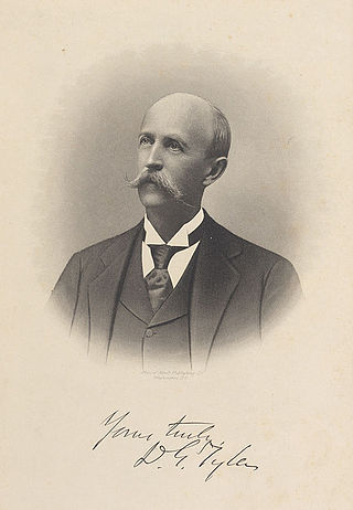
David Gardiner Tyler was an American politician and the ninth child and fourth son of John Tyler, the tenth president of the United States.

Isaac Ruth Sherwood was an American politician and newspaper editor from Toledo, Ohio, as well as an officer in the Union army during the Civil War. He served nine terms in the United States Congress, and was a noted pacifist during World War I.

Lake Sherwood is an unincorporated community in the Santa Monica Mountains, in Ventura County, California overlooking Lake Sherwood reservoir. It is a body contact lake, swimming, fishing, SUP and boating allowed, located south of the Conejo Valley and city of Thousand Oaks, and west of Westlake Village. The lake is naturally fed by thousand of acres of open-space, watershed mountains and natural springs.

Angora is a neighborhood in the Southwest section of Philadelphia, Pennsylvania, United States. Although its boundaries are not precise, West Philadelphia is to its north, Kingsessing is to the south, Cedar Park is to the east, and Cobbs Creek is to the west. The Angora Commuter Rail Station on the Media/Wawa Line, two bus lines, and a trolley line all intersect around Baltimore Avenue and 58th Street, which is unofficially the nexus of the neighborhood.

State Trunk Highway 55 is a state highway in Wisconsin, United States. It travels south-to-north in the northeastern part of Wisconsin from an intersection with U.S. Route 151 (US 151) approximately 1.5 miles (2.4 km) north of Brothertown, near the eastern shore of Lake Winnebago in Calumet County, to the Michigan state line at the Brule River approximately one mile (1.6 km) northeast of Nelma in Forest County, where it connects to M-73.

The Tualatin River National Wildlife Refuge is a 1,856 acres (751 ha) wetlands and lowlands sanctuary in the northwestern part of the U.S. state of Oregon. Established in 1992 and opened to the public in 2006, it is managed by the United States Fish and Wildlife Service. Located in southeastern Washington County, 15 miles (24 km) southwest of Portland, the refuge is bordered by Sherwood, Tualatin and Tigard. A newer area, extending into northern Yamhill County, is located further west near the city of Gaston surrounding the former Wapato Lake.

Cuivre River State Park is a public recreation area covering more than 6,400 acres (2,600 ha) northeast of the city of Troy in the Lincoln Hills region of northeastern Missouri, United States. The state park's rugged landscapes range from native grasslands and savannas to limestone bluffs overlooking forested hills. The park offers an extensive system of hiking trails plus swimming and camping facilities and is managed by the Missouri Department of Natural Resources. It encompasses the Lincoln Hills Natural Area and two designated wild areas: Big Sugar Creek and Northwoods.

Center Parcs UK and Ireland is a short-break holiday company that operates six holiday villages in the United Kingdom and Republic of Ireland, with each covering about 400 acres (1.6 km2) of woodland. The company's first village opened at Sherwood Forest, Nottinghamshire, in 1987 and its sixth, at Longford Forest, Ireland, opened in 2019.
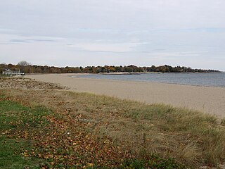
Sherwood Island State Park is a public recreation area on the shore of Long Island Sound in the Greens Farms section of Westport, Connecticut. The state park offers swimming, fishing, and other activities on 238 acres (96 ha) of beach, wetlands, and woodlands. Sherwood Island is numbered as Connecticut's first state park because state purchase of land at the site began in 1914. The park is managed by the Connecticut Department of Energy and Environmental Protection.
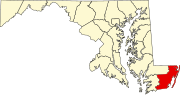
Sherwood Forest is an unincorporated community in Anne Arundel County, Maryland, United States.
Sherwood Forest is an unincorporated community in Frederick County, Maryland, United States.
Sherwood Forest is an unincorporated community in Montgomery County, Maryland, United States. It is roughly bounded by Randolph Road, Sherwood Forest Drive, Notley Road, the Intercounty Connector, and Northwest Branch Park.
Sherwood Forest is a neighborhood in Detroit, Michigan. The neighborhood is bounded by Seven Mile Road, Livernois, Pembroke, and Parkside. The community, with about 435 houses, consists of two subdivisions: Sherwood Forest and Sherwood Forest Manor.

Sherwood is an unincorporated community in Franklin County, Tennessee, United States. It is located along Tennessee State Route 56 13.1 miles (21.1 km) southeast of Winchester, and just north of the Alabama state line. Sherwood has a post office with ZIP code 37376.