South Platte River

Last updated
South Platte River [1]
Sprco2.jpg
South Platte River in Douglas County, Colorado
South Platte basin map.png
Native nameWašíŋ Wakpá (Lakota)
Physical characteristics
Source 
  locationConfluence of South Fork and Middle Fork
  coordinates 39°00′40″N105°44′25″W / 39.01111°N 105.74028°W / 39.01111; -105.74028
Mouth  
  location
Confluence with North Platte River
  coordinates
41°06′50″N100°40′33″W / 41.11389°N 100.67583°W / 41.11389; -100.67583
  elevation
2,762 ft (842 m)
Length439 mi (707 km) [2]
Discharge 
  average174 cu ft/s (4.9 m3/s)
Basin features
Progression PlatteMissouriMississippi
Discharge range0 to 4,640 cu ft/s (0 to 131 m3/s) [3]
The South Platte River in Platte Canyon, Colorado S.PlatteBridge.jpg
The South Platte River in Platte Canyon, Colorado
South Platte River in Denver, Colorado South Platter River Denver 2017.jpg
South Platte River in Denver, Colorado
Kayakers in Eleven Mile Canyon South Platte River kayaking Eleven Mile Canyon.jpg
Kayakers in Eleven Mile Canyon

The South Platte River is one of the two principal tributaries of the Platte River. Flowing through the U.S. states of Colorado and Nebraska, it is itself a major river of the American Midwest and the American Southwest/Mountain West. Its drainage basin includes much of the eastern flank of the Rocky Mountains in Colorado, much of the populated region known as the Colorado Front Range and Eastern Plains, and a portion of southeastern Wyoming in the vicinity of the city of Cheyenne. It joins the North Platte River in western Nebraska to form the Platte, which then flows across Nebraska to the Missouri. The river serves as the principal source of water for eastern Colorado. In its valley along the foothills in Colorado, it has permitted agriculture in an area of the Colorado Piedmont and Great Plains that is otherwise arid.

Contents

Description

The river is formed in Park County, Colorado, southwest of Denver in the South Park grassland basin by the confluence of the South Fork and Middle Fork, about 15 mi (24 km) southeast of Fairplay. Both forks rise along the eastern flank of the Mosquito Range, on the western side of South Park, which is drained by the tributaries at the headwaters of the river. From South Park, it passes through 50 mi (80 km) of the Platte Canyon and its lower section, Waterton Canyon. Here, it is joined by the North Fork before emerging from the foothills southwest of the Denver suburb of Littleton. At Littleton, the river is impounded to form Chatfield Reservoir, a flood-control basin for the Denver metropolitan area.

The river flows north through central Denver, which was founded along its banks at its confluence with Cherry Creek. The valley through Denver is highly industrialized, serving generally as the route for both the railroad lines, as well as Interstate 25. On the north side of Denver, it is joined somewhat inconspicuously by Clear Creek, which descends from the mountains to the west in a canyon that was the cradle of the Pike's Peak Gold Rush. North of Denver, it flows through the agricultural heartland of the Piedmont (a shale region that was formed through erosion by the ancestor of the river following the creation of the Rockies). It flows directly past the communities of Brighton and Fort Lupton, and is joined in succession by Saint Vrain Creek, the Little Thompson River, the Big Thompson River, and the Cache la Poudre River, which it receives just east of Greeley.

East of Greeley, it turns eastward, flowing across the Colorado Eastern Plains, past Fort Morgan and Brush, where it turns northeastward. It continues past Sterling, and runs into Nebraska between Julesburg, Colorado, and Big Springs, Nebraska. In Nebraska, it passes south of Ogallala and joins the North Platte River near the city of North Platte.

The South Platte River through Denver is on the U.S. Environmental Protection Agency's (US EPA) list of impaired waterbodies for pathogen impairment, with E. coli as the representative pathogen species. Other water issues involve the appearance of the New Zealand mud snail and zebra mussel.

The flows of the South Platte have been greatly modified by human activity. Originally the river was seasonal north of Fort Morgan to its confluence with the North Platte. In the 1800s the river would disappear in July, August, and September due to low flows and a sandy river bottom. By 1910 the increase in agriculture caused the river to reach the boarder of Colorado and Wyoming due to return flows and dams holding back water later in the year. Increasing diversions from the upper Colorado River in the 20th century mean that flows reach the North Platte year round. [4]

History

The South Platte was originally called Niinéniiniicíihéhe by the native Arapaho people who lived on its banks. The early Spanish explorers called it the Rio Chato (calm river). In 1702, it was named the Rio Jesus Maria by Captain Jose Naranjo, the Indigenous-Spanish scout and captain of war of the New Mexico Indian Auxiliaries, who was ordered by the viceroy of New Spain to search the Tierra Incognita for a French incursion into New Mexico. [5] The South Platte also served as a vital water source in Colorado. Long before the city of Denver was created, many travelers came to the South Platte River to escape the arid Great Plains. These people could survive the heat, but not without the vital water source that the South Platte gave them. Buckets and wells sufficed as a water system for a while, but eventually, the Denver Water System was created. [6]

Dams

In an arid region of the United States, the South Platte is marked with several dams. The first notable water impoundment on the South Platte is Antero Reservoir. "Antero" is derived from the Spanish word "delantero", which means "foremost" or "head", as the reservoir was the first dam on the South Platte River near the river's origin.

The next dam is Spinney Mountain Reservoir. At capacity, Spinney Mountain covers 2,500 acres (10 km2). A bottom-release dam, Spinney releases to the east of the inlet.

Two miles below Spinney Mountain Reservoir, the river enters Eleven Mile Reservoir, with a capacity of 97,000 acre-feet (120,000,000 m3). The Eleven Mile Reservoir Dam drains into Eleven Mile Canyon, which runs through Forest Service land. Three former Colorado towns, Howbert, Idlewild, and Freshwater Station, were submerged under the reservoir when it was built. [7]

From Eleven Mile Canyon, the South Platte runs northeast to Cheesman Reservoir, named for Denver water pioneer Walter S. Cheesman. At its completion in 1905, the dam was the world's tallest gravity dam, at 221 ft (67 m) above the streambed. The reservoir and related facilities were purchased in November 1918 by the Denver Water Board. Cheesman was the first reservoir of Denver's mountain storage facilities, and has been designated a National Historic Civil Engineering Landmark. Cheesman Reservoir feeds Cheesman Canyon. Six miles below Cheesman Reservoir is the town of Deckers; there, the river bends north for about 17 mi (27 km) to the confluence with the North Fork of the South Platte.

In the late 1980s, a proposal was put forth for the Two Forks Dam, which would have created a reservoir flooding the entire section from the North Fork confluence to the town of Deckers. In 1990, the US EPA vetoed the permit, calling the project an "environmental catastrophe."

From the confluence, the river flows towards Denver and enters Strontia Springs Reservoir.

Below Strontia Springs, the South Platte runs through Waterton Canyon before entering Chatfield Reservoir. Chatfield marks the seventh and final dam on the South Platte until it merges with the North Platte.

Fly fishing overview

The South Platte River is a gold medal western trout river on the eastern slope of Colorado, meaning it produces at least 12 trout of greater than 14 inches in length or greater per acre in areas accessible to the public. The river is well known for its wild trophy population of brown and rainbow trout. [8] As a result of its close proximity to Denver, the river has thousands of fly fishing enthusiasts visit each year. With seven dams on the river, the South Platte is considered a tailwater fishery. Most of these dams are bottom released, which allows for both stable water temperatures and year-round fly fishing. Popular fly-fishing stretches of the river include Waterton Canyon, Cheesman Canyon, and the Dream Stream.

See also

Related Research Articles

<span class="mw-page-title-main">Platte River</span> River in Nebraska, United States

The Platte River is a major river in the State of Nebraska. It is about 310 mi (500 km) long; measured to its farthest source via its tributary, the North Platte River, it flows for over 1,050 miles (1,690 km). The Platte River is a tributary of the Missouri River, which itself is a tributary of the Mississippi River which flows to the Gulf of Mexico. The Platte over most of its length is a broad, shallow, meandering stream with a sandy bottom and many islands—a braided stream.

<span class="mw-page-title-main">Cache la Poudre River</span> River in Colorado, United States

The Cache la Poudre River, also known as the Poudre River, is a river in the state of Colorado in the United States.

<span class="mw-page-title-main">North Platte River</span> River in the Western United States

The North Platte River is a major tributary of the Platte River and is approximately 716 miles (1,152 km) long, counting its many curves. In a straight line, it travels about 550 miles (890 km), along its course through the U.S. states of Colorado, Wyoming, and Nebraska.

<span class="mw-page-title-main">Big Thompson River</span> River in Colorado, United States

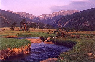
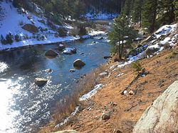
The Big Thompson River is a tributary of the South Platte River, approximately 78 miles (126 km) long, in the U.S. state of Colorado. Originating in Forest Canyon in Rocky Mountain National Park, the river flows into Lake Estes in the town of Estes Park and then through Big Thompson Canyon. It includes four crossings/bridges which are listed on the U.S. National Register of Historic Places.

<span class="mw-page-title-main">Salt River (Arizona)</span> River in Gila and Maricopa counties in Arizona, United States

The Salt River is a river in Gila and Maricopa counties in Arizona, United States, that is the largest tributary of the Gila River. The river is about 200 miles (320 km) long. Its drainage basin covers about 13,700 square miles (35,000 km2). The longest of the Salt River's many tributaries is the 195-mile (314 km) Verde River. The Salt's headwaters tributaries, the Black River and East Fork, increase the river's total length to about 300 miles (480 km). The name Salt River comes from the river's course over large salt deposits shortly after the merging of the White and Black Rivers.

<span class="mw-page-title-main">Cherry Creek (Colorado)</span> Tributary of the South Platte River

Cherry Creek is a tributary of the South Platte River, 48.0 miles (77.2 km) long, in Colorado in the United States.

<span class="mw-page-title-main">Boise River</span> River in Idaho, United States

The Boise River is a 102-mile-long (164 km) tributary of the Snake River in the Northwestern United States. It drains a rugged portion of the Sawtooth Range in southwestern Idaho northeast of Boise, as well as part of the western Snake River Plain. The watershed encompasses approximately 4,100 square miles (11,000 km2) of highly diverse habitats, including alpine canyons, forest, rangeland, agricultural lands, and urban areas.

<span class="mw-page-title-main">Platte Canyon</span>

The Platte Canyon is a deep, narrow, scenic gorge on the South Platte River in the Rocky Mountains of Colorado. The canyon is southwest of Denver on the border between Jefferson and Douglas counties. The canyon is at the entrance to the mountains, where the South Platte emerges through the Rampart Range through the hogbacks onto Eastern Plains. The lower narrow section is sometimes called Waterton Canyon, referring to Waterton, Colorado.

<span class="mw-page-title-main">Payette River</span> River in Idaho

The Payette River is an 82.7-mile-long (133.1 km) river in southwestern Idaho and is a major tributary of the Snake River.

<span class="mw-page-title-main">Colorado–Big Thompson Project</span> Federal water diversion project

The Colorado–Big Thompson Project is a federal water diversion project in Colorado designed to collect West Slope mountain water from the headwaters of the Colorado River and divert it to Colorado's Front Range and plains. In Colorado, approximately 80% of the state's precipitation falls on the West Slope, in the Rocky Mountains, while around 80% of the state's growing population lives along the eastern slope, between the cities of Fort Collins and Pueblo.

<span class="mw-page-title-main">Cherry Creek (Tuolumne River tributary)</span> River in California, United States

Cherry Creek is a large, swift-flowing stream in the Sierra Nevada mountain range, and is the largest tributary of the Tuolumne River. The creek is 44.6 miles (71.8 km) long measured to its farthest headwaters; the main stem itself is 27.7 miles (44.6 km) long, draining a watershed of 234 square miles (610 km2) in the Stanislaus National Forest. Part of the drainage also extends into the northwest corner of Yosemite National Park.

<span class="mw-page-title-main">Rio Chama</span> River of Colorado and New Mexico in the US

The Rio Chama, a major tributary river of the Rio Grande, is located in the U.S. states of Colorado and New Mexico. The river is about 130 miles (210 km) long altogether. From its source to El Vado Dam its length is about 50 miles (80 km), from El Vado Dam to Abiquiu Dam is about 51 miles (82 km), and from Abiquiu Dam to its confluence with the Rio Grande is about 34 miles (55 km).

<span class="mw-page-title-main">Crooked River (Oregon)</span> River in Oregon, United States

The Crooked River is a tributary, 125 miles (201 km) long, of the Deschutes River in the U.S. state of Oregon. The river begins at the confluence of the South Fork Crooked River and Beaver Creek. Of the two tributaries, the South Fork Crooked River is the larger and is sometimes considered part of the Crooked River proper. A variant name of the South Fork Crooked River is simply "Crooked River". The Deschutes River flows north into the Columbia River.

Denver Water is a water utility that operates as a public agency serving the City and County of Denver, Colorado, and a portion of its surrounding suburbs. Established in 1918, the utility is funded by water rates and new tap fees. It is Colorado's oldest and largest water utility.

<span class="mw-page-title-main">Eleven Mile State Park</span> State park in Colorado, United States

Eleven Mile State Park is a Colorado State Park located in Park County, 11 miles (18 km) south of Lake George, Colorado, United States. Established in 1970, the 7,662-acre (31.01 km2) park surrounds 3,405-acre (13.78 km2), 5.5 miles (8.9 km) long Eleven Mile Canyon Reservoir. The reservoir itself was completed in 1932 by Denver Water. Facilities include a marina, a visitors center and over 300 campsites. There are 5 miles (8.0 km) of trails available for hikers and bicyclists. Fish species include cutthroat, rainbow, brown trout and northern pike. Eleven Mile Reservoir is famous for the thriving Kokanee salmon population found in the river current along the north side of the reservoir known as the Dream Stream. This reservoir is also known for being very windy in the afternoon. A required daily vehicle park pass can be obtained at the entrance of the park. Daily species possession limits are as follows: trout, 4 total, two over 16" and two under 16", or four under 16"; salmon, 10; pike and crawdads, unlimited. Cottontail rabbit, white-tailed jackrabbit, coyote, muskrat and ground squirrels are commonly seen in the park. Mule deer, pronghorn, porcupine, badger, black bear and elk are seen occasionally.

<span class="mw-page-title-main">Jemez River</span> River in New Mexico, United States

The Jemez River is a tributary of the Rio Grande in eastern Sandoval County, New Mexico, United States.

<span class="mw-page-title-main">Bayou Gulch</span> River in Colorado, United States

Bayou Gulch is one of the tributaries of Cherry Creek, located mainly in the U.S. state of Colorado. It is part of the Colorado Eastern Plains. An archaeologically sensitive portion of the gulch was listed on the National Register of Historic Places in 2020.

The Sulphur Gulch is one of the tributaries of the Cherry Creek and is located in the U.S. states of Colorado. It is part of the Eastern Plains.

References

  1. "South Platte River". Geographic Names Information System . United States Geological Survey, United States Department of the Interior . Retrieved 2011-01-29.
  2. U.S. Geological Survey. National Hydrography Dataset high-resolution flowline data. The National Map, accessed March 25, 2011
  3. Water Data Report, Colorado 2003, from Water Resources Data Colorado Water Year 2003, USGS.
  4. Committee on Western Water Management (1992). Water Transfers in the West: Efficiency, Equity, and the Environment. Washington, D.C.: National Academy Press. pp. 140–142. ISBN   978-0-309-04528-5 . Retrieved 28 May 2024.
  5. Nebraska: A Guide to the Cornhusker State. Nebraska State Historical Society. p. 46.
  6. Denver Water History Archived 2016-09-03 at the Wayback Machine . Accessed June 23, 2014.
  7. Laura King Van Dusen, "Forty-Six Years in Howbert: 1887-1933: Former Ranching, Railroading Community Covered by Eleven-Mile Reservoir", Historic Tales from Park County: Parked in the Past (Charleston, South Carolina: The History Press, 2013), ISBN   978-1-62619-161-7, pp. 97-104.
  8. "Colorado Gold Waters". Colorado Gold Medal Waters. Trout Unlimited. Retrieved 28 May 2024.