Special routes of U.S. Route 271 | |
|---|---|
| Highway system | |

Several special routes of U.S. Route 271 exist, including the following:
Special routes of U.S. Route 271 | |
|---|---|
| Highway system | |
Several special routes of U.S. Route 271 exist, including the following:
Business U.S. Highway 271-H | |
|---|---|
| Location | Pittsburg |
| Length | 1.81 mi [1] (2.91 km) |
| Existed | March 31, 2016 [1] –present [1] |
Business U.S. Highway 271-E | |
|---|---|
| Location | Mount Pleasant |
| Length | 8.4 mi [2] (13.5 km) |
| Existed | 1990–present [3] |
Business U.S. Highway 271-D | |
|---|---|
| Location | Bogata |
| Length | 1.656 mi [4] (2.665 km) |
| Existed | 1990–present [4] |
Business U.S. Highway 271-D (Bus. US 271-D) is a business route of U.S. Highway 271 (US 271) in Bogata, Texas that is 1.656 miles (2.665 km) long. [4] It starts at US 271 in the center of Bogata, and goes through town, intersecting Texas State Highway 37 along the way. It then ends at US 271 outside of town. It is former Loop 38, of which the spur, Spur 38, still exists.
The entire route is in Red River County.
| Location | mi [4] [5] | km | Destinations | Notes | |
|---|---|---|---|---|---|
| Bogata | 0.000 | 0.000 | Southern terminus | ||
| 0.06 | 0.097 | ||||
| 0.6 | 0.97 | ||||
| 0.8 | 1.3 | ||||
| | 1.656 | 2.665 | Northern terminus | ||
| 1.000 mi = 1.609 km; 1.000 km = 0.621 mi | |||||
Business U.S. Highway 271-C | |
|---|---|
| Location | Deport |
| Length | 1.069 mi [6] (1.720 km) |
| Existed | 1990–present [6] |
Business U.S. Highway 271-B | |
|---|---|
| Location | Paris |
| Length | 4.193 mi [7] (6.748 km) |
| Existed | 1990–present [7] |
Business U.S. Highway 271-B (Bus. US 271-B) is a business route of US 271 in Texas that is 4.193 miles (6.748 km) in length. [7] It runs through the downtown of Paris, Texas, which U.S. 271 bypasses. It starts at an interchange with US 271 and Loop 286. and heads towards downtown Paris, intersecting multiple city streets. Close to the center of town, the route turns north onto US 82-H (12th Street), forming a concurrency. It then turns west onto Lamar Ave and continues heading towards downtown Paris. In the center of town, the route turns north on Main Street and the concurrency ends. Before the route ends it intersects multiple city streets. The route ends at another interchange with US 271, US 82, and Loop 286.
The entire highway is in Paris, Lamar County.
| mi | km | Destinations | Notes | ||
|---|---|---|---|---|---|
| 0.000 | 0.000 | Southern terminus | |||
| 2.2 | 3.5 | Southern end of concurrency with US 82 BUS | |||
| 3.1 | 5.0 | Northern end of concurrency with US 82 BUS | |||
| 4.193 | 6.748 | Northern terminus | |||
1.000 mi = 1.609 km; 1.000 km = 0.621 mi
| |||||
U.S. Highway 271 Business | |
|---|---|
| Location | Hugo |
| Length | 4.2 mi [8] (6.8 km) |
| Existed | 2019 |
U.S. 271 Business (Bus. US 271) was a business route of US 271 in Hugo, Oklahoma which is 4.2 miles (6.8 km) long. [8] It starts at an interchange with US 271 and U.S. Route 70, goes into Hugo, and then runs concurrently with U.S. Route 70 Business until they both end at an interchange with US 271, US 70, and the Indian Nation Turnpike. The route was decommissioned in 2019 to keep highway traffic from passing through Hugo.
The entire route is in Choctaw County.
| Location | mi [8] | km | Destinations | Notes | |
|---|---|---|---|---|---|
| | 0.0 | 0.0 | Southern terminus | ||
| Hugo | 1.6 | 2.6 | Southern end of concurrency with US 70 Bus. | ||
| | 4.2 | 6.8 | Northern terminus and northern end of concurrency with US 70 Bus. | ||
1.000 mi = 1.609 km; 1.000 km = 0.621 mi
| |||||

U.S. Route 190 (US 190) is an east–west United States Highway in Louisiana and Texas. Segments of US 190 will be upgraded to Interstate 14 (I-14); the first 24.8-mile (39.9 km) segment was opened on January 26, 2017.

U.S. Route 290 is an east–west U.S. Highway located entirely within the state of Texas. Its western terminus is at Interstate 10 southeast of Segovia, and its eastern terminus is at Interstate 610 in northwest Houston. It is the main highway between Houston and Austin and is a cutoff for travelers wanting to bypass San Antonio on Interstate 10. Throughout its length west of Austin, US 290 cuts across mountainous hills comprising the Texas Hill Country and the Edwards Plateau; between Austin and Houston, the highway then travels through gradually hilly grasslands and pine forests comprising the Gulf Coastal Plains.

State Highway 46 is a 71.4-mile (114.9 km) state highway in the U.S. state of Texas that runs from SH 16 east of Bandera to the intersection of SH 123 and SH 123 Business just south of Seguin.

State Highway 31 runs from U.S. 84 northeast of Waco via Corsicana, Athens, Tyler, Kilgore to U.S. 80 in Longview.

In the US state of Texas, Interstate 40 (I-40) runs west–east through the panhandle in the northwest part of the state. The only large city it passes through is Amarillo, where it meets the north end of I-27. The entire section of I-40 in Texas is designated as a Purple Heart Trail route.

U.S. Highway 59 (US 59) in the U.S. state of Texas is named the Lloyd Bentsen Highway, after Lloyd Bentsen, former U.S. senator from Texas. In northern Houston, US 59, co-signed with Interstate 69 (I-69), is the Eastex Freeway. To the south, which is also co-signed with I-69, it is the Southwest Freeway. The stretch of the Southwest Freeway just west of The Loop was formerly one of the busiest freeways in North America, with a peak AADT of 371,000 in 1998.

In the U.S. state of Texas, U.S. Route 82 (US 82) is a U.S. Highway that runs east from the New Mexico state line through West Texas and Lubbock to the Arkansas state line at Texarkana.

U.S. Route 77 (US 77) is a major highway that is part of the United States Numbered Highway System that runs from the Veterans International Bridge in Brownsville to Sioux City, Iowa. In Texas, the road runs south-north for 471.3 miles (758.5 km) from the International border with Mexico to the Oklahoma state line north of Gainesville. The highway is being upgraded to a freeway near Corpus Christi to connect to the freeway part of the highway in Raymondville as part of future I-69. A freeway in Robstown is already signed as part of I-69. From Waco to the Oklahoma state line, US 77 overlaps or runs parallel to I-35/I-35E.

U.S. Route 54 in Texas is a U.S. Highway that travels through two portions of the state: one in the far western point, and the other in the far northwest Panhandle.

Business Interstate 27-U is a business loop in the US state of Texas. It stretches 9.282 miles (14.938 km) along Columbia Street through Plainview between exits 45 and 53 on Interstate 27 (I-27). The highway follows the original alignment of U.S. Route 87 (US 87) prior to the construction of the new freeway to the west. Before becoming Bus. I-27-U, it was designated as Loop 445 and signed as a business route of US 87. Along the way, it intersects Farm to Market Road 3466, US 70 (5th Street), and FM 1767 (34th Street).

Interstate business routes are roads connecting a central or commercial district of a city or town with an Interstate bypass. These roads typically follow along local streets often along a former U.S. Route or state highway that had been replaced by an Interstate. Interstate business route reassurance markers are signed as either loops or spurs using a green shield shaped sign and numbered like the shield of the parent Interstate highway.

U.S. Route 70 is a transcontinental U.S. highway extending from Globe, Arizona to Atlantic, North Carolina. Along the way, 289.81 miles (466.40 km) of its route passes through the state of Oklahoma. Entering the state south of Davidson, the highway serves Oklahoma's southern tier before exiting the state east of Broken Bow. It serves the cities of Ardmore, Durant, Hugo, and Idabel, as well as Tillman, Cotton, Jefferson, Carter, Marshall, Bryan, Choctaw, and McCurtain counties.

Numerous special routes of U.S. Route 67, all business routes, exist. One other route, formerly an alternate route in western Illinois, has since been downgraded to state Route 267.
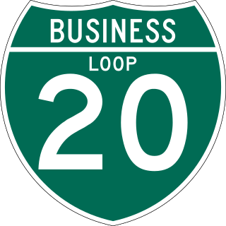
All of the business loops within Texas are maintained by the Texas Department of Transportation (TxDOT). Interstate 20 (I-20) has 15 business loops in the state, all located in western Texas. Along I-20, TxDOT identifies each business route as Business Interstate 20 followed by an alphabetic suffix. Along Texas Interstates, the alphabetic suffixes on business route names ascend eastward and northward. There are gaps in the alphabetic values to allow for future system expansion. The alphabetic naming suffixes are included as small letters on the bottom of route shields.

A total of twelve special routes of U.S. Route 79 exist, divided between the states of Arkansas, Louisiana, Tennessee and Texas. Currently, they are all business routes, except for one bypass of Humboldt, Tennessee, and one bypass of Homer, Louisiana.

Business US Highway 287-P is a 38.613-mile-long (62.142 km) business loop of US Highway 287 in the state of Texas that serves as main street for Mansfield, downtown Fort Worth and Saginaw. The highway is known as Main Street while in Mansfield, Mansfield Highway while in southern Fort Worth, Kennedale Parkway in Kennedale, Riverside Drive and Rosedale Street in central Fort Worth, Commerce Street in downtown Fort Worth, Main Street in northern Fort Worth, and Saginaw Boulevard in Saginaw. The highway was originally designated on January 14, 1991, to replace a portion of Loop 496, and the old route of US 287 and US 81. The route was then rerouted several times during the 1990s. Bus. US 287-P is located almost entirely in Tarrant County, and is mostly located in Fort Worth. The highway is, as of 2010, the longest business route of US 287, while located in Texas. Bus. US 287-P is one of the few highways to be designated as a north–south highway.
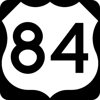
At least 13 special routes of U.S. Route 84 have existed.

There are currently three business routes of U.S. Route 83 in Texas that are designated and maintained by the Texas Department of Transportation (TxDOT). The business routes in the US state of Texas are traditionally short spurs or loops that connect the main route, in this case, U.S. Route 83 (US 83), to the center or commercial district of a city. The routes commonly follow the course of a decommissioned state highway, or the old course of the main route. Business routes are signed with the traditional US 83 highway shield, and with a small "business plate" placed above the marker. TxDOT regards business routes as official highways, and is responsible for the maintenance of the route.