Paris, Texas

Last updated

Paris, Texas
City
Paris Commercial Historic District Wiki (1 of 1).jpg
Historic Downtown Paris
Motto: 
Smile!
Map of Texas highlighting Lamar County.svg
Location of Lamar County
Lamar County Paris.svg
Coordinates: 33°39′45″N95°32′52″W / 33.66250°N 95.54778°W / 33.66250; -95.54778
Country United States
State Texas
County Lamar
Settledby 1824 [1]
Named1844
Incorporated1845
Named for Paris, France
Government
   City Council Reginald Hughes (Mayor)
Shatara Moore
Gary Savage
Mihir Pankaj
Rudy Kessel
Clayton Pilgrim
Rebecca Norment
   City Manager Grayson Path
Area
[2]
  Total37.07 sq mi (96.00 km2)
  Land35.19 sq mi (91.14 km2)
  Water1.88 sq mi (4.86 km2)
Elevation
600 ft (183 m)
Population
 (2020)
  Total24,171
  Density650/sq mi (250/km2)
   Demonym
Parisian
Time zone UTC−6 (Central (CST))
  Summer (DST) UTC−5 (CDT)
ZIP codes
75460-75462
Area code 903/430
FIPS code 48-55080
GNIS feature ID1364810 [3]
Website paristexas.gov

Paris is a city and county seat of Lamar County, Texas, United States. Located in Northeast Texas at the western edge of the Piney Woods, the population of the city was 24,171 in 2020. [4]

Contents

History

Present-day Lamar County was part of Red River County during the Republic of Texas. By 1840, population growth necessitated the organization of a new county. George Washington Wright, who had served in the Third Congress of the Republic of Texas as a representative from Red River County, was a major proponent of the new county. The Fifth Congress established the new county on December 17, 1840, and named it after Mirabeau B. Lamar, [5] who was the first Vice President and the second President of the Republic of Texas.

Map of the city in 1885 Old map-Paris-1885.jpg
Map of the city in 1885

Lamar County was one of the 18 Texas counties that voted against secession on February 23, 1861. [6]

In 1877, 1896, and 1916, major fires in the city forced considerable rebuilding. The 1916 fire destroyed almost half the town and caused an estimated $11 million in property damage. The fire ruined most of the central business district and swept through a residential area. The burned structures included the Federal Building and Post Office, the Lamar County Courthouse and Jail, City Hall, most commercial buildings, and several churches. [7]

In 1893, black teenager Henry Smith was accused of murder, tortured, and then burned to death on a scaffold in front of thousands of spectators in Paris. [8] In 1920, two black brothers from the Arthur family were tied to a flagpole and burned to death at the Paris fairgrounds. The city has prominent memorials to the Confederacy. [8]

In 1943, the U.S. Supreme Court in Largent v. Texas struck down a Paris ordinance that prohibited a person from selling or distributing religious publications without first obtaining a city-issued permit. The Court ruled that the ordinance abridged freedom of religion, freedom of speech, and freedom of the press in violation of the Fourteenth Amendment. [9]

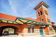
Historic Paris train station Paristrains.jpg
Historic Paris train station

Paris is a former railroad center. The Texas and Pacific reached town in 1876; the Gulf, Colorado and Santa Fe Railway (later merged into the Atchison, Topeka and Santa Fe Railway) and the Frisco in 1887; the Texas Midland Railroad (later Southern Pacific) in 1894; and the Paris and Mount Pleasant (Pa-Ma Line) in 1910. Paris Union Station, built 1912, served Frisco, Santa Fe, and Texas Midland passenger trains until 1956. Today, the station is used by the Lamar County Chamber of Commerce and serves as the research library for the Lamar County Genealogical Society. [10]

Following a tradition of American cities named "Paris" (named after France's capital), the city commissioned a 65-foot-tall (20 m) replica of the Eiffel Tower in 1993 and installed it on site of the Love Civic Center, southeast of the town square. In 1998, presumably as a response to the 1993 construction of a 60-foot-tall (18 m) tower in Paris, Tennessee, the city placed a giant red cowboy hat atop its tower. The current Eiffel Tower replica is at least the second one; an earlier replica constructed of wood was destroyed by a tornado.

Race relations

Lynching of Henry Smith, Paris Fairgrounds, 1893 Henry-smith-2-1-1893-paris-tx-2.jpg
Lynching of Henry Smith, Paris Fairgrounds, 1893

Race relations in Paris were described by Newsweek as "turbulent" and sometimes "explosive". [11] In the late-19th and early-20th centuries, several lynchings of African-Americans were staged at the Paris Fairgrounds. [12] [13] A black teenager, Henry Smith, lynched in 1893, was the first in US history captured in photographs. [14] Other lynchings included Irving and Herman Arthur in 1920. [15] [16]

Local resident and activist Brenda Cherry speaking at the rally for Brandon McClelland, 2009 1cherryandblackwell.jpg
Local resident and activist Brenda Cherry speaking at the rally for Brandon McClelland, 2009

In 2008, an African-American man, Brandon McClelland, was run over and dragged to death by two white men, who were not prosecuted due to lack of evidence. A rally over the death in 2009 had groups shouting "white power" and "black power". [17]

Other incidents included sentencing disparities between black and white juveniles, racist flags and graffiti, school discipline disparities, [18] [19] and racist labor practices. [20] [21]

Geography

According to the U.S. Census Bureau, the city has a total area of 44.4 square miles (115 km2), of which 42.8 square miles (111 km2) are land and 1.7 square miles (4.4 km2) (3.74%) are covered by water.

Paris has a humid subtropical climate (Cfa in the Köppen climate classification). It is located in "Tornado Alley", an area largely centered in the middle of the United States in which tornadoes occur frequently because of weather patterns and geography. Paris is in USDA plant hardiness zone 8a for winter temperatures. This is cooler than its southern neighbor Dallas, and while similar to Atlanta, Georgia, it has warmer summertime temperatures. Summertime average highs reach 94 and 95 °F (34 and 35 °C) in July and August, with associated lows of 72 and 71 °F (22 and 22 °C). Winter temperatures drop to an average high of 51 °F (11 °C) and low of 30 °F (−1 °C) in January. The highest temperature on record was 115 °F (46 °C), set in August 1936, and the record low was −5 °F (−21 °C), set in 1930. Average precipitation is 47.82 in (1,215 mm). Snow is not unusual, but is by no means predictable, and years can pass with no snowfall at all.

On April 2, 1982, Paris was hit by an F4 tornado that destroyed more than 1,500 homes, and left 10 people dead, 170 injured, and 3,000 homeless. The damage toll from this tornado was estimated at US$50 million in 1982. [22]

Climate

According to the Köppen Climate Classification system, Paris has a humid subtropical climate, abbreviated "Cfa" on climate maps. The hottest temperature recorded in Paris was 115 °F (46.1 °C) in August 1936, while the coldest temperature recorded was −5 °F (−20.6 °C) in January 1930. [23]

Climate data for Paris, Texas, 1991–2020 normals, extremes 1896–present
MonthJanFebMarAprMayJunJulAugSepOctNovDecYear
Record high °F (°C)90
(32)
90
(32)
94
(34)
96
(36)
100
(38)
108
(42)
111
(44)
115
(46)
112
(44)
99
(37)
94
(34)
87
(31)
115
(46)
Mean maximum °F (°C)73.9
(23.3)
77.8
(25.4)
83.9
(28.8)
87.5
(30.8)
93.0
(33.9)
98.1
(36.7)
102.5
(39.2)
103.5
(39.7)
99.2
(37.3)
91.8
(33.2)
82.3
(27.9)
74.9
(23.8)
104.7
(40.4)
Mean daily maximum °F (°C)53.5
(11.9)
58.5
(14.7)
66.5
(19.2)
75.0
(23.9)
82.7
(28.2)
91.2
(32.9)
95.8
(35.4)
96.2
(35.7)
88.7
(31.5)
78.2
(25.7)
65.2
(18.4)
55.8
(13.2)
75.6
(24.2)
Daily mean °F (°C)43.4
(6.3)
47.8
(8.8)
55.7
(13.2)
63.9
(17.7)
72.7
(22.6)
81.1
(27.3)
85.3
(29.6)
85.1
(29.5)
77.6
(25.3)
66.4
(19.1)
54.6
(12.6)
45.8
(7.7)
65.0
(18.3)
Mean daily minimum °F (°C)33.2
(0.7)
37.0
(2.8)
44.9
(7.2)
52.8
(11.6)
62.7
(17.1)
71.0
(21.7)
74.8
(23.8)
74.1
(23.4)
66.5
(19.2)
54.7
(12.6)
44.0
(6.7)
35.8
(2.1)
54.3
(12.4)
Mean minimum °F (°C)18.0
(−7.8)
21.9
(−5.6)
27.5
(−2.5)
37.3
(2.9)
47.4
(8.6)
60.6
(15.9)
66.5
(19.2)
65.6
(18.7)
52.4
(11.3)
38.3
(3.5)
28.1
(−2.2)
21.6
(−5.8)
14.4
(−9.8)
Record low °F (°C)−5
(−21)
−4
(−20)
7
(−14)
25
(−4)
30
(−1)
46
(8)
57
(14)
53
(12)
34
(1)
19
(−7)
15
(−9)
0
(−18)
−5
(−21)
Average precipitation inches (mm)3.08
(78)
3.34
(85)
4.35
(110)
4.71
(120)
5.63
(143)
4.26
(108)
3.51
(89)
2.95
(75)
3.95
(100)
4.62
(117)
4.21
(107)
4.28
(109)
48.89
(1,241)
Average snowfall inches (cm)0.4
(1.0)
0.1
(0.25)
trace0.0
(0.0)
0.0
(0.0)
0.0
(0.0)
0.0
(0.0)
0.0
(0.0)
0.0
(0.0)
0.0
(0.0)
trace0.4
(1.0)
0.9
(2.25)
Average precipitation days (≥ 0.01 in)8.89.19.59.09.97.76.35.46.57.57.48.395.4
Average snowy days (≥ 0.1 in)0.30.10.00.00.00.00.00.00.00.00.00.30.7
Source 1: NOAA (snow, snow days 19812010) [24] [25]
Source 2: National Weather Service [23]

Demographics

Historical population
CensusPop.Note
1880 3,980
1890 8,254107.4%
1900 9,35813.4%
1910 11,26920.4%
1920 15,04033.5%
1930 15,6494.0%
1940 18,67819.4%
1950 21,64315.9%
1960 20,977−3.1%
1970 23,44111.7%
1980 25,4988.8%
1990 24,799−2.7%
2000 25,8984.4%
2010 25,171−2.8%
2020 24,171−4.0%
Texas Almanac [26]

From a 1880 United States census population of 3,980, the population of the city of Paris increased to 25,898 at the 2000 census; in 2020, however, its population declined to 24,171. [4]

In 2010, 25,171 people 10,306 households, and 6,426 families resided in the city. [27] The population density was 588.1 people per square mile (227.1 people/km2); the 11,883 housing units averaged 277.6 per square mile (107.2/km2). of all households were made up of individuals, and 15.2% had someone living alone who was 65 or older. The average household size was 2.38 and the average family size was 3.01. In the city, the population was distributed as 25.0% under 18, 10.6% from 18 to 24, 24.1% from 25 to 44, 23.8% from 45 to 64, and 16.6% who were 65 or older. The median age was 37.1 years. For every 100 females, there were 87.3 males. For every 100 females 18 and over, there were 82.9 males.

By 2020, the city had 10,522 households according to the American Community Survey, and 3,549 were married-couple households. [28] The average household size was 2.29, and the average family size was 2.99. Of its 2020 population, 933 were foreign-born nationals, 18.9% of whom were naturalized U.S. citizens. As of the census estimates, 49.6% of housing units were owner-occupied and 50.4% were renter-occupied. [29]

Paris racial composition as of 2020 [30]
(NH = Non-Hispanic) [lower-alpha 1]
RaceNumberPercentage
White (NH)13,85356.6%
Black or African American (NH)5,64323.06%
Native American or Alaska Native (NH)3311.35%
Asian (NH)3471.42%
Pacific Islander (NH)190.08%
Some other race (NH)570.23%
Mixed/multiracial (NH)1,3185.38%
Hispanic or Latino 2,90811.88%
Total24,476

In 2010, according to the U.S. Census Bureau, the racial makeup of the city was 70.3% White, 24.8% Black and African American, 3.1% American Indian and Alaska Native, 1.1% Asian, and 4.1% from other races. Hispanics or Latinos of any race were 8.2% of the population. [27] In 2020, its racial and ethnic makeup was 56.6% non-Hispanic White, 23.06% Black and African American, 1.35% Native American, 1.42% Asian, 0.08% Pacific Islander, 0.23% some other race, 5.38% multiracial, and 11.88% Hispanic or Latino of any race, reflecting demographic trends of greater diversification. [33] [34]

Economy

In the past, Paris was a major cotton exchange, and the county was developed as cotton plantations. While cotton is still farmed on the lands around Paris, it is no longer a major part of the economy.

Paris's one major hospital has two campuses: Paris Regional Medical Center South (formerly St. Joseph's Hospital) and Paris Regional Medical Center North (formerly McCuistion Regional Medical Center). It serves as the center of healthcare for much of Northeast Texas and Southeast Oklahoma. Both campuses are now operated jointly under the name of the Paris Regional Medical Center, a division of Essent Healthcare. Paris Regional Medical Center South Campus has recently closed and only the North Campus remains open. The health network is one of the largest employers in the Paris area. [35]

Outside of healthcare, the largest employers are Kimberly-Clark and Campbell Soup.

#Employer# of employees
1Essent-PRMC1000
2 Campbell Soup 900
3 Kimberly-Clark 800
4Turner Industries700
5 Paris ISD 640
T-6 North Lamar ISD 500
T-6 Walmart 500
8TCIM480
9City of Paris320
10We-Pack Logistics300

[36]

Note: PRMC is Paris Regional Medical Center.

Arts and culture

The Culbertson Fountain Culbertson fountain 2010.jpg
The Culbertson Fountain
The 65-foot Paris Eiffel Tower with the red cowboy hat at its summit Paris Texas Eiffel.jpg
The 65-foot Paris Eiffel Tower with the red cowboy hat at its summit

The city is home to several late-19th to mid-20th century stately homes. Among these is the Rufus Fenner Scott Mansion, designed by German architect J.L. Wees and constructed in 1910. The structure is solid concrete and steel with four floors. Rufus Scott was a prominent businessman known for shipping, imports, and banking. He was well known by local farmers, who bought aging transport mules from him. The Scott Mansion narrowly survived the fire of 1916. After the fire, Scott brought the architect Wees back to Paris to redesign the historic downtown area. [37]

Government

City Hall in July 2015 Paris July 2015 25 (City Hall).jpg
City Hall in July 2015

Paris is governed by a city council as specified in the city's charter adopted in 1948.

Paris is represented in the Texas Senate by Republican Bryan Hughes, District 1, and in the Texas House of Representatives by Republican Gary VanDeaver, District 1.

The Texas Department of Criminal Justice operates the Paris District Parole Office [38]

At the federal level, the two U.S. senators from Texas are Republicans John Cornyn and Ted Cruz. Paris is part of Texas's 4th congressional district, represented by Republican Pat Fallon.

The United States Postal Service operates the Paris Post Office. [39]

Education

Paris Public Library in July 2015 Paris July 2015 20 (Paris Public Library).jpg
Paris Public Library in July 2015

Elementary and secondary education is split among three main school districts:

Prairiland ISD also serves a small portion of the town, along with Blossom ISD.

In addition, Paris Junior College provides postsecondary education. It hosts the Texas Institute of Jewelry Technology, a well-respected school[ according to whom? ] of gemology, horology, and jewelry. The Industrial Technology Division offers programs in air conditioning technology, refrigeration technology, agricultural technology, drafting and computer-aided design, electronics, electromechanical technology, and welding technology.

Texas A&M University-Commerce, a major university of over 12,000 students, is located in the neighboring city of Commerce, 40 miles southwest of Paris.

The Paris Public Library serves Paris, as does the Lamar County Genealogical Society Library. [40]

Infrastructure

Transportation

Paris is served by four major highways:

According to the Texas Transportation Commission, Paris is the second-largest city in Texas without a four-lane divided highway connecting to an interstate highway within the state. However, those traveling north of the city can go into the Midwest on a four-lane thoroughfare via US 271 across the Red River into Oklahoma, and then the Indian Nation Turnpike from Hugo to Interstate 40 at Henryetta, which in turn continues as a free four-lane highway via US 75 to Tulsa.

For public transit, Paris is served by the Ark-Tex Council of Governments Rural Transit District (TRAX). Local, fixed-route bus service runs hourly on weekdays between 6:30 am and 6:30 pm. [41] Dubbed the "Paris Metro", Texas Monthly has cited the town as a model for rural transport. [42] There is no intercity transit available in Paris. However, intercity bus routes can be accessed in nearby Mount Pleasant and Sulphur Springs. These services are operated by Greyhound [43] and Trailways.

Paris is served by two taxicab companies.[ citation needed ] Cox Field provides general aviation services.

Notable people

Notes

  1. Note: the US Census treats Hispanic/Latino as an ethnic category. This table excludes Latinos from the racial categories and assigns them to a separate category. Hispanics/Latinos can be of any race. [31] [32]

Related Research Articles

<span class="mw-page-title-main">New Hampshire</span> U.S. state

New Hampshire is a state in the New England region of the Northeastern United States. It borders Massachusetts to the south, Vermont to the west, Maine and the Gulf of Maine to the east, and the Canadian province of Quebec to the north. Of the 50 U.S. states, New Hampshire is the fifth smallest by area and the tenth least populous, with a population of 1,377,529 residents as of the 2020 census. Concord is the state capital and Manchester is the most populous city. New Hampshire's motto, "Live Free or Die", reflects its role in the American Revolutionary War; its nickname, "The Granite State", refers to its extensive granite formations and quarries. It is well known nationwide for holding the first primary in the U.S. presidential election cycle, and for its resulting influence on American electoral politics.

<span class="mw-page-title-main">North America</span> Continent in the Northern Hemisphere

North America is a continent in the Northern and Western Hemispheres. North America is bordered to the north by the Arctic Ocean, to the east by the Atlantic Ocean, to the southeast by South America and the Caribbean Sea, and to the west and south by the Pacific Ocean. The region includes the Bahamas, Bermuda, Canada, the Caribbean, Central America, Clipperton Island, Greenland, Mexico, Saint Pierre and Miquelon, Turks and Caicos Islands, and the United States.

<span class="mw-page-title-main">Northwest Territories</span> Territory of Canada

The Northwest Territories is a federal territory of Canada. At a land area of approximately 1,144,000 km2 (442,000 sq mi) and a 2016 census population of 41,790, it is the second-largest and the most populous of the three territories in Northern Canada. Its estimated population as of 2023 is 45,668. Yellowknife is the capital, most populous community, and only city in the territory; its population was 19,569 as of the 2016 census. It became the territorial capital in 1967, following recommendations by the Carrothers Commission.

<span class="mw-page-title-main">Namibia</span> Country in Southern Africa

Namibia, officially the Republic of Namibia, is a country in Southern Africa. Its western border is the Atlantic Ocean. It shares land borders with Angola and Zambia to the north, Botswana to the east and South Africa to the east and south. Although it does not border Zimbabwe, less than 200 metres of the Botswanan right bank of the Zambezi River separates the two countries. Its capital and largest city is Windhoek.
<span class="mw-page-title-main">Nairobi</span> Capital and largest city of Kenya

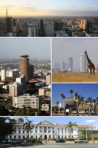
Nairobi is the capital and largest city of Kenya. The name is derived from the Maasai phrase Enkare Nairobi, which translates to 'place of cool waters', a reference to the Nairobi River which flows through the city. The city proper had a population of 4,397,073 in the 2019 census. The Greater Nairobi Metropolitan Area has a population of about 7,000,000 people. The city is commonly referred to as The Green City in the Sun.
<span class="mw-page-title-main">Nebraska</span> U.S. state

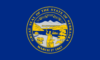
Nebraska is a triply landlocked state in the Midwestern region of the United States. It borders South Dakota to the north; Iowa to the east and Missouri to the southeast, both across the Missouri River; Kansas to the south; Colorado to the southwest; and Wyoming to the west. Nebraska is the 16th largest state by land area, with just over 77,220 square miles (200,000 km2). With a population of over 1.9 million, it is the 37th most populous state and the 7th least densely populated. Its capital is Lincoln, and its most populous city is Omaha, which is on the Missouri River. Nebraska was admitted into the United States in 1867, two years after the end of the American Civil War. The Nebraska Legislature is unlike any other American legislature in that it is unicameral, and its members are elected without any official reference to political party affiliation.

<span class="mw-page-title-main">New Jersey</span> U.S. state

New Jersey is a state situated within both the Mid-Atlantic and Northeastern regions of the United States. It is the most densely populated of all 50 U.S. states, and is situated at the center of the Northeast megalopolis. New Jersey is bordered on its north and east by New York state; on its east, southeast, and south by the Atlantic Ocean; on its west by the Delaware River and Pennsylvania; and on its southwest by Delaware Bay and Delaware. At 7,354 square miles (19,050 km2), New Jersey is the fifth-smallest state in land area, but with close to 9.3 million residents as of the 2020 United States census, its highest decennial count ever, it ranks 11th in population. The state capital is Trenton, and the state's most populous city is Newark. New Jersey is the only U.S. state in which every county is deemed urban by the U.S. Census Bureau with 13 counties included in the New York metropolitan area, seven counties in the Philadelphia metropolitan area, and Warren County part of the heavily industrialized Lehigh Valley metropolitan area.

<span class="mw-page-title-main">New Mexico</span> U.S. state

New Mexico is a landlocked state in the Southwestern region of the United States. It is one of the Mountain States of the southern Rocky Mountains, sharing the Four Corners region with Utah, Colorado, and Arizona. It also borders Texas to the east and southeast, Oklahoma to the northeast, and the Mexican states of Chihuahua and Sonora to the south. New Mexico's largest city is Albuquerque, and its state capital is Santa Fe, the oldest state capital in the U.S., founded in 1610 as the government seat of Nuevo México in New Spain.

<span class="mw-page-title-main">North Carolina</span> U.S. state

North Carolina is a state in the Southeastern region of the United States. It is bordered by Virginia to the north, the Atlantic Ocean to the east, South Carolina to the south, Georgia to the southwest, and Tennessee to the west. The state is the 28th-largest and 9th-most populous of the United States. Along with South Carolina, it makes up the Carolinas region of the East Coast. At the 2020 census, the state had a population of 10,439,388. Raleigh is the state's capital and Charlotte is its most populous city. The Charlotte metropolitan area, with an estimated population of 2,805,115 in 2023, is the most populous metropolitan area in North Carolina, the 22nd-most populous in the United States, and the largest banking center in the nation after New York City. The Research Triangle, with an estimated population of 2,368,947 in 2023, is the second-most populous combined metropolitan area in the state, 31st-most populous in the United States, and is home to the largest research park in the United States, Research Triangle Park.

<span class="mw-page-title-main">Nashville, Tennessee</span> Capital city of Tennessee, United States

Nashville is the capital and most populous city in the U.S. state of Tennessee and the county seat of Davidson County. Located in Middle Tennessee, it had a population of 689,447 at the 2020 U.S. census. Nashville is the 21st most populous city in the United States, and the fourth most populous city in the southeastern U.S. Located on the Cumberland River, the city is the center of the Nashville metropolitan area, and is one of the fastest growing in the nation.

<span class="mw-page-title-main">Ohio</span> U.S. state

Ohio is a state in the Midwestern region of the United States. Ohio borders Lake Erie to the north, Pennsylvania to the east, West Virginia to the southeast, Kentucky to the southwest, Indiana to the west, and Michigan to the northwest. Of the 50 U.S. states, it is the 34th-largest by area. With a population of nearly 11.8 million, Ohio is the seventh-most populous and tenth-most densely populated state. Its capital and most populous city is Columbus, with other large population centers including Cleveland, Cincinnati, Dayton, Akron, and Toledo. Ohio is nicknamed the "Buckeye State" after its Ohio buckeye trees, and Ohioans are also known as "Buckeyes". Its flag is the only non-rectangular flag of all U.S. states.

<span class="mw-page-title-main">Oklahoma</span> U.S. state

Oklahoma is a landlocked state in the South Central region of the United States. It borders Texas to the south and west, Kansas to the north, Missouri to the northeast, Arkansas to the east, New Mexico to the west, and Colorado to the northwest. Partially in the western extreme of the Upland South, it is the 20th-most extensive and the 28th-most populous of the 50 United States. Its residents are known as Oklahomans and its capital and largest city is Oklahoma City. The state's name is derived from the Choctaw words okla, 'people' and humma, which translates as 'red'. Oklahoma is also known informally by its nickname, "The Sooner State", in reference to the Sooners, settlers who staked their claims in formerly American Indian-owned lands until the Indian Appropriations Act of 1889 authorized the Land Rush of 1889 opening the land to white settlement.

<span class="mw-page-title-main">Pennsylvania</span> U.S. state

Pennsylvania, officially the Commonwealth of Pennsylvania, is a state spanning the Mid-Atlantic, Northeastern, Appalachian, and Great Lakes regions of the United States. Pennsylvania borders Delaware to its southeast, Maryland to its south, West Virginia to its southwest, Ohio and the Ohio River to its west, Lake Erie and New York to its north, the Delaware River and New Jersey to its east, and the Canadian province of Ontario to its northwest.

<span class="mw-page-title-main">Purdue University</span> Public university in West Lafayette, Indiana, US

Purdue University is a public land-grant research university in West Lafayette, Indiana, and the flagship campus of the Purdue University system. The university was founded in 1869 after Lafayette businessman John Purdue donated land and money to establish a college of science, technology, and agriculture; the first classes were held on September 16, 1874.

<span class="mw-page-title-main">Perth</span> Capital city of Western Australia

Perth is the capital city of Western Australia. It is the fourth most populous city in Australia, with a population of over 2.3 million within Greater Perth. It is part of the South West Land Division of Western Australia, with the majority of Perth's metropolitan area on the Swan Coastal Plain between the Indian Ocean and the Darling Scarp. The city has expanded outward from the original British settlements on the Swan River, upon which its central business district and port of Fremantle are situated.

<span class="mw-page-title-main">Lamar County, Texas</span> County in Texas, United States

Lamar County is a county located in the U.S. state of Texas, in the Northeast Texas region. As of the 2020 census, its population was 50,088. Its county seat is Paris. The county was formed by the Congress of the Republic of Texas on December 17, 1840, and organized the next year. It is named for Mirabeau B. Lamar, the second president of the Republic of Texas. Lamar County comprises the Paris, TX micropolitan statistical area.

<span class="mw-page-title-main">Pampa, Texas</span> City in Texas, United States

Pampa is a city in Gray County, Texas, United States. Its population was 16,867 as of the 2020 census. Pampa is the county seat of Gray County and is the principal city of the Pampa micropolitan statistical area, which includes both Gray and Roberts Counties. Pampa is named after the Pampas Lowlands in Argentina, Uruguay, and southern Brazil.

Powderly is a census-designated place (CDP) and unincorporated community in Lamar County, Texas, United States. As of the 2010 census, the population was 1,178.

<span class="mw-page-title-main">Funk's Grove Township, McLean County, Illinois</span> Township in Illinois, United States

Funk's Grove Township is a township in McLean County, Illinois. As of the 2010 census, its population was 245 and it contained 105 housing units.

<span class="mw-page-title-main">Funing County, Yunnan</span> County in Yunnan, China

Funing County is located in Wenshan Zhuang and Miao Autonomous Prefecture, in the east of Yunnan province, China. It is the easternmost county-level division of Yunnan, bordering Guangxi to the north, east and southeast, and Vietnam's Hà Giang Province to the south.

References

  1. Harvill, Daisy. "Paris, TX". Texas State Historical Association. Retrieved April 19, 2024.
  2. "2019 U.S. Gazetteer Files". United States Census Bureau. Retrieved August 7, 2020.
  3. "US Board on Geographic Names". United States Geological Survey. October 25, 2007. Retrieved January 31, 2008.
  4. 1 2 "2020 Race and Population Totals". Data.census.gov. Retrieved April 24, 2022.
  5. John Sayles; Henry Sales (1889). Revised Civil Statutes and Laws Passed by the 16th, 17th, 18th, 19th, & 20th Legislatures of the State of Texas. Vol. 1. Gilbert Book Company. p. 281. Retrieved January 7, 2018.
  6. "Texas Almanac: Secession and the Civil War". Texas State Historical Association. Archived from the original on October 21, 2016. Retrieved January 7, 2017.{{cite web}}: More than one of |archivedate= and |archive-date= specified (help); More than one of |archiveurl= and |archive-url= specified (help)
  7. Tx State Historical Commission (1978). "The Paris Fire of 1916 – Texas State Historical Marker". Stoppingpoints.com.
  8. 1 2 Campbell Roberts (February 10, 2015). "History of Lynchings in the South Documents Nearly 4,000 Names". The New York Times. Retrieved August 19, 2016.
  9. "Largent v. State of Tex". U.S. Supreme Court. Retrieved January 7, 2018 via FindLaw.
  10. "Union Station - Paris, Texas - Train Stations/Depots". Waymarking.com.
  11. Gretel C. Kovach; Ariel Campo–Flores (July 27, 2009). "The turbulent racial history of Paris, Texas". Newsweek, via Anderson Cooper 360°. CNN. Archived from the original on October 2, 2015. Retrieved May 1, 2015.{{cite web}}: More than one of |archivedate= and |archive-date= specified (help); More than one of |archiveurl= and |archive-url= specified (help)
  12. Howard Witt (March 12, 2007). "To some in Paris, sinister past is back". Chicago Tribune. Retrieved May 1, 2015.
  13. Howard Witt (February 1, 2009). "Paris, Texas, race relations dialogue turns into dispute". Chicago Tribune. Retrieved May 1, 2015.
  14. Minutaglio, Bill (2021). A Single Star and Bloody Knuckles: A History of Politics and Race in Texas. University of Texas Press. pp. 48–51. ISBN   9781477310366.
  15. "Man Acquitted of Murder" . Fort Worth Star-Telegram . January 14, 1922. p. 7. ISSN   0889-0013. OCLC   60616134 . Retrieved July 23, 2020. "Texas Mob Burns Negroes At Stake". New Britain Herald. New Britain, Connecticut: Herald Pub. Co. July 7, 1920. pp. 1–12. ISSN   2643-4954. OCLC   8783515 . Retrieved July 7, 2020 via Chronicling America. "Mob of Texans Burns Negroes". Bisbee Daily Review . Bisbee, Arizona: W.B. Kelly. July 7, 1920. pp. 1–8. ISSN   2157-3255. OCLC   11363144 . Retrieved July 7, 2020 via Chronicling America.
  16. "Officer of the Law Assaults Innocent Girls" (PDF). New York Age . New York City. September 4, 1920. OCLC   9274417 . Retrieved July 15, 2020.
  17. Jeff Carlton (August 21, 2009). "Riot Police Storm Texas Town After Black, White Protesters Clash Over Dragging Death". Huffington Post. Retrieved May 3, 2015.
  18. Howard Witt (February 25, 2009). "Racism bedevils Texas town". Chicago Tribune. Retrieved May 5, 2015.
  19. Howard Witt (March 31, 2007). "Girl in prison for shove gets released early". Chicago Tribune. Retrieved May 5, 2015.
  20. Alejandra Cancino (February 10, 2015). "Sara Lee discriminated against black employees, attorneys say". Chicago Tribune. Retrieved May 3, 2015.
  21. "Workers Targets of Racist Behavior at Sara Lee Plant: EEOC". NBC Channel 5 Dallas–Fort Worth. February 10, 2015. Retrieved May 3, 2015.
  22. Boyd, Matthew. "Paris officers remember deadly tornado of 1982". Archived from the original on October 27, 2016. Retrieved October 27, 2016.{{cite news}}: More than one of |archivedate= and |archive-date= specified (help); More than one of |archiveurl= and |archive-url= specified (help)
  23. 1 2 "NOAA Online Weather Data – NWS Dallas/Fort Worth". National Weather Service. Retrieved February 5, 2023.
  24. "U.S. Climate Normals Quick Access – Station: Paris, TX (19912020)". National Oceanic and Atmospheric Administration. Retrieved February 5, 2023.
  25. "U.S. Climate Normals Quick Access – Station: Paris, TX (19812010)". National Oceanic and Atmospheric Administration. Retrieved February 5, 2023.
  26. "PARIS". Texas Almanac. November 22, 2010. Retrieved August 26, 2013.
  27. 1 2 "U.S. Census website". United States Census Bureau . Retrieved January 31, 2008.
  28. "2020 ACS 5-Year Selected Social Characteristics". Data.census.gov. Retrieved April 24, 2022.
  29. "2020 ACS 5-Year Households and Families Estimates". Data.census.gov. Retrieved April 24, 2022.
  30. "Explore Census Data". Data.census.gov. Retrieved May 22, 2022.
  31. "US Census". Census.gov. Archived from the original on December 27, 1996. Retrieved October 29, 2023.
  32. "About the Hispanic Population and its Origin". Census.gov. Retrieved May 18, 2022.
  33. Frey, William H. (July 1, 2020). "The nation is diversifying even faster than predicted, according to new census data". Brookings. Retrieved May 22, 2022.
  34. "The Chance That Two People Chosen at Random Are of Different Race or Ethnicity Groups Has Increased Since 2010". Census.gov. Retrieved May 22, 2022.
  35. "Major employers". parisedc.com. Archived from the original on April 18, 2017. Retrieved April 17, 2017.{{cite web}}: More than one of |archivedate= and |archive-date= specified (help); More than one of |archiveurl= and |archive-url= specified (help)
  36. "Comprehensive Annual Financial report for City of Paris, Texas" (PDF). Archived from the original (PDF) on June 2, 2016. Retrieved May 12, 2016.{{cite web}}: More than one of |archivedate= and |archive-date= specified (help); More than one of |archiveurl= and |archive-url= specified (help)
  37. Tx State Historical Commission (1984). "Scott Mansion – Texas State Historical Marker". Stoppingpoints.com.
  38. [ dead link ]
  39. "PARIS Post Office™ Location". May 7, 2010. Archived from the original on May 7, 2010. Retrieved October 29, 2023.{{cite web}}: More than one of |archivedate= and |archive-date= specified (help); More than one of |archiveurl= and |archive-url= specified (help)
  40. "Paris Public Library - Paris". Paristexas.gov.
  41. "TRAX: About the Transportation Program". Ark-Tex Council of Governments. Retrieved November 30, 2023.
  42. "What Can Public Transit Deserts Learn From Paris, Texas?". Texas Monthly. November 28, 2023. Retrieved November 30, 2023.
  43. "Sulphur Springs, TX to Dallas, TX Bus - Affordable Bus Tickets". www.greyhound.com. Retrieved January 10, 2024.

33°39′45″N95°32′52″W / 33.662508°N 95.547692°W / 33.662508; -95.547692