Breckenridge, Texas

Last updated

Breckenridge, Texas
Furniture Thurmon downtown Breckenridge Wiki-1.jpg
Breckenridge, Texas
Breckenridge, Texas
Breckenridge, Texas
Breckenridge, Texas
Coordinates: 32°45′24″N98°54′20″W / 32.75667°N 98.90556°W / 32.75667; -98.90556
Country United States
State Texas
County Stephens
Area
[1]
  Total4.20 sq mi (10.88 km2)
  Land4.20 sq mi (10.87 km2)
  Water0.00 sq mi (0.01 km2)
Elevation
[2]
1,204 ft (367 m)
Population
 (2020)
  Total5,187
  Estimate 
(2021)
5,349
  Density1,200/sq mi (480/km2)
Time zone UTC-6 (Central (CST))
  Summer (DST) UTC-5 (CDT)
ZIP code
76424
Area code 254
FIPS code 48-10132 [3]
GNIS feature ID1372709 [2]
Website breckenridgetx.gov

Breckenridge is a city and county seat of Stephens County, Texas, Texas, United States. The estimated population was 5,349 as of February 2021. [4] [5] The mayor is Bob Sims.

Contents

Breckenridge was a stop on the since defunct Wichita Falls and Southern Railroad, one of the properties of Frank Kell and Joseph A. Kemp of Wichita Falls, Texas. The line was thereafter operated until 1969 by the Chicago, Rock Island and Pacific Railroad. [6]

History

Oil rig, Main Street, Breckenridge, Texas, 1920 Oil Rig, Main Street, Breckinridge, Texas, 1920.JPG
Oil rig, Main Street, Breckenridge, Texas, 1920

The town of Breckenridge originated in 1854 as Picketville, either named after the structure of its early homes or after rancher Bill Pickett, who lived in the area at the time. In 1876, Stephens County was established, and its territory included Picketville. The town was renamed "Breckenridge" after former U.S. Vice President and Confederate Army General John C. Breckinridge, though with an altered spelling. [7]

Breckenridge was a major oil producer in the early 1920s. The population jumped from around 1000 to 5000 in under five years. Briefly, it was the home of legendary figure of the Old West, John "Doc" Holliday. Breckenridge's boomtown era was well documented by the hundreds of photographs of pioneer photographer Basil Clemons.

Geography

Breckenridge is located at 32°45′24″N98°54′20″W / 32.75667°N 98.90556°W / 32.75667; -98.90556 (32.756793, –98.905580). [8]

According to the United States Census Bureau, the city has a total area of 4.2 sq mi (10.8 km2), of which 0.24% is covered by water.

Demographics

Historical population
CensusPop.Note
1880 497
1890 462−7.0%
1920 1,846
1930 7,569310.0%
1940 5,826−23.0%
1950 6,61013.5%
1960 6,273−5.1%
1970 5,944−5.2%
1980 6,92116.4%
1990 5,665−18.1%
2000 5,8683.6%
2010 5,780−1.5%
2020 5,187−10.3%
U.S. Decennial Census [9]

2020 census

Breckenridge racial composition [10]
(NH = Non-Hispanic) [lower-alpha 1]
RaceNumberPercentage
White (NH)3,12360.21%
Black or African American (NH)891.72%
Native American or Alaska Native (NH)190.37%
Asian (NH)490.94%
Pacific Islander (NH)10.02%
Some Other Race (NH)210.4%
Mixed/Multi-Racial (NH)1603.08%
Hispanic or Latino 1,72533.26%
Total5,187

As of the 2020 United States census, there were 5,187 people, 2,018 households, and 1,267 families residing in the city.

2000 census

As of the census [3] of 2000, 5,868 people, 2,274 households, and 1,546 families were residing in the city. The population density was 1,412.8 people/sq mi (545.9/km2). The 2,776 housing units had an average density of 668.4 per square mile (258.1/km2). The racial makeup of the city was 83.88% White, 0.34% Native American, 0.46% Asian, 11.35% from other races, and 1.76% from two or more races. Hispanics or Latinos of any race were 20.64% of the population.

Of the 2,274 households, 36.5% had children under 18 living with them, 51.1% were married couples living together, 12.6% had a female householder with no husband present, and 32.0% were not families. About 29.2% of all households were made up of individuals, and 14.8% had someone living alone who was 65 or over. The average household size was 2.55, and the average family size was 3.16.

In the city, the age distribution was 30.2% under 18, 8.5% from 18 to 24, 26.0% from 25 to 44, 20.0% from 45 to 64, and 15.3% who were 65 or older. The median age was 34 years. For every 100 females, there were 89.7 males. For every 100 females age 18 and over, there were 84.3 males.

The median income for a household in the city was $28,697, and for a family was $35,164. Males had a median income of $25,923 versus $20,467 for females. The per capita income for the city was $14,014. About 16.9% of families and 19.3% of the population were below the poverty line, including 26.9% of those under age 18 and 14.4% of those age 65 or over.

Education

Burch Hotel in downtown Breckenridge Burch Hotel.JPG
Burch Hotel in downtown Breckenridge

The City of Breckenridge is served by the Breckenridge Independent School District.

Breckenridge High School's mascot is a Buckaroo (a cowboy riding a bucking horse). The junior high school's mascot is a Bronco. The school colors are green and white. The Breckenridge High School football team of 1958, coached by Emory Bellard, was voted the Ft. Worth Star Telegram team of the century. The Buckaroos are undefeated in six Class 3A State Football Championships, winning four times in 1951, 1952, 1954, and 1958 with ties in 1929 and 1959. Breckenridge High School has also produced girls tennis state champions, girls golf state champions, FFA and 4-H state and national champions, and academic state champions over the past few decades.[ citation needed ]

In 2011, the U.S. Department of Education recognized Breckenridge Junior High School as a National Blue Ribbon School.

Breckenridge is also the home of a West Texas campus of the Texas State Technical College System. Environmental science technology, construction management technology, computer-aided drafting and design, digital imaging and design, software and business accounting, associate degree nursing, chemical-dependency counseling, and health-information technology are some of the courses offered at the Breckenridge TSTC campus. TSTC partners with BHS and other Texas high schools to offer dual-credit courses.

Climate

The climate in this area is characterized by hot, humid summers and generally mild to cool winters. According to the Köppen climate classification, Breckenridge has a humid subtropical climate, Cfa on climate maps. [12]

Around 5:20 pm local time on April 9, 2008, three tornadoes, including two "sisters", were confirmed to have hit at least a portion of the town. [13] Within the city limits, 15 citizens were reported as injured. Five buildings were destroyed, including the airport, which was a former Air Force training facility.[ citation needed ]

Climate data for Breckenridge, Texas, 1991–2020 normals, extremes 1898–present
MonthJanFebMarAprMayJunJulAugSepOctNovDecYear
Record high °F (°C)90
(32)
97
(36)
98
(37)
101
(38)
109
(43)
111
(44)
112
(44)
114
(46)
111
(44)
105
(41)
93
(34)
90
(32)
114
(46)
Mean maximum °F (°C)80.0
(26.7)
84.2
(29.0)
89.0
(31.7)
93.8
(34.3)
97.8
(36.6)
100.3
(37.9)
103.8
(39.9)
103.5
(39.7)
99.8
(37.7)
93.3
(34.1)
85.4
(29.7)
79.6
(26.4)
105.8
(41.0)
Mean daily maximum °F (°C)57.4
(14.1)
61.4
(16.3)
69.6
(20.9)
78.0
(25.6)
84.7
(29.3)
91.7
(33.2)
96.0
(35.6)
95.9
(35.5)
88.5
(31.4)
79.0
(26.1)
67.4
(19.7)
58.8
(14.9)
77.4
(25.2)
Daily mean °F (°C)42.8
(6.0)
47.0
(8.3)
55.1
(12.8)
63.4
(17.4)
72.0
(22.2)
79.8
(26.6)
83.6
(28.7)
83.1
(28.4)
75.5
(24.2)
64.9
(18.3)
52.9
(11.6)
44.6
(7.0)
63.7
(17.6)
Mean daily minimum °F (°C)28.2
(−2.1)
32.5
(0.3)
40.6
(4.8)
48.9
(9.4)
59.3
(15.2)
67.9
(19.9)
71.2
(21.8)
70.2
(21.2)
62.4
(16.9)
50.8
(10.4)
38.4
(3.6)
30.4
(−0.9)
50.1
(10.0)
Mean minimum °F (°C)14.7
(−9.6)
17.9
(−7.8)
23.2
(−4.9)
32.3
(0.2)
42.9
(6.1)
57.7
(14.3)
64.0
(17.8)
61.7
(16.5)
47.9
(8.8)
34.0
(1.1)
23.0
(−5.0)
15.9
(−8.9)
11.4
(−11.4)
Record low °F (°C)−6
(−21)
−8
(−22)
7
(−14)
24
(−4)
33
(1)
47
(8)
51
(11)
51
(11)
38
(3)
20
(−7)
14
(−10)
−7
(−22)
−8
(−22)
Average precipitation inches (mm)1.57
(40)
1.89
(48)
2.35
(60)
2.33
(59)
3.92
(100)
3.68
(93)
2.25
(57)
2.53
(64)
2.64
(67)
2.88
(73)
1.88
(48)
1.78
(45)
29.70
(754)
Average snowfall inches (cm)0.2
(0.51)
0.1
(0.25)
0.3
(0.76)
0.5
(1.3)
0.0
(0.0)
0.0
(0.0)
0.0
(0.0)
0.0
(0.0)
0.0
(0.0)
0.0
(0.0)
0.1
(0.25)
0.4
(1.0)
1.6
(4.07)
Average precipitation days (≥ 0.01 in)4.75.67.05.18.07.24.65.95.86.65.35.471.2
Average snowy days (≥ 0.1 in)0.10.20.10.10.00.00.00.00.00.00.10.20.8
Source 1: NOAA [14]
Source 2: National Weather Service [15]

Notable people

Related Research Articles

<span class="mw-page-title-main">Stephens County, Texas</span> County in Texas, United States

Stephens County is a county located in the U.S. state of Texas. As of the 2020 census, its population was 9,101. Its county seat is Breckenridge. The county was created in 1858 and organized in 1876. It was originally named Buchanan County, after U.S. President James Buchanan, but was renamed in 1861 for Alexander H. Stephens, the vice president of the Confederate States of America.

<span class="mw-page-title-main">Bellville, Texas</span> City in Texas, United States

Bellville is a city in the U.S. state of Texas and the seat of Austin County. The city's population was 4,206 at the 2020 census. Bellville is on the eastern edge of the Texas-German belt, and Bellville is known for its German culture and descendants of those Germans still call Bellville home.

<span class="mw-page-title-main">Brownwood, Texas</span> City in Texas, United States

Brownwood is a city in and the county seat of Brown County, Texas, United States. The population was 18,862 as of the 2020 census. Brownwood is located in the Northern Texas Hill Country and is home to Howard Payne University, which was founded in 1889.

<span class="mw-page-title-main">Caldwell, Texas</span> City in Texas, United States

Caldwell is a city in and the county seat of Burleson County, Texas, United States. The population was 3,993 at the 2020 census. It is part of the Bryan-College Station metropolitan area.

<span class="mw-page-title-main">Pittsburg, Texas</span> City in Texas, United States

Pittsburg is a city in, and the county seat of, Camp County, Texas, United States. Best known as the former home of the giant poultry producer Pilgrim's and the home of racing legend Carroll Shelby, Pittsburg is also the birthplace of Cavender's Boot City. In 1902, it was the site of an early flight attempt by the Ezekiel Air Ship Mfg Co. With a 2020 census-tabulated population of 4,335, it is the most populous city in Camp County.

<span class="mw-page-title-main">Atlanta, Texas</span> City in Texas, United States

Atlanta is a city in Cass County, northeastern Texas, United States. According to the 2010 U.S. census, the city had a population of 5,675, which decreased to 5,433 as of 2020.

<span class="mw-page-title-main">Rusk, Texas</span> City in Cherokee County, Texas

Rusk is a city and the county seat of Cherokee County in the U.S. state of Texas. At the 2020 United States census, it had a population of 5,285.

<span class="mw-page-title-main">Wellington, Texas</span> City in Texas, United States

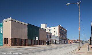
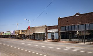
Wellington is a city and county seat of Collingsworth County, Texas, United States. The population was 2,189 at the 2010 census.

<span class="mw-page-title-main">Cuero, Texas</span> City in Texas, United States

Cuero is a city in and the county seat of DeWitt County, Texas, United States. Its population was 8,128 at the 2020 census.

<span class="mw-page-title-main">Ranger, Texas</span> City in Texas, United States

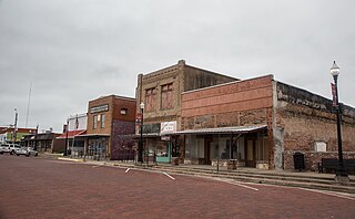
Ranger is a city in Eastland County, Texas, United States. Its population was 2,300 at the 2020 census. Ranger College, a community college, is the second-largest employer in the community.

<span class="mw-page-title-main">Fairfield, Texas</span> City in Texas, United States

Fairfield is a city and county seat of Freestone County, Texas, United States. The population was 2,850 at the 2020 census, down from 3,094 at the 2000 census. It was founded in 1851.

<span class="mw-page-title-main">Pearsall, Texas</span> City in Texas, United States

Pearsall is a city in and the county seat of Frio County, Texas, United States. The population was 7,325 at the 2020 census, down from 9,146 at the 2010 census.

<span class="mw-page-title-main">Athens, Texas</span> City in Texas, United States

Athens is a city and the county seat of Henderson County, Texas, in the United States. As of the 2020 census, the city population was 12,857. The city has called itself the "Black-Eyed Pea Capital of the World." Athens was selected as one of the first "Certified Retirement Communities" in Texas. Athens was incorporated in 1856 and was named after Athens, the capital of Greece.

<span class="mw-page-title-main">Groesbeck, Texas</span> Town in Texas, United States

Groesbeck is a city in and the county seat of Limestone County, Texas, United States. Its population was 3,631 at the 2020 census. The community is named after a railroad employee.

<span class="mw-page-title-main">Bay City, Texas</span> City in Texas, United States

Bay City is a city and the county seat of Matagorda County, Texas, United States. The population was 17,614 at the 2010 census and 18,061 at the 2020 census.

<span class="mw-page-title-main">Robstown, Texas</span> City in Texas, United States

Robstown is a city in Nueces County, Texas, United States, and a western suburb of Corpus Christi. It was founded circa 1906, and was named for Robert Driscoll. The population was 10,143 as of the 2020 census.

<span class="mw-page-title-main">Gilmer, Texas</span> City in Texas, United States

Gilmer is a city in, and the county seat of, Upshur County, Texas, United States. It is best known for being the home of the East Texas Yamboree and the birthplace of popular music singers Don Henley of the Eagles band and Johnny Mathis, as well as blues musician Freddie King. Its population was 4,843 at the 2020 census.

<span class="mw-page-title-main">Burkburnett, Texas</span> City in Texas, United States

Burkburnett is a city in Wichita County, Texas, United States. It is part of the Wichita Falls, Texas metropolitan statistical area. Its population was 10,939 at the 2020 census.

<span class="mw-page-title-main">Vernon, Texas</span> City in Texas, United States

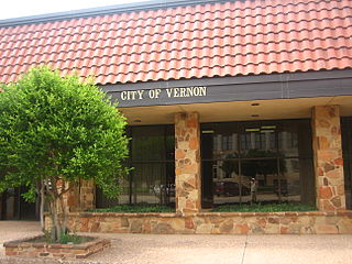
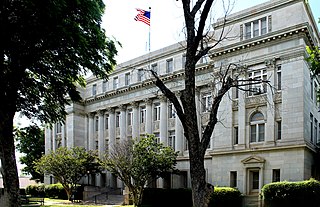
Vernon is a city and the county seat of Wilbarger County, Texas, United States. and as of the 2010 Census had a population of 11,002.

<span class="mw-page-title-main">Olney, Texas</span> City in Texas, United States

Olney is a city in Young County, Texas, United States. Its population was 3,007 as of the 2020 census.

References

  1. "2019 U.S. Gazetteer Files". United States Census Bureau. Retrieved August 7, 2020.
  2. 1 2 U.S. Geological Survey Geographic Names Information System: Breckenridge, Texas
  3. 1 2 "U.S. Census website". United States Census Bureau . Retrieved January 31, 2008.
  4. "Breckenridge, Texas Population 2021 (Demographics, Maps, Graphs)".
  5. "Find a County". National Association of Counties. Archived from the original on June 15, 2011. Retrieved June 7, 2011.
  6. "H. Allen Anderson, "Wichita Falls and Southern Railroad"". tshaonline.org. Retrieved April 19, 2013.
  7. "BRECKENRIDGE, TX". Texas State Historical Association. Retrieved June 21, 2017.
  8. "US Gazetteer files: 2010, 2000, and 1990". United States Census Bureau. February 12, 2011. Retrieved April 23, 2011.
  9. "Census of Population and Housing". Census.gov. Retrieved June 4, 2015.
  10. "Explore Census Data". data.census.gov. Retrieved May 21, 2022.
  11. "About the Hispanic Population and its Origin". www.census.gov. Retrieved May 18, 2022.
  12. Climate Summary for Breckenridge, Texas
  13. "Cbs11tv.com - Apparent Tornado Strikes Breckenridge, Injures 15". Archived from the original on November 22, 2008. Retrieved April 9, 2008.
  14. "U.S. Climate Normals Quick Access – Station: Breckenridge, TX". National Oceanic and Atmospheric Administration. Retrieved April 30, 2023.
  15. "NOAA Online Weather Data – NWS Dallas". National Weather Service. Retrieved April 30, 2023.
  1. Note: the US Census treats Hispanic/Latino as an ethnic category. This table excludes Latinos from the racial categories and assigns them to a separate category. Hispanics/Latinos can be of any race. [11]