 | |
|---|---|
| Highway system | |
Several special routes of U.S. Route 421 exist. In order from south to north they are as follows.
| | |
|---|---|
| Highway system | |
Several special routes of U.S. Route 421 exist. In order from south to north they are as follows.
U.S. Highway 421 Truck | |
|---|---|
| Location | Wilmington, North Carolina |
| Length | 1.0 mi [1] (1.6 km) |
| Existed | 2009–present |

U.S. Route 421 Truck (US 421 Truck), established on March 2009, is a truck route along Front Street from US 421 (Burnett Boulevard) to the Cape Fear Memorial Bridge. [2]
The entire route is in Wilmington, New Hanover County.
| mi [1] | km | Destinations | Notes | ||
|---|---|---|---|---|---|
| 0.0 | 0.0 | US 421 Truck begins | |||
| 1.0 | 1.6 | US 421 Truck ends | |||
| 1.000 mi = 1.609 km; 1.000 km = 0.621 mi | |||||
U.S. Highway 421 Business | |
|---|---|
| Location | Sanford, North Carolina |
| Length | 9.9 mi [3] (15.9 km) |
| Existed | 2015–present |
U.S. Route 421 Business (US 421 Bus) is a 9.9-mile (15.9 km) multi-lane business loop along Horner Boulevard, through downtown Sanford. Approved by AASHTO on May 3, 2013, its official establishment is dependent on the completion of the Sanford bypass, which mainline US 421 will be rerouted along, sharing with already established NC 87 Bypass. [4] [5]
The entire route is in Lee County.
| Location | mi [3] | km | Destinations | Notes | |
|---|---|---|---|---|---|
| Sanford | 0.0 | 0.0 | |||
| 0.7 | 1.1 | South end of NC 87 overlap | |||
| 1.8 | 2.9 | East end of NC 42 overlap | |||
| 4.4 | 7.1 | West end of NC 42 overlap | |||
| 5.8 | 9.3 | North end of NC 87 overlap | |||
| | 9.9 | 15.9 | |||
1.000 mi = 1.609 km; 1.000 km = 0.621 mi
| |||||
U.S. Highway 421 Business | |
|---|---|
| Location | North Wilkesboro, North Carolina |
| Length | 6.2 mi [6] (10.0 km) |
| Existed | 1969–present |
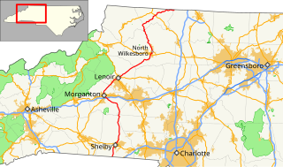
U.S. Route 421 Business (US 421 Bus) was established on November, 1969 as a renumbering of all US 421A and part of mainline US 421. The 6.2 miles (10.0 km) route begins along Statesville Avenue heading into downtown North Wilkesboro, where it follows along Main Street, 6th Street, and D Street. It reconnects with mainline US 421 in Wilkesboro. [7]
The entire route is in Wilkes County.
| Location | mi [6] | km | Destinations | Notes | |
|---|---|---|---|---|---|
| | 0.0 | 0.0 | South end of NC 115 overlap | ||
| North Wilkesboro | 3.0 | 4.8 | North end of NC 18/NC 115 and east end of NC 268 overlap | ||
| 3.5 | 5.6 | South end of NC 18 and west end of NC 268 overlap | |||
| Wilkesboro | 6.2 | 10.0 | |||
1.000 mi = 1.609 km; 1.000 km = 0.621 mi
| |||||
U.S. Highway 421 Truck | |
|---|---|
| Location | Boone, North Carolina |
| Length | 4.8 mi [8] (7.7 km) |
U.S. Route 421 Truck (US 421 Truck), is an alternate route for trucks in Boone, which are not allowed to go through the downtown area. The route starts south on NC 105 from US 421 King Street to NC Highway 105 Bypass, then back to US 421 west of Boone. US 221 Truck and US 321 Truck also overlap along the route.
The entire route is in Boone, Watauga County.
| mi [8] | km | Destinations | Notes | ||
|---|---|---|---|---|---|
| 0.0 | 0.0 | North end of US 221 and NC 105 overlap | |||
| 0.8 | 1.3 | South end of US 221 overlap | |||
| 3.0 | 4.8 | South end of NC 105 overlap | |||
| 4.8 | 7.7 | ||||
1.000 mi = 1.609 km; 1.000 km = 0.621 mi
| |||||
U.S. Route 421 Business | |
|---|---|
| Location | Gate City, Virginia |
| Length | 2.65 mi [9] [10] (4.26 km) |

U.S. Route 421 Business (US 421 Bus) is a business route of US 421 in Scott County. The business route is co-existent with US 23 Business and US 58 Business through Gate City. US 421 Business begins at the east end of the town at an intersection with US 421, US 23 and US 58. The business route heads west along Kane Street, which crosses Norfolk Southern Railway's Appalachia Division rail line on its way to the downtown area, where the route meets the southern end of SR 71 (Jackson Street). US 421 Business turns west onto Jackson Street and parallels the rail line to the business route's western end at an interchange with US 421, US 23, and US 58 just west of the western town limit of Gate City. [9] [10]
U.S. Highway 421 Business | |
|---|---|
| Location | Wilmington, North Carolina |
| Length | 2.4 mi [11] (3.9 km) |
| Existed | 1970–1979 |
U.S. Route 421 Business (US 421 Bus) was established by 1970 as a renumbering of mainline US 421 along Third Street to the Isabel Holmes Bridge. The business loop was decommissioned by 1979. [12] [ unreliable source ]
U.S. Highway 421A | |
|---|---|
| Location | Clinton, North Carolina |
| Existed | 1952–1960 |
U.S. Route 421 Alternate (US 421A), was established by 1952 when mainline US 421 was bypassed west. It followed Lisbon Street and McKay Streets, with a partial overlap with US 701A. In 1960, the route was renumbered as US 421 Business. [13] [ unreliable source ]
U.S. Highway 421 Business | |
|---|---|
| Location | Clinton, North Carolina |
| Existed | 1960–1963 |
U.S. Route 421 Business (US 421 Bus) was established in 1960 as a renumbering of US 421A through downtown Clinton, via Lisbon Street and McKoy Streets. By 1963 it was decommissioned. [12]
U.S. Highway 421A | |
|---|---|
| Location | North Wilkesboro, North Carolina |
| Length | 4.3 mi [14] (6.9 km) |
| Existed | 1957–1969 |
U.S. Route 421 Alternate (US 421A), was established in 1957 when mainline US 421 was bypassed south through Wilkesboro; the old alignment continued to go through downtown North Wilkesboro via D Street. On November, 1969, it was renumbered as part of US 421 Business. [13] [7]
U.S. Route 321 (US 321) is a spur of U.S. Route 21. It runs for 516.9 miles (831.9 km) from Hardeeville, South Carolina to Lenoir City, Tennessee; with both serving as southern termini. It reaches its northernmost point at Elizabethton, Tennessee. Because of its unusual "north–south–north" routing, U.S. Route 321 intersects both Interstate 40 and U.S. Route 70 three separate times. The highway serves different roles in each state: An alternate route to interstates in South Carolina, a major highway in North Carolina, and a scenic route in Tennessee.
U.S. Route 158 (US 158) is an east–west United States highway that runs for 350 miles (560 km) from Mocksville to Whalebone Junction in Nags Head, entirely in the state of North Carolina. It is also a critical route that connects the cities of Winston-Salem, Summerfield, and Reidsville with one another.
U.S. Route 264 (US 264) is an east–west United States highway that runs for 215.7 miles (347.1 km) from Raleigh to Manns Harbor, completely in the state of North Carolina. From its western terminus to Greenville it is a freeway, bypassing Wilson to the south and passing through or near several small towns such as Knightdale, Wendell, Zebulon, Middlesex, Bailey, Saratoga, and Farmville. It continues as a divided highway with at-grade intersections from Greenville east to Washington, where it passes through town along 5th Street. East of Washington it is an undivided road passing through the marshes along the Pamlico River and Pamlico Sound, going along the south shore of Lake Mattamuskeet and meeting its eastern terminus with US 64 near Manns Harbor. The route has significant concurrencies with US 64, I-87 and I-795. The route from Zebulon to Greenville has been designated as Future Interstate 587, pending upgrades to the freeway to Interstate Highway standards. The freeway section is paralleled by Alternate 264, and a business loop is designated in Belhaven.

North Carolina Highway 16 (NC 16) is a primary state highway in the U.S. state of North Carolina. Traveling north–south, it connects the cities of Charlotte, Conover, Taylorsville, Wilkesboro and Jefferson; linking the Charlotte metropolitan area with the High Country. NC 16 is part of a three-state route 16 that connects the Charlotte region with northwestern West Virginia.

North Carolina Highway 211 (NC 211) is a 162.5-mile-long (261.5 km) primary state highway in the U.S. state of North Carolina. It traverses mostly through the Sandhills and Coastal Plain regions of the state; connecting the cities of Candor, Aberdeen, Raeford, Lumberton, Bladenboro, and Southport.
North Carolina Highway 18 (NC 18) is a primary state highway in the U.S. state of North Carolina. Traveling north–south through the Foothills region, it connects the cities of Shelby, Morganton, Lenoir, Wilkesboro and North Wilkesboro.

North Carolina Highway 87 (NC 87) is a primary state highway in the U.S. state of North Carolina. NC 87 begins in the Atlantic coastal town of Southport and crosses into Virginia at the Virginia state line five miles (8 km) north of Eden in Rockingham County. At 240 miles (390 km) in length, NC 87 is the second longest state highway in the U.S. state of North Carolina. Labeled as a north–south route, NC 87 travels along a relatively straight southeast–northwest path, connecting Cape Fear region with the Piedmont. It is also the main north-south route connecting the cities of Fayetteville, Sanford, Burlington and Reidsville.

North Carolina Highway 268 (NC 268) is a primary state highway in the U.S. state of North Carolina. It connects many communities as it traverses through the northwestern North Carolina mountains and foothills.
Several special routes of U.S. Route 1 exist, from Florida to Maine. In order from south to north, separated by type, these special routes are as follows.
A total of at least twenty-three special routes of U.S. Route 17 have existed.
U.S. Route 421 (US 421) is part of the United States Numbered Highway System that runs from Fort Fisher, North Carolina to Michigan City, Indiana. In the U.S. state of North Carolina, US 421 travels 328 miles (528 km) from its southern terminus at Fort Fisher to the Tennessee state line near the community of Zionville, North Carolina. US 421 traverses the state from east to west travelling from the coastal plains to Appalachian Mountains. It provides an important connection between the cities of Wilmington, Sanford, Greensboro, Winston-Salem, and Boone. Despite being signed as north-south, much of the routing of US 421 in North Carolina runs in an east-west direction, particularly between Greensboro and the Tennessee state line. Portions of US 421 have been upgraded to freeway standards including the majority of its routing between Sanford and North Wilkesboro.
A total of at least seven special routes of U.S. Route 301 exist and at least eleven have been deleted.
Several special routes of U.S. Route 70 exist. In order from west to east, these special routes are as follows.
Several special routes of U.S. Route 74 exist. In order from west to east they are as follows.
Several special routes of U.S. Route 64 exist. In order from west to east they are as follows.
Several special routes of U.S. Route 221 exist. In order from south to north they are as follows.
Several special routes of U.S. Route 29 exist. In order from south to north they are as follows.
A total of at least eight special routes of U.S. Route 501 exist and at least four have been deleted.
Several special routes of U.S. Route 25 exist. In order from south to north they are as follows.
Several special routes of U.S. Route 401 exist, from South Carolina to North Carolina. In order from south to north, separated by type, they are as follows.