Special routes of U.S. Route 52

Last updated

US 52.svg


Special routes of U.S. Route 52
Highway system

Several special routes of U.S. Route 52 exist, from North Dakota to South Carolina. In order from northwest to southeast, they are as follows.

Contents

Minot business loop

Business plate.svg

US 52.svg

U.S. Highway 52 Business

Location Minot, North Dakota

Harvey business loop

Business plate.svg

US 52.svg

U.S. Highway 52 Business

Location Harvey, North Dakota
Length2 mi (3.2 km)

U.S. Route 52 Business is a 2-mile-long (3.2 km) business route of U.S. Route 52 in Harvey, North Dakota. It runs from U.S. Route 52 in Harvey to U.S. Route 52/North Dakota Highway 3.

Jamestown truck bypass route

Truck plate.svg
Bypass plate.svg
US 52.svg

U.S. Route 52 Truck Bypass

Location Jamestown, North Dakota
Major junctions

The entire route is in Stutsman County.

Locationmi [1] kmExitDestinationsNotes
0.000.00US 52.svgUS 281.svg US 52  / US 281  Carrington, Jamestown
Truck plate.svg
US 281.svg
US 281 Truck (By-pass) begins
Western terminus of US 52 Truck Byp.; northern terminus of US 281 Truck Byp.; west end of US 281 Truck Byp. concurrency
Jamestown 3.4–
3.8
5.5–
6.1
West plate blue.svg
I-94.svg
I-94 west Bismarck
West end of I-94 concurrency; I-94 exit 256
4.36.9257 Jamestown Exit numbers follow I-94; eastbound left exit and westbound entrance
5.3–
5.7
8.5–
9.2
258 US 281 Truck (By-pass) south
West plate.svg
US 52.svg
US 281.svg US 52 west / US 281  Jamestown
Eastern end of US 281 Truck Byp. concurrency
I-94.svgEast plate.svg
US 52.svg
I-94  / US 52 east
East end of I-94 concurrency; continuation beyond eastern terminus
1.000 mi = 1.609 km; 1.000 km = 0.621 mi

Iowa alternate route

Alternate plate 1961.svg

US 52 (1961).svg

U.S. Highway 52 Alternate

Location LuxemburgDubuque
Length26.82 mi [2]  (43.16 km)
Existed1964–1968

U.S. Highway 52 Alternate (US 52 Alt.) existed in northeastern Iowa in the 1960s. The original pavement on US 52 between Dubuque and Luxemburg was in such poor condition that in 1964, the Iowa State Highway Commission temporarily rerouted US 52. It was rerouted along US 20 and Iowa Highway 136. As a result of this, the alternate route was then established along the old route. [3] Once comprehensive repairs were made to the roadway by 1968, the mainline designation was restored to the routing. [4]

The entire route was in Dubuque County.

Locationmi [2] kmDestinationsNotes
Luxemburg 0.000.00West plate 1961.svg
US 52 (1961).svg
South plate 1961.svg
Circle sign 136 (small).svg
Circle sign 3.svg US 52 west / Iowa 136 south / Iowa 3  Dyersville, Colesburg, Guttenberg
Western end of Iowa 3 overlap
Sageville 21.1734.07East plate 1961.svg
Circle sign 386 (small).svg
Iowa 386 east
22.7536.61North plate 1961.svg
Circle sign 386 (small).svg
Iowa 386 north (John Deere Road)
Dubuque 25.2240.59North plate 1961.svg
US 61 (1961).svg
North plate 1961.svg
US 151 (1961).svg
US 61 north / US 151 north (20th Street) Wisconsin
Western end of US 61 / US 151 overlap
26.4542.57North plate 1961.svg
US 61 (1961).svg
North plate 1961.svg
US 151 (1961).svg
North plate 1961.svg
Alternate plate 1961.svg
US 52 (1961).svg
North plate 1961.svg
Circle sign 3.svg
US 61 north / US 151 north / US 52 Alt. north / Iowa 3 north (Locust Street)
Other half of one-way couplet
26.8243.16US 20 (1961).svgUS 52 (1961).svgSouth plate 1961.svg
US 61 (1961).svg
South plate 1961.svg
US 67 (1961).svg
South plate 1961.svg
US 151 (1961).svg
End plate 1961.svg
Circle sign 3.svg
US 20 (Dodge Street) / US 52  / US 61 south / US 67 south / US 151 south (Locust Street) / Iowa 3 ends
Eastern end of US 61 / US 151 and Iowa 3 overlaps
1.000 mi = 1.609 km; 1.000 km = 0.621 mi

Ironton business loop

Business plate.svg

US 52.svg

U.S. Route 52 Business

Location Ironton, Ohio

U.S. Route 52 Business is a special business route of U.S. Route 52 in Ironton, Ohio. U.S. Route 52 Business exits the mainline route at the village of Coal Grove, just south of Ironton then follows the original pre-1962 routing of U.S. 52 through the central business district of Ironton before rejoining the mainline near Hanging Rock. U.S. 52 mainline was moved to its current alignment in 1962, which is a controlled-access 4-lane highway which bypasses the city itself. The business route was established at that time but was poorly signed for many years until 1999 when an effort to improve signage was completed. Since then it has been sufficiently signed as U.S. Route 52 Business.

Williamson truck route

Truck plate.svg

US 52.svg

U.S. Route 52 Truck

Location Williamson, West Virginia
View north along US 52 Truck in Williamson 2017-07-22 09 14 36 View north along U.S. Route 52 Truck (Prichard Street) at 3rd Avenue in Williamson, Mingo County, West Virginia.jpg
View north along US 52 Truck in Williamson

Welch alternate route

Alt plate.svg

US 52.svg

U.S. Route 52 Alternate

Location Welch, West Virginia
Length2.3 mi [5]  (3.7 km)
Existedcirca 1950–present
View south along US 52 Alt. and north along WV 16 in Welch 2017-07-22 13 15 40 View south along U.S. Route 52 Alternate and north along West Virginia State Route 16 (Riverside Drive) at Lake Drive in Welch, McDowell County, West Virginia.jpg
View south along US 52 Alt. and north along WV 16 in Welch

US 52's Welch Alternate route follows the original path of US 52 through town prior to construction of the Welch bypass around 1950. The route follows West Virginia Route 16 along with portions of Virginia Avenue and other streets. [6]

Bluefield truck route

Truck plate.svg

US 52.svg

U.S. Route 52 Truck

Location Bluefield, West Virginia
View south along US 52 Truck and north along US 19 just northeast of Bluefield 2017-07-21 16 46 26 View north along U.S. Route 19 and south along U.S. Route 52 Truck (Princeton Avenue) at Grassy Branch Road just northeast of Bluefield in Mercer County, West Virginia.jpg
View south along US 52 Truck and north along US 19 just northeast of Bluefield

U.S. Route 52 Truck follows US 19 from the edge of downtown Bluefield to US 460, a 4-lane highway which it then follows back to regular US 52. The truck route bypasses several 90-degree turns and a residential neighborhood.

Mount Airy alternate route

US 52A North Carolina 1950.svg

U.S. Highway 52A

Location Mount Airy, North Carolina
Existed1953–1960

U.S. Route 52A was established in 1953, replacing the old mainline US 52 through downtown Mount Airy, via Main Street. It was renumbered in 1960 as US 52 Business. [7]

Mount Airy business loop

Business plate.svg

US 52.svg

U.S. Highway 52 Business

Location Mount Airy, North Carolina
Length5.4 mi [8]  (8.7 km)
Existed1960–present

U.S. Route 52 Business was established in 1960, a renumbering of US 52A through downtown Mount Airy, via Main Street, Renfro Street, and Lebanon Street. Between 1963 and 1967, US 52 Business was split on one-way streets: northbound via Cherry and Renfro Streets, southbound via Main Street. Sometime between 1969 and 1972, southbound US 52 Business was removed from Main and Cherry Streets, and moved onto an extended Renfro Street. [9]

Pilot Mountain alternate route

US 52A North Carolina 1950.svg

U.S. Highway 52A

Location Pilot Mountain, North Carolina
Existed1949–1960

U.S. Route 52A was established in 1949, replacing the old mainline US 52 through Pilot Mountain, via Main Street. It was renumbered in 1960 as US 52 Business. [7]

Pilot Mountain business loop

Business plate 1961.svg

US 52 (1961).svg

U.S. Highway 52 Business

Location Pilot Mountain, North Carolina
Existed1960–1964

U.S. Route 52 Business was established in 1960, a renumbering of US 52A through Pilot Mountain, via Main Street. It was decommissioned in 1964 when the Pilot Mountain Parkway was opened, taking US 52 onto a new alignment west of town. [9]

Albemarle business loop

Business plate.svg

US 52.svg

U.S. Highway 52 Business

Location Albemarle, North Carolina
Length2.1 mi [10]  (3.4 km)
Existedmid-1990s–present

U.S. Route 52 Business was established in the mid-1990s, it goes through downtown Albemarle, via First Street. [9]

Cheraw truck route

Truck plate.svg

US 52.svg

U.S. Highway 52 Truck

Location Cheraw, South Carolina
Length3.550 mi [11] [12]  (5.713 km)
Existed2002[ citation needed ]–present

U.S. Route 52 Truck (US 52 Truck) is a 3.550-mile (5.713 km) truck route of US 52 that has about half of its path within the city limits of Cheraw. All but the northernmost 0.320 miles (0.515 km) of its path is concurrent with US 1 Truck. [13]

Florence truck route

Truck plate.svg

US 52.svg

U.S. Highway 52 Truck

Location Florence, South Carolina
Length4.780 mi [14] [15]  (7.693 km)

U.S. Route 52 Truck (US 52 Truck) is a 4.780-mile (7.693 km) truck route of US 52 that is mostly within the city limits of Florence, South Carolina. It is mostly unsigned. It begins concurrent with US 301 (Freedom Boulevard, which is signed as a US 301 truck route), but branches off on its own. [16]

Florence connector route

Connector plate.svg

US 52.svg

U.S. Highway 52 Connector

Location Florence, South Carolina
Length1.070 mi [17]  (1.722 km)

U.S. Route 52 Connector (US 52 Conn.) is a 1.070-mile (1.722 km) connector route of US 52 that is entirely within the city limits of Florence, South Carolina. It has a one-block-long concurrency with US 76 (West Palmetto Street). The rest of the highway uses Coit Street. [18] It is unsigned. [19]

Darlington business loop

Business plate.svg

US 52.svg

U.S. Highway 52 Business

Location Darlington, South Carolina
Length4.508 mi [20]  (7.255 km)

U.S. Route 52 Business (US 52 Bus.) is a 4.508-mile (7.255 km) business route of US 52 that has most of its length within the city limits of Darlington. Except for its termini, the only other major intersection is that with SC 34/SC 151 at SC 151's southern terminus. [21]

North Charleston connector route

Connector plate.svg

US 52.svg

U.S. Highway 52 Connector

Location North Charleston, South Carolina
Length0.900 mi [22]  (1,448 m)

U.S. Route 52 Connector (US 52 Conn.) is a 0.900-mile (1.448 km) connector route of US 52 that has its entire length within the city limits of North Charleston. It is a short freeway that connects Interstate 26 (I-26) and US 52/US 78 (Rivers Avenue). Except for its termini, it has no other major interchanges. [23] It is an unsigned highway. [24]

Charleston spur route

Spur plate.svg

US 52.svg

U.S. Highway 52 Spur

Location Charleston, South Carolina
Length2.980 mi [25]  (4.796 km)
Existedearly 1950s[ citation needed ]–present
Columbus Street Terminal viewed from the southwest Charleston-ColumbusSt-port-terminal.jpg
Columbus Street Terminal viewed from the southwest

U.S. Route 52 Spur (US 52 Spur) is an unsigned 2.980-mile (4.796 km) long spur route of US 52 in Charleston, South Carolina. It extends from Broad Street to US 52 (where it is named Meeting Street) along the northeastern side of the peninsula of downtown Charleston. The highway provides access for trucks to shipping terminals of the Port of Charleston on the Charleston peninsula: Union Pier and Columbus Street.

The entire length of the highway is in the city of Charleston. 1.290 miles (2.076 km) of the route is named Morrison Drive and the remaining 1.690 miles (2.720 km) is named East Bay Street. [26]

One section of the route, Morrison Drive near Jackson Street, will flood regularly during a spring tide. The southern terminus is near the historic wharves of Charleston, including Adgers Wharf, which is now the site of a playground. It is also adjacent to the Old Exchange, or Customs House, of Charleston. The current Customs House that was built around the time of the Civil War is on this route.

The section named Morrison Drive was constructed in the early 1950s. [27] It was named for William McG. Morrison, mayor of Charleston from 1953 to 1954. [28]

When Morrison Drive was constructed, there was still one private terminal operating near the southern terminus, the Clydeline Steamship Company. The Clydeline terminal burned down in 1955. In the late 1980s, the land of the terminal was rebuilt as Waterfront Park. [29]

Related Research Articles

<span class="mw-page-title-main">U.S. Route 321</span> Highway in the United States

U.S. Route 321 (US 321) is a spur of U.S. Route 21. It runs for 516.9 miles (831.9 km) from Hardeeville, South Carolina to Lenoir City, Tennessee; with both serving as southern termini. It reaches its northernmost point at Elizabethton, Tennessee, just northeast of Johnson City. Because of its unusual "north–south–north" routing, U.S. Route 321 intersects both Interstate 40 and U.S. Route 70 three separate times. The highway serves different roles in each state: An alternate route to interstates in South Carolina, a major highway in North Carolina, and a scenic route in Tennessee.

<span class="mw-page-title-main">South Carolina Highway 5</span> Highway in South Carolina

South Carolina Highway 5 (SC 5) is a 51.719-mile (83.234 km) primary state highway in the U.S. state of South Carolina. The highway, signed as north–south, travels in a northwest–southeast direction connecting the cities of Rock Hill, York and Blacksburg.

<span class="mw-page-title-main">South Carolina Highway 9</span> Highway in South Carolina, USA

South Carolina Highway 9 (SC 9) is a 259.570-mile (418 km) major state highway in the U.S. state of South Carolina. The highway travels from Cherry Grove Beach to the North Carolina state line upstate. The highway is currently the longest state highway in South Carolina. It is signed as a north–south highway, even though it travels in an east–west direction.

<span class="mw-page-title-main">South Carolina Highway 6</span> State highway in South Carolina

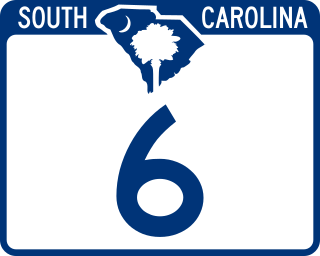
South Carolina Highway 6 (SC 6) is a 116.092-mile (186.832 km) primary state highway in the U.S. state of South Carolina. It extends from US 76 in Ballentine to US 52/SC 6 Truck in Moncks Corner. It uniquely links all three of the major hydropower projects in South Carolina: Lake Murray, Lake Marion, and Lake Moultrie.

<span class="mw-page-title-main">South Carolina Highway 34</span> Highway in South Carolina, US

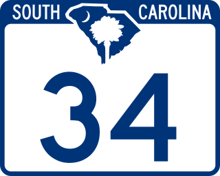
South Carolina Highway 34 (SC 34) is a 185.930-mile (299.225 km) primary state highway in the U.S. state of South Carolina. As one of the longer state highways, it traverses the state east-west from Greenwood to Dillon, connecting the cities of Newberry, Winnsboro, Camden, Bishopville and Darlington.

<span class="mw-page-title-main">U.S. Route 17 Alternate (South Carolina)</span> Alternate route in South Carolina

U.S. Highway 17 Alternate is a 123.900-mile (199.398 km) alternate route of US 17 in South Carolina that travels between Pocotaligo and Georgetown. It has been four-laned in various segments since 1970.

<span class="mw-page-title-main">Special routes of U.S. Route 1</span> American highway system

Several special routes of U.S. Route 1 (US 1) exist, from Florida to Maine. In order from south to north, separated by type, these special routes are as follows.

<span class="mw-page-title-main">Special routes of U.S. Route 17</span>

A total of at least 31 special routes of U.S. Route 17 (US 17) exist: 3 in Florida, 5 in South Carolina, 17 in North Carolina, and 6 in Virginia.

<span class="mw-page-title-main">U.S. Route 52 in South Carolina</span>

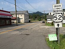
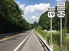
U.S. Route 52 (US 52) is a 159.960-mile (257.431 km) north–south U.S. Highway that travels from Charleston to the North Carolina state line near Cheraw. It serves as a strategic highway through the central part of the state. Though an even-numbered U.S. Highway, which are typically signed east–west, it is signed north–south in South Carolina. In some other states along its route, it is signed east–west. The South Carolina segment is signed such that US 52 north corresponds to the general westward direction of the highway, and vice versa.

<span class="mw-page-title-main">South Carolina Highway 28</span> State highway in South Carolina

South Carolina Highway 28 (SC 28) is a 131.220-mile (211.178 km) primary state highway in the U.S. state of South Carolina. It consists of two segments of highway signed as east–west but physically traveling north–south from the Georgia state line near Mountain Rest to Beech Island. It is part of a continuous highway separated by a 17.5-mile (28.2 km) stretch through Augusta, Georgia.

<span class="mw-page-title-main">Special routes of U.S. Route 221</span>

Several special routes of U.S. Route 221 exist. In order from south to north they are as follows.

<span class="mw-page-title-main">South Carolina Highway 72</span> State highway in South Carolina

South Carolina Highway 72 (SC 72) is a 124.860-mile (200.943 km) state highway, traversing interior portions of the South Carolina Piedmont region. This route is part of a multi two-state route 72 that begins at Athens, Georgia and ends at Rock Hill, South Carolina. The route connects many smaller communities outside major metropolitan areas and is roughly parallel with Interstate 85 (I-85) to the north and I-20 and I-77 to the south and east. The route shares the longest concurrency in the state with SC 121, from Whitmire to Rock Hill.

<span class="mw-page-title-main">Special routes of U.S. Route 29</span>

Several special routes of U.S. Route 29 exist. In order from south to north they are as follows.

<span class="mw-page-title-main">Special routes of U.S. Route 601</span>

A total of at least five special routes of U.S. Route 601 have existed, one of which has been deleted.

<span class="mw-page-title-main">Special routes of U.S. Route 25</span> Routes in Georgia

Several special routes of U.S. Route 25 exist. In order from south to north they are as follows.

<span class="mw-page-title-main">South Carolina Highway 64</span> State highway in South Carolina

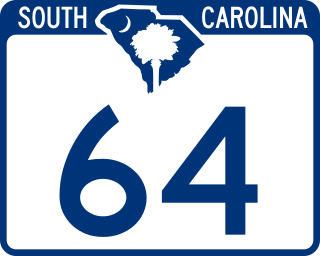
South Carolina Highway 64 (SC 64) is a 73.730-mile (118.657 km) primary state highway in the U.S. state of South Carolina. It serves the cities of Barnwell and Walterboro while also providing a direct route to Charleston, via U.S. Route 17 (US 17).

<span class="mw-page-title-main">Special routes of U.S. Route 21</span> Special routes or bypasses in the US

Several special routes of U.S. Route 21 exist. In order from south to north they are as follows.

<span class="mw-page-title-main">South Carolina Highway 20</span> State highway in South Carolina

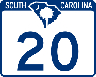
South Carolina Highway 20 (SC 20) is a primary state highway in the U.S. state of South Carolina. The highway connects the cities of Abbeville, Belton, Williamston and Greenville. The 53-mile-long (85 km) highway is signed as a west-east highway though it physically runs south-to-north.

<span class="mw-page-title-main">South Carolina Highway 18</span>

South Carolina Highway 18 (SC 18) is a 39.040-mile (62.829 km) primary state highway in the U.S. state of South Carolina. It serves to connect the cities of Union, Gaffney and Shelby, North Carolina.

<span class="mw-page-title-main">Special routes of U.S. Route 521</span>

Four special routes of U.S. Route 521 exist, and two others have existed in the past. In order from south to north they are as follows.

References

  1. "Overview of US 52 Truck Byp". Google Maps . Google, Inc. Retrieved January 18, 2022.
  2. 1 2 1965 Volume of Traffic on the Primary Road System of Iowa (PDF) (Report). Iowa State Highway Commission. June 1966. Retrieved December 8, 2020.
  3. Iowa State Highway Commission (1964). State of Iowa Transportation Map (PDF) (Map). Ames: Iowa State Highway Commission. Retrieved August 7, 2020.
  4. Iowa State Highway Commission (1968). State of Iowa Transportation Map (PDF) (Map). Ames: Iowa State Highway Commission. Retrieved August 7, 2020.
  5. "Riverside Dr to 750 Virginia Ave".
  6. West Virginia Department of Transportation (2003). Welch (PDF) (Map).
  7. 1 2 "NCRoads.com: U.S. 52-A". Archived from the original on 2010-11-25. Retrieved 2011-03-05.
  8. Google (2011-03-05). "US 52 Bus – Mount Airy" (Map). Google Maps . Google. Retrieved 2011-03-05.
  9. 1 2 3 "NCRoads.com: U.S. 52 Business". Archived from the original on 2010-11-25. Retrieved 2011-03-05.
  10. Google (2011-03-05). "US 52 Bus – Albemarle" (Map). Google Maps . Google. Retrieved 2011-03-05.
  11. "Highway Logmile Report". South Carolina Department of Transportation. Retrieved December 8, 2020.
  12. "Highway Logmile Report". South Carolina Department of Transportation. Retrieved December 8, 2020.
  13. Google (December 8, 2020). "Overview map of US 52 Truck (Cheraw)" (Map). Google Maps . Google. Retrieved December 8, 2020.
  14. "Highway Logmile Report". South Carolina Department of Transportation. Retrieved December 8, 2020.
  15. "Highway Logmile Report". South Carolina Department of Transportation. Retrieved December 8, 2020.
  16. Google (December 8, 2020). "Overview map of US 52 Truck (Florence)" (Map). Google Maps. Google. Retrieved December 8, 2020.
  17. "Highway Logmile Report". South Carolina Department of Transportation. Retrieved December 8, 2020.
  18. Google (December 8, 2020). "Overview map of US 52 Conn. (Florence)" (Map). Google Maps. Google. Retrieved December 8, 2020.
  19. Florence Urban Area (PDF) (Map). July 2020. p. Sheet 4. § D7. Retrieved December 8, 2020.
  20. "Highway Logmile Report". South Carolina Department of Transportation. Retrieved December 8, 2020.
  21. Google (December 8, 2020). "Overview map of US 52 Bus. (Darlington)" (Map). Google Maps. Google. Retrieved December 8, 2020.
  22. "Highway Logmile Report". South Carolina Department of Transportation. Retrieved December 8, 2020.
  23. Google (December 8, 2020). "Overview map of US 52 Conn. (North Charleston)" (Map). Google Maps. Google. Retrieved December 8, 2020.
  24. Charleston Urban Area (PDF) (Map). South Carolina Department of Transportation. August 2020. p. Sheet 12. § J12. Retrieved December 8, 2020.
  25. "Highway Logmile Report". South Carolina Department of Transportation. Retrieved December 8, 2020.
  26. South Carolina Department of Transportation Highway Logmile Listing for Charleston County dated November 1, 2006
  27. South Carolina State Highway Department Docket No. 10.348 dated July 17, 1950
  28. Political Graveyard List of Charleston mayors, accessed April 12, 2007
  29. Charleston Waterfront Park: A Success Story Archived October 29, 2007, at the Wayback Machine , Accessed April 17, 2007