Stratford, Iowa

Last updated
Stratford, Iowa
Stratford Iowa 20090419 Sign.JPG
City sign
Motto: 
The place to be
Hamilton County Iowa Incorporated and Unincorporated areas Stratford Highlighted.svg
Location of Stratford, Iowa
Coordinates: 42°16′15″N93°55′37″W / 42.27083°N 93.92694°W / 42.27083; -93.92694 Coordinates: 42°16′15″N93°55′37″W / 42.27083°N 93.92694°W / 42.27083; -93.92694
Country Flag of the United States.svg  United States
State Flag of Iowa.svg  Iowa
Counties Hamilton, Webster
Area
[1]
  Total1.81 sq mi (4.70 km2)
  Land1.81 sq mi (4.70 km2)
  Water0.00 sq mi (0.00 km2)
Elevation
1,109 ft (338 m)
Population
 (2020)
  Total707
  Density389.53/sq mi (150.39/km2)
Time zone UTC-6 (Central (CST))
  Summer (DST) UTC-5 (CDT)
ZIP code
50249
Area code 515
FIPS code 19-75810
GNIS feature ID0462029
Website www.stratfordiowa.com

Stratford is a city in Hamilton and Webster counties in the U.S. state of Iowa. The population was 707 at the time of the 2020 census. [2]

Contents

History

Stratford was platted in 1880. [3] It was named after Stratford-upon-Avon, in England. [3] A post office has been in operation in Stratford since 1881. [4] Stratford was actually first founded at Hook's Point, Hamilton County, Iowa. Stratford had a train coming through from 1880 until World War II. Stratford has an independent school system with an elementary school located on the corner of Shakespeare Avenue and Dryden Street.

An F3 tornado struck Stratford on November 12, 2005, with one person killed.

A church in Stratford seen in 1912 M.E. Church in Stratford, Iowa.jpg
A church in Stratford seen in 1912

Geography

Stratford's longitude and latitude coordinates
in decimal form are 42.270919, -93.926862. [5]

According to the United States Census Bureau, the city has a total area of 1.91 square miles (4.95 km2), all land. [6]

Demographics

Historical populations
YearPop.±%
1900 458    
1910 554+21.0%
1920 694+25.3%
1930 699+0.7%
1940 712+1.9%
1950 673−5.5%
1960 703+4.5%
1970 710+1.0%
1980 806+13.5%
1990 715−11.3%
2000 746+4.3%
2010 743−0.4%
2020 707−4.8%
Source: "U.S. Census website". United States Census Bureau . Retrieved 2020-03-29. and Iowa Data Center
Source:
U.S. Decennial Census [7] [2]
Stratford Public Library Stratford Iowa 20090419 Library.JPG
Stratford Public Library
Downtown Stratford Stratford Iowa 20090419 Downtown.JPG
Downtown Stratford

2010 census

As of the census [8] of 2010, there were 743 people, 307 households, and 183 families living in the city. The population density was 389.0 inhabitants per square mile (150.2/km2). There were 334 housing units at an average density of 174.9 per square mile (67.5/km2). The racial makeup of the city was 99.2% White and 0.8% from two or more races. Hispanic or Latino of any race were 1.3% of the population.

There were 307 households, of which 26.1% had children under the age of 18 living with them, 49.2% were married couples living together, 7.8% had a female householder with no husband present, 2.6% had a male householder with no wife present, and 40.4% were non-families. 36.2% of all households were made up of individuals, and 21.2% had someone living alone who was 65 years of age or older. The average household size was 2.25 and the average family size was 2.96.

The median age in the city was 46.3 years. 22.2% of residents were under the age of 18; 6.3% were between the ages of 18 and 24; 19.1% were from 25 to 44; 25.5% were from 45 to 64; and 26.9% were 65 years of age or older. The gender makeup of the city was 49.3% male and 50.7% female.

2000 census

As of the census [9] of 2000, there were 746 people, 307 households, and 186 families living in the city. The population density was 387.7 inhabitants per square mile (149.7/km2). There were 324 housing units at an average density of 168.4 per square mile (65.0/km2). The racial makeup of the city was 99.06% White, and 0.94% from two or more races. Hispanic or Latino of any race were 0.27% of the population.

There were 307 households, out of which 24.1% had children under the age of 18 living with them, 52.4% were married couples living together, 5.5% had a female householder with no husband present, and 39.1% were non-families. 35.5% of all households were made up of individuals, and 22.5% had someone living alone who was 65 years of age or older. The average household size was 2.21 and the average family size was 2.90.

In the city, the population was spread out, with 20.2% under the age of 18, 6.6% from 18 to 24, 22.8% from 25 to 44, 20.9% from 45 to 64, and 29.5% who were 65 years of age or older. The median age was 45 years. For every 100 females, there were 91.8 males. For every 100 females age 18 and over, there were 80.9 males.

The median income for a household in the city was $29,375, and the median income for a family was $41,042. Males had a median income of $28,571 versus $22,344 for females. The per capita income for the city was $15,553. About 2.3% of families and 5.7% of the population were below the poverty line, including 5.9% of those under age 18 and 3.2% of those age 65 or over.

Related Research Articles

<span class="mw-page-title-main">Moulton, Iowa</span> City in Iowa, United States

Moulton is a city in Appanoose County, Iowa, United States. The population was 607 at the time of the 2020 census.

<span class="mw-page-title-main">Raymond, Iowa</span> City in Iowa, United States

Raymond is a city in Black Hawk County, Iowa, United States. The population was 759 at the time of the 2020 census. It is part of the Waterloo–Cedar Falls Metropolitan Statistical Area.

<span class="mw-page-title-main">Fairbank, Iowa</span> City in Iowa, United States

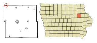
Fairbank is a city in Buchanan and Fayette counties in the U.S. state of Iowa. The population was 1,111 at the time of the 2020 census.

<span class="mw-page-title-main">Orleans, Iowa</span> City in Iowa, United States

Orleans is a city in Dickinson County, Iowa, United States. The population was 521 at the time of the 2020 census. Orleans is part of the Iowa Great Lakes region, located along Spirit Lake. Numerous state parks are located within a few miles of the town, including Marble Beach and Mini-Wakan.

<span class="mw-page-title-main">Gruver, Iowa</span> City in Iowa, United States

Gruver is a city in Emmet County, Iowa, United States. The population was 63 at the time of the 2020 census.

<span class="mw-page-title-main">St. Lucas, Iowa</span> City in Iowa, United States

St. Lucas is a city in Fayette County, Iowa, United States. The population was 167 at the time of the 2020 census.

<span class="mw-page-title-main">Marble Rock, Iowa</span> City in Iowa, United States

Marble Rock is a city in Floyd County, Iowa, United States, along the Shell Rock River. The population was 271 at the time of the 2020 census. Marble Rock has a city park, historical museums, a powerhouse on the river, and a veterans' memorial. The Marble Rock Historical Society has a website with information about the museums.

<span class="mw-page-title-main">Williams, Iowa</span> City in Iowa, United States

Williams is a city in Hamilton County, Iowa, United States. The population was 307 at the time of the 2020 census. Williams is a regional center of wind power generation.

<span class="mw-page-title-main">Little Sioux, Iowa</span> City in Iowa, United States

Little Sioux is a city in Harrison County, Iowa, United States. The population was 166 at the time of the 2020 census. The city is most known for Little Sioux Scout Ranch of the Boy Scouts of America.

<span class="mw-page-title-main">Liscomb, Iowa</span> City in Iowa, United States

Liscomb is a city in Marshall County, Iowa, United States. The population was 291 at the time of the 2020 census.

<span class="mw-page-title-main">Emerson, Iowa</span> City in Iowa, United States

Emerson is a city in Mills County, Iowa, United States. The population was 403 at the time of the 2020 census.

<span class="mw-page-title-main">Braddyville, Iowa</span> City in Iowa, United States

Braddyville is a city in Page County, Iowa, United States. The population was 147 at the 2020 census.

<span class="mw-page-title-main">Runnells, Iowa</span> City in Iowa, United States

Runnells is a city in the southeastern corner of Polk County, Iowa, United States. The population was 457 at the time of the 2020 census. It is part of the Des Moines–West Des Moines Metropolitan Statistical Area.

<span class="mw-page-title-main">Carson, Iowa</span> City in Iowa, United States

Carson is a city in Pottawattamie County, Iowa, United States. The population was 766 at the 2020 census. Carson has a number of interesting and historic places.

<span class="mw-page-title-main">Hancock, Iowa</span> City in Iowa, United States

Hancock is a city in Pottawattamie County, Iowa, United States, along the West Nishnabotna River. The population was 200 at the time of the 2020 census.

<span class="mw-page-title-main">Hartwick, Iowa</span> City in Iowa, United States

Hartwick is a city in Poweshiek County, Iowa, United States. The population was 92 at the time of the 2020 census.

<span class="mw-page-title-main">Diagonal, Iowa</span> City in Iowa, United States

Diagonal is a city in northwest Ringgold County, Iowa, United States. The population was 344 at the time of the 2020 census.

<span class="mw-page-title-main">Dixon, Iowa</span> City in Iowa, USA

Dixon is a city in Scott County, Iowa, United States. The population was 202 at the time of the 2020 census.

<span class="mw-page-title-main">Maysville, Iowa</span> City in Iowa, USA

Maysville is a city in Scott County, Iowa, United States. The population was 156 at the time of the 2020 census.

<span class="mw-page-title-main">Clearfield, Iowa</span> City in Iowa, United States

Clearfield is a city in Taylor and Ringgold counties in the U.S. state of Iowa. The population was 278 at the time of the 2020 census.

References

  1. "2020 U.S. Gazetteer Files". United States Census Bureau. Retrieved March 16, 2022.
  2. 1 2 "2020 Census State Redistricting Data". census.gov. United states Census Bureau. Retrieved 12 August 2021.
  3. 1 2 Chicago and North Western Railway Company (1908). A History of the Origin of the Place Names Connected with the Chicago & North Western and Chicago, St. Paul, Minneapolis & Omaha Railways. p. 127.
  4. "Hamilton County". Jim Forte Postal History. Retrieved 29 March 2015.
  5. "US Gazetteer files: 2010, 2000, and 1990". United States Census Bureau. 2011-02-12. Retrieved 2011-04-23.
  6. "US Gazetteer files 2010". United States Census Bureau. Archived from the original on 2012-01-25. Retrieved 2012-05-11.
  7. "Census of Population and Housing". Census.gov. Retrieved June 4, 2015.
  8. "U.S. Census website". United States Census Bureau . Retrieved 2012-05-11.
  9. "U.S. Census website". United States Census Bureau . Retrieved 2008-01-31.