Summer Street Bridge disaster

Last updated
Summer Street Bridge disaster
BERy 393 being raised from Fort Point Channel, November 8, 1916.jpg
The streetcar being raised from the river the next day
Map of Boston and Cambridge.png
Red pog.svg
USA Massachusetts location map.svg
Red pog.svg
Usa edcp location map.svg
Red pog.svg
Details
DateNovember 7, 1916 (1916-11-07)
Around 5:25 p.m. EDT (UTC-4)
Location Boston, Massachusetts
Coordinates 42°21′3.7″N71°3′6.42″W / 42.351028°N 71.0517833°W / 42.351028; -71.0517833
CountryUnited States
Line City Point to Downtown
Operator Boston Elevated Railway
Statistics
Deaths46

The Summer Street Bridge disaster occurred on November 7, 1916, when a streetcar loaded with passengers ran off an open drawbridge into Fort Point Channel near downtown Boston, Massachusetts, United States. Forty-six passengers were killed, making it the deadliest disaster in Boston's history until surpassed by the Cocoanut Grove fire in 1942.

Contents

Background

Summer Street Bridge in 2016, showing the tracks that the retractable sections slid on Summer Street Bridge aerial view, May 2016.JPG
Summer Street Bridge in 2016, showing the tracks that the retractable sections slid on

By 1916, the Boston Elevated Railway (BERy) operated all streetcar and rapid transit lines in Boston. Original plans had called for an elevated rapid transit loop line through South Boston; however, that line was never constructed. [1] Instead, South Boston was served by a network of surface streetcar lines that connected to the rapid transit lines at South Station, Broadway, and Andrew Square.

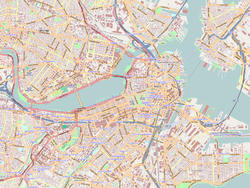
The line from City Point to Washington Street served many industrial workers who worked along East First Street and Summer Street in South Boston. [2] It ran along Summer Street for most of its length, crossing the 1899-built Summer Street Bridge over Fort Point Channel to cross into downtown Boston. The retractable bridge has two sliding sections of roadway – one for inbound lanes, one for outbound – that can move away from the bridge at a 45-degree angle to create a channel for ships to pass. [2]

Incident

At 5:13 pm on November 7, 1916, Car #393 began an inbound run from City Point with motorman Gerald Walsh at the controls. The car was an extra, operated to fill a gap between scheduled service. Walsh had not worked the City Point route before, nor had the conductor George McKeon, but both were familiar with the area. [2] Car #393 was a typical 1900-built 25-foot (7.6 m) streetcar, a workhorse of the BERy fleet of the day. As it approached the Summer Street Bridge, it was full with around sixty passengers on board. [3]

The bridge was in the midst of opening to allow a ship to pass; the inbound roadway was already slid to its furthest position. Walsh failed to obey a small stop sign located at Melcher Street, though he slowed for a boarding passenger. Walsh noticed the open bridge too late to stop; the wheels locked and the streetcar crashed through a set of metal gates and into the channel. Heavy with passengers, it sank quickly into the cold waters of the channel, some 30 feet (9.1 m) deep. [2]

Walsh, McKeon, and around fifteen passengers managed to escape the car and were rescued by tugboats and passing pedestrians. Forty-six passengers drowned, many still inside the crowded streetcar. [2]

Aftermath

An MBTA route 7 bus - the descendant of the streetcar route run in 1916 - on the bridge in 2017 MBTA route 7 bus on Summer Street bridge, June 2017.JPG
An MBTA route 7 bus – the descendant of the streetcar route run in 1916 – on the bridge in 2017

Divers from the Hugh Nawn company began work at 9 pm; bodies were removed from the wreckage from 10 pm to 12:40 am. Forty-five bodies were discovered in the channel and the sunken streetcar; the forty-sixth victim did not wash ashore until May 1917. Boston newspapers, each vying for the best story, reported body counts as high as 60. The streetcar was removed from the channel at 3:30 am by a crane on the wrecking lighter Admiral. [2]

Boston's Public Service Commission ruled the accident to be the fault of Walsh for failing to stop at the posted sign, but noted that such signs were hard to notice and that many drawbridges lacked them entirely. Walsh went on trial for manslaughter in October 1917, with witnesses differing on many aspects of the accident. [2] The bridge tenders claimed the required red lantern had been hung on the gate to warn streetcars of the open bridge, but Walsh claimed he saw no such lantern. Some questioned how the glass lantern had survived the impact of the trolley with the gates, which broke a 4-inch (100 mm) iron post in two; they alleged that the bridge tenders may have actually hung it after the accident. [4] Walsh was declared not guilty, but he never ran a streetcar again and died around 1932 at age 41. McKeon died in combat in France in July 1918. [2]

The disaster was the first major accident involving the BERy. [3] It remained the worst in Boston for many years; the more famous Boston Molasses Disaster in 1919 had less than half the fatalities. It was only surpassed in 1942, when the Cocoanut Grove fire killed nearly 500 people. [2]

Car #393 was returned to service but most operators refused to run it; it was converted to a work car and later scrapped. The streetcar route was converted to bus on June 20, 1953. After several reroutings between 1968 and 2005, the modern MBTA route 7 bus follows largely the same route as the streetcar involved in the disaster. [5] [2]

See also

Related Research Articles

<span class="mw-page-title-main">Green Line (MBTA)</span> Light rail system

The Green Line is a light rail system run by the Massachusetts Bay Transportation Authority (MBTA) in the Boston, Massachusetts, metropolitan area. It is the oldest MBTA subway line, and with tunnel sections dating from 1897, the oldest subway in North America. It runs underground through downtown Boston, and on the surface into inner suburbs via six branches on radial boulevards and grade-separated alignments. With an average daily weekday ridership of 137,700 in 2019, it is the third most heavily used light rail system in the country. The line was assigned the green color in 1967 during a systemwide rebranding because several branches pass through sections of the Emerald Necklace of Boston.

<span class="mw-page-title-main">Ashmont–Mattapan High-Speed Line</span> Light rail line in Boston and Milton, Massachusetts

The Ashmont–Mattapan High-Speed Line, commonly referred to as the Mattapan Trolley, is a partially grade-separated light rail line which forms part of the MBTA's Red Line rapid transit line. The line, which runs through Boston and Milton, Massachusetts, opened on August 26, 1929, as a conversion of a former commuter rail line. It exclusively uses PCC streetcars built in the 1940s. Passengers must transfer at Ashmont to access the rest of the Red Line, which uses heavy rail metro rolling stock.

<span class="mw-page-title-main">Harvard station</span> Subway station in Cambridge, Massachusetts, US

Harvard station is a rapid transit and bus transfer station in Cambridge, Massachusetts. Located at Harvard Square, it serves the MBTA's Red Line subway system as well as MBTA buses. Harvard averaged 18,528 entries each weekday in FY2019, making it the third-busiest MBTA station after Downtown Crossing and South Station. Five of the fifteen key MBTA bus routes stop at the station.

<span class="mw-page-title-main">Government Center station (MBTA)</span> Subway station in Boston, Massachusetts, US

Government Center station is an MBTA subway station in Boston, Massachusetts. It is located at the intersection of Tremont, Court and Cambridge Streets in the Government Center area. It is a transfer point between the light rail Green Line and the rapid transit Blue Line. With the Green Line platform having opened in 1898, the station is the third-oldest operating subway station in the MBTA system; only Park Street and Boylston are older. The station previously served Scollay Square before its demolition for the creation of Boston City Hall Plaza.

<span class="mw-page-title-main">Boston, Revere Beach and Lynn Railroad</span>

The Boston, Revere Beach and Lynn Railroad was a 3 ft narrow-gauge passenger-carrying shortline railroad between East Boston and Lynn, Massachusetts, from 1875 to 1940. Part of the railroad's right of way now forms the outer section of the Massachusetts Bay Transportation Authority's Blue Line rapid transit service.

<span class="mw-page-title-main">MBTA bus</span> Greater Boston bus network

The Massachusetts Bay Transportation Authority (MBTA) operates 152 bus routes in the Greater Boston area. The MBTA has a policy objective to provide transit service within walking distance for all residents living in areas with population densities greater than 5,000 inhabitants per square mile (1,900/km2) within the MBTA's service district. Much of this service is provided by bus. In 2022, the system had a ridership of 83,623,600, or about 319,400 per weekday as of the first quarter of 2023.

<span class="mw-page-title-main">Boston College station</span> Light rail station in Boston, Massachusetts, US

Boston College station is a light rail station on the MBTA Green Line B branch. It is located at St. Ignatius Square on the Boston College campus near the intersection of Commonwealth Avenue and Lake Street, on the border between the Brighton neighborhood of Boston and the Chestnut Hill neighborhood of Newton, Massachusetts. Originally opened in 1896, it has been the terminus of the Commonwealth Avenue line since 1900. The current station is planned to be replaced by a new station located in the median of Commonwealth Avenue just east of Lake Street.

<span class="mw-page-title-main">Lechmere station</span> Light rail station in Cambridge, Massachusetts, US

Lechmere station is a Massachusetts Bay Transportation Authority (MBTA) Green Line light rail station in Lechmere Square in East Cambridge, Massachusetts. It is located on the east side of Monsignor O'Brien Highway near First Street, adjacent to the NorthPoint development. The accessible elevated station has a single island platform, with headhouses at both ends. It opened on March 21, 2022, as part of the Green Line Extension (GLX). Lechmere station is served by Green Line D branch and E branch service.

<span class="mw-page-title-main">Hynes Convention Center station</span> Subway station in Boston, Massachusetts, US

Hynes Convention Center station is an underground light rail station on the Massachusetts Bay Transportation Authority (MBTA) Green Line. It is located at the intersection of Newbury Street and Massachusetts Avenue near the western end of the Back Bay neighborhood of Boston, Massachusetts. The station is named for the Hynes Convention Center, which is located about 700 feet (210 m) to the east along Boylston Street. It has two side platforms serving the two tracks of the Boylston Street subway, which are used by the Green Line B branch, C branch, and D branch. The main entrance to the station from Massachusetts Avenue leads to a fare lobby under the 360 Newbury Street building.

<span class="mw-page-title-main">Boston Elevated Railway</span> Defunct public transit company serving the Boston metro area, MA, USA (1894-1947)

The Boston Elevated Railway (BERy) was a streetcar and rapid transit railroad operated on, above, and below, the streets of Boston, Massachusetts and surrounding communities. Founded in 1894, it eventually acquired the West End Street Railway via lease and merger to become the city's primary mass transit provider. Its modern successor is the state-run Massachusetts Bay Transportation Authority (MBTA), which continues to operate in part on infrastructure developed by BERy and its predecessors.

<span class="mw-page-title-main">Atlantic Avenue Elevated</span> Former elevated railway in Boston, Massachusetts, US

The Atlantic Avenue Elevated was an elevated railway around the east side of Downtown Boston, Massachusetts, providing a second route for the Boston Elevated Railway's Main Line Elevated around the Washington Street tunnel. It was in use from 1901 to 1938, when it was closed due to low ridership, later being demolished.

<span class="mw-page-title-main">Green Line B branch</span> Light rail line in Boston, Massachusetts

The B branch, also called the Commonwealth Avenue branch or Boston College branch, is a branch of the MBTA Green Line light rail system which operates on Commonwealth Avenue west of downtown Boston, Massachusetts. One of four branches of the Green Line, the B branch runs from Boston College station down the median of Commonwealth Avenue to Blandford Street. There, it enters Blandford Street portal into Kenmore station, where it merges with the C and D branches. The combined services run into the Boylston Street subway and Tremont Street subway to downtown Boston. B branch service has terminated at Government Center since October 2021. Unlike the other branches, the B branch runs solely through the city limits of Boston. The Green Line Rivalry between Boston College and Boston University is named in reference to the B branch, which runs to both universities.

<span class="mw-page-title-main">Green Line A branch</span> Former streetcar line in Massachusetts, US

The A branch or Watertown Line was a streetcar line in the Boston, Massachusetts, area, operating as a branch of the Massachusetts Bay Transportation Authority Green Line. The line ran from Watertown through Newton Corner, Brighton, and Allston to Kenmore Square, then used the Boylston Street subway and Tremont Street subway to reach Park Street station.

<span class="mw-page-title-main">Trolleybuses in Greater Boston</span> Electric powered public transportation

The Boston-area trolleybussystem formed part of the public transportation network serving Greater Boston in the U.S. state of Massachusetts. It opened on April 11, 1936, with a large network operating for the next quarter-century. Measured by fleet size, the Boston-area system was the third-largest trolleybus system in the United States at its peak, with only the Chicago and Atlanta systems having more trolleybuses than Boston's 463. After 1963, the only remaining portion was a four-route cluster operating from the Harvard bus tunnel at Harvard station, running through Cambridge, Belmont, and Watertown. The Massachusetts Bay Transportation Authority took over the routes in 1964.

<span class="mw-page-title-main">Boston-area streetcar lines</span>

As with many large cities, a large number of Boston-area streetcar lines once existed, and many continued operating into the 1950s. However, only a few now remain, namely the four branches of the Green Line and the Ashmont–Mattapan High-Speed Line, with only one running regular service on an undivided street.

<span class="mw-page-title-main">Andrew station</span> Subway station in Boston, Massachusetts, US

Andrew station is a rapid transit station in Boston, Massachusetts. Located at Andrew Square in South Boston, it serves the MBTA Red Line and the MBTA bus system. Named for John Albion Andrew, the square is at the intersection of several major thoroughfares: Dorchester Avenue, Dorchester Street, Southampton Street, and Boston Street. Andrew is the primary transfer point between the Red Line subway and the MBTA surface bus routes into South Boston. Opened in 1918 and renovated in 1990–1994, it is fully accessible.

<span class="mw-page-title-main">Suffolk Downs station</span> Rapid transit station in East Boston, Massachusetts

Suffolk Downs station is a rapid transit station on the Massachusetts Bay Transportation Authority (MBTA) Blue Line, located on the east side of Orient Heights in East Boston, Massachusetts, United States. It is named for the now-defunct Suffolk Downs racetrack, located just to the north. Suffolk Downs station has two side platforms, with a footbridge structure of brick, concrete, and steel connecting them. The station is accessible. With just 521 daily boardings in FY 2019, Suffolk Downs is the least-used fare-controlled station on the MBTA subway system.

<span class="mw-page-title-main">Watertown Yard</span> Boston MBTA former subway station

Watertown Carhouse is a bus maintenance facility and former streetcar carhouse located in the southern section of Watertown, Massachusetts, across the Charles River from Watertown Square. As Watertown Yard, the site also serves as a bus depot serving local and express routes, with additional connections available at Watertown Square on the opposite end of the Watertown Bridge.

<span class="mw-page-title-main">Capen Street station</span> Light rail station in Milton, Massachusetts, US

Capen Street station is a light rail station in Milton, Massachusetts. It serves the MBTA Ashmont–Mattapan High Speed Line. It is located on Capen Street off Eliot Street; the westernmost of the four MBTA stations in Milton, it consists of two side platforms flanking the eponymous street's grade crossing. The platforms are staggered to allow trains to make the stop at Capen Street before crossing the street itself, as there is no signal at the grade crossing. Capen Street is accessible via wooden ramps on both platforms. Capen Street opened in September 1930 as an infill station on the line.

<span class="mw-page-title-main">Egleston station</span> Boston MBTA former subway station

Egleston was a rapid transit station in Boston, Massachusetts. It served the Washington Street Elevated, part of the MBTA's Orange Line. It was located over Egleston Square at the intersection of Washington Street and Columbus Avenue in the Roxbury neighborhood. The station opened in November 1909, and was closed in April 1987 when the Orange Line was rerouted to the west along the Southwest Corridor.

References

  1. Cheney, Frank; Sammarco, Anthony M. (2000). When Boston Rode The El. Arcadia Publishing. p. 13. ISBN   9780738504629.
  2. 1 2 3 4 5 6 7 8 9 10 Moskowitz, Eric (October 29, 1916). "STREET CAR PLUNGE 46 DROWNED: 'WORST TRAGEDY IN THE HISTORY OF THE CITY' (And the one Boston completely forgot)". Boston Globe . Retrieved November 7, 2016.
  3. 1 2 "Fatal Drawbridge Accident At Boston". Electric Railway Journal . 48 (20): 1034. November 11, 1916 via Internet Archive.
  4. "Trolley Car Victims Buried". The Telegraph. November 11, 1916. p. 7 via Google Newspapers.
  5. Belcher, Jonathan (September 30, 2016). "Changes to Transit Service in the MBTA district 1964–2016" (PDF). NETransit.