The National Register of Historic Places (NRHP) is the United States federal government's official list of districts, sites, buildings, structures and objects deemed worthy of preservation for their historical significance. A property listed in the National Register, or located within a National Register Historic District, may qualify for tax incentives derived from the total value of expenses incurred in preserving the property.

A National Historic Landmark (NHL) is a building, district, object, site, or structure that is officially recognized by the United States government for its outstanding historical significance. Only some 2,500 (~3%) of over 90,000 places listed on the country's National Register of Historic Places are recognized as National Historic Landmarks.

Fort Pillow State Historic Park is a state park in western Tennessee that preserves the American Civil War site of the Battle of Fort Pillow. The 1,642 acre (6.6 km²) Fort Pillow, located in Lauderdale County on the Chickasaw Bluffs overlooking the Mississippi River, is rich in both historic and archaeological significance. In 1861, the Confederate army built extensive fortifications and named the site for General Gideon Johnson Pillow of Maury County. It was attacked and held by the Union Army for most of the American Civil War period except immediately after the Battle of Fort Pillow, when it was retaken by the Confederate Army. The battle ended with a massacre of African-American Union troops and their white officers attempting to surrender, by soldiers under the command of Confederate Major General Nathan Bedford Forrest. Interpretive sites are part of the park.

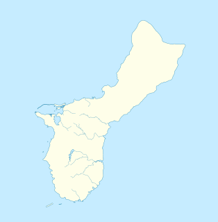
This is a list of the buildings, sites, districts, and objects listed on the National Register of Historic Places in Guam. There are currently 134 listed sites spread across 17 of the 19 villages of Guam. The villages of Agana Heights and Mongmong-Toto-Maite do not have any listings. Listed historic sites include Spanish colonial ruins, a few surviving pre-World War II ifil houses, Japanese fortifications, two massacre sites, and a historic district. Two other locations that were previously listed have been removed from the Register.

Paynes Creek Historic State Park is a Florida State Park located on Lake Branch Road one-half mile southeast of Bowling Green, Florida. On November 21, 1978, it was added to the United States National Register of Historic Places, under the title of Payne's Creek Massacre-Fort Chokonikla Site.

This is intended to be a complete list of properties and districts listed on the National Register of Historic Places in Orleans County, New York. The locations of National Register properties and districts may be seen in a map by clicking on "Map of all coordinates". Two listings, the New York State Barge Canal and the Cobblestone Historic District, are further designated a National Historic Landmark.
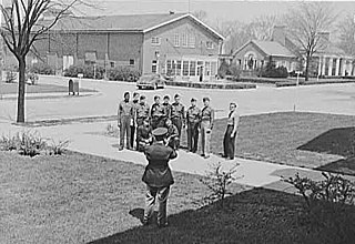
Fort Benjamin Harrison was a U.S. Army post located in suburban Lawrence Township, Marion County, Indiana, northeast of Indianapolis, between 1906 and 1991. It is named for the 23rd United States president, Benjamin Harrison.
The Wounded Knee Battlefield, known also as Wounded Knee, was the site of the Wounded Knee Massacre of 1890 in South Dakota, United States.
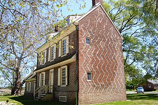
The Hancock House is a historic structure in the Hancock's Bridge section of Lower Alloways Creek Township, Salem County, New Jersey, United States. It was the site of the 1778 Hancock's Bridge massacre. The site is on the National Register of Historic Places.

There are 71 properties listed on the National Register of Historic Places in Albany, New York, United States. Six are additionally designated as National Historic Landmarks (NHLs), the most of any city in the state after New York City. Another 14 are historic districts, for which 20 of the listings are also contributing properties. Two properties, both buildings, that had been listed in the past but have since been demolished have been delisted; one building that is also no longer extant remains listed.

The Merlyn G. Cook School, also known as the Merizo School, is a historic former school building on GU 4 in Merizo, Guam. Built sometime before 1931, it is one of the first schools built during the administration of the island by the United States Navy. Its construction methods are transitional, including both traditional Chamorro-Spanish methods and period American methods. A series of concrete pillars provide the main structure, with the flooring substructure and wall framing of insect-resistant ifil wood. The windows are covered with rare ifil-wood shutters that pivot horizontally. The building's interior is clad in wood planking typical of early 20th-century Chamorro construction. The school has long served as a community meeting point, and was used as a place of refuge during World War II.
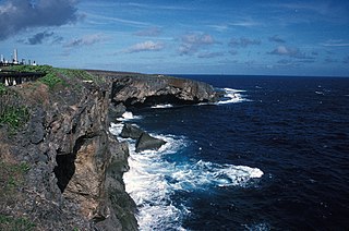
Banzai Cliff is a historic site at the northern tip of Saipan island in the Northern Mariana Islands, overlooking the Pacific Ocean. Towards the end of the Battle of Saipan in 1944, hundreds of Japanese civilians and soldiers jumped off the cliff to their deaths in the ocean and rocks below, to avoid being captured by the Americans. Not far away, a high cliff named Suicide Cliff overlooks the coastal plain, and was another site of numerous suicides. At Banzai Cliff, some who jumped did not die and were captured by American ships.

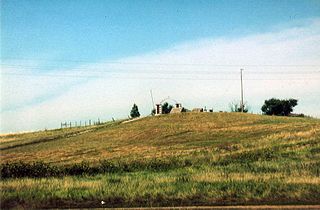
Long Cane Massacre Site is a historic site located near Troy, McCormick County, South Carolina. The district encompasses 40 contributing buildings in Mount Carmel. The site includes a gravestone marking the place where 23 Long Cane settlers were killed in a bloody massacre by the Cherokee on February 1, 1760.
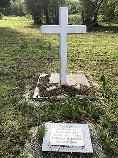
The Faha Massacre Site is located just behind the Pigua cemetery in the village of Merizo on the United States island of Guam. The site is demarcated by four concrete pillars, connected by metal cables, with several crosses placed inside that area. A metal plaque mounted on a concrete block commemorates the thirty native Chamorro men who were slaughtered here on July 16, 1944, by members of the Imperial Japanese Army (IJA) during the Japanese occupation of the island during World War II. The IJA routinely forced Guam's native population to work on its construction projects. The men who were killed here were rounded up for a work crew; why they were killed is unclear, as there were no survivors. The massacre took place one day after the Tinta Massacre, and about one week before the liberation of the island began.
The Malessu' Pillbox is a World War II-era Japanese-built defensive fortification on the shore of Merizo, Guam. Located about 15 metres (49 ft) from the high-tide line at Merizo Beach, it is a rectangular structure built of steel-reinforced concrete and basalt rock. It is 3.9 metres (13 ft) deep, 2.4 metres (7.9 ft) wide, and about 2.42 metres (7.9 ft) high, although only about 0.75 metres (2.5 ft) of the structure is visible above ground. Its gun port has a view of the Merizo pier, and is approximately at ground level. It was built by Japanese defenders during their occupation of the island 1941–44.
The Merizo Conbento is a historic building on Guam Route 4 in Merizo, Guam. Built in 1856, it is the oldest known occupied building on the island. It is a two-story concrete and ifil-wood structure with a gabled corrugated-metal roof, and a large set of concrete stairs leading to the main level above a raised basement. The present-day exterior is a faithful representation of the building's original appearance (with the exception of the roofing material, and original walls of manposteria remain inside the structure. It was built as a parish house for the local Roman Catholic diocese, and saw use as a military post and prison during the Japanese occupation period during World War II.

The West Pleasant Street Historic District is a nationally recognized historic district located in Maquoketa, Iowa, United States. It was listed on the National Register of Historic Places in 1991. At the time of its nomination it contained 50 resources, which included 29 contributing buildings, 21 non-contributing buildings, and one non-contributing site. The historic district is primarily a residential area that was built during Maquoketa's "Boom Years" (1873-1899) and the "Comfortable Years" (1900-1922). The first house built in the district was in 1863 and the last was in 1914. This is where many of the city's business and professional leaders choose to build their houses. Most of the 28 houses were probably not designed by an architect, but were crafted in the "High Style" of the time by local builders. With the exception of Greek Revival, all the major styles of the period built in Maquoketa are found here. Eight of the houses and one of the three remaining carriage houses are brick structures; the rest are wood.

The Melrose Historic District is a nationally recognized historic district located in Iowa City, Iowa, United States. It was listed on the National Register of Historic Places in 2004. At the time of its nomination it consisted of 134 resources, which included 112 contributing buildings, one contributing site, 20 non-contributing buildings, and one non-contributing structure. This neighborhood first developed as a sparsely populated rural area, and between World War I and World War II developed into an automobile suburb. It grew along with the University of Iowa when it expanded to the west side of the Iowa River, and it borders the large University of Iowa Hospitals and Clinics complex. Among the prominent people who lived here was Howard Jones who coached the Iowa football team from 1916 to 1923. Other prominent residents included professors and local professionals and politicians.
Chaqui'an Massacre Site, at Chalan Emsley in Yigo on Guam, was the site of a massacre in 1944 by Japanese soldiers of 45 native Chamorro men. The men were from 15 to 76 years old, and were dressed in civilian clothes. They were tied and were beheaded. The site, a 1.94 acres (0.79 ha) area, was listed on the National Register of Historic Places in 2016.

Blytheville Air Force Base was a United States Air Force base from 1942, until it closed in 1992. In 1988, the facility was renamed Eaker Air Force Base in honor of World War II General of the Eighth Air Force, Ira C. Eaker. It was located 3 miles (4.8 km) northwest of Blytheville, Arkansas. The facility now operates as the Arkansas Aeroplex and Arkansas International Airport.

