
Modes of transport in the Central African Republic include road, water, and air. Most of the country is connected to the road network, but not all of it. Some roads in the country do not connect to the rest of the national road network and may become impassable, especially during heavy monsoon rain. Many remote areas that not connected to the country's road network, especially in the eastern part of the country outside of the major cities and towns, can only be reached by light aircraft, boat or on foot. Most roads are unpaved, and which centres on the routes nationales identified as RN1 to RN11. Bangui serves as a seaport, and 900 km of inland waterways are navigable, the main route being the Oubangui river. There is one international airport at Bangui-Mpoko, two other paved airports, and over 40 with unpaved runways.

Transport in the Dominican Republic utilizes a system of roads, airports, ports, harbours, and an urban railway.

El Salvador has transport links by road, rail, sea and air.
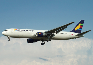
Transport in Eritrea includes highways, airports and seaports, in addition to various forms of public and private vehicular, maritime and aerial transportation.

Transport in Ethiopia is overseen by the Ministry of Transport and Communications. Over the last years, the Ethiopian federal authorities have significantly increased funding for rail and road construction to build an infrastructure, that allows better economic development.
Modes of transport in Gabon include rail, road, water, and air. The one rail link, the Trans-Gabon Railway, connects the port of Owendo with the inland town of Franceville. While most of the country is connected by roads, not all areas are accessible. Much of the road network remains unpaved, and it primarily revolves around seven "national routes" labeled N1 through N7. The largest seaports are Port-Gentil and the newer Owendo, and 1,600 km of inland waterways are navigable. There are three international airports, eight other paved airports, and over 40 with unpaved runways. Nearly 300 km of pipelines carry petroleum products, mainly crude oil.
The United States territory of Guam has no railways or freeways, nor does it have a merchant marine. The largest port is Apra Harbor, which serves almost all commercial traffic including cruise, cargo and fishing vessels. There are smaller harbors located on the island which serve recreational boaters. Roads are primarily paved by a coral/oil mixture that, when it gets wet, tends to have oil float to the surface, making the roads dangerous. This is one of the reasons the speed limit on most of the island is 35 mph. But, during road repair or maintenance, a different mixture of asphalt that is not as slippery is used. Its main commercial airport is the Antonio B. Won Pat International Airport.

Transport infrastructure in Guinea-Bissau is basic, with most roads outside the capital Bissau being unpaved.
Transport in Hungary relies on several main modes, including transport by road, rail, air and water.
Transport in Jamaica consists of roadways, railways, ship and air transport, with roadways forming the backbone of the island's internal transport system.

Railways: 0 km
This article describes the transport in Peru.
There are no railways in Saint Vincent and the Grenadines.
Most internal transport in Solomon Islands is conducted through boat travel between islands. Road transport infrastructure is rudimentary, with few paved roads.
Trinidad and Tobago, a country that relies heavily on industrialisation and tourism, has various transport systems.

Vanuatu's undeveloped road system, with fewer than 100 miles of paved roads, consists mostly of dirt tracks suitable only for four-wheel-drive vehicles. Every island has one or two short airstrips where Vanair’s Twin Otter planes land two or three times weekly. In addition, every island has a small port or wharf where small cargo ships and boats regularly dock.

One of the British overseas territories, the Caribbean island of Anguilla measures only 16 miles (26 km) long by 3 miles (4.8 km) wide, so transport is simpler than in many countries. There is no public transport, such as bus or rail systems, since there isn't enough need. However, Anguilla's roads are better maintained than on many Caribbean islands.
Antigua and Barbuda's transport systems include both public and privately run services. Roads in the country are paved and follow a winding and gently sloping course connecting parishes to villages and communities. Driving is on the left-hand side. The speed limit is set at 40 mph, Traffic signs posted throughout main roads in Antigua and Barbuda allow for ease of commute, and with GPS coordinates posted throughout the country, the process of navigation has become even easier.
