Mount Logan is located in North Cascades National Park in the U.S. state of Washington. Mount Logan is in a remote location of North Cascades National Park that requires hiking 20 mi (32 km) from a trailhead to reach the peak. The mountain itself is not a difficult climb, though the easiest approaches require traversing glaciers and ropes are recommended. The peak supports three glaciers including Banded Glacier to the north, Fremont Glacier to the southwest and Douglas Glacier on the southeast slopes.

Klawatti Peak is located in North Cascades National Park in the U.S. state of Washington. Klawatti Peak is a nunatak, a peak surrounded by glaciers. These are Klawatti Glacier to the east, McAllister Glacier to the northwest and Inspiration Glacier to the south.

Cosho Peak is in North Cascades National Park in the U.S. state of Washington. Cosho Peak is a summit along a ridge known as Ragged Ridge and the Kimtah Glacier is on the northeast slopes of the peak.
Kimtah Peak, elevation 8,600+ feet, is in North Cascades National Park in the U.S. state of Washington. Kimtah Peak is a summit along a ridge known as Ragged Ridge. Kimtah Glacier is on the northwest slopes of the peak, while Katsuk Glacier is to the northeast.
Mount Fury, elevation 8,280+ ft, is in North Cascades National Park in the U.S. state of Washington. Several small glaciers are on the slopes of Mount Fury, and it is the second tallest peak in the Picket Range, after Luna Peak which lies 2.6 mi (4.2 km) to the northeast.

Crooked Thumb Peak is located in North Cascades National Park in the U.S. state of Washington. Located in the northern section of the park, Crooked Thumb Peak is in the Picket Range and is .50 mi (0.80 km) south of Mount Challenger and the same distance north of Phantom Peak.

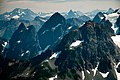
McMillan Spire is a mountain peak in the Picket Range in the U.S. state of Washington and within North Cascades National Park. The peak lies .75 mi (1.21 km) east of Mount Degenhardt, and 0.47 mi (0.76 km) east of Inspiration Peak. The subpeak known as East McMillan Spire is .14 mi (0.23 km) east of McMillan Spire and they are collectively referred to as the McMillan Spires. The Terror Glacier lies to the west of the peak.

Neve Peak is in North Cascades National Park in the U.S. state of Washington. Located in the south unit of the park, Neve Peak is .66 mi (1.06 km) west of Colonial Peak. The Neve Glacier is just south of Neve Peak while the Colonial Glacier descends from the north slopes of the mountain.
Beebe Mountain is a 7,416-foot (2,260-metre) mountain summit located in the Cascade Range in the U.S. state of Washington. It is situated on the border of North Cascades National Park. Its nearest higher neighbor is Elija Ridge, 1.86 miles (2.99 km) to the southwest, and McKay Ridge is set 4 miles (6.4 km) to the northeast on the opposite side of the North Cascades Highway. The mountain's name honors Frank Beebe who worked for the Forest Service and maintained a cabin near the base of the mountain in the 1920s. Precipitation runoff on the mountain drains into Ross Lake via Granite Creek and Panther Creek.

Magic Mountain is a 7,610-foot (2,320-metre) mountain summit located on the shared boundary of Skagit County and Chelan County in Washington state. It is part of the North Cascades, a subset of the Cascade Range. Magic Mountain is situated southeast of Cascade Pass on the shared border of North Cascades National Park and Glacier Peak Wilderness. The nearest peak is Pelton Peak 0.4 miles (0.64 km) to the northeast, and the nearest higher peak is Hurry-up Peak 0.83 miles (1.34 km) to the south. The Yawning Glacier and Cache Col Glacier rest on its northern flank. Magic Mountain is at the northern end of the Ptarmigan Traverse. Surface runoff on the north side the mountain drains into the Stehekin River, while precipitation drains into the Cascade River from the southwest side.

Mix-up Peak, also known as Mixup Peak, is a 7,440-foot (2,270-metre) mountain summit located on the shared boundary of Skagit County and Chelan County in Washington state. It is part of the North Cascades Range and is situated one mile south of Cascade Pass on the shared border of North Cascades National Park and Glacier Peak Wilderness. The nearest higher peak is Magic Mountain, 1.02 miles (1.64 km) to the east-southeast. Mix-up Peak is at the northern end of the Ptarmigan Traverse which is an alpine route to remote mountains such as Mount Formidable and Dome Peak. The Cache Glacier occupies a cirque below its eastern flank. Surface runoff on the east side the mountain drains into the Stehekin River, whereas precipitation runoff drains into the Cascade River from the west side.

Repulse Peak is a 7,923-foot (2,415-metre) mountain summit in the North Cascades in the U.S. state of Washington. It is located on the border of the Stephen Mather Wilderness and North Cascades National Park. It is situated midway between Black Peak and Fisher Peak, and can be seen from the North Cascades Highway. Precipitation runoff from Repulse Peak drains into tributaries of the Skagit River and Stehekin River. Topographic relief is significant as the east face rises over 2,900 feet in 0.53 mile (0.85 km).

Hurry-up Peak is a 7,821-foot-elevation summit located on the shared boundary of Skagit County and Chelan County in Washington state. It is positioned on the crest of the North Cascades Range, and is set at the northern end of the Ptarmigan Traverse. Hurry-up Peak is situated southeast of Cascade Pass on the shared border of North Cascades National Park and Glacier Peak Wilderness. The nearest higher peak is Spider Mountain, 1.49 miles (2.40 km) to the south, with Magic Mountain 0.83 miles (1.34 km) to the north, and Trapper Mountain 0.7 miles (1.1 km) to the east. The S Glacier rests on the eastern flank of the peak and meltwater from it drains into Trapper Lake. Precipitation runoff on the east side the mountain drains into tributaries of the Stehekin River, while precipitation drains into the Cascade River from the west side. Ess Mountain and S Mountain are variant names for Hurry-up Peak. This geographical feature's toponym was officially adopted in 1969 by the U.S. Board on Geographic Names.

Mineral Mountain is a 6,800-foot (2,100-metre) mountain summit in the Skagit Range of the North Cascades of Washington state. Mineral Mountain is situated in North Cascades National Park and the summit offers views of Mount Shuksan, Icy Peak, and the Picket Range. Easy Peak is set 2 mi (3.2 km) to the east, and the nearest higher neighbor is Ruth Mountain, 3.06 mi (4.92 km) to the west. Precipitation runoff from Mineral Mountain finds its way north into the Chilliwack River, and south into the Baker River.

Logger Butte is a 6,160-foot (1,878-metre) mountain summit near the western edge of the North Cascades, in Skagit County of Washington state. It is located north of Marblemount and Diobsud Buttes, on the shared boundary of North Cascades National Park and the Noisy-Diobsud Wilderness. The nearest higher peak is Electric Butte, 1.0 mi (1.6 km) to the north. Precipitation runoff from Logger Butte drains into tributaries of the Skagit River.

Glory Mountain is a 7,228-foot (2,203-metre) mountain summit located in the North Cascades Range in Chelan County of Washington state. Glory Mountain is situated southeast of Trapper Lake on the shared border of North Cascades National Park and Glacier Peak Wilderness. The nearest higher peak is Trapper Mountain, 1.72 miles (2.77 km) to the west. Precipitation runoff from the mountain drains into Cottonwood Creek and Flat Creek, both tributaries of the Stehekin River. An unofficially named secondary peak called Halleluja Peak 7,120+ ft lies 0.32 miles (0.51 km) to the west of the summit.

Mount Arriva is an 8,215 ft (2,500 m) elevation mountain summit located in the North Cascades in the U.S. state of Washington. It is situated in North Cascades National Park, on the shared border of Chelan County and Skagit County. Despite its position only 1.55 mi (2.49 km) southwest of Easy Pass, and 3.7 mi (6.0 km) west of the North Cascades Highway, it is not visible from either. Its nearest higher peak is Black Peak, 2.57 mi (4.14 km) to the southeast. Mount Arriva has a secondary summit, called East Peak, which was first climbed in August 1940 by Fred Beckey, Jim Crooks, and Ed Kennedy. The first ascent of the true summit was made July 6, 1966, by Joe and Joan Firey, John and Irene Meulemans.
Easy Peak is a 6,613-foot (2,016-metre) mountain summit in the Skagit Range of the North Cascades, in Whatcom County of Washington state. Easy Peak is situated in North Cascades National Park, and is often climbed during the Easy Ridge approach to Mount Challenger and the remote northern Pickets. The nearest higher neighbor is Mineral Mountain, 2 mi (3.2 km) to the west, and Whatcom Peak is set 2.1 mi (3.4 km) to the east. Glacierets line the north slope of Easy Ridge between Easy Peak and Whatcom Peak. Precipitation runoff from this peak drains north into the Chilliwack River, or south into headwaters of the Baker River.
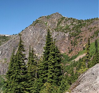
Trappers Peak is a 5,966-foot (1,818 m) elevation mountain summit located in the North Cascades of Washington state. It is situated within North Cascades National Park, Stephen Mather Wilderness, and Whatcom County. It rises steeply above Lower Thornton Lake which is set at the southwestern face of the mountain. Like many North Cascades peaks, Trappers Peak is more notable for its large, steep rise above local terrain than for its absolute elevation. Topographic relief is significant as the southeast aspect rises 5,500 feet (1,700 m) above the North Cascades Highway in approximately two miles. The nearest higher neighbor is Thornton Peak, 1.5 miles (2.4 km) to the northwest, Mount Triumph is two miles to the northwest, and Newhalem is three miles to the east-southeast. Precipitation runoff from the mountain drains into tributaries of the Skagit River. The summit of Trappers Peak is known for its grand view of the jagged peaks of the Picket Range.
Majestic Mountain is a 7,530-foot-elevation (2,295-meter) mountain summit located in Whatcom County in Washington state.