Troy, Illinois

Last updated
Troy, Illinois
William W. Jarvis House.jpg
Madison County Illinois Incorporated and Unincorporated areas Troy Highlighted.svg
Locationin Madison County, Illinois
Usa edcp location map.svg
Red pog.svg
Troy
Location in the United States
Coordinates: 38°43′45″N89°53′30″W / 38.72917°N 89.89167°W / 38.72917; -89.89167 Coordinates: 38°43′45″N89°53′30″W / 38.72917°N 89.89167°W / 38.72917; -89.89167
Country Flag of the United States.svg  United States
State Flag of Illinois.svg  Illinois
County Madison
Townships Jarvis, Pin Oak
Area
[1]
  Total5.67 sq mi (14.69 km2)
  Land5.62 sq mi (14.56 km2)
  Water0.05 sq mi (0.14 km2)
Elevation
[2]
558 ft (170 m)
Population
 (2020) [3]
  Total10,960
  Density1,950.18/sq mi (752.96/km2)
Time zone UTC-6 (CST)
  Summer (DST) UTC-5 (CDT)
ZIP code
62294
Area code 618
FIPS code 17-76199
GNIS feature ID2397061 [2]
Wikimedia CommonsTroy, Illinois
Website www.troyil.us

Troy is a city in Madison County, Illinois, United States. The population was 10,960 at the 2020 census, [3] up from 9,888 in 2010.

Contents

Troy is part of the St. Louis Metropolitan Statistical Area. Its namesake in Lincoln County, Missouri, is also part of this MSA, making it (along with the two O'Fallons in Illinois and Missouri) one of the few pairs of like-named municipalities to be part of the same MSA.

History

Troy was platted in 1819. [4] It was incorporated as a town on February 18, 1857, and as a city in 1892. [5]

Geography

Troy is located in south-central Madison County at 38°43′45″N89°53′30″W / 38.72917°N 89.89167°W / 38.72917; -89.89167 (38.729236, -89.891733). [6] It is bordered to the west by Maryville and to the northwest by Glen Carbon.

Interstates 55 and 70 pass through the west side of Troy, with access from exits 17 and 18. The highways together lead southwest 20 miles (32 km) to St. Louis, while diverging just north of Troy: I-55 leads north 75 miles (121 km) to Springfield, the state capital, while I-70 leads east 50 miles (80 km) to Vandalia. U.S. Route 40 passes through the south side of Troy, joining I-55 and I-70 at the western edge of the city and leading east 11 miles (18 km) to Highland. Illinois Route 162 passes through the center of Troy as Center Street, Market Street, and Edwardsville Road, leading east 2.5 miles (4.0 km) to US 40 and west 4 miles (6 km) to the north part of Maryville.

According to the U.S. Census Bureau, Troy has a total area of 5.67 square miles (14.69 km2), of which 5.62 square miles (14.56 km2) are land and 0.05 square miles (0.13 km2), or 0.92%, are water. [1] Most of the city drains eastward into tributaries of Silver Creek, a south-flowing tributary of the Kaskaskia River. The westernmost part of the city drains to Canteen Creek, which flows southwest to the Mississippi River valley at East St. Louis.

Demographics

Historical population
CensusPop.
1880 648
1890 82627.5%
1900 1,08030.8%
1910 1,44734.0%
1920 1,312−9.3%
1930 1,122−14.5%
1940 1,1542.9%
1950 1,2609.2%
1960 1,77841.1%
1970 2,14420.6%
1980 3,77275.9%
1990 6,04660.3%
2000 8,52441.0%
2010 9,88816.0%
2020 10,96010.8%
U.S. Decennial Census [7]

At the 2000 census there were 8,524 people in 3,100 households, including 2,356 families, in the city. The population density was 2,037.6 inhabitants per square mile (786.7/km2). There were 3,201 housing units at an average density of 765.2 per square mile (295.4/km2). The racial makeup of the city was 95.48% White, 1.48% African American, 0.32% Native American, 0.70% Asian, 0.38% from other races, and 1.64% from two or more races. Hispanic or Latino of any race were 1.49%. [8]

Of the 3,100 households 45.2% had children under the age of 18 living with them, 60.1% were married couples living together, 12.5% had a female householder with no husband present, and 24.0% were non-families. 19.5% of households were one person and 6.8% were one person aged 65 or older. The average household size was 2.75 and the average family size was 3.16.

The age distribution was 30.2% under the age of 18, 8.6% from 18 to 24, 34.3% from 25 to 44, 19.2% from 45 to 64, and 7.7% 65 or older. The median age was 33 years. For every 100 females, there were 96.0 males. For every 100 females age 18 and over, there were 91.5 males.

The median household income was $53,720 and the median family income was $59,643. Males had a median income of $41,705 versus $27,542 for females. The per capita income for the city was $21,174. About 2.1% of families and 3.4% of the population were below the poverty line, including 3.4% of those under age 18 and 4.5% of those age 65 or over.

Notable people

Related Research Articles

<span class="mw-page-title-main">Madison County, Illinois</span> County in Illinois, United States

Madison County is a county in the U.S. state of Illinois. It is a part of the Metro East in southern Illinois. According to the 2020 census, it had a population of 264,776, making it the eighth-most populous county in Illinois and the most populous in the southern portion of the state. The county seat is Edwardsville, and the largest city is Granite City.

<span class="mw-page-title-main">Pierron, Illinois</span> Village in Illinois, United States

Pierron is a village in Bond and Madison counties, Illinois, United States. The population was 459 at the 2020 census, down from 600 at the 2010 census.

<span class="mw-page-title-main">Ava, Illinois</span> City in Illinois, United States

Ava is a city in northwest Jackson County, Illinois, United States. The population was 654 at the 2010 census.

<span class="mw-page-title-main">White City, Illinois</span> Village in Illinois, United States

White City is a village in Macoupin County, Illinois, United States. The population was 212 as of the 2020 census.

<span class="mw-page-title-main">Alhambra, Illinois</span> Village in Illinois, United States

Alhambra is a village in Madison County, Illinois, United States. The population was 681 at the 2010 census.

<span class="mw-page-title-main">Collinsville, Illinois</span> City in Illinois, United States

Collinsville is a city located mainly in Madison County and partially in St. Clair County, Illinois, United States. As of the 2020 census, the city had a population of 24,366. Collinsville is approximately 14 miles (23 km) east of St. Louis, Missouri, and is part of that city's Metro East area.

<span class="mw-page-title-main">Godfrey, Illinois</span> Village in Illinois, United States

Godfrey is a village in Madison County, Illinois, United States. The population was 17,982 at the 2010 census. Godfrey is located within the Riverbend portion of the Greater St. Louis metropolitan area.

<span class="mw-page-title-main">Grantfork, Illinois</span> Village in Illinois, United States

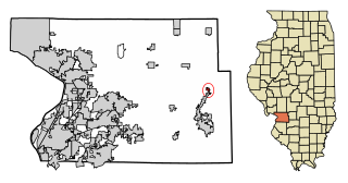
Grantfork is a village in Madison County, Illinois, United States. The population was 337 as of the 2010 census.

<span class="mw-page-title-main">Hamel, Illinois</span> Village in Illinois, United States

Hamel is a village in Madison County, Illinois, United States. The population was 929 at the 2020 census. It is a part of the Illinois Metro East portion of the Greater St. Louis metropolitan area.

<span class="mw-page-title-main">Livingston, Illinois</span> Village in Illinois, United States

Livingston is a village in Madison County, Illinois, United States. The population was 858 at the 2010 census.

<span class="mw-page-title-main">Madison, Illinois</span> City in Illinois, United States

Madison is a city in Madison and St. Clair counties in the U.S. state of Illinois. The population was 3,171 at the 2020 census, down from 3,891 in 2010. It is home to World Wide Technology Raceway at Gateway and the first Bulgarian Orthodox church in the United States.

<span class="mw-page-title-main">Marine, Illinois</span> Village in Illinois, United States

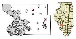
Marine is a village in Madison County, Illinois, United States. The population was 960 at the 2010 census.

<span class="mw-page-title-main">Maryville, Illinois</span> Village in Illinois, United States

Maryville is a village in Madison County, Illinois, United States. The population was 8,221 at the 2020 census, an increase of 61.0% since the 2000 census.

<span class="mw-page-title-main">New Douglas, Illinois</span> Village in Illinois, United States

New Douglas is a village in Madison County, Illinois, United States. The population was 319 at the 2010 census. It is a community that was centered on the local coal mines and farming in the early 1900s. When need for coal dropped in the 1950s the town fell back on its farming roots, mostly of corn and soybeans.

<span class="mw-page-title-main">St. Jacob, Illinois</span> Village in Illinois, United States

St. Jacob is a village in Madison County, Illinois, United States. The population was 1098 at the 2010 census.

<span class="mw-page-title-main">Williamson, Illinois</span> Village in Illinois, United States

Williamson is a village in Madison County, Illinois, United States. The population was 230 at the 2010 census.

<span class="mw-page-title-main">Wood River, Illinois</span> City in Illinois, United States

Wood River is a city in Madison County, Illinois. The population was 10,657 according to the 2010 census.

<span class="mw-page-title-main">Worden, Illinois</span> Village in Illinois, United States

Worden is a village in Madison County, Illinois, United States. The population was 1,044 at the 2010 census.

<span class="mw-page-title-main">Fairview Heights, Illinois</span> City in Illinois, United States

Fairview Heights is a city in St. Clair County, Illinois, United States. The population was 17,078 at the 2010 census. Fairview Heights is a dominant shopping center for Southern Illinois and includes numerous shopping plazas and the St. Clair Square mall.

<span class="mw-page-title-main">O'Fallon, Illinois</span> City in Illinois, United States

O'Fallon is a city in St. Clair County, Illinois, United States. The 2020 census listed the population at 32,289. The city is the second largest city in the Metro-East region and Southern Illinois. It sits 5 miles (8.0 km) from Scott Air Force Base and 18 miles (29 km) from Downtown St Louis.

References

  1. 1 2 "2022 U.S. Gazetteer Files: Illinois". United States Census Bureau. Retrieved February 13, 2023.
  2. 1 2 U.S. Geological Survey Geographic Names Information System: Troy, Illinois
  3. 1 2 "P1. Race – Troy city, Illinois: 2020 DEC Redistricting Data (PL 94-171)". U.S. Census Bureau. Retrieved February 13, 2023.
  4. Norton, William T. (1913). Centennial History of Madison County, Illinois, and Its People, 1812 to 1912. The Lewis Publishing Co. p. 560.
  5. Troy, Illinois History and Families 1803-2002. Paducah:Turner. p. 10.
  6. "US Gazetteer files: 2010, 2000, and 1990". United States Census Bureau. 2011-02-12. Retrieved 2011-04-23.
  7. "Census of Population and Housing". Census.gov. Retrieved June 4, 2015.
  8. "U.S. Census website". United States Census Bureau . Retrieved 2008-01-31.