U.S. Route 122 (1935–1963)

Last updated

US 122 (1961 cutout).svg

U.S. Route 122

Route information
Auxiliary route of US 22
Maintained by PDH
Existed1935 [1] [2] –1963 [3]
Major junctions
South endUS 1 (1948).svgPA-472 (1948).svg US 1  / PA 472 in Oxford
Major intersections
North endUS 11 (1948).svgPA-14 (1948).svg US 11  / PA 14 in Northumberland
Location
Country United States
State Pennsylvania
Counties Chester, Lancaster, Berks, Schuylkill, Columbia, Northumberland
Highway system
PA-121.svg PA 121 PA-123 (1926).svg PA 123

U.S. Route 122 (US 122) was a United States Numbered Highway that was a spur of US 22. Located in the state of Pennsylvania, it existed from 1935 to 1963. At its greatest extent, the route ran from US 1 and Pennsylvania Route 472 (PA 472) in Oxford north to US 11 and PA 14 in Northumberland. Along the way, US 122 passed through Parkesburg, Honey Brook, Morgantown, Reading, Hamburg, Schuylkill Haven, Pottsville, Frackville, Ashland, Centralia, Mount Carmel, Shamokin, and Sunbury.

Contents

What would become US 122 between Reading and Northumberland was designated as part of US 120 in 1926. In 1927, PA 42 was designated onto what became US 122 between Oxford and Centralia, running concurrently with US 120 between Reading and Centralia. The same year, US 120 became concurrent with PA 45 between Ashland and Shamokin, PA 55 between Shamokin and Sunbury, and PA 14 between Sunbury and Northumberland. All the concurrent state routes except PA 14 were removed from US 120 in 1928, which split PA 42 into two sections; the southern section ran from Oxford to Reading. In 1935, US 122 was designated to run from US 1/PA 472 in Oxford north to US 11/US 111/PA 14 in Northumberland, replacing PA 42 between Oxford and Reading and US 120 between Reading and Northumberland. In the 1950s, the south end of US 122 was cut back to PA 23 in Morgantown, with PA 10 replacing the route between Oxford and Morgantown. US 122 was decommissioned in 1963 and was replaced with an extended PA 10 between Morgantown and Reading, PA 61 between Reading and Sunbury, and PA 147 (now PA 405) between Sunbury and Northumberland.

Route description

This route description features US 122 as it existed in 1950, with references to today's highways to provide context.

Oxford to Reading

US 122 began at an intersection with US 1 and PA 472 at Third and Market streets in Oxford, Chester County, where US 1 headed south on Third Street and headed north on Market Street concurrent with southbound PA 472. From here, US 122 headed north concurrent with PA 472 on two-lane undivided Third Street for a block before PA 472 split to the northwest. US 122 continued north along present-day PA 10 and left Oxford. The route became Limestone Road and continued northeast to a junction with PA 896 in Russellville. A short distance later, the road intersected the western terminus of PA 926. US 122 continued north and reached Cochranville, where it crossed PA 41. The route headed north as Limestone Road before it came to Parkesburg, where it became Church Street and intersected PA 372. After leaving Parkesburg, US 122 continued northwest along Octorara Trail before it split from the present-day alignment of PA 10 by following current Hershey Lane north to an intersection with US 30; this intersection is now cut off by the interchange between US 30 and the western terminus of US 30 Bus. At this point, US 122 turned west for a concurrency with US 30 along multilane Lincoln Highway. US 122 split from US 30 by turning north onto two-lane Octorara Trail, once again following the present-day alignment of PA 10. The route continued north and reached Compass, where it turned northwest for a short concurrency with PA 340 along Kings Highway. Following this, US 122 followed Compass Road and headed northeast and then north. The route reached Honey Brook, where it became Pequea Avenue before it crossed US 322, where the name changed to Conestoga Avenue. The road left Honey Brook as Twin County Road. [4]

US 122 entered Lancaster County and continued north along Twin County Road, crossing the Conestoga Creek before it reached a junction with PA 23. At this point, the route turned northeast to form a concurrency with PA 23 on Main Street, crossing into Berks County. In Morgantown, US 122 split from PA 23 by turning north onto Morgantown Road. The route continued north and passed through the communities of Plowville and Beckersville. Farther north, the road entered the city of Reading. [4] US 122 continued into Reading along Morgantown Road and headed northwest to an intersection with US 222/PA 73 (present-day US 222 Bus.) at Lancaster Avenue. At this point, US 122 turned northeast to join US 222/PA 73 along Lancaster Avenue, crossing the Schuylkill River. After crossing the river, the road name changed to Bingaman Street. US 122/US 222 turned north onto Fifth Street while PA 73 continued northeast along Bingaman Street. The road headed into the downtown area of Reading, where it crossed US 422/PA 83 at Penn Street. Following this, US 122/US 222 continued north along Fifth Street. [5]

Reading to Northumberland

US 122 split from US 222 by turning northwest onto Centre Avenue, which is present-day PA 61. [5] The route left the city of Reading and became multilane Pottsville Pike. The road passed through Tuckerton and continued north to Leesport. In Leesport, US 122 turned to the northwest as Centre Avenue and intersected PA 383, which headed southwest along Wall Street. At this point, US 122 became concurrent with PA 383, with PA 383 splitting by turning northeast onto Shackamaxon Street. The route left Leesport and continued north along Pottsville Pike a short distance to the east of the Schuylkill River. In Shoemakersville, the road intersected the northern terminus of PA 662. US 122 continued north to Hamburg, where it split from the present-day alignment of PA 61 by heading north along two-lane Fourth Street into Hamburg. In the center of Hamburg, the route intersected US 22 at State Street. US 122 turned northwest onto Port Clinton Avenue and left Hamburg, heading parallel to the Schuylkill River. [4]

US 122 entered Schuylkill County and followed Blue Mountain Road to Port Clinton, where it turned north onto multilane Center Street, once again following the present-day alignment of PA 61. The road left Port Clinton and became Centre Turnpike, crossing the Little Schuylkill River before it reached a junction with PA 895 in Molino. At this point, PA 895 became concurrent with US 122 and the two routes headed to the northwest. In Deer Lake, PA 895 split from US 122 by turning to the southwest. From here, the route continued northwest and became a two-lane road as it bypassed Orwigsburg to the southwest. US 122 came to an intersection with PA 443, at which point that route joined US 122 in a concurrency. The two routes headed west as a multilane road called Center Avenue to Schuylkill Haven, where PA 443 split from US 122 by heading south. Past Schuylkill Haven, US 122 reached a junction with the northern terminus of PA 83 (present-day PA 183) and turned north as an unnamed road, running to the east of the Schuylkill River. Farther north, US 122 split from present-day PA 61 by turning northwest onto Center Street, crossing the Schuylkill River. The route headed north along Center Street through Mount Carbon. [4] US 122 entered the city of Pottsville and followed Center Street north to a junction with US 209 at Mauch Chunk Street. At this point, Center Street continued north as US 209 southbound while US 122 turned east for a concurrency with US 209 on Mauch Chunk Street. US 122 split from US 209 by turning north onto multilane Pottsville Boulevard (now Claude A. Lord Boulevard), picking up the current alignment of PA 61 again. The road turned east and north as it headed out of the city of Pottsville. [5]

US 122 continued north along multilane Pottsville-St. Clair Highway before it deviated from present-day PA 61 by heading north through St. Clair along two-lane Second Street. After leaving St. Clair, the route continued north along current PA 61 again, following an unnamed multilane road north-northwest to Frackville. In Frackville, US 122 followed Lehigh Avenue north to an intersection with the southern terminus of PA 924, where PA 924 continued north along Lehigh Avenue and US 122 turned west onto Oak Street. After leaving Frackville, the route continues west and the name changes to Fountain Street before it passes through Fountain Springs, where it turns northwest onto Broad Street. The road curves north and enters Ashland, where it becomes Hoffman Boulevard. In Ashland, US 122 came to an intersection with the western terminus of the eastern section of PA 45 (present-day PA 54) at Centre Street, where US 122 turned west onto Centre Street. US 122 came to an intersection with the eastern terminus of PA 54, where PA 54 continued west along Centre Street and US 122 turned north onto Memorial Boulevard. The route left Ashland and curved northeast. US 122 entered Columbia County and became an unnamed road. The route deviated again from present-day PA 61 as it headed onto an alignment that is now closed because of the Centralia mine fire. After picking up the current alignment of PA 61 again, US 122 continued north into Centralia along Locust Avenue. The route intersected the southern terminus of PA 42, where PA 42 continued north along Locust Avenue and US 122 turned west onto Centre Street. The road left Centralia and became unnamed. [4]

US 122 crossed into Northumberland County and continued west along a multilane road to Mount Carmel. In Mount Carmel, the route followed Fifth Street before it intersected PA 54 at Chestnut Street. At this point, PA 54 became concurrent with US 122 and the two routes turned north on Market Street and west on East Avenue. US 122/PA 54 turned north onto Poplar Street and headed out of Mount Carmel, where the multilane road became unnamed and headed west through Atlas. PA 54 split from US 122 by turning to the north while US 122 continued west and passed through Kulpmont on Chestnut Street. The route continued west as an unnamed multilane road and entered Shamokin, where it headed northwest on Mt. Carmel Street before turning west onto Sunbury Street. US 122 came to an intersection with the northern terminus of PA 125 and turned northwest onto Sixth Street, leaving Shamokin. The route became an unnamed multilane road and reached a junction with the northern terminus of PA 225. A short distance past this intersection, the road narrowed to two lanes and came to the community of Weigh Scales, where it turned north and became a multilane road again. US 122 came to an intersection with the western terminus of PA 742 (present-day PA 487) in Paxinos, where it turned west and soon narrowed to two lanes. The route passed through Stonington and briefly became a multilane road before narrowing back to two lanes. Farther west, the road name became State Street and it intersected the northern terminus of PA 890. The route entered Sunbury and headed west through the city along Market Street. US 122 came to an intersection with PA 14 (present-day PA 405) along the east bank of the Susquehanna River, at which point it turned north to form a concurrency with PA 14 along Front Street. The road crossed the Susquehanna River, Packer Island, and more of the river into Northumberland. In Northumberland, the road became King Street and US 122 reached its northern terminus at an intersection with US 11, where PA 14 turned southwest to follow US 11 and continue along the present-day alignment of PA 405. [4]

History

The portion of US 122 along Limestone Road in Chester County was originally a Native American trail. [6] On March 25, 1805, the Centre Turnpike Road Company was chartered to build the Centre Turnpike, a turnpike running from Reading northwest to Sunbury along the rough alignment of what would become US 122. Construction of the Centre Turnpike began in 1808 and was completed in 1814. [7] Following the passage of the Sproul Road Bill in 1911, what would become US 122 was designated as Legislative Route 274 between Oxford and Reading, Legislative Route 160 between Reading and Hamburg, Legislative Route 141 between Hamburg and Schuylkill Haven, Legislative Route 140 between Schuylkill Haven and Pottsville, and Legislative Route 161 between Pottsvile and Sunbury. [8] By 1926, the entire length of Legislative Route 274 was paved except between Compass and south of Honey Brook and Honey Brook and Morgantown. [9]

With the creation of the U.S. Highway System in 1926, the road between Reading and Northumberland was designated as part of US 120, a route that ran from Philadelphia northwest to Erie. At this time, the entire length of US 120 between US 22 in Reading and Northumberland was paved. [9] [10] In 1927, the road between US 1/PA 12 (now PA 472) in Oxford and Centralia was designated as part of PA 42, which continued north from Centralia to the New York border in South Waverly; PA 42 ran concurrent with US 120 between Reading and Centralia. The same year, PA 45 was designated concurrent with US 120 between Ashland and Shamokin, PA 55 was designated concurrent on the section of US 120 between Shamokin and Sunbury, and PA 14 was designated concurrent with US 120 between Sunbury and Northumberland. [11] The concurrent state routes were removed from US 120 between Reading and Sunbury in 1928, with PA 14 remaining concurrent with US 120, which split PA 42 into two sections. The southern section of PA 42 ran along the road from US 1/PA 472 in Oxford north to US 222/PA 73 (now US 222 Bus.) in Reading, continuing south from Oxford to the Maryland border south of Chrome, while the northern section of PA 42 ran from US 120 in Centralia north to US 220 in Laporte. At this time, the entire length of PA 42 between Oxford and Reading was paved. [12]

In May 1935, the eastern terminus of US 120 was truncated to US 220 in Lock Haven. US 122 was designated in April 1935 to run from US 1/PA 472 in Oxford north to US 11/US 111/PA 14 in Northumberland, replacing PA 42 between Oxford and Reading and US 120 between Reading and Northumberland, effective in May 1935. [1] [2] [13] US 122 was rerouted to bypass Orwigsburg to the southwest by 1940, having previously followed Brick Hill Road, Market Street, and present-day PA 443 through the town. In the 1930s, US 122 was widened to a multilane road between Reading and Leesport, from a point north of Shoemakersville to Hamburg, between a point south of Schuylkill Haven and Pottsville, for a short distance south of Frackville, and for a short distance north of Shamokin. [13] US 122 was upgraded to a multilane road in the 1940s between Leesport and north of Shoemakersville, between Port Clinton and south of Orwigsburg, between St. Clair and south of Frackville, between Frackville and Shamokin, between north of Weigh Scales and north of Paxinos, and for a short distance north of Stonington. [4] In the 1940s, US 122 was realigned to bypass Center City Pottsville to the east along Pottsville Boulevard between US 209 in Pottsville and south of St. Clair, having previously followed Centre Street through Center City Pottsville and Nichols Street and Ann Street between Pottsville and St. Clair [5] By 1953, US 122 was rerouted to bypass Hamburg to the west on a divided highway between south of Hamburg and Port Clinton, having previously followed Fourth Street and Port Clinton Avenue between Hamburg and Port Clinton. [14] US 122 was upgraded to a divided highway in the 1950s between north of Leesport and north of Shoemakersville, along the bypass of Orwigsburg, from north of St. Clair to south of Frackville, between Ashland and the border between Columbia and Northumberland counties, and between Weigh Scales and Paxinos. [15] In the 1950s, US 122 was upgraded to a divided highway from Schuylkill Haven through Pottsville to south of St. Clair, being realigned to bypass Mount Carbon. This alignment of US 122 bypassed the previous alignment that followed Centre Street through Mount Carbon north to US 209 in Pottsville. [15] [16] [17]

On July 19, 1955, the American Association of State Highway Officials (AASHO) approved the removal of the US 122 designation between Oxford and Morgantown, with the southern terminus of the route moved to Morgantown. [18] PA 10 was designated along the former alignment of US 122 between US 1/PA 472 in Oxford and PA 23 in Morgantown. [15] On December 1, 1962, AASHO approved the elimination of the US 122 designation; [19] US 122 was decommissioned in 1963. [3] [15] The section of US 122 between PA 23 in Morgantown and US 222 in Reading became a northern extension of PA 10, the route was removed from a concurrency with US 222 through Reading, the section between US 222 in Reading and PA 147 in Sunbury was designated PA 61, and the section between PA 61 in Sunbury and US 11 in Northumberland became part of PA 147 (now PA 405). [3] [20] [21]

Major intersections

This table shows the intersections of US 122 as they existed in 1950. 

CountyLocationmikmDestinationsNotes
Chester Oxford US 1 (1948).svgSouth plate 1948.svg
PA-472 (1948).svg
US 1  / PA 472 south (South 3rd Street/Market Street) Lewisville
Southern terminus; south end of PA 472 overlap
North plate 1948.svg
PA-472 (1948).svg
PA 472 north (Lancaster Avenue) Quarryville
North end of PA 472 overlap
Upper Oxford Township PA-896 (1948).svg PA 896 (Newark Road) Octoraro, New London
East plate 1948.svg
PA-926 (1948).svg
PA 926 east (Street Road) London Grove
Western terminus of PA 926
West Fallowfield Township PA-41 (1948).svg PA 41 (Gap Newport Pike) Atglen, Avondale
Parkesburg PA-372 (1948).svg PA 372 (First Avenue) Parkesburg, Coatesville
Sadsbury Township East plate 1948.svg
US 30 (1948).svg
US 30 east (Lincoln Highway) Coatesville
South end of US 30 overlap
West plate 1948.svg
US 30 (1948).svg
US 30 west (Lincoln Highway) Lancaster
North end of US 30 overlap
West Caln Township East plate 1948.svg
PA-340 (1948).svg
PA 340 east (West Kings Highway) Wagontown
South end of PA 340 overlap
West plate 1948.svg
PA-340 (1948).svg
PA 340 west (West Kings Highway) Lancaster
North end of PA 340 overlap
Honey Brook US 322 (1948).svg US 322 (Horseshoe Pike) Beartown, Downingtown
Lancaster Caernarvon Township West plate 1948.svg
PA-23 (1948).svg
PA 23 west (Main Street) Lancaster
South end of PA 23 overlap
Berks Caernarvon Township East plate 1948.svg
PA-23 (1948).svg
PA 23 east (Main Street) Elverson
North end of PA 23 overlap
Reading South plate 1948.svg
US 222 (1948).svg
West plate 1948.svg
PA-73 (1948).svg
US 222 south / PA 73 west (Lancaster Avenue) Lancaster
South end of US 222/PA 73 overlap
East plate 1948.svg
PA-73 (1948).svg
PA 73 east (Bingaman Street)
North end of PA 73 overlap
US 422 (1948).svgPA-83 (1948).svg US 422  / PA 83 (Penn Street)
North plate 1948.svg
US 222 (1948).svg
US 222 north (5th Street) Allentown
North end of US 222 overlap
Leesport West plate 1948.svg
PA-383 (1948).svg
PA 383 west (East Wall Street) Bernville
South end of PA 383 overlap
East plate 1948.svg
PA-383 (1948).svg
PA 383 east (Shackamaxon Street)
North end of PA 383 overlap
Shoemakersville South plate 1948.svg
PA-662 (1948).svg
PA 662 south (Moselem Springs Road) Moselem Springs
Northern terminus of PA 662
Hamburg US 22 (1948).svg US 22 (State Street) Harrisburg, Allentown
Schuylkill West Brunswick Township East plate 1948.svg
PA-895 (1948).svg
PA 895 east McKeansburg, New Ringgold
South end of PA 895 overlap
Deer Lake West plate 1948.svg
PA-895 (1948).svg
PA 895 west Auburn
North end of PA 895 overlap
North Manheim Township East plate 1948.svg
PA-443 (1948).svg
PA 443 east Orwigsburg, New Ringgold
South end of PA 443 overlap
Schuylkill Haven West plate 1948.svg
PA-443 (1948).svg
PA 443 west (Dock Street) Pine Grove
North end of PA 443 overlap
North Manheim Township South plate 1948.svg
PA-83 (1948).svg
PA 83 south (Pottsville Street) Cressona
Northern terminus of PA 83
Pottsville South plate 1948.svg
US 209 (1948).svg
US 209 south (South Centre Street) Tremont
South end of US 209 overlap
North plate 1948.svg
US 209 (1948).svg
US 209 north (Mauch Chunk Street) Tamaqua
North end of US 209 overlap
Frackville North plate 1948.svg
PA-924 (1948).svg
PA 924 north (Lehigh Avenue) Shenandoah
Southern terminus of PA 924
Ashland East plate 1948.svg
PA-45 (1948).svg
PA 45 east (Centre Street) Shenandoah
Western terminus of PA 45
West plate 1948.svg
PA-54 (1948).svg
PA 54 west (Centre Street) Locust Gap
Eastern terminus of PA 54
Columbia Centralia North plate 1948.svg
PA-42 (1948).svg
PA 42 north (Locust Street) Bloomsburg
Southern terminus of PA 42
Northumberland Mount Carmel East plate 1948.svg
PA-54 (1948).svg
PA 54 east (Chestnut Street)
South end of PA 54 overlap
Mount Carmel Township West plate 1948.svg
PA-54 (1948).svg
PA 54 west Danville
North end of PA 54 overlap
Shamokin South plate 1948.svg
PA-125 (1948).svg
PA 125 south (Market Street)
Northern terminus of PA 125
Coal Township South plate 1948.svg
PA-225 (1948).svg
PA 225 south Trevorton
Northern terminus of PA 225
Shamokin Township East plate 1948.svg
PA-742 (1948).svg
PA 742 east Elysburg
Western terminus of PA 742
Upper Augusta Township South plate 1948.svg
PA-890 (1948).svg
PA 890 south Trevorton
Northern terminus of PA 890
Sunbury East plate 1948.svg
PA-242 (1948).svg
PA 242 east (North 11th Street) Snydertown
Western terminus of PA 242
South plate 1948.svg
PA-14 (1948).svg
PA 14 south (Front Street) Millersburg
South end of PA 14 overlap
Northumberland US 11 (1948).svgNorth plate 1948.svg
PA-14 (1948).svg
US 11  / PA 14 north (Water Street) Selinsgrove, Milton, Bloomsburg
Northern terminus; north end of PA 14 overlap
1.000 mi = 1.609 km; 1.000 km = 0.621 mi

See also

Related Research Articles

<span class="mw-page-title-main">Mount Carmel, Pennsylvania</span> Borough in Pennsylvania, United States

Mount Carmel is a borough in Northumberland County, located in the Coal Heritage Region of Central Pennsylvania's Susquehanna River Valley, United States. The population was 5,725 at the 2020 census. It is located 88 miles (141 km) northwest of Philadelphia and 71 miles (114 km) northeast of Harrisburg, in the Coal Region. It is completely encircled by Mount Carmel Township.

<span class="mw-page-title-main">Pennsylvania Route 61</span> State highway in Pennsylvania, US

Pennsylvania Route 61 is an 81.8-mile-long (131.6 km) state highway that is located in Pennsylvania in the United States. The route is signed on a north–south direction, running from U.S. Route 222 Business in Reading northwest to US 11/US 15/PA 147 in Shamokin Dam.

<span class="mw-page-title-main">Pennsylvania Route 54</span> State highway in Pennsylvania, US

Pennsylvania Route 54 is a state highway which runs for 82 miles (132 km) in eastern Pennsylvania in the United States.

<span class="mw-page-title-main">Pennsylvania Route 42</span> State highway in Pennsylvania, US

Pennsylvania Route 42 is a 58.6-mile-long (94.3 km) state route that is located in central Pennsylvania. The southern terminus of the route is situated at PA 61 in Centralia. The northern terminus is located at U.S. Route 220 in Laporte.

<span class="mw-page-title-main">Pennsylvania Route 309</span> State highway in Pennsylvania, United States

Pennsylvania Route 309 is a state highway that runs for 134 miles (216 km) through eastern Pennsylvania. The route runs from an interchange between PA 611 and Cheltenham Avenue on the border of Philadelphia and Cheltenham Township north to an intersection with PA 29 in Bowman Creek, a village in Monroe Township in Wyoming County. The highway connects Philadelphia and its northern suburbs to Allentown and the Lehigh Valley, and Hazleton and Wilkes-Barre in Wyoming Valley.

<span class="mw-page-title-main">Mahantongo</span>

"Mahantongo" is a Lenape word, translated "where we had plenty of meat to eat" or "good hunting grounds." The name is shared by a creek, a valley, and a mountain in central Pennsylvania, and is a common street name in the area. The alternate spelling "Mahantango" is often found in early publications, e.g.,.

<span class="mw-page-title-main">Pennsylvania Route 724</span> State highway in Pennsylvania, US

Pennsylvania Route 724 is a 30-mile (48 km) road in the U.S. commonwealth of Pennsylvania that runs from U.S. Route 422 in Sinking Spring southeast to PA 23 near Phoenixville. PA 724 travels through Berks and Chester counties. The route runs through the southern suburbs of Reading, passing through Shillington and Kenhorst. Past the Reading area, PA 724 continues southeast parallel to the Schuylkill River, passing through or near Birdsboro, Pottstown, and Spring City. The route intersects many roads including US 222 near Shillington, PA 10 and Interstate 176 (I-176) southeast of Reading, PA 345 in Birdsboro, and PA 100 and US 422 near Pottstown.

<span class="mw-page-title-main">Pennsylvania Route 901</span> State highway in Pennsylvania, US

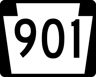
Pennsylvania Route 901 is a 26.4-mile-long (42.5 km) state route located in eastern Pennsylvania. The western terminus of the route is at PA 61 in the Coal Township hamlet of Ranshaw. Its eastern terminus is at PA 183 in Cressona. PA 901 runs northwest-southeast through forested mountains in the Coal Region within Northumberland and Schuylkill counties. The route runs concurrent with PA 54 between Locust Gap and Merrian in Mount Carmel Township before it leaves Northumberland County for Schuylkill County. PA 901 has an interchange with Interstate 81 (I-81) and continues southeast to Minersville. The route runs concurrent with U.S. Route 209 to Pottsville before it splits south and continues to PA 183.

Centre Turnpike, also known as the Reading-Sunbury Road, was an early United States turnpike located in Pennsylvania. It followed the path of the King's Highway, which had been surveyed in 1770 by Francis Yarnall. Running from Reading to Sunbury, it was 75 miles (121 km) long, was started in 1808, and was completed around 1814 at a cost of US$208,000. The final toll was collected near Bear Gap in Ralpho Township in 1885. The general path of the original turnpike is now covered partly by Pennsylvania Route 61 and Pennsylvania Route 54. It was maintained and controlled by the Centre Turnpike Road Company, which was formed on March 25, 1805.

<span class="mw-page-title-main">Pennsylvania Route 10</span> State highway in Pennsylvania, US

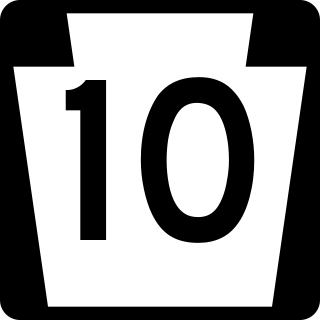
Pennsylvania Route 10 is a 44.04-mile-long (70.88 km) state route in southeastern Pennsylvania. Its southern terminus is at PA 472 in Oxford. Its northern terminus is at U.S. Route 222 Business in Reading. PA 10 is mostly a two-lane undivided road that serves Chester, Lancaster, and Berks counties. The route begins in Oxford and passes through rural areas of western Chester County, serving Cochranville, Parkesburg, Compass, and Honey Brook. The route passes through a small corner of eastern Lancaster County before it enters Berks County and reaches Morgantown, where it has interchanges with Interstate 176 (I-176) and the Pennsylvania Turnpike (I-76). Between Morgantown and Reading, PA 10 parallels I-176.

<span class="mw-page-title-main">Pennsylvania Route 23</span> State highway in Pennsylvania, US

Pennsylvania Route 23 is an 81.14-mile-long (130.58 km) state highway in southeastern Pennsylvania. The route begins at PA 441 in Marietta and heads east to U.S. Route 1 at City Avenue on the border of Lower Merion Township and Philadelphia. PA 23 begins at Marietta in Lancaster County and continues east to Lancaster, where it passes through the city on a one-way pair of streets and intersects US 222 and US 30.

<span class="mw-page-title-main">U.S. Route 222 Business (Reading, Pennsylvania)</span> Highway in Pennsylvania

U.S. Route 222 Business is a 12.17-mile (19.59 km) business route of US 222 in Reading, Pennsylvania. The southern terminus is at US 222 in Cumru Township. Its northern terminus is at US 222 in Ontelaunee Township. The route begins at the US 222 freeway and heads through the southwestern suburbs of Reading as Lancaster Avenue, intersecting Pennsylvania Route 724 in Shillington. US 222 Bus. continues into Reading on Lancaster Avenue and intersects the northern termini of PA 625 and PA 10 before reaching an interchange with the US 422 freeway.

<span class="mw-page-title-main">U.S. Route 422 Business (Reading, Pennsylvania)</span> Business route in Pennsylvania, United States

U.S. Route 422 Business is a 7.29-mile-long (11.73 km) business route of US 422 located in the Reading, Pennsylvania area. The route is one of four auxiliary routes of US 422 in Pennsylvania. Its western terminus is at an interchange with US 222 and US 422 in Wyomissing. Its eastern terminus is at an interchange with US 422 in Reiffton. US 422 Bus. heads east from US 222/US 422 along Penn Avenue, passing through Wyomissing and West Reading. The route has an interchange with the US 422 freeway before it crosses the Schuylkill River into Reading. US 422 Bus. passes through downtown Reading on the one-way pair of Franklin Street eastbound and Washington Street westbound, intersecting the southern terminus of Pennsylvania Route 183 and crossing US 222 Bus. The business route heads into the eastern part of the city southeast on Perkiomen Avenue before following the one-way pair of Perkiomen Avenue eastbound and Mineral Spring Road westbound into Mount Penn. US 422 Bus. continues along Perkiomen Avenue to St. Lawrence, where it intersects the western terminus of PA 562 and turns southeast. The route passes through Reiffton before it merges into eastbound US 422.

<span class="mw-page-title-main">Pennsylvania Route 183</span> State highway in Pennsylvania, US

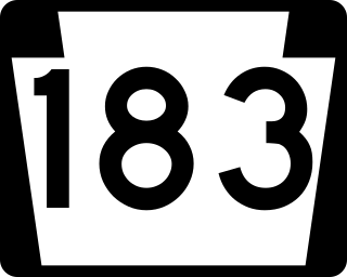
Pennsylvania Route 183 (PA 183) is a 31.7-mile-long (51.0 km) route that runs north to south in southeastern Pennsylvania. The southern terminus is at U.S. Route 422 Business in Reading in Berks County. Its northern terminus is at PA 61 near Schuylkill Haven in Schuylkill County. The road passes through developed areas near Reading before continuing north through rural areas, crossing from Berks County into Schuylkill County at Blue Mountain. PA 183 serves the communities of Bernville, Strausstown, and Cressona.

<span class="mw-page-title-main">Pennsylvania Route 443</span> State highway in Pennsylvania, US

Pennsylvania Route 443 is an 80-mile-long (130 km) east–west state highway in the US state of Pennsylvania. The western terminus is at an intersection with State Route 3009 at North Front Street on the east bank of the Susquehanna River in the community of Fort Hunter in Middle Paxton Township, just west of an interchange with the U.S. Route 22 /US 322 freeway. The eastern terminus is at US 209 in Lehighton. The route runs through rural areas in the Ridge-and-Valley Appalachians in Dauphin, Lebanon, Schuylkill, and Carbon counties, serving Fort Indiantown Gap, Pine Grove, Schuylkill Haven, Orwigsburg, New Ringgold, and South Tamaqua. PA 443 intersects several major roads, including US 22/US 322 near its western terminus, PA 72 in Union Township, Interstate 81 (I-81) near Pine Grove, PA 61 between Schuylkill Haven and Orwigsburg, and PA 309 in South Tamaqua.

<span class="mw-page-title-main">Pennsylvania Route 147</span> State highway in Dauphin and Northumberland counties in Pennsylvania, United States

Pennsylvania Route 147 is a north–south route that runs for 58.3 miles (93.8 km) along the east shore of the Susquehanna River in central Pennsylvania, United States. The southern terminus is at an interchange with U.S. Route 22 /US 322 in Reed Township. The northern terminus is at an interchange with Interstate 80 (I-80) and I-180 in Turbot Township.

<span class="mw-page-title-main">Pennsylvania Route 487</span> State highway in Pennsylvania, United States

Pennsylvania Route 487 is a 64.2-mile-long (103.3 km), north–south state highway running from PA 61 in Shamokin Township, Northumberland County, to PA 87 in Dushore, Sullivan County. In Bloomsburg, PA 487 and US 11 share a brief wrong-way concurrency. After its brief concurrency with PA 118, PA 487 goes up a steep grade through Ricketts Glen State Park. PA 487 is used to carry traffic up the Fishing Creek valley.

<span class="mw-page-title-main">Pennsylvania Route 125</span> State highway in Pennsylvania, US

Pennsylvania Route 125 is a 32.0-mile-long (51.5 km) state highway located in Schuylkill and Northumberland counties in Pennsylvania. The southern terminus is at PA 443 in Pine Grove. The northern terminus is at PA 61 in Shamokin. The route follows a winding alignment through mountains and valleys in the western part of the Coal Region. PA 125 does not directly access Interstate 81 (I-81); however, north of Pine Grove, there is an interchange with SR 3013 just yards from the highway in Ravine. The route has a concurrency with U.S. Route 209 in Tremont and crosses PA 25 in Hegins. PA 125 was designated in 1928 between PA 25 in Hegins and US 209 in Newtown while the present alignment between Pine Grove and Hegins was a part of PA 25 and the section between Line Mountain and Shamokin was part of PA 225. PA 125 was realigned to its current alignment between PA 443 in Pine Grove and US 122 in Shamokin in the 1930s, with the former section between Hegins and Newtown becoming a realigned PA 25.

<span class="mw-page-title-main">Pennsylvania Route 225</span>

Pennsylvania Route 225 is a 48.5-mile-long (78.1 km) state highway located in Dauphin and Northumberland Counties in Pennsylvania. The southern terminus is at an interchange with U.S. Route 22 /US 322 in Dauphin. The northern terminus is at PA 61 in Shamokin. PA 225 is mostly a two-lane undivided road running through mountain and valley areas in the central part of the state. The route serves the communities of Halifax, Elizabethville, Berrysburg, Pillow, and Trevorton. PA 225 intersects PA 325 north of Dauphin, PA 147 in Halifax, US 209 in Elizabethville, PA 25 in Berrysburg, and PA 890 in Trevorton.

<span class="mw-page-title-main">Pennsylvania Route 924</span> State highway in Pennsylvania, US

Pennsylvania Route 924 is a 22-mile-long (35 km) state highway in the U.S. state of Pennsylvania. The highway runs from PA 61 in Frackville, Schuylkill County, northeast to PA 309 in Hazleton, Luzerne County. PA 924 runs through rural areas in the Coal Region, serving Gilberton, Shenandoah, Brandonville, and West Hazleton. The route is mostly a two-lane road with the section between Frackville and Shenandoah a four-lane divided highway with an interchange serving Gilberton and another four-lane divided highway section to the west of Hazleton. PA 924 intersects PA 54 in Shenandoah, PA 339 in Brandonville, Interstate 81 (I-81) west of Hazleton, and PA 93 in West Hazleton.

References

  1. 1 2 "Highway Route Number Changed". Shamokin News-Dispatch. May 31, 1935. p. 3. U.S. Route 122 will designate the road from Oxford, on U.S. No. 1, in Chester county, continuing northward through Chochransville, Honey Brook, Reading, Hamburg, Pottsville, Frackville, Mount Carmel, Shamokin and Sunbury, joining U.S. Nos. 11 and 111 at Northumberland. This replaces No. 42 entirely and U.S. No. 120 south of Lock Haven.
  2. 1 2 "State to Change Route Numbers". The Plain Speaker. Hazleton, Pennsylvania. April 18, 1935. p. 12. Retrieved January 13, 2016 via Newspapers.com. Open Access logo PLoS transparent.svg
  3. 1 2 3 "State Eliminating Route 14 Designation". Williamsport Sun-Gazette. April 1, 1963. p. 5. Retrieved August 11, 2015 via Newspapers.com. Open Access logo PLoS transparent.svg
  4. 1 2 3 4 5 6 7 Pennsylvania Department of Highways (1950). Official Road Map of Pennsylvania (PDF) (Map). Harrisburg: Pennsylvania Department of Highways. Retrieved April 19, 2019.
  5. 1 2 3 4 Pennsylvania Department of Highways (1950). Official Road Map of Pennsylvania (PDF) (Map). Harrisburg: Pennsylvania Department of Highways. Back side. Retrieved December 9, 2019.
  6. Futhey, John Smith; Cope, Gilbert (1881). History of Chester County, Pennsylvania, with Genealogical and Biographical Sketches. Philadelphia: Louis H. Everts. p. 354. Retrieved January 19, 2014.
  7. Mowry, C. (1822). Documents, Accompanying the Report of the Committee, on Roads, Bridges and Inland Navigation Read in the Senate of Pennsylvania on the 23d March 1822 (PDF). Pennsylvania Senate. Retrieved December 2, 2019.
  8. Pennsylvania Department of Highways (1911). Map of Pennsylvania Showing State Highways (PDF) (Map). Harrisburg: Pennsylvania Department of Highways. Retrieved June 24, 2010.
  9. 1 2 Pennsylvania Highway Map (Map). Gulf Oil. 1926. Eastern side. Retrieved December 26, 2007.[ full citation needed ]
  10. Bureau of Public Roads & American Association of State Highway Officials (November 11, 1926). United States System of Highways Adopted for Uniform Marking by the American Association of State Highway Officials (Map). 1:7,000,000. Washington, DC: United States Geological Survey. OCLC   32889555 . Retrieved November 7, 2013 via Wikimedia Commons.
  11. Pennsylvania Department of Highways (1927). Pennsylvania Highway Map (Map). Harrisburg: Pennsylvania Department of Highways. Retrieved December 26, 2007.
  12. Pennsylvania Department of Highways (1928). Map of Pennsylvania (Map). Harrisburg: Pennsylvania Department of Highways. Retrieved May 7, 2015.
  13. 1 2 Pennsylvania Department of Highways (1940). Official Road Map of Pennsylvania (PDF) (Map). Harrisburg: Pennsylvania Department of Highways. Retrieved June 24, 2010.
  14. Pennsylvania Department of Highways (1953). Berks County Map (PDF) (Map). Harrisburg: Pennsylvania Department of Highways. Sheet 1. Retrieved December 5, 2019.
  15. 1 2 3 4 Pennsylvania Department of Highways (1960). Official Map of Pennsylvania (PDF) (Map). Harrisburg: Pennsylvania Department of Highways. Retrieved January 13, 2014.
  16. Pennsylvania Department of Highways (1960). Official Map of Pennsylvania (back) (PDF) (Map). Harrisburg: Pennsylvania Department of Highways. Retrieved January 16, 2014.
  17. Pennsylvania Department of Highways (1964). Schuylkill County Map (PDF) (Map). Harrisburg: Pennsylvania Department of Highways. Sheet 1. Retrieved December 5, 2019.
  18. U.S. Route Numbering Committee (July 19, 1955). [Report of the U.S. Route Numbering Committee to the Executive Committee] (PDF) (Report). Washington, DC: American Association of State Highway Officials. p. 133. Retrieved October 26, 2020 via Wikimedia Commons.
  19. U.S. Route Numbering Committee (December 2, 1962). "U.S. Route Numbering Committee Agenda Showing Action Executive Committee at Its Meeting" (PDF) (Report). Washington, DC: American Association of State Highway Officials. p. 243. Retrieved October 26, 2020 via Wikimedia Commons.
  20. Pennsylvania Department of Highways (1970). Official Map of Pennsylvania (PDF) (Map). Harrisburg: Pennsylvania Department of Highways. Retrieved June 30, 2010.
  21. Pennsylvania Department of Highways (1966). Berks County Map (PDF) (Map). Harrisburg: Pennsylvania Department of Highways. Sheet 1. Retrieved December 28, 2007.