U.S. Route 240

Last updated

US 240 (1961).svg

U.S. Route 240

Washington National Pike
Wisconsin Avenue
U.S. Route 240
US 240 highlighted in red, US 240 Alt. in blue, and US 240 Truck in pink
Route information
Auxiliary route of US 40
Existed1926–1972
Major junctions
South endUS 50 (1926).svg US 50 in Washington, D.C.
Major intersectionsI-270 (1961).svgMD Route 355.svg I-270  / MD 355 near Bethesda, MD
I-70 (1961).svg I-70 in Frederick, MD
North endUS 40 (1961).svg US 40 in Frederick, MD
Location
Country United States
States District of Columbia, Maryland
CountiesDC: Washington
MD: Montgomery, Frederick
Highway system
MD Route 239.svg MD 239 MD MD Route 242.svg MD 242
US 211.svg US 211 DC I-270.svg I-270

U.S. Route 240 is a defunct designation for a short, but once very important, segment of highway between Frederick, Maryland, and Washington, D.C. It is now commonly known as Wisconsin Avenue, Maryland Route 355 (MD 355), and Interstate 270 (I-270).

Contents

Route description

This route description features US 240 as it existed in 1945, with references to today's highways to provide context.

Washington, D.C.

US 240 began at the intersection of Pennsylvania Avenue and 14th Street, NW, near the White House in Washington, D.C. [ citation needed ] US 240 headed west on Pennsylvania Avenue to 15th Street, then headed west from that intersection on Treasury Place for one block (entering an area now closed to the public and known as President's Park). The U.S. Highway curved around the south side of the South Lawn on South Executive Avenue past the Zero Milestone Marker to continue onto E Street west one block to 17th Street. US 240 followed 17th Street north to Farragut Square, where the highway intersected K Street, which carried US 50.

US 240 continued north along Connecticut Avenue to Dupont Circle, which did not have an underpass for Connecticut Avenue when US 240 was designated. At the circle, the U.S. Highway met US 29, which used New Hampshire Avenue on both sides of the circle, and US 240 Alternate, which headed north on Connecticut Avenue. US 240 continued northwest on Massachusetts Avenue. The highway passed through Sheridan Circle, crossed Rock Creek on what is now named the Charles C. Glover Memorial Bridge, and passed along part of Observatory Circle on the edge of the circular U.S. Naval Observatory grounds. US 240 followed Massachusetts Avenue to its intersection with Wisconsin Avenue next to Washington National Cathedral. There, the U.S. Highway turned north and followed Wisconsin Avenue through Tenleytown to the District of Columbia boundary at Western Avenue in Friendship Heights.

By 1959, the starting point and routing of US 240 south of Massachusetts Avenue and 22nd Street (one block east of Sheridan Circle) had changed. [1] The southern terminus was at the traffic circle around the Lincoln Memorial (which carried US 50) heading north on 23rd Street, NW, passing through Washington Circle where it intersected with US 29 which headed west on K St. and northeast on New Hampshire Avenue. Due to one-way roads the north and southbound lanes of US 240 ran on different streets for the next six blocks. Northbound US 240 followed New Hampshire Avenue (and US 29) northeast for one block and then turning directly north on 22nd Street (one way northbound) to Massachusetts Avenue, where it turned northwest. Southbound from Massachusetts Avenue on 22nd it forked onto 23rd Street (one way southbound) to Washington Circle. The southern terminus of US 240 Alternate was rerouted down Florida Avenue from Connecticut Avenue to connect with US 240 at the intersection of Massachusetts Avenue, 22nd Street, and Florida Avenue.

Maryland

US 240 followed a divided highway north to its intersection with MD 191, which as today headed west as Bradley Boulevard, a divided highway, and east as Bradley Lane. The U.S. highway became undivided and intersected MD 82 (Leland Street) and crossed over the Georgetown Branch of the Baltimore and Ohio Railroad before meeting the southern and western ends of MD 187 (Old Georgetown Road) and MD 410 (EastWest Highway), respectively, in the center of Bethesda. This intersection also served as the northern end of US 240 Alternate, which headed east along MD 410 to Connecticut Avenue, which was then MD 193 and is now MD 185. North of Bethesda, US 240 met the western end of MD 702 (Jones Bridge Road) just south of the National Naval Medical Center. The highway descended into the valley of Rock Creek then left the valley and met the western end of MD 547 (Strathmore Avenue).

US 240 intersected Montrose Road and then the northern end of MD 187 (Old Georgetown Road) at the village of Montrose. The highway began to parallel the Baltimore and Ohio Railroad (now CSX's Metropolitan Subdivision) as it approached the town of Rockville. US 240 entered the county seat at Dodge Street and had an acute intersection with MD 28 (Viers Mill Road). The two highways ran concurrently northwest along a street that no longer exists to Montgomery Avenue, then west on Montgomery Avenue to Washington Street. There, MD 28 continued west on Montgomery Avenue and US 240 continued out of town on Washington Street. The U.S. Highway paralleled the railroad to Derwood, where the highway intersected MD 688 (Redland Road) just north of Indianola Drive. US 240 intersected Shady Grove Road and entered the town of Gaithersburg at Summit Avenue. The highway crossed over the Baltimore and Ohio Railroad between a pair of oblique intersections with MD 124 (West and East Diamond Avenue), which ran concurrently with US 240 across the railroad.

US 240 continued north from Gaithersburg across Great Seneca Creek to the hamlets of Middlebrook and Neelsville. In the latter location, the highway met the northern end of MD 118 (Germantown Road) at what is now Boland Farm Road and the southern end of MD 27 (Ridge Road) at what is presently Henderson Corner Road. US 240 crossed Little Seneca Creek and had a pair of staggered intersections with MD 121 (Clarksburg Road); the latter highway followed what are now Spire Street and Redgrave Place north and south, respectively. The U.S. Highway crossed Little Bennett Creek just south of the village of Hyattstown, where the highway intersected Old Hundred Road; MD 109 did not yet extend to Hyattstown. Just north of Hyattstown, US 240 crossed the MontgomeryFrederick county line and met the southern end of MD 75 (Green Valley Road).

US 240 crossed Bennett Creek as it approached Urbana, through which the highway ran concurrently with MD 80 (Fingerboard Road). The U.S. Highway descended into the valley of the Monocacy River, which the highway crossed just south of its bridge across the Old Main Line of the Baltimore and Ohio Railroad at Frederick Junction. South of the city limits of Frederick, US 240 had an oblique intersection with US 15 (Buckeystown Pike) just south of the modern intersection of MD 355 and MD 85. US 15 and US 240 entered Frederick together along Market Street. The U.S. Highways crossed Carroll Creek before US 240 ended at US 40 (Patrick Street) in the center of downtown Frederick. US 15 continued north along Market Street toward Gettysburg.

History

U.S. 240's original route between Maryland Route 109 and Maryland Route 85 (then part of U.S. 15) was supplanted by a new freeway alignment in 1953; U.S. 240 was diverted away from its original route onto the new freeway as it was completed south to the future alignment of the Capital Beltway. In 1956, with the arrival of the Interstate Highway System, the route gained the designation Interstate 70S (now Interstate 270).

In Maryland, the whole of U.S. 240 was redesignated as Maryland Route 355 around 1970. U.S. 240 crossed into Washington, D.C., on Wisconsin Avenue, it turns southwest onto Massachusetts Avenue (Washington, D.C.) and then south-southwest onto Connecticut Avenue at Dupont Circle. It reached U.S. Route 50 at K Street and by 1968 extended to the area around the Lincoln Memorial . [2] [3] Signs for U.S. 240 within Washington existed at least into the early 1970s, when the route was deleted in its entirety, leaving I-70S (now I-270) as the sole route following the original freeway.

In addition, Alternate U.S. 240 ran along Connecticut Avenue through Washington, D.C., and Maryland inside the Washington Beltway with its southern end at the intersection with U.S. 240 at Dupont Circle. [2] [3]


Junction list

This table shows the intersections of US 240 as they existed in 1945. 

CountyLocationmikmDestinationsNotes
Washington US 1 (1926).svgEast plate.svg
DC-4.svg
South plate.svg
DC-5.svg
US 1 (14th Street) / DC 4 east / DC 5 south (Pennsylvania Avenue) Richmond, Baltimore, Upper Marlboro
Southern terminus; intersection of E Street, 14th Street, and Pennsylvania Avenue
US 50 (1926).svg US 50 (K Street) Annapolis, Arlington Intersection of 17th Street, K Street, and Connecticut Avenue
US 29 (1926).svgAlternate plate 1927.svg
US 240 (1926).svg
US 29  / US 240 Alt. / Massachusetts Avenue east Baltimore, Arlington
Dupont Circle; southern terminus of US 240 Alt.
Western Avenue District of Columbia Maryland boundary
Montgomery Chevy Chase MD Route 191.svg MD 191 (Bradley Boulevard / Bradley Lane) Potomac
MD Route 82.svg MD 82 (Leland Street)Intersection of MD 355 and Leland Street
Bethesda South plate.svg
Alternate plate 1927.svg
US 240 (1926).svg
East plate.svg
MD Route 410.svg
North plate.svg
MD Route 187.svg
US 240 Alt. south / MD 410 east (East–West Highway) / MD 187 north (Old Georgetown Road) Washington, Silver Spring, Rockville
Northern terminus of US 240 Alt.; western terminus of MD 410; southern terminus of MD 187
East plate.svg
MD Route 702.svg
MD 702 east (Jones Bridge Road)
Western terminus of MD 702; intersection of MD 355 and Jones Bridge Road
East plate.svg
MD Route 547.svg
MD 547 east (Strathmore Avenue) Garrett Park, Kensington
Western terminus of MD 547
Montrose Road Near intersection of MD 355 and Montrose Parkway
South plate.svg
MD Route 187.svg
MD 187 south (Old Georgetown Road) Bethesda
Northern terminus of MD 187; intersection of MD 355 and Hoya Street
Rockville MD Route 28.svgTo plate.svg
MD Route 586.svg
MD 28 (Veirs Mill Road) to MD 586  Norbeck, Wheaton
Southern end of MD 28 concurrency
MD Route 28.svgTo plate.svg
MD Route 189.svg
MD 28 (Montgomery Avenue) to MD 189  Darnestown, Potomac
Northern end of MD 28 concurrency; intersection of Montgomery Avenue and Washington Street
Derwood East plate.svg
MD Route 688.svg
MD 688 east (Redland Road) Redland
Western terminus of MD 688; intersection of MD 355 and Paramount Drive
Gaithersburg West plate.svg
MD Route 124.svg
MD 124 west (West Diamond Avenue) Germantown
Southern end of MD 124 concurrency; near intersection of MD 355 and MD 117A
East plate.svg
MD Route 124.svg
MD 124 east (East Diamond Avenue) Washington Grove
Northern end of MD 124 concurrency; near intersection of MD 355 and Brookes Avenue
South plate.svg
MD Route 118.svg
MD 118 south (Germantown Road) Germantown
Northern terminus of MD 118; intersection of MD 355 and Boland Farm Road
North plate.svg
MD Route 27.svg
MD 27 north (Ridge Road) Damascus
Southern terminus of MD 27; intersection of MD 355 and Henderson Corner Road
Clarksburg South plate.svg
MD Route 121.svg
MD 121 south (Germantown Road) Boyds
Southern end of MD 121 concurrency; intersection of MD 355 and Redgrave Place
North plate.svg
MD Route 121.svg
MD 121 north (Germantown Road)
Northern end of MD 121 concurrency; intersection of MD 355 and Spire Street
Frederick Hyattstown MD Route 75.svg MD 75 (Green Valley Road) New Market
Urbana East plate.svg
MD Route 80.svg
MD 80 east (Fingerboard Road) Damascus
Southern end of MD 80 concurrency; intersection of MD 355 and MD 80
West plate.svg
MD Route 80.svg
MD 80 west (Fingerboard Road) Buckeystown
Northern end of MD 80 concurrency; intersection of MD 355 and Old MD 80
Frederick South plate 1926.svg
US 15 (1926).svg
US 15 south (Buckeystown Pike) Buckeystown, Leesburg
Southern end of US 15 concurrency; near intersection of MD 355 and MD 85
North plate 1926.svg
US 15 (1926).svg
US 40 (1926).svgUS 340 (1926).svg US 15 north (Market Street) / US 40 (Patrick Street) to US 340  Hagerstown, Baltimore, Gettysburg, Harpers Ferry
Northern terminus; northern end of US 15 concurrency; intersection of Market Street and MD 144FA
1.000 mi = 1.609 km; 1.000 km = 0.621 mi

See also

Related Research Articles

<span class="mw-page-title-main">U.S. Route 111</span>

U.S. Route 111 (US 111) was a U.S. Highway that extended from Baltimore, Maryland north to the Harrisburg, Pennsylvania area. It replaced part of the Susquehanna Trail, partially signed as Pennsylvania Route 4, and was in turn replaced by Interstate 83 (I-83). Portions of its pre-freeway alignment are now Maryland Route 45 and I-83 Business. Other old sections in Pennsylvania are now unsigned Quadrant Routes or township-maintained roads. US 111 extended north to the Pennsylvania–New York state line where U.S. Route 15 now crosses it between 1928 and 1937.

<span class="mw-page-title-main">U.S. Route 522</span> Highway in the United States

U.S. Route 522 is a spur route of US 22 in the states of Virginia, West Virginia, Maryland, and Pennsylvania. The U.S. Highway travels in a north-south direction, and runs 308.59 miles (496.63 km) from US 60 near Powhatan, Virginia, to its northern terminus at US 11 and US 15 near Selinsgrove, Pennsylvania. US 522 serves many small cities and towns in the Piedmont, Blue Ridge Mountains, and northern Shenandoah Valley of Virginia. The highway serves the Virginia communities of Goochland, Mineral, Culpeper, the town of Washington, and Front Royal and the independent city of Winchester. US 522 then follows the Ridge-and-Valley Appalachians north and then east through the Eastern Panhandle of West Virginia, a 2-mile-wide (3.2 km) stretch of Western Maryland, and South Central Pennsylvania to its terminus in the Susquehanna Valley. The highway serves Berkeley Springs, West Virginia; Hancock, Maryland; and the Pennsylvania communities of McConnellsburg, Mount Union, Lewistown, and Middleburg.

<span class="mw-page-title-main">U.S. Route 140</span>

U.S. Route 140 was a U.S. highway connecting Gettysburg, Pennsylvania, to Baltimore, Maryland. The route was deleted from the system in 1979; today the road's route is followed by portions of Pennsylvania Route 97, Maryland Route 97, and Maryland Route 140.

<span class="mw-page-title-main">Maryland Route 5</span> Highway in Maryland, United States

Maryland Route 5 is a 74.34-mile (119.64 km) long state highway that runs north–south in the U.S. state of Maryland. The highway runs from Point Lookout in St. Mary's County north to the Washington, D.C. border in Suitland, Prince George's County. MD 5 begins as two-lane undivided Point Lookout Road which runs from Point Lookout to an intersection with MD 235 in the northern part of St. Mary's County. Point Lookout Road passes through rural areas as well as the county seat of Leonardtown. After the MD 235 intersection, the route becomes four-lane divided Three Notch Road and continues into Charles County, where it becomes Leonardtown Road. Here, the route bypasses Hughesville and continues north toward the Waldorf area, which it bypasses to the east on Mattawoman Beantown Road. The route merges onto U.S. Route 301 and enters Prince George's County, splitting from US 301 at an interchange in Brandywine. From here, MD 5 continues north on Branch Avenue, running through suburban areas, before becoming a freeway as it passes Andrews Air Force Base and has an interchange with Interstate 95 (I-95)/I-495. Past the Capital Beltway, the route runs through suburban areas of Hillcrest Heights and Suitland before reaching the Washington, D.C. border, where Branch Avenue SE continues, crossing Pennsylvania Avenue SE and eventually terminating at Randle Circle.

<span class="mw-page-title-main">Maryland Route 185</span> State highway in Montgomery County, Maryland, United States, known as Connecticut Avenue

Maryland Route 185 is a state highway in the U.S. state of Maryland. Known as Connecticut Avenue, the state highway runs 8.30 mi (13.36 km) from Chevy Chase Circle at the Washington, D.C., border north to MD 97 in Aspen Hill. MD 185 serves as a major north-south commuter route in southern Montgomery County, connecting the District of Columbia with the residential suburbs of Chevy Chase, Kensington, and Wheaton.

<span class="mw-page-title-main">U.S. Route 50 in Maryland</span> Section of U.S. Highway in Maryland, United States

U.S. Route 50 is a major east–west route of the U.S. Highway system, stretching just over 3,000 miles (4,800 km) from West Sacramento, California, east to Ocean City, Maryland, on the Atlantic Ocean. In the U.S. state of Maryland, US 50 exists in two sections. The longer of these serves as a major route connecting Washington, D.C., with Ocean City; the latter is the eastern terminus of the highway. The other section passes through the southern end of Garrett County for less than 10 miles (16 km) as part of the Northwestern Turnpike, entering West Virginia at both ends. One notable section of US 50 is the dual-span Chesapeake Bay Bridge across the Chesapeake Bay, which links the Baltimore–Washington metropolitan area with the Eastern Shore region, allowing motorists to reach Ocean City and the Delaware Beaches.

<span class="mw-page-title-main">Maryland Route 17</span> State highway in Frederick County, Maryland, US

Maryland Route 17 is a state highway in the U.S. state of Maryland. The state highway begins at the Virginia state line at the Potomac River in Brunswick, where the highway continues south as Virginia State Route 287. MD 17 runs 29.49 miles (47.46 km) north from the Brunswick Bridge to the Frederick–Washington county line near Wolfsville. The state highway serves as the main north–south highway of the Middletown Valley of western Frederick County. MD 17 connects Brunswick and Wolfsville with Rosemont, Burkittsville, Middletown, and Myersville. The state highway also connects those communities with the valley's main east–west highways, which include U.S. Route 340, US 40 Alternate, Interstate 70 (I-70), and US 40.

<span class="mw-page-title-main">Maryland Route 144</span> State highway in Maryland, US

Maryland Route 144 is a collection of state highways in the U.S. state of Maryland. These highways are sections of old alignment of U.S. Route 40 between Cumberland and Baltimore. Along with US 40 Scenic, US 40 Alternate, and a few sections of county-maintained highway, MD 144 is assigned to what was once the main highway between the two cities, connecting those endpoints with Hancock, Hagerstown, Frederick, New Market, Mount Airy, Ellicott City, and Catonsville. MD 144 has seven disjoint sections of mainline highway that pass through the Appalachian Mountains in Allegany and Washington counties and the rolling Piedmont of Frederick, Carroll, Howard, and Baltimore counties.

<span class="mw-page-title-main">Maryland Route 355</span> State highway in Montgomery and Frederick Counties, Maryland, United States

Maryland Route 355 (MD 355) is a 36.75-mile (59.14 km) north–south road in western central Maryland in the United States. The southern terminus of the route, Wisconsin Avenue, is located in Bethesda in Montgomery County, at the county's border with Washington, D.C. It continues south into Washington, D.C. as Wisconsin Avenue NW. The northern terminus is just north of a bridge over Interstate 70 (I-70)/U.S. Route 40 (US 40) in the city of Frederick in Frederick County, where the road continues north as Market Street through Frederick towards MD 26.

<span class="mw-page-title-main">Maryland Route 410</span> State highway in the U.S. state of Maryland, known for most of its length as East–West Highway

Maryland Route 410 (MD 410) is a state highway in the U.S. state of Maryland and known for most of its length as East–West Highway. The highway runs east to west for 13.92 miles (22.40 km) from MD 355 in Bethesda east to Pennsy Drive in Landover Hills. MD 410 serves as a major east–west commuter route through the inner northern suburbs of Washington, D.C., connecting the commercial districts of Bethesda, Silver Spring, and Hyattsville. In addition, the highway serves the industrial area of Landover Hills and the residential suburbs of Chevy Chase, Takoma Park, Chillum, Riverdale, and East Riverdale. The road also connects many of the arterial highways and freeways that head out of Washington. Additionally, it provides a highway connection to transit and commercial hubs centered around Washington Metro subway stations in Bethesda, Takoma Park, Hyattsville, Silver Spring, and New Carrollton–the latter two of which provide additional connections to MARC and Amtrak trains.

<span class="mw-page-title-main">Maryland Route 28</span> State highway in Maryland, US

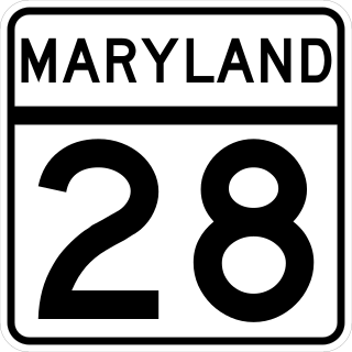
Maryland Route 28 is a state highway in the U.S. state of Maryland. The state highway runs 37.38 miles (60.16 km) from U.S. Route 15 in Point of Rocks east to MD 182 in Norwood. The western portion of MD 28 is a rural highway connecting several villages in southern Frederick County and western Montgomery County. By contrast, the eastern portion of the state highway is a major east–west commuter route, particularly within Gaithersburg and Rockville.

<span class="mw-page-title-main">U.S. Route 1 in Maryland</span> Section of U.S. Route in Maryland, United States

U.S. Route 1 (US 1) is the easternmost and longest of the major north–south routes of the older 1920s era United States Numbered Highway System, running from Key West, Florida, to Fort Kent, Maine. In the U.S. state of Maryland, it runs 81 miles (130 km) from the Washington, D.C. line to the Pennsylvania state line near the town of Rising Sun.

<span class="mw-page-title-main">Maryland Route 140</span> State highway in Maryland, US

Maryland Route 140 is a 49-mile (79 km) state highway in the U.S. state of Maryland. The route runs from U.S. Route 1 and US 40 Truck in Baltimore northwest to the Pennsylvania border, where the road continues into that state as Pennsylvania Route 16. MD 140 passes through the northern part of central Maryland, connecting Baltimore, Pikesville, Reisterstown, Westminster, Taneytown, and Emmitsburg.

<span class="mw-page-title-main">Maryland Route 27</span> State highway in Maryland, United States

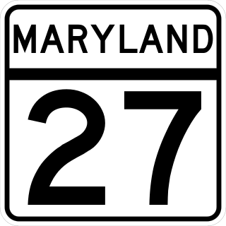
Maryland Route 27 is a state highway in the U.S. state of Maryland. Known for most of its length as Ridge Road, the highway runs 39.17 miles (63.04 km) from MD 355 in Germantown north to MD 30 in Manchester. MD 27 follows a ridge that separates several watersheds in northern Montgomery County and Carroll County. The highway connects Germantown and Manchester with Damascus in far northern Montgomery County; Westminster, the county seat of Carroll County; and Mount Airy, which lies at the junction of Carroll, Frederick, Howard, and Montgomery counties and where MD 27 intersects Interstate 70 (I-70)/U.S. Route 40.

<span class="mw-page-title-main">U.S. Route 40 in Maryland</span> Section of U.S. Highway in Maryland, United States

U.S. Route 40 in the U.S. state of Maryland runs from Garrett County in Western Maryland to Cecil County in the state's northeastern corner. With a total length of 221 miles (356 km), it is the longest numbered highway in Maryland. Almost half of the road overlaps or parallels with Interstate 68 (I-68) or I-70, while the old alignment is generally known as US 40 Alternate, US 40 Scenic, or Maryland Route 144. West of Baltimore, in the Piedmont and Appalachian Mountains / Blue Ridge region of the Western Maryland panhandle of the small state, the portions where it does not overlap an Interstate highway are mostly two-lane roads. The portion northeast of Baltimore going toward Wilmington in northern Delaware and Philadelphia in southeastern Pennsylvania is a four-lane divided highway, known as the Pulaski Highway. This section crosses the Susquehanna River at the north end of the Chesapeake Bay on the Thomas J. Hatem Memorial Bridge.

<span class="mw-page-title-main">U.S. Route 15 in Maryland</span> Part of the U.S. Highway System in Maryland

U.S. Route 15 (US 15) is a part of the United States Numbered Highway System that runs from Walterboro, South Carolina, north to Painted Post, New York. In Maryland, the highway runs 37.85 miles (60.91 km) from the Virginia state line at the Potomac River in Point of Rocks north to the Pennsylvania state line near Emmitsburg. Known for most of its length as Catoctin Mountain Highway, US 15 is the primary north–south highway of Frederick County. The highway connects the county seat of Frederick with Point of Rocks, Leesburg, Virginia, and Charles Town, West Virginia, to the south and with Thurmont, Emmitsburg, and Gettysburg, Pennsylvania, to the north. US 15 is a four-lane divided highway throughout the state except for the portion between the Point of Rocks Bridge and the highway's junction with US 340 near Jefferson. The highway is a freeway along its concurrency with US 340 and through Frederick, where the highway meets US 40 and Interstate 70 (I-70). US 15 has a business route through Emmitsburg.

<span class="mw-page-title-main">Randolph Road</span> County highway in Montgomery County, Maryland, US

Randolph Road is a county highway in the U.S. state of Maryland. The highway is the major component of a mostly four- to six-lane 16.8-mile (27.0 km) highway spanning southern Montgomery County and northwestern Prince George's County that also includes Montrose Road, Josiah Henson Memorial Parkway, and Cherry Hill Road, and forms an important link between eastern Montgomery County and Rockville. Montrose Road begins at Maryland Route 189 in Potomac. The highway heads east through a junction with Interstate 270 (I-270) before the main course continues as Josiah Henson Memorial Parkway in North Bethesda. Josiah Henson Memorial Parkway continues through a junction with MD 355, east of which the highway becomes Randolph Road. Randolph Road intersects MD 586 and MD 185 in Wheaton, MD 97 in Glenmont, and MD 650 in Colesville. The highway continues southeast toward Fairland, where it meets U.S. Route 29. The highway continues from US 29 as Cherry Hill Road through an intersection with MD 212 in Calverton before reaching its eastern end at US 1 in College Park.

<span class="mw-page-title-main">Maryland Route 586</span> Highway in Montgomery County, Maryland, United States

Maryland Route 586 is a state highway in the U.S. state of Maryland. Known as Veirs Mill Road, the highway runs 5.78 miles (9.30 km) from MD 28 and MD 911 in Rockville east to MD 97 in Wheaton. MD 586 is a four- to six-lane northwest–southeast highway through southern Montgomery County. The highway was originally constructed in the mid-1930s. MD 586 was expanded to a divided highway in the mid-1950s.

<span class="mw-page-title-main">Maryland Route 109</span> State highway in Montgomery County, Maryland, US

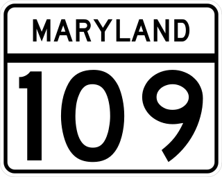
Maryland Route 109 is a state highway in the U.S. state of Maryland. The highway runs 11.87 miles (19.10 km) from MD 107 in Poolesville north to MD 355 in Hyattstown. MD 109 connects the northwestern Montgomery County communities of Poolesville, Beallsville, Barnesville, and Hyattstown with each other and with Interstate 270 (I-270). The highway was built between Beallsville and Barnesville by 1910. MD 109 was extended to Poolesville in the early 1920s and to Comus in the late 1920s. The route was extended north through its early 1950s interchange with I-270 to Hyattstown in the late 1950s.

<span class="mw-page-title-main">Maryland Route 191</span> State highway in Montgomery County, Maryland, known for most of its length as Bradley Boulevard

Maryland Route 191 is a state highway in southwestern Montgomery County in the U.S. state of Maryland.

References

  1. "Metropolitan Washington", Amoco map, 1959
  2. 1 2 1946 DC Map
  3. 1 2 Torch & Trefoil. Fall 1968. Vol. 44, No. 1. p. 2.
Template:Attached KML/U.S. Route 240
KML is not from Wikidata