
Reisterstown is an unincorporated community and census-designated place in Baltimore County, Maryland, United States. As of the 2010 census, it had a population of 25,968.

Interstate 795 (I-795), also known as the Northwest Expressway, is a nine-mile (14 km) auxiliary Interstate Highway linking Baltimore's northwestern suburbs of Pikesville, Owings Mills, and Reisterstown, Maryland, to the Baltimore Beltway (I-695). The route bypasses Maryland Route 140, carrying part of the Maryland Transit Administration (MTA)'s Baltimore Metro SubwayLink in its median for a four-mile (6.4 km) stretch, and provides direct access to the former Owings Mills Mall. It never connects to its parent, I-95, except via I-695.
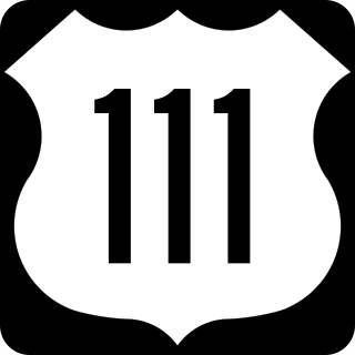
U.S. Route 111 (US 111) was a U.S. Highway that extended from Baltimore, Maryland north to the Harrisburg, Pennsylvania area. It replaced part of the Susquehanna Trail, partially signed as Pennsylvania Route 4, and was in turn replaced by Interstate 83 (I-83). Portions of its pre-freeway alignment are now Maryland Route 45 and I-83 Business. Other old sections in Pennsylvania are now unsigned Quadrant Routes or township-maintained roads. US 111 extended north to the Pennsylvania–New York state line where U.S. Route 15 now crosses it between 1928 and 1937.

U.S. Route 240 is a defunct designation for a short, but once very important, segment of highway between Frederick, Maryland, and Washington, D.C. It is now commonly known as Wisconsin Avenue, Maryland Route 355, and Interstate 270 (I-270).
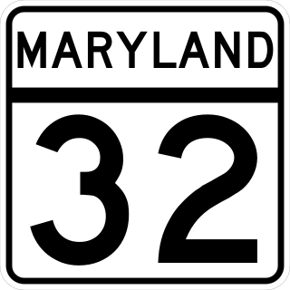
Maryland Route 32 (MD 32) is a state highway in the U.S. state of Maryland. The road runs 51.79 miles (83.35 km) from Interstate 97 (I-97) and MD 3 in Millersville west and north to Washington Road in Westminster. The 30 mile four- to six-lane freeway portion of MD 32 is the Patuxent Freeway between I-97 and I-70 in West Friendship. The freeway passes through Odenton and Fort Meade, the site of Fort George G. Meade and the National Security Agency (NSA), in western Anne Arundel County and along the southern part of Columbia in Howard County. Via I-97, MD 32 connects those communities with U.S. Route 50 (US 50)/US 301 in Annapolis. MD 32 also intersects the four primary highways connecting Baltimore and Washington: the Baltimore–Washington Parkway, US 1, I-95, and US 29. MD 32's north–south section, Sykesville Road, connects West Friendship and Westminster by way of Sykesville and Eldersburg in southern Carroll County.
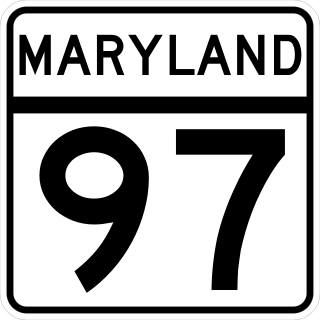
Maryland Route 97 (MD 97) is a state highway in the U.S. state of Maryland. The route runs 55.27 mi (88.95 km) from U.S. Route 29 (US 29) in Silver Spring, Montgomery County, north to the Pennsylvania border in Carroll County, where the road continues into that state as Pennsylvania Route 97 (PA 97). Throughout most of Montgomery County, MD 97 is known as Georgia Avenue, which continues south from the southern terminus along US 29 into Washington, D.C. It is a suburban four- to six-lane divided highway from Silver Spring north to Olney. From here, the route continues as a rural two-lane undivided road north through Brookeville and into Howard County. MD 97 continues through Carroll County where it passes through the county seat of Westminster. The route intersects many major roads, including Interstate 495 north of Silver Spring, MD 28 and MD 200 in Norbeck, I-70/US 40 near Cooksville, MD 26 in Dorsey Crossroads, and MD 27, MD 32, and MD 140 in the Westminster area.
The Baltimore Pike was an auto trail connecting Baltimore, Maryland, with Philadelphia, Pennsylvania.

Pennsylvania Route 94 is a 30-mile (48 km) long north–south state highway located in southern Pennsylvania. The southern terminus of the route is at the Mason–Dixon line, where PA 94 continues into Maryland as Maryland Route 30. The northern terminus is at PA 34 south of Mount Holly Springs. PA 94 heads north-northwest from the state line through southwestern York County, where it passes through Hanover and intersects PA 116/PA 194 in the center of town. Past Hanover, the route heads into rural areas and crosses into the eastern portion of Adams County. Here, PA 94 intersects U.S. Route 30 east of New Oxford, PA 394 in Hampton, PA 234 north of Hampton, and US 15 in York Springs. The route heads into Cumberland County and crosses South Mountain, reaching its end at PA 34. PA 94 is designated as the 94th Infantry Division Memorial Highway for its entire length.

Pennsylvania Route 97 is one of two Pennsylvania state highways that carries the PA 97 designation; the other PA 97 is in Erie County. This southern PA 97, known for most of its length as Baltimore Pike, runs 9.363 miles (15.068 km) from the Maryland state line near Littlestown, where the highway continues as Maryland Route 97, northwest to U.S. Route 15 near Gettysburg. PA 97 connects Gettysburg and Littlestown in southeastern Adams County. The highway also links those communities with Westminster and Baltimore. From PA 97's northern end, Baltimore Pike continues toward Gettysburg as State Route 2035 through the Gettysburg Battlefield Historic District, where it provides access to the Gettysburg Museum and Visitor Center.

Maryland Route 140 is a 49-mile (79 km) state highway in the U.S. state of Maryland. The route runs from U.S. Route 1 and US 40 Truck in Baltimore northwest to the Pennsylvania border, where the road continues into that state as Pennsylvania Route 16. MD 140 passes through the northern part of central Maryland, connecting Baltimore, Pikesville, Reisterstown, Westminster, Taneytown, and Emmitsburg.
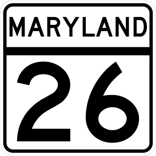
Maryland Route 26 is a state highway in the U.S. state of Maryland. Known for most of its length as Liberty Road, the state highway runs 44.10 miles (70.97 km) from U.S. Route 15 in Frederick east to MD 140 in Baltimore. MD 26 connects Frederick and Baltimore with the highway's namesake of Libertytown in eastern Frederick County, the suburban area of Eldersburg in southern Carroll County, and the western Baltimore County suburbs of Randallstown, Milford Mill, and Lochearn. The highway also serves as a major thoroughfare in the western part of Baltimore, where the street is named Liberty Heights Avenue. MD 26 is maintained by the Maryland State Highway Administration outside of Baltimore and by the Baltimore City Department of Transportation within the city.
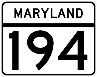
Maryland Route 194 (MD 194) is a state highway in the U.S. state of Maryland. The state highway runs 23.87 miles (38.42 km) from MD 26 in Ceresville north to the Pennsylvania state line near Taneytown, where the highway continues as Pennsylvania Route 194 (PA 194) toward Hanover. MD 194 is the main highway between Frederick and Hanover; the state highway connects the towns of Walkersville and Woodsboro in northeastern Frederick County with Keymar and Taneytown in northwestern Carroll County. MD 194 was blazed as a migration route in the 18th century and a pair of turnpikes in Frederick County in the 19th century, one of which was the last private toll road in Maryland. The state highway, which was originally designated MD 71, was built as a modern highway in Frederick County in the mid-1920s and constructed as Francis Scott Key Highway in Carroll County in the late 1920s and early 1930s. MD 194 received its modern route number in 1956 as part of a three-route number swap. The state highway's bypasses of Walkersville and Woodsboro opened in the early 1980s and mid-1990s, respectively.

Maryland Route 30 is a state highway in the U.S. state of Maryland. Known for most of its length as Hanover Pike, the highway runs 19.16 miles (30.84 km) from MD 140 in Reisterstown north to the Pennsylvania state line near Melrose, where the highway continues as Pennsylvania Route 94. MD 30 is a major, two-lane regional highway in western Baltimore County and northeastern Carroll County. Locally, the highway serves the towns of Manchester and Hampstead; the latter town is bypassed by the highway but served by a business route. Regionally, MD 30 connects Reisterstown and Baltimore with Hanover, Pennsylvania.

U.S. Route 15 (US 15) is a part of the United States Numbered Highway System that runs from Walterboro, South Carolina, north to Painted Post, New York. In Maryland, the highway runs 37.85 miles (60.91 km) from the Virginia state line at the Potomac River in Point of Rocks north to the Pennsylvania state line near Emmitsburg. Known for most of its length as Catoctin Mountain Highway, US 15 is the primary north–south highway of Frederick County. The highway connects the county seat of Frederick with Point of Rocks, Leesburg, Virginia, and Charles Town, West Virginia, to the south and with Thurmont, Emmitsburg, and Gettysburg, Pennsylvania, to the north. US 15 is a four-lane divided highway throughout the state except for the portion between the Point of Rocks Bridge and the highway's junction with US 340 near Jefferson. The highway is a freeway along its concurrency with US 340 and through Frederick, where the highway meets US 40 and Interstate 70 (I-70). US 15 has a business route through Emmitsburg.

Pennsylvania Route 194 is a 31-mile-long (50 km) north–south state highway located in south-central Pennsylvania. The southern end is at the Maryland state line, where it continues south as Maryland Route 194, and the northern terminus is at the intersection with PA 74 near the borough of Dillsburg. PA 194 heads northeast from the state line through rural areas in southeastern Adams County, intersecting PA 97 in Littlestown. The route continues into the southwestern section of York County and passes through Hanover, where it forms a concurrency with PA 116 and crosses PA 94 in the downtown area. Past here, PA 194 heads north and crosses back into the eastern portion of Adams County, passing through rural land and intersecting U.S. Route 30 in Abbottstown and PA 234 in East Berlin. The route heads into the northwestern portion of York County and passes through Franklintown before coming to its northern terminus.
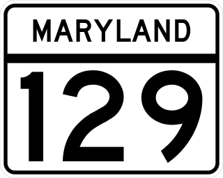
Maryland Route 129 is a state highway in the U.S. state of Maryland, running north-northwesterly from U.S. Route 40 and MD 295 in the city of Baltimore into Baltimore County, ending at Garrison Forest Road east of Reisterstown. The route leaves downtown on the one-way pair of McCulloh Street and Druid Hill Avenue, and then uses the entire length of Park Heights Avenue to the end. MD 129 connects Downtown Baltimore with Druid Hill Park using McCulloh Street and Druid Hill Avenue. As Park Heights Avenue, the state highway is one of two primary radial routes in the northwestern part of the city, providing access to The Maryland Zoo and Pimlico Race Course. In Baltimore County, MD 129 passes through Pikesville, where it has a junction with Interstate 695 (I-695) and serves an affluent rural area north of Pikesville and east of Reisterstown.
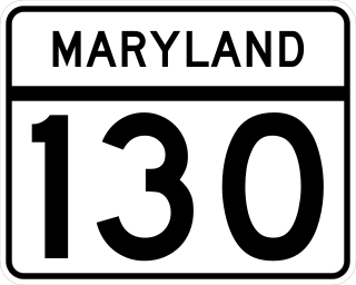
Maryland Route 130 is a state highway located in Baltimore County in the U.S. state of Maryland. Known as Greenspring Valley Road, the state highway runs 5.57 miles (8.96 km) from MD 140 in Garrison east to MD 25 in Brooklandville. MD 130 passes through the Green Spring Valley, an affluent area around the upper reaches of Jones Falls that contains Stevenson University. The state highway was paved by 1910 except for a gap near Stevenson that was closed in the mid-1930s.

Maryland Route 64 is a state highway in the U.S. state of Maryland. The state highway runs 13.33 miles (21.45 km) from U.S. Route 40 in Hagerstown east to the Pennsylvania state line near Ringgold, where the highway continues north as Pennsylvania Route 997. MD 64 is an L-shaped route in northeastern Washington County, connecting Hagerstown with Smithsburg, Cavetown, and Chewsville and Smithsburg with Ringgold and Waynesboro, Pennsylvania. The state highway is maintained by the Maryland State Highway Administration except for the municipally-maintained portion within the city limits of Hagerstown. MD 64 was once a turnpike between Hagerstown and Smithsburg. The state highway was constructed from Smithsburg to the Pennsylvania state line in the mid 1910s and from Hagerstown to Smithsburg in the early 1920s. MD 64 was reconstructed in its entirety in the 1950s, resulting in bypasses of all four communities east of Hagerstown the highway serves.

Maryland Route 128 is a state highway located in Baltimore County in the U.S. state of Maryland. Known as Butler Road, the state highway runs 7.62 miles (12.26 km) from MD 30 in Reisterstown east to MD 25 at Butler. MD 128 was constructed in the early 1930s east of Glyndon. The state highway was extended west to MD 30 in the late 1940s concurrent with the removal of the parallel MD 127 in Reisterstown. An intermediate section of MD 128 was maintained by Baltimore County and MD 127 temporarily returned to its old route between 1970 and 1987.

Maryland Route 496 is a state highway in the U.S. state of Maryland. Known as Bachmans Valley Road, the state highway runs 7.23 miles (11.64 km) from MD 97 near Pleasant Valley east to MD 30 in Melrose. MD 496 was constructed from Pleasant Valley to Bachman Mills in the mid-1930s. The state highway was completed to Melrose in the late 1940s.

