The Mississippi River is the primary river, and second-longest river, of the largest drainage basin in the United States. From its traditional source of Lake Itasca in northern Minnesota, it flows generally south for 2,340 miles (3,766 km) to the Mississippi River Delta in the Gulf of Mexico. With its many tributaries, the Mississippi's watershed drains all or parts of 32 U.S. states and two Canadian provinces between the Rocky and Appalachian mountains. The main stem is entirely within the United States; the total drainage basin is 1,151,000 sq mi (2,980,000 km2), of which only about one percent is in Canada. The Mississippi ranks as the thirteenth-largest river by discharge in the world. The river either borders or passes through the states of Minnesota, Wisconsin, Iowa, Illinois, Missouri, Kentucky, Tennessee, Arkansas, Mississippi, and Louisiana.

Interstate 20 (I‑20) is a major east–west Interstate Highway in the Southern United States. I-20 runs 1,539 miles (2,477 km) beginning at an interchange with I-10 in Reeves County, Texas, and ending at an interchange with I-95 in Florence, South Carolina. Between Texas and South Carolina, I-20 runs through northern Louisiana, Mississippi, Alabama, and Georgia. The major cities that I-20 connects to include Dallas-Fort Worth, Texas; Shreveport, Louisiana; Jackson, Mississippi; Birmingham, Alabama; Atlanta, Georgia; and Columbia, South Carolina.

Warren County is a county located in the U.S. state of Mississippi. Its western border is formed by the Mississippi River. As of the 2020 census, the population was 44,722. Its county seat is Vicksburg. Established by legislative act of December 22, 1809, Warren County is named for American Revolutionary War officer Joseph Warren.

Vicksburg is a historic city in Warren County, Mississippi, United States. It is the county seat. The population was 21,573 at the 2020 census. Located on a high bluff on the east bank of the Mississippi River across from Louisiana, Vicksburg was built by French colonists in 1719. The outpost withstood an attack from the native Natchez people. It was incorporated as Vicksburg in 1825 after Methodist missionary Newitt Vick. The area that is now Vicksburg was long occupied by the Natchez Native Americans as part of their historical territory along the Mississippi. The first Europeans who settled the area were French colonists who built Fort Saint Pierre in 1719 on the high bluffs overlooking the Yazoo River at present-day Redwood. They conducted fur trading with the Natchez and others, and started plantations. During the American Civil War, it was a key Confederate river-port, and its July 1863 surrender to Ulysses S. Grant, along with the concurrent Battle of Gettysburg, marked the turning-point of the war.

U.S. Route 61 or U.S. Highway 61 (U.S. 61) is a major United States highway that extends 1,400 miles (2,300 km) between New Orleans, Louisiana and the city of Wyoming, Minnesota. The highway generally follows the course of the Mississippi River and is designated the Great River Road for much of its route. As of 2004, the highway's northern terminus in Wyoming, Minnesota, is at an intersection with Interstate 35 (I-35). Until 1991, the highway extended north on what is now Minnesota State Highway 61 through Duluth to the Canada–U.S. border near Grand Portage, then continued to Thunder Bay, Canada, as Ontario Highway 61. Its southern terminus in New Orleans is at an intersection with U.S. Route 90. The route was an important south–north connection in the days before the interstate highway system.

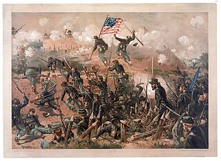
The Siege of Vicksburg was the final major military action in the Vicksburg campaign of the American Civil War. In a series of maneuvers, Union Major General Ulysses S. Grant and his Army of the Tennessee crossed the Mississippi River and drove the Confederate Army of Mississippi, led by Lieutenant General John C. Pemberton, into the defensive lines surrounding the fortress city of Vicksburg, Mississippi, leading to the successful siege and Confederate surrender.

The Vicksburg campaign was a series of maneuvers and battles in the Western Theater of the American Civil War directed against Vicksburg, Mississippi, a fortress city that dominated the last Confederate-controlled section of the Mississippi River. The Union Army of the Tennessee under Major General Ulysses S. Grant gained control of the river by capturing this stronghold and defeating Lieutenant General John C. Pemberton's forces stationed there.

U.S. Route 80 or U.S. Highway 80 (US 80) is a major east–west United States Numbered Highway in the Southern United States, much of which was once part of the early auto trail known as the Dixie Overland Highway. As the "0" in the route number indicates, it was originally a cross-country route, from the Pacific Ocean to the Atlantic Ocean. Its original western terminus was at Historic US 101 in San Diego, California. However, the entire segment west of Dallas, Texas, has been decommissioned in favor of various Interstate Highways and state highways. Currently, the highway's western terminus is at an interchange with Interstate 30 (I-30) on the Dallas–Mesquite city line. Its eastern terminus is in Tybee Island, Georgia near the Atlantic Ocean. Between Jonesville, Texas and Kewanee, Mississippi, US 80 runs parallel to or concurrently with Interstate 20. It also currently runs through Dallas, Texas; Shreveport, Louisiana; Jackson, Mississippi; Montgomery, Alabama; Columbus, Georgia; Macon, Georgia; and Savannah, Georgia.

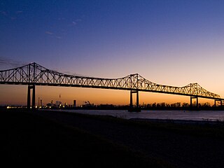
The Sunshine Bridge is a cantilever bridge over the Mississippi River in St. James Parish, Louisiana. Completed in 1963, it carries Louisiana Highway 70 (LA70), which connects Donaldsonville on the west bank of Ascension Parish with Sorrento on the east bank of Ascension Parish as well as with Gonzales on the east bank of Ascension Parish. The approach roads on the east and west banks begin in Ascension Parish before crossing into St. James Parish.

The Natchez–Vidalia Bridge are two twin cantilever bridges carrying U.S. Route 84, and 425 across the Mississippi River between Vidalia, Louisiana and Natchez, Mississippi. It is the tallest bridge in Mississippi.

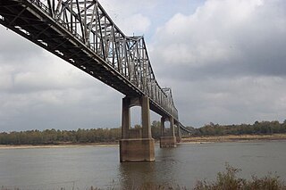
The Old Vicksburg Bridge, also known as Mississippi River Bridge, is a cantilever bridge carrying one rail line across the Mississippi River between Delta, Louisiana and Vicksburg, Mississippi.

The Benjamin G. Humphreys Bridge was a two-lane cantilevered truss bridge carrying U.S. Route 82/U.S. Route 278 across the Mississippi River between Lake Village, Arkansas and Greenville, Mississippi. It was the first bridge to connect the two towns. The bridge was named for Benjamin G. Humphreys II, a former United States Congressman from Greenville.

The Jackson Avenue–Gretna ferry was a ferry across the Mississippi River in the U.S. state of Louisiana, connecting Jackson Avenue in New Orleans with Huey P. Long Avenue in Gretna. It carried automobiles for $1.00; bicycles and pedestrians for free. The Crescent City Connection Division of the Louisiana Department of Transportation and Development operated the ferry on weekdays from 06:00 to 20:45.

Louisiana Highway 10 (LA 10) is a state highway located in southern Louisiana. It runs 255.51 miles (411.20 km) in an east–west direction from U.S. Highway 171 (US 171) south of Leesville to the Mississippi state line east of Bogalusa.
The Edgard–Reserve Ferry was a ferry across the Mississippi River in the U.S. state of Louisiana, connecting Edgard and Reserve. The ferry was one of three routes then operated by the Louisiana Department of Highways, District 2. The others were the vehicle Luling–Destrehan Ferry and the pedestrian Taft–Norco Ferry. The ferry ceased operation on July 31, 2013.

The Pointe à la Hache Ferry or Pointe a la Hache Ferry, is a ferry across the Mississippi River in the U.S. state of Louisiana, connecting West Pointe à la Hache and Pointe à la Hache in Plaquemines Parish, Louisiana. Currently, it is $1 for single or double axle vehicles, three or more axles are $2. It is the last vehicle crossing of the river in the down river direction. The East Bank side of the ferry is near the end of paved roadway; on the West Bank the river road continues down to Venice, Louisiana. As the eastbank of Plaquemines Parish has little population in the aftermath of Hurricane Katrina, ferry service to the eastbank occurs at the top of every hour between 6 AM and 10 PM, as well as at 6:30 AM. Likewise, ferry service to the westbank occurs at 6:15 AM, 6:45 AM, and on the bottom of every hour between 7:30 AM and 10:30 PM.

Interstate 20 (I-20) is a part of the Interstate Highway System that spans 1,539.38 miles (2,477.39 km) from Reeves County, Texas, to Florence, South Carolina. Within the state of Louisiana, the highway travels 189.84 miles (305.52 km) from the Texas state line west of Greenwood to the Mississippi River, which it crosses into Vicksburg, Mississippi.

Several special routes of U.S. Route 61 exist in the states of Louisiana, Mississippi, Missouri, and Iowa.

U.S. Highway 65 (US 65) is a part of the United States Numbered Highway System that spans 966 miles (1,555 km) from Clayton, Louisiana to Albert Lea, Minnesota. Within the state of Louisiana, the highway travels 100.77 miles (162.17 km) from the national southern terminus at US 425/LA 15 in Clayton to the Arkansas state line north of Lake Providence.
The Luling–Destrehan Ferry was a ferry across the Mississippi River in the U.S. state of Louisiana, connecting Luling and Destrehan. The ferry was one of three routes then operated by the Louisiana Department of Highways, District 2. The others were the pedestrian Taft–Norco Ferry and the vehicle Edgard–Reserve Ferry. The ferry ceased operation in October 1983 with the opening of the Luling-Destrehan Bridge.


