West Siloam Springs, Oklahoma

Last updated

West Siloam Springs, Oklahoma
OKMap-doton-WestSiloamSprings.PNG
Location of West Siloam Springs, Oklahoma
Coordinates: 36°10′34″N94°35′50″W / 36.17611°N 94.59722°W / 36.17611; -94.59722
Country United States
State Oklahoma
County Delaware
Area
[1]
  Total3.84 sq mi (9.94 km2)
  Land3.84 sq mi (9.94 km2)
  Water0.00 sq mi (0.00 km2)
Elevation
[2]
1,158 ft (353 m)
Population
 (2020)
  Total1,000
  Density260.48/sq mi (100.57/km2)
Time zone UTC-6 (Central (CST))
  Summer (DST) UTC-5 (CDT)
FIPS code 40-80350 [3]
GNIS feature ID2413468 [2]

West Siloam Springs is a town in Delaware County, Oklahoma, United States. The population was 1,000 at the 2020 census, an 18.2 percent increase from the figure of 846 recorded in 2010. [4] A bedroom community for Siloam Springs, Arkansas, it is notable for its Cherokee casino, [5] and is the closest town to Natural Falls State Park. [6]

Contents

History

In the mid-20th century, the population of Siloam Springs, Arkansas spilled across the Oklahoma - Arkansas state line, creating the need for Oklahoma-based town government. The population of the community had grown to 142 by July 10, 1969, when 35 out of 49 eligible voters approved incorporation. [6]

Geography

West Siloam Springs is immediately west of Siloam Springs, Arkansas.

According to the United States Census Bureau, the town has a total area of 3.5 square miles (9.1 km2), all land.

Demographics

Historical population
CensusPop.Note
1970 210
1980 431105.2%
1990 53925.1%
2000 87762.7%
2010 846−3.5%
2020 1,00018.2%
U.S. Decennial Census [7]

As of the census [3] of 2000, there were 877 people, 306 households, and 205 families residing in the town. The population density was 253.9 inhabitants per square mile (98.0/km2). There were 349 housing units at an average density of 101.1 per square mile (39.0/km2). The racial makeup of the town was 76.40% White, 0.11% African American, 11.74% Native American, 0.57% Asian, 1.14% from other races, and 10.03% from two or more races. Hispanic or Latino of any race were 4.56% of the population.

There were 306 households, out of which 30.1% had children under the age of 18 living with them, 47.4% were married couples living together, 13.4% had a female householder with no husband present, and 33.0% were non-families. 26.8% of all households were made up of individuals, and 8.8% had someone living alone who was 65 years of age or older. The average household size was 2.45 and the average family size was 2.95.

In the town, the population was spread out, with 22.7% under the age of 18, 6.8% from 18 to 24, 27.1% from 25 to 44, 20.9% from 45 to 64, and 22.5% who were 65 years of age or older. The median age was 41 years. For every 100 females, there were 85.4 males. For every 100 females age 18 and over, there were 78.0 males.

The median income for a household in the town was $28,750, and the median income for a family was $31,953. Males had a median income of $22,243 versus $20,000 for females. The per capita income for the town was $12,858. About 13.4% of families and 18.3% of the population were below the poverty line, including 20.0% of those under age 18 and 26.2% of those age 65 or over.

Transportation

The town is located on U.S routes 59 and 412. [8]

Smith Field, a/k/a the Siloam Springs Municipal Airport, is approximately six miles to the east, [9] and features a paved runway of almost 5000’. [10] Commercial air transportation is available from Northwest Arkansas Regional Airport, about 24 miles to the east-northeast. [11]

Natural Falls State Park

Nearby is Natural Falls State Park, off Hwy 412 west of town. [12] one of the most beautiful scenic wonders in the state of Oklahoma. The natural setting and scenic beauty of the waterfall is known to millions of movie lovers. The popular 1974 film Where the Red Fern Grows was filmed in part at Natural Falls (then called Dripping Springs). The movie tells the story of a young boy growing up in rural Oklahoma during the hard times of the Great Depression and is considered an American classic.

Hildebrand Mill

To the west of town about 10 miles is Hildebrand Mill, a 1907 water-powered grain mill, later used up to 1967 as a gas-powered lumber mill. It is on the National Register of Historic Places listings in Delaware County, Oklahoma.

Related Research Articles

<span class="mw-page-title-main">Delaware County, Oklahoma</span> County in Oklahoma, United States

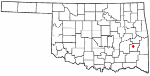
Delaware County is a county located in the U.S. state of Oklahoma. As of the 2020 census, the population was 40,397. Its county seat is Jay. The county was named for the Delaware Indians, who had established a village in the area prior to the Cherokees being assigned to relocate to Indian Territory in the 1830s. Delaware County was created in 1907. Prior to becoming Delaware County, a large portion of the area was known as the Delaware District of the Cherokee Nation. Today, Delaware County continues to be recognized by the Cherokee Nation as the Delaware District.

<span class="mw-page-title-main">Benton County, Arkansas</span> County in Arkansas, United States

Benton County is a county within the Northwest Arkansas region with a culture, economy, and history that have transitioned from rural and agricultural to suburban and white collar since the growth of Walmart, which is headquartered in Benton County. Created as Arkansas's 35th county on September 30, 1836, Benton County contains thirteen incorporated municipalities, including Bentonville, the county seat, and Rogers, the most populous city. The county was named after Thomas Hart Benton, a U.S. Senator from Missouri influential in Arkansas statehood.

<span class="mw-page-title-main">Decatur, Arkansas</span> City in Arkansas, United States

Decatur is a city, in Benton County, Arkansas, United States. The population was 1,773 at the 2020 census. It is part of the Northwest Arkansas region. This town is named after Commodore Stephen Decatur, Jr.

<span class="mw-page-title-main">Gentry, Arkansas</span> City in Arkansas, United States

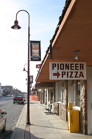
Gentry is a city in Benton County, Arkansas, United States. The population was 3,790 as of the 2020 census. The city was founded in the Ozark Mountains in 1894 along what would become the Kansas City Southern Railroad. The city's prior prosperity in the orchard industry, especially apples, was further strengthened by the rail connection. Following the decline of the apple industry in the 1930s, Gentry shifted its economy towards poultry along with many other areas of Northwest Arkansas.

<span class="mw-page-title-main">Siloam Springs, Arkansas</span> City in Arkansas, United States

Siloam Springs is a city in Benton County, Arkansas, United States, and located on the western edge of the Northwest Arkansas metropolitan area. As of the 2020 census, the population of the city was 17,287. The community was founded in 1882 and was characterized by the purported healing powers of the spring water feeding Sager Creek and trading with nearby Native American tribes. The city shares a border on the Arkansas–Oklahoma state line with the city of West Siloam Springs, Oklahoma, which is within the Cherokee Nation territory. It is home of John Brown University.

<span class="mw-page-title-main">Lockesburg, Arkansas</span> City in Arkansas, United States

Lockesburg is a city in Sevier County, Arkansas, United States. The population was 739 at the 2010 census.

<span class="mw-page-title-main">Southwest City, Missouri</span> City in Missouri, United States

Southwest City is a city in McDonald County, Missouri, United States. The population was 922 at the 2020 census. It is located in the southwestern corner of the state of Missouri.

<span class="mw-page-title-main">Watts, Oklahoma</span> Town in Oklahoma, United States

Watts is a town in northern Adair County, Oklahoma, United States. It was named for John Watts, also known as Young Tassel, a Chickamauga Cherokee chief, who died in 1802. The population was 324 at the 2010 census, an increase of 2.5 percent over the figure of 316 recorded in 2000.

<span class="mw-page-title-main">Westville, Oklahoma</span> Township in Oklahoma, United States

Westville is a town in Adair County, Oklahoma, located in the foothills of the Ozark Mountains. Westville lies at the junction of U.S. Highways 59 and 62, and approximately 13 miles north of Stilwell, the county seat.

<span class="mw-page-title-main">Colcord, Oklahoma</span> Town in Oklahoma, United States

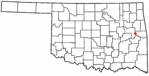
Colcord is a town in southern Delaware County, Oklahoma, United States. The community lies in the northeastern part of the state in a region known as Green Country. The population was 815 at the 2010 census, a decline of 0.5 percent from the figure of 819 recorded in 2000.

Dripping Springs is an unincorporated community and census-designated place (CDP) in Delaware County, Oklahoma, United States. The population was 50 at the 2010 census, up from the figure of 41 recorded in 2000.

<span class="mw-page-title-main">Vici, Oklahoma</span> Town in Oklahoma, United States

Vici is a town in Dewey County, Oklahoma, United States. The population was 611 at the time of the 2020 census. No information appears on the origins of the town name, but Vici is Latin for “I conquered.”

<span class="mw-page-title-main">Wilburton, Oklahoma</span> City in Oklahoma, United States

Wilburton is a city in Latimer County, Oklahoma, United States. It is the county seat of Latimer County. The city had a population of 2,285 as of the 2020 Census. Robbers Cave State Park is 5 miles (8.0 km) north of Wilburton.

<span class="mw-page-title-main">Pocola, Oklahoma</span> Town in Oklahoma, United States

Pocola is a town in Le Flore County, Oklahoma, United States. It is part of the Fort Smith, Arkansas-Oklahoma metropolitan area. The population was 4,056 in 2010, a gain of 1.6 percent over the figure of 3,994 recorded in 2000. Pocola is a Choctaw word meaning "ten", the approximate distance in miles from Fort Smith, Arkansas.

<span class="mw-page-title-main">Valliant, Oklahoma</span> Town in Oklahoma, United States

Valliant is a town in McCurtain County, Oklahoma, United States. The population was 754 at the 2010 census.

<span class="mw-page-title-main">Haskell, Oklahoma</span> Town in Oklahoma, United States

Haskell is a city, as of March 2024, in Muskogee County, Oklahoma, United States. The population was 2,007 at the 2010 census, a gain of 13.7 percent over the figure of 1,765 recorded in 2000. Haskell was established in 1904 on the Midland Valley Railroad. It was named for town site developer Charles N. Haskell, who would become the first governor of the State of Oklahoma in 1907.

<span class="mw-page-title-main">Gore, Oklahoma</span> Town in Oklahoma, United States

Gore is a town in western Sequoyah County, Oklahoma, United States. It is part of the Fort Smith, Arkansas-Oklahoma Metropolitan Statistical Area. The population was 977 at the 2010 census, an increase of 15 percent over the figure of 850 recorded in 2000.

<span class="mw-page-title-main">Sallisaw, Oklahoma</span> City in Oklahoma, United States

Sallisaw is a city and county seat in Sequoyah County, Oklahoma, United States. As of the 2010 Census, it had a population of 8,880, an 11.2 percent increase over the figure of 7,891 recorded in 2000. Sallisaw is part of the Fort Smith, Arkansas–Oklahoma Metropolitan Statistical Area.

<span class="mw-page-title-main">Wagoner, Oklahoma</span> City in Oklahoma, United States

Wagoner is a city in Wagoner County, Oklahoma, United States. The population was 8,323 at the 2010 census, compared to the figure of 7,669 recorded in 2000. It is the county seat of Wagoner County. Wagoner became the first city incorporated in Indian Territory on January 4, 1896.

<span class="mw-page-title-main">Hammon, Oklahoma</span> Town in Oklahoma, United States

Hammon is a town in the U.S. state of Oklahoma, the majority of which is in Roger Mills County, but some of which extends into Custer County. It is located at the junction of Oklahoma State Highways 33 and 34.

References

  1. "ArcGIS REST Services Directory". United States Census Bureau. Retrieved September 20, 2022.
  2. 1 2 U.S. Geological Survey Geographic Names Information System: West Siloam Springs, Oklahoma
  3. 1 2 "U.S. Census website". United States Census Bureau . Retrieved January 31, 2008.
  4. CensusViewer: Population of the City of West Siloam Springs, Oklahoma
  5. "New Okla. casino to also benefit Arkansas town", Associated Press in Arkansas Democrat-Gazette , November 15, 2008.
  6. 1 2 Sharon Koons, "West Siloam Springs" Encyclopedia of Oklahoma History and Culture. Accessed July 19, 2012.
  7. "Census of Population and Housing". Census.gov. Retrieved June 4, 2015.
  8. "West Siloam Springs, Oklahoma". Google Maps. Retrieved September 4, 2020.
  9. "City of Siloam Springs Airport to West Siloam Springs". Google Maps. Retrieved September 4, 2020.
  10. "Airport". City of Siloam Springs. Retrieved September 4, 2020.
  11. "Northwest Arkansas Regional Airport to West Siloam Springs". Google Maps. Retrieved September 4, 2020.
  12. "Natural Falls State Park". TravelOK.com. Retrieved September 26, 2019.