Kansas, Oklahoma

Last updated

Kansas, Oklahoma
OKMap-doton-Kansas.PNG
Location of Kansas, Oklahoma
Coordinates: 36°12′19″N94°47′20″W / 36.20528°N 94.78889°W / 36.20528; -94.78889 [1]
Country United States
State Oklahoma
County Delaware
Area
[2]
  Total2.04 sq mi (5.28 km2)
  Land2.04 sq mi (5.28 km2)
  Water0.00 sq mi (0.00 km2)
Elevation
[1]
1,148 ft (350 m)
Population
 (2020)
  Total711
  Density348.53/sq mi (134.57/km2)
Time zone UTC-6 (Central (CST))
  Summer (DST) UTC-5 (CDT)
ZIP code
74347
Area code(s) 539/918
FIPS code 40-38600 [3]
GNIS feature ID2412816 [1]

Kansas is a town in Delaware County, Oklahoma, United States. The population was 802 at the 2010 census. [4]

Contents

Geography

Kansas is located in southern Delaware County. Spring Creek flows through Kansas.

Oklahoma State Highway 10 passes through Kansas.

According to the United States Census Bureau, the town has a total area of 1.9 square miles (4.8 km2), all land. [4]

Climate

Climate data for Kansas, Oklahoma
MonthJanFebMarAprMayJunJulAugSepOctNovDecYear
Mean daily maximum °F (°C)46.8
(8.2)
52.2
(11.2)
62
(17)
72.3
(22.4)
78.1
(25.6)
85.2
(29.6)
91.3
(32.9)
90.6
(32.6)
82.7
(28.2)
73.2
(22.9)
60.4
(15.8)
49.8
(9.9)
70.4
(21.3)
Mean daily minimum °F (°C)25.2
(−3.8)
29.7
(−1.3)
38.8
(3.8)
48.6
(9.2)
56.2
(13.4)
64.1
(17.8)
68.4
(20.2)
67.2
(19.6)
60.5
(15.8)
49.6
(9.8)
39.1
(3.9)
29.1
(−1.6)
48
(9)
Average precipitation inches (mm)2.2
(56)
2.3
(58)
4.2
(110)
4.3
(110)
5.4
(140)
5
(130)
2.6
(66)
3.8
(97)
5.4
(140)
4.1
(100)
3.9
(99)
3.2
(81)
46.4
(1,180)
Source 1: weather.com
Source 2: Weatherbase.com [5]

Demographics

Historical population
CensusPop.Note
1920 154
1930 1635.8%
1970 317
1980 49154.9%
1990 55613.2%
2000 68523.2%
2010 80217.1%
2020 711−11.3%
U.S. Decennial Census [6]

As of the census [3] of 2010, there were 802 people, 231 households, and 182 families residing in the town. The population density was 457.7 inhabitants per square mile (176.7/km2). There were 260 housing units at an average density of 173.7 per square mile (67.1/km2). The racial makeup of the town was 45.84% White, 46.42% Native American, 0.15% Pacific Islander, 0.15% from other races, and 7.45% from two or more races. Hispanic or Latino of any race were 1.17% of the population.

There were 231 households, out of which 45.0% had children under the age of 18 living with them, 56.7% were married couples living together, 18.2% had a female householder with no husband present, and 20.8% were non-families. 19.0% of all households were made up of individuals, and 7.4% had someone living alone who was 65 years of age or older. The average household size was 2.97 and the average family size was 3.36.

In the town, the population was spread out, with 34.0% under the age of 18, 10.7% from 18 to 24, 27.9% from 25 to 44, 18.2% from 45 to 64, and 9.2% who were 65 years of age or older. The median age was 29 years. For every 100 females, there were 85.1 males. For every 100 females age 18 and over, there were 90.7 males.

The median income for a household in the town was $25,893, and the median income for a family was $26,736. Males had a median income of $19,000 versus $21,771 for females. The per capita income for the town was $9,984. About 26.5% of families and 30.8% of the population were below the poverty line, including 36.2% of those under age 18 and 17.5% of those age 65 or over.

Economy

Kansas is the location of one of the few remaining domestic custom pew and church manufacturers. Born Again Pews, owned and operated by local church leader Rex Blisard, began in 2005 as a ministry service, and evolved into a successful operation that delivers furniture nationwide. [7]

Kansas is the location of one of the four campuses of Northeast Tech, a vocational and technical school. [8] The Kansas campus has approximately 300 students, both adults as well as high school juniors and seniors from the Colcord, Jay, Locust Grove, Oaks, and Kansas schools districts. [9]

Notable people

Related Research Articles

<span class="mw-page-title-main">Woods County, Oklahoma</span> County in Oklahoma, United States

Woods County is a county located in the northwestern part of the U.S. state of Oklahoma. As of the 2020 census, the population was 8,624. Its county seat is Alva. The county is named after Samuel Newitt Wood, a renowned Kansas populist.

<span class="mw-page-title-main">Coffeyville, Kansas</span> City in Montgomery County, Kansas

Coffeyville is a city in southeastern Montgomery County, Kansas, United States, located along the Verdigris River in the state's southeastern region. As of the 2020 census, the population of the city was 8,826. Coffeyville is the most populous city of Montgomery County, and the home to Coffeyville Community College. The town of South Coffeyville, Oklahoma is approximately 1 mile south of the city.

<span class="mw-page-title-main">Marlboro, New York</span> CDP in New York, United States

Marlboro is a hamlet in Ulster County, New York, United States. The population was 3,669 at the 2020 census. Marlboro is in the southeastern part of the town of Marlborough, located in the southeastern corner of the county.

<span class="mw-page-title-main">Ketchum, Oklahoma</span> Town in Oklahoma, United States

Ketchum is a town in Craig and Mayes counties, Oklahoma, United States. The population was 442 at the 2010 census, a 27 percent gain from 286 at the 2000 census.

<span class="mw-page-title-main">Leach, Oklahoma</span> Census-designated place in Oklahoma, United States

Leach is an unincorporated community and census-designated place (CDP) in southwestern Delaware County, Oklahoma, United States, along U.S. Route 412 and 412 Alternate. The population was 237 at the 2010 census.

<span class="mw-page-title-main">Twin Oaks, Oklahoma</span> Census-designated place in Oklahoma, United States

Twin Oaks is an unincorporated community and census-designated place (CDP) in Delaware County, Oklahoma, United States. The population was 198 at the 2010 census. A tornado hit the town on March 12, 2006, destroying 36 homes and damaging 31 others. 8 people were injured.

<span class="mw-page-title-main">Wapanucka, Oklahoma</span> Town in Oklahoma, United States

Wapanucka is a town in northeastern Johnston County, Oklahoma, United States. The population was 438 at the 2010 census, a 1.6 percent decrease from the figure of 445 in 2000. It is about 20 miles (32 km) northeast of Tishomingo. The town name refers to the Delaware Nation and means "Eastern Land People."

<span class="mw-page-title-main">Fort Coffee, Oklahoma</span> Town in Oklahoma, United States

Fort Coffee is a town in Le Flore County, Oklahoma, United States. Originally constructed as a U. S. Army fort in 1834, it was named for U. S. General John Coffee, a veteran of the Seminole Wars. It is part of the Fort Smith, Arkansas-Oklahoma Metropolitan Statistical Area. The population was 424 at the 2010 census, a gain of 2.9 percent over the figure of 412 in 2000.

<span class="mw-page-title-main">Howe, Oklahoma</span> Town in Oklahoma, United States

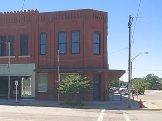
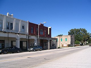
Howe is a town in Le Flore County, Oklahoma, United States. It is part of the Fort Smith, Arkansas-Oklahoma Metropolitan Statistical Area. The population was 802 at the 2010 census, a gain of 15.1 percent over the figure of 697 recorded in 2000. The town was once noted for producing coal and coke, but today is chiefly supported by agriculture.

<span class="mw-page-title-main">Rock Island, Oklahoma</span> Town in Oklahoma, United States

Rock Island is a town in Le Flore County, Oklahoma, United States. It is part of the Fort Smith, Arkansas-Oklahoma Metropolitan Statistical Area. The population was 646 at the 2010 census, a decline of 8.9 percent from the figure of 709 recorded in 2000.

<span class="mw-page-title-main">Agra, Oklahoma</span> Town in Oklahoma, United States

Agra is a town in northern Lincoln County, Oklahoma, United States. The population was 339 at the 2010 census. An early real estate developer coined the town's name from the word "agriculture".

<span class="mw-page-title-main">Kendrick, Oklahoma</span> Town in Oklahoma, United States

Kendrick is a town in Lincoln County, Oklahoma, United States. The population was 139 at the 2010 census.

<span class="mw-page-title-main">Langston, Oklahoma</span> Town in Oklahoma, United States

Langston is a town in Logan County, Oklahoma, United States, and is part of the Oklahoma City Metropolitan Statistical Area. The population was 1,619 as of the 2020 United States census. Langston is home to Langston University, the only historically black college in Oklahoma.

<span class="mw-page-title-main">South Coffeyville, Oklahoma</span> Town in Oklahoma, United States

South Coffeyville is a town in Nowata County, Oklahoma, United States. As of the 2010 census, the town population was 785. The city of Coffeyville, Kansas is located approximately one mile north of the city, existing as a separate political entity.

<span class="mw-page-title-main">Arcadia, Oklahoma</span> Town in Oklahoma County, Oklahoma

Arcadia is a town in Oklahoma County, Oklahoma, United States, and a part of the Oklahoma City metropolitan area. The population was 247 at the 2010 census, a decrease of 11.5 percent from the figure of 279 in 2000.

<span class="mw-page-title-main">Afton, Oklahoma</span> Town in Oklahoma, United States

Afton is a town in northeast Oklahoma in Ottawa County, Oklahoma, United States. The population was 734 at the time of the 2020 United States census.

<span class="mw-page-title-main">Peoria, Oklahoma</span> Town in Oklahoma, United States

Peoria is a town in Ottawa County, Oklahoma, United States. It was named for the Peoria people, a tribe of Native Americans who were removed to Indian Territory from east of the Mississippi River during the 19th century. The territory had been occupied by the Quapaw people, who sold some of their land to the Peoria. The population was 131 at the 2010 U. S. Census, down from 141 at the 2000 census. The long decline of mining meant that jobs moved elsewhere.

<span class="mw-page-title-main">Tyrone, Oklahoma</span> Town in Oklahoma, United States

Tyrone is a town in northeastern Texas County, Oklahoma, United States. The population was 729 at the 2020 census.

<span class="mw-page-title-main">Elk Lick Township, Pennsylvania</span> Township in Pennsylvania, United States

Elk Lick Township is a township in Somerset County, Pennsylvania, United States. The population was 2,264 at the 2020 census. Mount Davis, the highest point in Pennsylvania, is located within the township.

<span class="mw-page-title-main">Marlboro, Vermont</span> Town in Vermont, United States

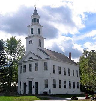
Marlboro is a town in Windham County, Vermont, United States. The population was 1,722 at the 2020 census. The town is home to both the Southern Vermont Natural History Museum and Potash Hill, the campus that was formerly Marlboro College. Potash Hill hosts the Marlboro Music School and Festival each summer, as well as other arts and education programs throughout the year.

References

  1. 1 2 3 U.S. Geological Survey Geographic Names Information System: Kansas, Oklahoma
  2. "ArcGIS REST Services Directory". United States Census Bureau. Retrieved September 20, 2022.
  3. 1 2 "U.S. Census website". United States Census Bureau . Retrieved January 31, 2008.
  4. 1 2 "Geographic Identifiers: 2010 Demographic Profile Data (G001): Kansas town, Oklahoma". U.S. Census Bureau, American Factfinder. Archived from the original on February 13, 2020. Retrieved December 8, 2015.
  5. "Historical Weather for Kansas, Oklahoma, United States".
  6. "Census of Population and Housing". Census.gov. Retrieved June 4, 2015.
  7. "Church Pew & Church Furniture Manufacturer | Born Again Pews". Church Pews & Furniture For Sale.
  8. "About Us". Northeast Tech. Retrieved August 3, 2020.
  9. "Kansas Campus". Northeast Tech. Retrieved August 3, 2020.