Westhampton, New York

Last updated

Westhampton, New York
WesthamptonInnerWaterway.jpg
Inland waterway in Westhampton
Westhampton-map.gif
USA New York location map.svg
Red pog.svg
Westhampton
Coordinates: 40°49′22″N72°39′52″W / 40.82278°N 72.66444°W / 40.82278; -72.66444
Country United States
State New York
County Suffolk
Area
[1]
  Total14.85 sq mi (38.47 km2)
  Land12.64 sq mi (32.75 km2)
  Water2.21 sq mi (5.72 km2)
Elevation
36 ft (11 m)
Population
 (2020)
  Total3,621
  Density286.38/sq mi (110.57/km2)
Time zone UTC-5 (Eastern (EST))
  Summer (DST) UTC-4 (EDT)
ZIP code
11977
Area code 631
FIPS code 36-80170 [2]
GNIS feature ID0970920 [3]

Westhampton is a hamlet and census-designated place (CDP) in Suffolk County, New York, United States. The population was 3,079 at the 2010 census. [4]

Contents

Westhampton is in the Town of Southampton.

Geography

Westhampton is located at 40°49′22″N72°39′52″W / 40.82278°N 72.66444°W / 40.82278; -72.66444 (40.822894, -72.664306). [5]

According to the United States Census Bureau, the CDP has a total area of 14.9 square miles (38.5 km2), of which 12.7 square miles (32.8 km2) is land and 2.2 square miles (5.7 km2), or 14.74%, is water. [4]

Climate

Westhampton has an oceanic climate (Cfb) under the Köppen climate classification, with moderately cold winters and warm summers. The plant hardiness is more similar to a humid continental climate (Dfb) although winter days are mild enough that Westhampton is unlikely to maintain long-term snow cover in a normal winter. Due to the lack of an urban environment and being away from the immediate coastline, the area has a lot colder nights than New York City. Westhampton sees an average of 43.4 inches of precipitation per year.

Climate data for Westhampton, New York (Francis S. Gabreski Airport), 1991–2020 normals, extremes 1951–present
MonthJanFebMarAprMayJunJulAugSepOctNovDecYear
Record high °F (°C)67
(19)
71
(22)
76
(24)
88
(31)
93
(34)
96
(36)
100
(38)
99
(37)
94
(34)
88
(31)
80
(27)
71
(22)
100
(38)
Mean maximum °F (°C)56.7
(13.7)
55.3
(12.9)
64.8
(18.2)
75.0
(23.9)
82.4
(28.0)
88.8
(31.6)
93.1
(33.9)
90.6
(32.6)
84.9
(29.4)
77.6
(25.3)
67.1
(19.5)
61.0
(16.1)
94.8
(34.9)
Average high °F (°C)38.7
(3.7)
40.4
(4.7)
46.8
(8.2)
56.6
(13.7)
66.2
(19.0)
75.4
(24.1)
81.3
(27.4)
80.3
(26.8)
73.6
(23.1)
63.4
(17.4)
53.3
(11.8)
44.5
(6.9)
60.0
(15.6)
Daily mean °F (°C)29.4
(−1.4)
30.6
(−0.8)
37.2
(2.9)
46.1
(7.8)
55.9
(13.3)
65.6
(18.7)
71.9
(22.2)
70.8
(21.6)
63.7
(17.6)
52.9
(11.6)
43.5
(6.4)
35.2
(1.8)
50.2
(10.1)
Average low °F (°C)20.0
(−6.7)
20.9
(−6.2)
27.6
(−2.4)
35.6
(2.0)
45.6
(7.6)
55.8
(13.2)
62.5
(16.9)
61.4
(16.3)
53.9
(12.2)
42.5
(5.8)
33.7
(0.9)
25.8
(−3.4)
40.4
(4.7)
Mean minimum °F (°C)−1.7
(−18.7)
2.8
(−16.2)
9.2
(−12.7)
20.3
(−6.5)
29.0
(−1.7)
39.6
(4.2)
49.5
(9.7)
47.6
(8.7)
38.0
(3.3)
25.7
(−3.5)
15.7
(−9.1)
8.1
(−13.3)
−3.4
(−19.7)
Record low °F (°C)−15
(−26)
−12
(−24)
−9
(−23)
11
(−12)
24
(−4)
33
(1)
42
(6)
39
(4)
32
(0)
16
(−9)
6
(−14)
−1
(−18)
−15
(−26)
Average precipitation inches (mm)3.19
(81)
2.72
(69)
4.28
(109)
3.79
(96)
3.31
(84)
3.50
(89)
2.88
(73)
3.74
(95)
3.75
(95)
4.65
(118)
3.48
(88)
4.17
(106)
43.46
(1,104)
Average snowfall inches (cm)8.4
(21)
9.5
(24)
7.5
(19)
0.9
(2.3)
0.0
(0.0)
0.0
(0.0)
0.0
(0.0)
0.0
(0.0)
0.0
(0.0)
0.0
(0.0)
0.8
(2.0)
6.8
(17)
33.9
(85.3)
Average precipitation days (≥ 0.01 in)10.510.110.711.913.611.19.59.710.212.010.511.0130.8
Average snowy days (≥ 0.1 in)4.64.53.70.40.00.00.00.00.00.00.33.416.9
Source: NOAA (mean maxima/minima 19982020, snow/snow days 19511969) [6] [7]

Demographics

Historical population
CensusPop.Note
2020 3,621
U.S. Decennial Census [8]

Demographics of the CDP

As of the census [2] of 2000, there were 2,869 people, 1,070 households, and 766 families residing in the CDP. The population density was 326.2 inhabitants per square mile (125.9/km2). There were 1,601 housing units at an average density of 182.0 per square mile (70.3/km2). The racial makeup of the CDP was 91.04% White, 4.43% African American, 0.28% Native American, 1.25% Asian, 0.80% from other races, and 2.20% from two or more races. Hispanic or Latino of any race were 5.47% of the population.

There were 1,070 households, out of which 37.9% had children under the age of 18 living with them, 58.7% were married couples living together, 8.9% had a female householder with no husband present, and 28.4% were non-families. 23.0% of all households were made up of individuals, and 7.6% had someone living alone who was 65 years of age or older. The average household size was 2.66 and the average family size was 3.14.

In the CDP, the population was spread out, with 26.6% under the age of 18, 7.1% from 18 to 24, 30.3% from 25 to 44, 25.5% from 45 to 64, and 10.6% who were 65 years of age or older. The median age was 37 years. For every 100 females, there are 100.3 males. For every 100 females age 18 and over, there were 97.1 males.

The median income for a household in the CDP was $67,125, and the median income for a family was $80,313. Men had a median income of $51,331 versus $36,875 for women. The per capita income for the CDP was $31,894. About 3.4% of families and 4.5% of the population were below the poverty line, including 3.7% of those under age 18 and 9.0% of those age 65 or over.

Notable persons

Howard Cosell, 20th century television sports journalist.

Maria Bartiromo, of Fox News owns a beach house in Westhampton. [9]

Related Research Articles

<span class="mw-page-title-main">Denali Park (CDP), Alaska</span> Census-designated place in Alaska, United States

Denali Park, formerly McKinley Park, is a census-designated place (CDP) in Denali Borough, in the U.S. state of Alaska. As of the 2020 census, the population of the CDP was 163, down from 185 at the 2010 census.

<span class="mw-page-title-main">Moose Pass, Alaska</span> Census-designated place in Alaska, United States

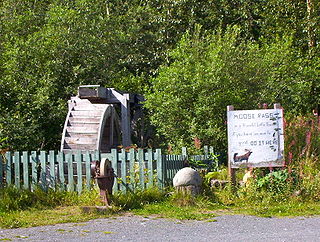
Moose Pass is a census-designated place (CDP) in Kenai Peninsula Borough, Alaska, United States. The population was 219 at the 2010 census, up from 206 in 2000.

Dry Creek is a census-designated place (CDP) in Southeast Fairbanks Census Area, Alaska, United States. At the 2010 census the population was 94, down from 128 in 2000.

Paxson is a census-designated place (CDP) in Copper River Census Area, Alaska, United States. As of the 2020 census, its population was 26, down from 40 in 2010. It is located on the Richardson Highway at the junction with the Denali Highway.

<span class="mw-page-title-main">Lake Minchumina, Alaska</span> CDP in Alaska, United States

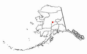
Lake Minchumina is a census-designated place (CDP) in Yukon-Koyukuk Census Area, Alaska, United States. As of the 2020 census, the population of the CDP is 30.

<span class="mw-page-title-main">South San Gabriel, California</span> Census-designated place in California, United States

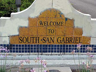
South San Gabriel is a census-designated place (CDP) in Los Angeles County, California, United States. The population was 8,070 at the 2010 census, up from 7,595 at the 2000 census.

<span class="mw-page-title-main">Freedom, California</span> Census-designated place in California, United States

Freedom is a census-designated place (CDP) in Santa Cruz County, California, United States. The population was 3,070 at the 2010 census.

<span class="mw-page-title-main">Experiment, Georgia</span> CDP in Georgia, United States

Experiment is a census-designated place (CDP) in Spalding County, Georgia, United States. The population was 3,233 at the 2000 census.

<span class="mw-page-title-main">Kaunakakai, Hawaii</span> Census-designated place in Hawaii, United States

Kaunakakai is a census-designated place (CDP) in Maui County, Hawaiʻi, United States. It is the largest town on the island of Molokaʻi. The population was 3,419 at the 2020 census. It has the largest port on the island and the longest pier in Hawaii. The town was made famous in the 1930s by the song "The Cockeyed Mayor of Kaunakakai", beginning an ongoing tradition of designating an honorary mayor for the town.

<span class="mw-page-title-main">Perryman, Maryland</span> Census-designated place in Maryland, United States

Perryman is an unincorporated community and census-designated place (CDP) in Harford County, Maryland, United States. The population was 2,342 at the 2010 census.

<span class="mw-page-title-main">Lakeland Village, California</span> Census-designated place in California, United States

Lakeland Village is a census-designated place (CDP) in Riverside County, California, United States. The population was 11,541 at the 2010 census, more than double the 5,626 reported at the 2000 census.

<span class="mw-page-title-main">Big Bay, Michigan</span> Census-designated place & unincorporated community in Michigan, United States

Big Bay is an unincorporated community in Marquette County of the U.S. state of Michigan. It is a census-designated place (CDP) for statistical purposes and does not have any legal status as an incorporated municipality. As of the 2020 census, the CDP had a population of 257. The community is located within Powell Township near the shore of "Big Bay" on Lake Superior.

<span class="mw-page-title-main">East Missoula, Montana</span> CDP in Montana, United States

East Missoula is a census-designated place (CDP) in Missoula County, Montana, United States. It is part of the 'Missoula, Montana Metropolitan Statistical Area'. The population was 2,157 at the 2010 census, an increase from its population of 2,070 in 2000.

<span class="mw-page-title-main">Ponderosa, New Mexico</span> CDP in New Mexico, United States

Ponderosa is a census-designated place (CDP) in Sandoval County, New Mexico, United States. The population was 383 as of New Mexico's 2015 Census. It is part of the Albuquerque Metropolitan Statistical Area.

<span class="mw-page-title-main">Bridgehampton, New York</span> Hamlet and census-designated place in New York, United States

Bridgehampton is a hamlet and census-designated place (CDP) on the South Fork of Suffolk County, New York, United States. The population was 1,756 at the 2010 census.

<span class="mw-page-title-main">Cloverdale, Oregon</span> Census-designated place in Oregon, United States

Cloverdale is an unincorporated community in Tillamook County, Oregon, United States. For statistical purposes, the United States Census Bureau has defined Cloverdale as a census-designated place (CDP). The census definition of the area may not precisely correspond to local understanding of the area with the same name. The population was 242 at the 2000 census.

<span class="mw-page-title-main">Sewanee, Tennessee</span> CDP in Tennessee, United States

Sewanee is a census-designated place (CDP) in Franklin County, Tennessee, United States. The population was 2,535 at the 2020 census. It is part of the Tullahoma, Tennessee Micropolitan Statistical Area.

<span class="mw-page-title-main">Lipscomb, Texas</span> Census-designated place in Texas, United States

Lipscomb is an unincorporated community and census-designated place (CDP) in Lipscomb County, Texas, United States. It is the Lipscomb county seat. The population was 37 at the 2010 census.

<span class="mw-page-title-main">La Sal, Utah</span> CDP in Utah, United States

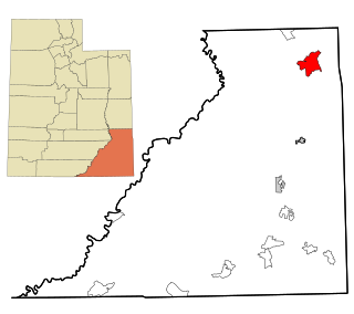
La Sal is a census-designated place (CDP) in northeastern San Juan County, Utah, United States. The population was 339 at the 2000 census. The name comes from the La Sal Mountains which means in Spanish "The Salt". The area is known for its uranium resources.

<span class="mw-page-title-main">Fontenelle, Wyoming</span> Census-designated place in Wyoming, United States

Fontenelle is a census-designated place (CDP) in Lincoln County, Wyoming, United States. The population was 13 at the 2010 census. It is named after the hamlet of Fontenelle, which is located in the southeast corner of the roughly-rectangular CDP.

References

  1. "ArcGIS REST Services Directory". United States Census Bureau. Retrieved September 20, 2022.
  2. 1 2 "U.S. Census website". United States Census Bureau . Retrieved January 31, 2008.
  3. "US Board on Geographic Names". United States Geological Survey. October 25, 2007. Retrieved January 31, 2008.
  4. 1 2 "Geographic Identifiers: 2010 Demographic Profile Data (G001): Westhampton CDP, New York". U.S. Census Bureau, American Factfinder. Archived from the original on February 12, 2020. Retrieved January 10, 2013.
  5. "US Gazetteer files: 2010, 2000, and 1990". United States Census Bureau. February 12, 2011. Retrieved April 23, 2011.
  6. "NowData - NOAA Online Weather Data". National Oceanic and Atmospheric Administration . Retrieved August 11, 2021.
  7. "Station: Westhampton Gabreski AP, NY". U.S. Climate Normals 2020: U.S. Monthly Climate Normals (19912020). National Oceanic and Atmospheric Administration. Retrieved August 11, 2021.
  8. "Census of Population and Housing". Census.gov. Retrieved June 4, 2016.
  9. "How I Made It: Maria Bartiromo's stock has risen at Fox Business Network and Fox News". Los Angeles Times. April 25, 2019. Retrieved April 6, 2023.