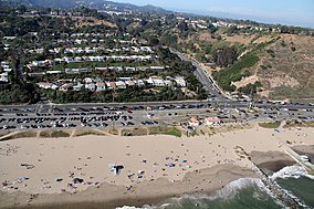
Manhattan Beach is a city in southwestern Los Angeles County, California, United States, on the Pacific coast south of El Segundo, west of Hawthorne and Redondo Beach, and north of Hermosa Beach. As of the 2020 census, the population was 35,506.
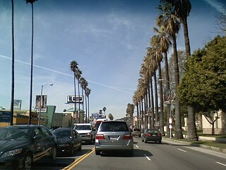
Sunset Boulevard is a boulevard in the central and western part of Los Angeles, California, United States, that stretches from the Pacific Coast Highway in Pacific Palisades east to Figueroa Street in Downtown Los Angeles. It is a major thoroughfare in the cities of Beverly Hills and West Hollywood, as well as several districts in Los Angeles.

Pacific Palisades is a neighborhood in the Westside region of Los Angeles, California, situated about 20 miles (32 km) west of Downtown Los Angeles.

Will Rogers State Historic Park is the former estate of American humorist Will Rogers. It lies in the Santa Monica Mountains in Los Angeles, in the Pacific Palisades area.
The history of Santa Monica, California, covers the significant events and movements in Santa Monica's past.
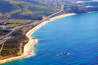
Crystal Cove State Park is a state park of California, United States, encompassing 3.2 miles (5.1 km) of Pacific coastline, inland chaparral canyons, and the Crystal Cove Historic District of beach houses. The park is located partially in Newport Beach and partially in an unincorporated area of Orange County, and is part of the larger South Coast Wilderness area. Crystal Cove is a stretch of coastal cliffs and a beachfront cove situated between the Pacific Coast Highway and the Pacific Ocean, southeast of Newport Beach and northwest of Laguna Beach. The 3,936-acre (1,593 ha) park was established in 1979. The entire park hosts a total of three miles (4.8 km) of beaches and tide pools, a 1,400-acre marine Conservation Area (570 ha) as well as underwater park, 400 acres (160 ha) of bluffs, and 2,400 acres (970 ha) of canyons.

The Santa Monica Mountains National Recreation Area is a United States national recreation area containing many individual parks and open space preserves, located primarily in the Santa Monica Mountains of Southern California. The SMMNRA is in the greater Los Angeles region, with two thirds of the parklands in northwest Los Angeles County, and the remaining third, including a Simi Hills extension, in southeastern Ventura County.

Sepulveda Boulevard is a major street and transportation corridor in the City of Los Angeles and several other cities in western Los Angeles County, California. The street parallels Interstate 405 for much of its route. Portions of Sepulveda Boulevard between Manhattan Beach and Los Angeles International Airport (LAX) are designated as part of State Route 1.

The Marvin Braude Bike Trail is a 22-mile (35 km) paved bicycle path that runs mostly along the shoreline of Santa Monica Bay in Los Angeles County, California. The coastal bike trail is widely acknowledged as Los Angeles’ “most popular bike path.”

Wrigley is a group of neighborhoods in Long Beach, California. It includes the neighborhoods North Wrigley, South Wrigley, Southeast Wrigley and Wrigley Heights. Its name derives from William Wrigley Jr., the owner and founder of the famed Wrigley Spearmint Gum Empire in Chicago. It was one of the first communities established in Long Beach. With the exception of Wrigley Heights, the area is developed throughout on a gridiron street pattern.
Rustic Canyon is a residential neighborhood and canyon in eastern Pacific Palisades, on the west side of Los Angeles, California. It is along Rustic Creek, in the Santa Monica Mountains.

Zuma Beach is a county beach at 30000 Pacific Coast Highway (PCH) in Malibu, California. One of the largest and most popular beaches in Los Angeles County, California, it is known for its long, wide sands and excellent surf. It consistently ranks among the healthiest beaches for clean water conditions in Los Angeles County.

Santa Monica State Beach is a California State Park operated by the city of Santa Monica.

The Balboa Line was the southernmost route of the Pacific Electric Railway. It ran between Downtown Los Angeles and the Balboa Peninsula in Orange County by way of North Long Beach, though the route was later cut back to the Newport Dock. It was designated as route 17.

Point Sal State Beach is a beach on the Pacific coast of California, located near the city of Guadalupe, in the northwestern part of Santa Barbara County. There are approximately 80 acres (320,000 m2) of property with 1.5 miles (2.4 km) of ocean frontage. The rocks around the headland constitute part of the Coast Range Ophiolite, one of the largest ophiolite terranes in the world. This beach is at risk of landslides as there are rocky shorelines and extremely steep slopes.
There are 9 routes assigned to the "N" zone of the California Route Marker Program, which designates county routes in California. The "N" zone includes county highways lying in Los Angeles and Orange counties.

The Los Angeles Pacific Railroad (1896−1911) (LAP) was an electric public transit and freight railway system in Los Angeles County, California. At its peak it had 230 miles (370 km) of track extending from Downtown Los Angeles to the Westside, Santa Monica, and the South Bay towns along Santa Monica Bay.
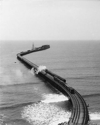
The Long Wharf in Santa Monica, also known as Port Los Angeles or the Mile Long Pier, was an extensive pier wharf constructed by the Southern Pacific Railroad Company in Santa Monica Bay from 1892 to 1894. When it opened in 1894, it was the longest wharf in the world, measuring approximately 4,700 feet (1,400 m). It served as a cargo and passenger port until 1913, and in 1919 removal of the wharf started. The wharf, the 1,000 foot (300 m) tip of the pier, was removed by 1920. The remaining 3,600 feet (1,100 m) of pier was used as a run down fishing pier until 1933, when the remainder of the pier was removed. One of the major imports to the wharf was lumber from Northern ports, to help in the construction boom in Southern California. Southern Pacific Railroad and the street cars of the Los Angeles Pacific Railroad served the wharf. Los Angeles Pacific Railroad ran passenger trams to the wharf and from midnight to sunrise ran cargo cars.
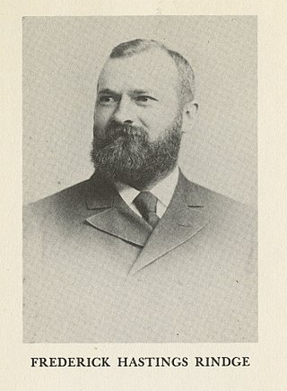
The Hueneme, Malibu & Port Los Angeles Railway was a standard-gauge, 15-mile railroad (24 km) in Malibu, California. It was founded by Frederick Hastings Rindge (1857–1905) and operated on his 13,000-acre ranch (5,300 ha) along the coast, which encompassed most of what is today Malibu. He struggled for years to keep trespassers off of his land, and feared that the Southern Pacific Company would use the power of eminent domain to build a railroad through his property. This threat animated Rindge to plan his own railroad to thwart the efforts of the Southern Pacific. This was part of his overall effort to keep outsiders off of his ranch and spoil what he considered to be paradise.
