A13 road (England)

Last updated

UK road A13.svg
A13
A13 road map.png
Route information
Length41.7 mi [1]  (67.1 km)
HistoryRoute pre-dates inception of 1922 Roads list; first all-new bypass section opened 1924; last all-new section opened 1999; latest grade-separation completed 2013
Major junctions
West endUK road A11.svg A11 in Whitechapel, London
Major intersectionsUK road A12.svgUK road A102.svg A12  / A102 in Poplar, London

UK road A406.svgUK road A1020.svg A406  / A1020 near Barking
UK-Motorway-M25.svgUK road A282.svg M25  / A282 near Aveley
UK road A1089.svg A1089 near Grays
UK road A130.svg A130 near South Benfleet

Contents

UK road A127.svg A127 in Southend-on-Sea
East endNess Road / Campfield Road in Shoeburyness
Location
Country United Kingdom
Constituent country England
Primary
destinations
Docklands, Barking, Dartford Crossing, Tilbury, Basildon, Southend
Road network
UK road A12.svg A12 UK road A14.svg A14

The A13 is a major road in England linking Central London with east London and south Essex. Its route is similar to that of the London, Tilbury and Southend line via Rainham, Grays, Tilbury, Stanford-Le-Hope & Pitsea,and runs the entire length of the northern Thames Gateway area, terminating on the Thames Estuary at Shoeburyness. It is a trunk road between London and the Tilbury junction, a primary route between there and Sadlers Hall Farm near South Benfleet, and a non-primary route between there and Shoeburyness.

Route

London

Commercial Road looking west near Limehouse railway station A13 Limehouse stn.JPG
Commercial Road looking west near Limehouse railway station

The A13 used to start at Aldgate Pump; but now begins at the junction with the A11 at what used to be the Aldgate one way system in east London and heads eastwards through the boroughs of Tower Hamlets, Newham, Barking & Dagenham and Havering before reaching the Greater London boundary.

Commercial Road and East India Dock Road

At the central London end, Commercial Road and East India Dock Road form one of two main arteries through the historic East End (the other being the A11 Whitechapel Road). The A13 route is a relatively recent addition to London's radial network, having been built at the beginning of the 19th century to connect the City with the (then) newly expanding Docklands area. Commercial Road dates from 1802, [2] while East India Dock Road was set out from 1806 to 1812. [3] The first iron bridge across the River Lea was built in 1810. [4] Today the route is still largely single carriageway, though notable is the junction with the A12 and A102 at the northern portal of the Blackwall Tunnel. This section of A13 is used by the important London Bus routes 15 (as far as Blackwall) and 115.

East Ham & Barking By-pass (Newham Way and Alfreds Way)

Newham Way looking west between A406 and A117 junctions (the latter just ahead) A13 Beckton.JPG
Newham Way looking west between A406 and A117 junctions (the latter just ahead)

However, just east of Blackwall, at the crossing of the River Lea, there is a TOTSO (turn-off to stay on) with the A1261 East India Dock Link Tunnel, and the road changes character dramatically, becoming a dual three-lane expressway. This grade-separated route continues all the way to the Greater London Boundary. Notable junctions include Canning Town, and the A406 junction near Beckton, as well as the single carriageway Lodge Avenue flyover near Barking, where the old A13 route (Ripple Road) merges with the new. Grade-separated in 2002–2004, the dual carriageway section through Newham is Newham Way, while through Barking it is Alfreds Way, both comprising the East Ham & Barking Bypass, and originally dualled by the 1960s. [5] This section is structurally sound and built to high standards, but was subject to a 40 mph (64 km/h) speed limit. Prior to grade-separation, the speed limit was 50 mph (80 km/h). [6] Works involved inserting new underpasses at Prince Regent and Movers Lane, a new flyover at Beckton Alps, and expanding Canning Town flyover from two lanes either way to three. Also inserted was the free-flow link to the A1261 tunnel. London Bus route 173 is the only route to use the A13 here, between Beckton Alps and Ripple Road. However, the speed limit was increased back to 50 mph in 2011.

Ripple Road and the Thames Gateway

East of the Lodge Avenue junction near Barking, the route then takes over the much older Ripple Road, with its last at-grade junction at Renwick Road, while the all-new grade-separated section east of the Goresbrook Interchange at Dagenham is termed the Thames Gateway, completed in 1999. This is notable for the award-winning viaduct [7] over Fords works, opening in late 1999, [8] and the causeway over Rainham and Wennington Marshes, the latter structure causing some delay to the project due to necessary studies on its environmental impact, [9] [10] although this section opened first, in mid-1997. [11] The contract also included the Wennington to M25 motorway section (see below). It has National Speed Limit from just east of Goresbrook Interchange. London Bus routes 173 and 287 are the only routes to use the A13 here, between Ripple Road and Goresbrook.

In 2005, Havering Council commissioned the Litmus Towers sculptures on the A13 junctions near Rainham which display local environmental data using large LED arrays. [12]

Essex

Sadlers Farm Roundabout Sadlers farm roundabout.jpg
Sadlers Farm Roundabout

Wennington to Sadlers Hall Farm

The Thames Gateway section of the A13 leaves London at Wennington on the border with Thurrock, still dual three lanes, intersecting with the M25 motorway at Junction 30, close to the Dartford Crossing and Lakeside Shopping Centre. The A13 here is a much older dual carriageway, dating mostly to the 1980s, including the four-lane flyover above the M25, left incomplete for over 15 years. The Wennington to M25 section opened in late 1998. [13] The next junction, the turn-off for Lakeside (A126), has only west-facing slips, so there is no exit eastbound. It is then dual three lanes past the junction with the A1089, the road into Tilbury, and loses its Trunk Road status to the latter. The A13 finally drops down to two lanes each way at the nearby A128 junction. It is dual for another 9 miles (14 km), bypassing Stanford-le-Hope and Basildon before it reaches the Sadlers Hall Farm (or Sadlers Farm) roundabout. Here the road meets the A130 and loses its dual and Primary Route status. The main route into Southend is now the A127 Southend Arterial Road, accessible via the A130.

A13/A130 Sadlers Farm Junction

Improvements to the A13/A130 Sadlers Farm Junction were first given government approval in July 2006 following a 2005 public consultation. [14] The project involved by-passing the roundabout by creating a new full-depth cutting link road between the A13 and A130, building slip roads connecting traffic to the Sadlers Farm roundabout and widening the A13 to dual four lane carriageway to Pitsea and the A130 to dual three lane carriageway to the Rayleigh Spur roundabout. [15] The scheme is part of the Thames Gateway transport infrastructure plans which gave it an estimated cost of £63 million in 2007 and timelines it for 2012. [16] The scheme was opened in 2012.

Benfleet to Shoeburyness

The A13 continues east of Sadlers Farm as mostly single-carriageway through Thundersley, Hadleigh, Leigh-on-Sea and Westcliff, before reaching the seaside resort of Southend-on-Sea. This is the last major town on the route, but it continues eastwards, including brief dual sections (London Road, Hadleigh, Queensway round the town centre, with its roundabouts with the A127 and A1160 (another TOTSO), and Southchurch Boulevard in Southchurch), and on to Shoeburyness, on the estuary 3 miles (4.8 km) east of Southend proper. It turns to the south at Parsons Corner, and then as Ness Road, it terminates at an end-on junction with the B1016, also forming part of Ness Road.

A13 Road
Eastbound exitsJunctionWestbound exits
Tower Hamlets
Start of grade-separated section, merge with A1261 East India Dock Link, signed Barking, Tilbury A13

(see Note just below)

Junction 7: Leamouth JunctionTurn-off to stay on for Central London, Blackwall Tunnel A13, Leamouth (A1020), mainline signed Canary Wharf, Isle of Dogs A1261 , becomes East India Dock Link
Newham
Plaistow A124 , Stratford, Canning Town, West Ham, Royal Docks, London City Airport, ExCeL A1011 , B164

Note: sliproad starts on Tower Hamlets side of the River Lea!

Junction 8: Canning Town Plaistow A124 , Stratford, Canning Town, West Ham, Royal Docks, London City Airport, ExCeL A1011 (Entrance via Junction 7)
New Barn Street, no access to A13(New Barn Street exit)No exit - Use Junction 9.
Custom House, London City Airport, ExCeL, Stratford, Plaistow A112 , Tollgate RoadJunction 9: Prince Regent Custom House, London City Airport, ExCeL, Stratford, Plaistow A112 , Tollgate Road, Freemasons Road
Noel Road (no access to A13)(signed side streets)East Ham Industrial Estate
Beckton, Manor Park, East Ham, London Industrial Park A117 Junction 10: Beckton Alps Beckton, Manor Park, East Ham, London Industrial Park A117
North Circular Road, Ilford, Barking, (M11) A406 , London City Airport, Royal Docks, ExCeL A1020 , Woolwich Ferry (A117), Jenkins laneJunction 11: (A406 terminus) North Circular Road, Ilford, Barking, (M11) A406 , London City Airport, Royal Docks, ExCeL A1020 , Woolwich Ferry (A117)
Barking & Dagenham
Barking, Creekmouth, River Road Industrial Estate, Thames View EstateJunction 12: Movers Lane Barking, Creekmouth, River Road Industrial Estate, Thames View Estate
Barking A123 , Becontree, Romford A1153 Junction 13: Lodge Avenue Junction (Ripple Road Junction) (NB: flyover here is single carriageway) Barking A123 , Becontree, Romford A1153
Rippleside, Commercial Estate, Container Base, Freight Centre

through traffic is free-flow

(Renwick Road westbound traffic lights)Rippleside, Commercial Estate, Container Base, Freight Centre

through traffic liable to stop at lights

Dagenham, Hornchurch A1306 , Dagenham Dock, Scrattons Farm EstateJunction 14: Goresbrook Interchange Dagenham, Hornchurch A1306 , Dagenham Dock, Scrattons Farm Estate
Havering
Dagenham, Rainham A1306 , Hornchurch, Elm Park (A125), CEME, Fords Junction 15: (Marsh Way ?) Dagenham, Rainham A1306 , Hornchurch, Elm Park (A125), CEME, Fords
Ferry Lane Industrial AreasJunction 16: (Ferry Lane ?)Ferry Lane Industrial Areas
Wennington, West Thurrock A1306 , Purfleet (A1090), Aveley (B1335)Junction 17: Wennington Wennington, West Thurrock A1306 , Purfleet (A1090), Aveley (B1335)
Thurrock
Stansted Airport, (M11) M25 , Dartford Crossing, Gatwick Airport (A282), South Ockendon (A1306), Purfleet (A1090), Thurrock services Junction 18/Junction J30 (M25) Mar Dyke Interchange link to J31 (A282) Stansted Airport, (M11) M25 , Dartford Crossing, Gatwick Airport (A282), South Ockendon (A1306), Purfleet (A1090), Thurrock services
Lakeside Shopping Centre, West Thurrock A126 (no access to A13)Junction 19: (Lakeside ?)No Exit
Grays A1012 , North Stifford, Orsett Junction 20: Stifford InterchangeGrays A1012 , North Stifford, Orsett
Tilbury A1089 Junction 21: Baker Street Interchange Tilbury A1089
Brentwood A128 , Grays, Linfield, East Tilbury A1013 , Chadwell St Mary Junction 22: Orsett Cock Brentwood A128 , Grays, Linfield, East Tilbury A1013 , Chadwell St Mary
ServicesServices
Stanford-le-Hope, Coryton A1014 , Linford, East Tilbury A1013 , Horndon-on-the-Hill, Laindon B1007 Junction 23: Manorway Junction (Stanford Interchange) Stanford-le-Hope, Coryton A1014 , Linford, East Tilbury A1013 , Horndon-on-the-Hill, Laindon B1007
Greenacres Farm(Private junction - farm access only)Greenacres Farm
Basildon
Basildon A176 , Vange B1464 , Corringham B1420 , FobbingJunction 24: Five Bells (Vange) Basildon A176 , Vange B1464 , Corringham B1420 , Fobbing
Basildon A132 , Pitsea (B1464), Pitsea Hall LaneJunction 25: Pitsea Basildon A132 , Pitsea (B1464), Pitsea Hall Lane
end of grade-separated dual carriageway

Chelmsford, Southend A130 (A127), Canvey Island A130 , Bowers Gifford B1464 , South Benfleet A13

Junction 26: Sadlers Farm Chelmsford, Southend A130 (A127),

Canvey Island A130 , Bowers Gifford B1464 , London, Basildon A13start of grade-separated dual carriageway

A13 enters/leaves Castle Point to Junction 27 (Tarpots)

History

Original route through Newham and Barking

East of the River Lea, through Newham and Barking, the original route followed the A124 Barking Road and then the A123 Ripple Road. [17] The present A13 still uses much of the eastern end of Ripple Road. The route was replaced by the East Ham & Barking Bypass first opened in 1928, [18] which was given the number A118 before being redesignated. [17] As with the route west of the River Lea, Barking Road is a relatively new route, being built c.1812. [19]

Original route through Dagenham and Havering

Ripple Road leads to Dagenham. The eastern end of this as well as New Road heading towards Rainham, in Havering, and the Greater London border, were bypassed by the new-build Thames Gateway in 1999. The former route was redesignated A1306. The western end between Dagenham and Rainham is still dual, but a short section near Rainham was singled in recent years. Like Barking Road further west, the original section of New Road between Dagenham and Rainham dates from c.1810, [20] and was dualled at roughly the same time as the East & Ham and Barking Bypass. New Road east of Rainham is much newer, and dates from the 1920s. It is and was single all the way towards the border at Wennington, consequently suffering congestion, especially after Lakeside Shopping Centre opened in 1990.

Original route in Thurrock and Basildon

The eastern half of New Road originates from 1924, [21] and continues past Wennington as the A1306 Arterial Road, completed in 1925, [22] bypassing Purfleet (the project including that town's now unclassified "bypass"). It subsequently intersects with the M25 and A282 at Junction 31, heads past Lakeside and then ends at the A1012 near Grays. The route continues as the unclassified Lodge Lane before the latter becomes part of the A1013. The A1013 continues as far as Stanford-le-Hope, where the old A13 route merges with new at the A1014 junction. The eastern end of the erstwhile single-carriageway bypass is now a farm access, but can be shadowed on foot, meeting the B1420 at a roundabout just south of the modern A13 (the actual original A13 (pre-1930s) followed London Road and Southend Road through Stanford and Corringham [23] ). East of there, the B1420 meets the A13 at the A176 junction at Thurrock/Essex border and then the B1464 London Road continues the route south of Basildon, before meeting the newer road and the A130 at Sadlers Farm. The section of the route between the M25 and Sadlers Farm was by-passed or dualled in several stages between the mid-1970s and early 1990s, [24] [25] [26] with Wennington to M25 opening in 1998 (see above).

Original route in Southend

In Southend, the short dual carriageway Queensway bypasses the original route through the town centre, and while much of this is pedestrianised, it can be followed on foot. East of the town centre, Shoebury Road was bypassed by the single-carriageway Bournes Green Chase, just a few yards to the north, linking Southchurch with Shoeburyness. Finally, the terminus of the A13 has been truncated, the road formerly ending on Shoeburyness High Street at the railway station. [27]

Proposed route near Southend

In the 1960s, a route along the lines of the A13 was planned to take traffic to a new airport located at Maplin Sands near Southend. Only preliminary planning was carried out for the road (which may have been designated a motorway) before the proposals for the airport were dropped in favour of expanding Stansted Airport). [28] The route would have followed a similar route to the current A13 through Barking and Dagenham to Rainham before heading north-east towards South Ockendon then east towards Basildon. It would have continued eastwards between Basildon and Stanford-le-Hope before passing north of Canvey Island and south of Hadleigh, Leigh-on-Sea. The last section of road would have been constructed in the Thames Estuary passing south of Southend-on-Sea and Shoeburyness to reach the proposed site of the airport. [29]

Dump truck incident

In February 2016, Nicholas Churchill, a disgruntled middle aged construction worker stole his employer's mining truck and drove for about 50 km on this highway and other roads. During this time, he drove into various structures and police vehicles. He finally stopped the truck in Brandon where he was arrested. [30]

Management

The section between Limehouse and Wennington is maintained by RMS (A13) Plc as part of a 30-year DBFO deal reached with the Highways Agency in 2000. [31] [32] It was RMS who undertook grade-separation of the East Ham & Barking Bypass section in 2002–2004. RMS also maintain the A1203 Limehouse Link tunnel as well as the Aspen Way and East India Dock Link tunnel sections of the A1261 through Docklands. This latter route runs just south of the A13, is dual carriageway and nearly all grade-separated and acts as an alternative to East India Dock Road and much of Commercial Road.

Despite the DBFO, Transport for London (who took over responsibility for all trunk non-motorway routes in London from the Highways Agency in 2000 [33] ) still have overall responsibility for the entire A13 section inside Greater London, while the Highways Agency have responsibility for the remaining Trunk Road section between Wennington and the A1089 junction near Tilbury. [34] From there until Sadlers Hall Farm, the A13 is a primary route and is maintained by Essex County Council, as is the non-primary section through Castle Point, although the sections through Southend-on-Sea and Thurrock are managed by their respective unitary authorities.

Cycle Superhighway 3

Cycle Superhighway 3 (CS3) runs along the A13 between Poplar and Barking.

To the east CS3 joins the A13 at the junction with the A1020/Leamouth Road. CS3 runs eastbound, crossing the Bow Creek and Barking Creek and passing through Canning Town and Beckton en route. To the west, CS3 ends at Greatfields Park, Barking, at the junction with Movers Lane/River Road. [35] [36]

West from Canning Town, CS3 crosses over the A1020/Leamouth Road, heading southbound along the pavement until a junction with Sorrel Lane, where it turns right. It is signposted from Sorrel Lane and runs unbroken to Tower Hill in the City and Lancaster Gate, Hyde Park. [35]

For the entirety of its route, CS3 runs adjacent to the westbound carriageway of the A13 (to the south of the road) as a two-way bike freeway. The route is segregated from other traffic, except at some junctions. It is signposted and marked by blue paint.

Between Greatfields Park and the Lodge Avenue Junction, the two-way, segregated bike freeway continues along the southern edge of the A13. The route is part of National Cycle Route 13 (NCR 13), but not the TfL Cycleways network. NCR 13 leaves the A13 to the east of Lodge Avenue Junction, crossing the A13 and joining residential streets as it runs towards Rainham. The northern terminus of NCR 13 is in Fakenham, Norfolk. [37] [38]

Future developments

A13 Passenger Transport Corridor (Southend)

The scheme aims to improve public transport along the A13; it includes bus stop improvements, provision of real time information and bus prioritisation at signals as well as junction enhancements and road widening. The road widening is planned for a number of points on the Hatley Gardens and Kenneth Road stretch of the A13. Following a public consultation in March 2009, the scheme was approved. [39] "The people of Thurrock have been calling for this for more than a decade, now at last the money is in sight and we can start to get things moving." [40] The original estimated cost of the scheme was given at £4 million in the 2001–2006 Local Transport Plan and increased to £4.9 million in the 2006–2011 update. [39] "The government is recognising that a further £80 million more is needed to actually build the scheme." [40]

London

Grade-separation of Renwick Road traffic lights in Barking, the final at-grade junction between Canning Town and Sadlers Hall Farm, was due to be undertaken "in time for the Olympics in 2012". [41] The works may also involve replacement of the nearby Lodge Avenue Flyover (Ripple Road Flyover), but this is subject to available funding and development of Barking Riverside. [42]

The junction with the A406 North Circular Road was built in 1987 [43] and is incomplete. The long-awaited Thames Gateway Bridge is yet to get the go ahead, [44] but if built it will start at a flyover above the A13, thereby linking the A406 with the road network south of the River Thames. As of 2008, the project in its original form was cancelled by newly elected mayor Boris Johnson. [45]

M25 Junction 30

Improvements including widening are being made at J30 of the M25 motorway and at nearby Lakeside turn-off (A126), following a Route Management Strategy undertaken by the Highways Agency. [46] The work commenced in late 2014 and was scheduled to be completed in autumn 2016.

Junction list

CountyLocationmi [1] kmDestinationsNotes
Greater London Tower Hamlets 0.00.0Whitechapel High Street (A11 west)Western terminus; no access from A13 to A11 east or from A11 west to A13
1.32.1UK road A1203.svg Butcher Row (A126 south) to A1203  Wapping, Isle of Dogs To A1203 signed westbound only, Isle of Dogs eastbound only; northern terminus of A126
1.82.9UK road A101.svg A101 south (Rotherhithe Tunnel) Surrey Quays Northern terminus of A101
2.23.5UK road A1261.svgUK road A1205.svg A1261 east / A1205 north (Burdett Road) Docklands, Isle of Dogs, Mile End Only A1205 and Mile End signed westbound; western terminus of A1261; southern terminus of A1205
3.04.8UK road A1206.svgAircraft Airport ecomo.svg A1206 south (Preston's Road) Isle of Dogs, Docklands, City Airport Docklands and City Airport signed westbound only; northern terminus of A1206
2.84.5UK road A12.svgUK road A102.svg A12 north-east / A102 south (Blackwall Tunnel) Stratford, Dalston, Lewisham, Bow, Hackney Bow and Hackney signed westbound only; south-western terminus of A12; northern terminus of A102
3.15.0UK road A1020.svgAircraft Airport ecomo.svg A1020 east Leamouth, Woolwich Ferry, City Airport, Isle of Dogs, Canary Wharf Woolwich Ferry and City Airport signed eastbound only, Isle of Dogs and Canary Wharf westbound only; western terminus of A1020
3.25.1Begin expressway
UK road A1011.svg A1011  Stratford, Canning Town Eastbound exit and westbound entrance
UK road A1261.svg A1261 west Isle of Dogs, Canary Wharf Westbound exit and eastbound entrance; eastern terminus of A1261
Newham 3.76.0UK road A1011.svgAircraft Airport ecomo.svg A1011  Stratford, City Airport Westbound exit only
4.4–
4.9
7.1–
7.9
UK road A112.svgAircraft Airport ecomo.svg A112  Custom House, Silvertown, Plaistow, City Airport Plaistow signed eastbound only, City Airport westbound only
5.6–
6.0
9.0–
9.7
UK road A117.svg A117  Manor Park, East Ham, Beckton
6.3–
6.7
10.1–
10.8
UK road A406.svgUK road A1020.svgUK road A12.svgUK-Motorway-M11.svg A406 west (North Circular) / A1020 west to A12  / M11 Eastern terminus of A406 / A1020
Barking and Dagenham 7.2–
7.6
11.6–
12.2
Barking, Creekmouth
8.0–
8.4
12.9–
13.5
UK road A1153.svg A1153  Romford, Becontree Heath
UK road A123.svg A123  Barking
A1153 and destinations signed eastbound only, A123 and Barking westbound only
9.3–
9.7
15.0–
15.6
UK road A1306.svg A1306  Dagenham, Hornchurch
Havering 10.8–
11.2
17.4–
18.0
UK road A1306.svgUK road A125.svg To A1306  / A125  Dagenham east, Hornchurch, Elm Park To A1306, A125, and Elm Park signed westbound only
11.6–
12.1
18.7–
19.5
Ferry Lane Industrial Area
Greater London
Essex boundary
Havering
Aveley boundary
13.8–
14.3
22.2–
23.0
UK road A1306.svgUK road A1090.svg A1306 to A1090  / B1335 Wennington, West Thurrock, Purfleet, Aveley, Rainham To A1090 and B1335 signed eastbound only, A1306 and Rainham westbound only
Essex 15.9–
16.4
25.6–
26.4
UK-Motorway-M25.svgUK road A282.svgUK-Motorway-M11.svgUK-Motorway-M1.svgAircraft Airport ecomo.svg M25 north / A282 south (Dartford Crossing) to M11  / M1  Stansted Airport Southern terminus of M25; northern terminus of A282
South Ockendon
Grays boundary
16.927.2UK road A126.svg A126 east Thurrock Eastbound exit and westbound entrance; western terminus of A126
Grays 18.0–
18.5
29.0–
29.8
UK road A1012.svgUK road A1036.svg A1012 south to A1036  Grays Northern terminus of A1012
OrsettGrays
boundary
19.6–
20.3
31.5–
32.7
UK road A1089.svg A1089 south Tilbury Docks Tilbury Docks signed westbound only; northern terminus of A1089
21.0–
21.6
33.8–
34.8
UK road A128.svg A128 north Brentwood Southern terminus of A128
Stanford-le-Hope
Horndon-on-the-Hill
boundary
23.1–
23.5
37.2–
37.8
UK road A1014.svgUK road A1013.svg A1014 east / A1013  / B1007 Shell Haven, Coryton, Stanford-le-Hope, Horndon-on-the-Hill, Corringham, East Tilbury, Linford A1013, East Tilbury, and Linford signed westbound only; western terminus of A1014
FobbingBasildon
boundary
25.9–
26.5
41.7–
42.6
UK road A176.svg A176 north Basildon Southern terminus of A176
Basildon 28.0–
28.4
45.1–
45.7
UK road A132.svg A132 north-east Basildon South-western terminus of A132
BasildonCastle Point
district boundary
End expressway
29.3–
29.9
47.2–
48.1
UK road A130.svgUK road A127.svgAircraft Airport ecomo.svg A130 (Canvey Way) / B1464 (London Road) / A127  Chelmsford, Canvey Island, Bowers Gifford, Southend Airport
Hadleigh 32.552.3UK road A129.svg A129 north-west (Rayleigh Road) / B1014 (Benfleet Road) Rayleigh, Canvey Island, South Benfleet South-eastern terminus of A129
Southend-on-Sea 36.158.1UK road A1158.svgUK road A127.svg A1158 north (Southbourne Grove) to A127  London, Chelmsford, Airport Only Airport signed eastbound; southern terminus of A1158
37.760.7UK road A127.svgUK road A130.svg A127 west (Victoria Avenue) to A130  London, Basildon, Chelmsford Eastern terminus of A127
37.961.0Queensway (A1160 south) / Sutton Road (B1015) / Southchurch RoadNorthern terminus of A1160
39.763.9UK road A1159.svgUK road A127.svgUK road A130.svg A1159 north-west / Thorpe Hall Road to A127  / A130  Rochford, London, Chelmsford Only A1159 and Rochford signed eastbound; south-eastern terminus of A1159
41.767.1Ness Road (B1016) / Campfield RoadEastern terminus
1.000 mi = 1.609 km; 1.000 km = 0.621 mi

The A13 has inspired at least two rock songs: Billy Bragg's "A13, Trunk Road to the sea", which is a localisation of Bobby Troup's song about Route 66; [47] The music video for the Underworld song "Scribble" also features the A13, with the distinctive fencing on the side of the road clearly visible during the video.[ citation needed ] There is also the spoken word track called 'A13' featured on the album Without Judgement by Jah Wobble's Invaders of the Heart, in which Wobble intones his deeper, satirical thoughts concerning the "hopeless highway of Essex" over the musical backing of the band.[ citation needed ] In 2004, British author Iain Sinclair published a psychogeographic road novel, titled Dining on Stones, which loosely follows the route of the A13 from East London to the Thames Estuary. [48] Mike Newman published an account of attempting to walk the route of the A13 in Adverse Camber: An Incomplete walk to the seaside in 2018. [49]

Related Research Articles

<span class="mw-page-title-main">M25 motorway</span> Circular motorway around Greater London

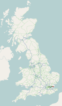
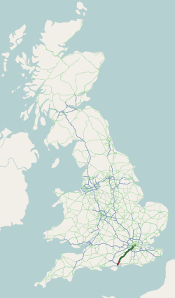
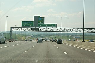
The M25 or London Orbital Motorway is a major road encircling most of Greater London. The 117-mile (188-kilometre) motorway is one of the most important roads in the UK and one of the busiest. Margaret Thatcher opened the final section in 1986, making the M25 the longest ring road in Europe upon opening. The Dartford Crossing completes the orbital route but is not classed as motorway; it is classed as a trunk road and designated as the A282. In some cases, including notable legal contexts such as the Communications Act 2003, the M25 is used as a de facto alternative boundary for Greater London.

<span class="mw-page-title-main">London Borough of Barking and Dagenham</span> London borough in United Kingdom

The London Borough of Barking and Dagenham is a London borough in East London. It lies around 9 miles (14.4 km) east of Central London. It is an Outer London borough and the south is within the London Riverside section of the Thames Gateway; an area designated as a national priority for urban regeneration. At the 2011 census it had a population of 187,000, the majority of which are within the Becontree estate. The borough's three main towns are Barking, Chadwell Heath and Dagenham. The local authority is the Barking and Dagenham London Borough Council. Barking and Dagenham was one of six London boroughs to host the 2012 Summer Olympics.

<span class="mw-page-title-main">Dagenham</span> Town in east London, England

Dagenham is a town in East London, England, within the London Borough of Barking and Dagenham. Dagenham is centred 11.5 miles (18.5 km) east of Charing Cross.

<span class="mw-page-title-main">A3 road</span> London to Portsmouth road in England

The A3, known as the Portsmouth Road or London Road in sections, is a major road connecting the City of London and Portsmouth passing close to Kingston upon Thames, Guildford, Haslemere and Petersfield. For much of its 67-mile (108 km) length, it is classified as a trunk road and therefore managed by National Highways. Almost all of the road has been built to dual carriageway standards or wider. Apart from bypass sections in London, the road travels in a southwest direction and, after Liss, south-southwest.

The A1 also known as the Great North Road is the longest numbered road in the United Kingdom, at 410 miles (660 km). It connects London, the capital of England, with Edinburgh, the capital of Scotland. It passes through or near north London, Hatfield, Welwyn Garden City, Stevenage, Baldock, Letchworth Garden City, Biggleswade, Eaton Socon, Buckden, Peterborough, Stamford, Grantham, Newark-on-Trent, Retford, Doncaster, Pontefract, York, Wetherby, Ripon, Darlington, Durham, Sunderland, Gateshead, Newcastle upon Tyne, Morpeth, Alnwick and Berwick-upon-Tweed.

<span class="mw-page-title-main">A2 road (England)</span> Road in southern England

The A2 is a major road in south-east England, connecting London with the English Channel port of Dover in Kent. This route has always been of importance as a connection between London and sea trade routes to Continental Europe. It was originally known as the Dover Road. The M2 motorway has replaced part of the A2 as the strategic route.

<span class="mw-page-title-main">A12 road (England)</span> Road in England

The A12 is a major road in Eastern England. It runs north-east/south-west between London and the coastal town of Lowestoft in the north-eastern corner of Suffolk, following a similar route to the Great Eastern Main Line until Ipswich. A section of the road between Lowestoft and Great Yarmouth became part of the A47 in 2017. Between the junctions with the M25 and the A14, the A12 forms part of the unsigned Euroroute E30. Unlike most A roads, this section of the A12, together with the A14 and the A55, has junction numbers as if it were a motorway.

<span class="mw-page-title-main">North Circular Road</span> Ring road around Central London, England

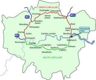
The North Circular Road is a 25.7-mile-long (41.4 km) ring road around Central London in England. It runs from Chiswick in the west to Woolwich in the east via suburban North London, connecting various suburbs and other trunk roads in the region. Together with its counterpart, the South Circular Road, it forms a ring road around central London. This ring road does not make a complete circuit of the city, being C-shaped rather than a complete loop as the crossing of the River Thames in the east is made on the Woolwich Ferry.

<span class="mw-page-title-main">A21 road (England)</span> Major road in southern England running from London to Hastings

For other roads with the same name see List of A21 roads.

<span class="mw-page-title-main">London, Tilbury and Southend line</span> Commuter railway line in Essex, England

The London, Tilbury and Southend line, also known as Essex Thameside, is a commuter railway line on the British railway system. It connects Fenchurch Street station, in central London, with destinations in east London and Essex, including Barking, Upminster, Basildon, Grays, Tilbury, Southend and Shoeburyness.

<span class="mw-page-title-main">Dagenham Dock railway station</span> National Rail station in London, England

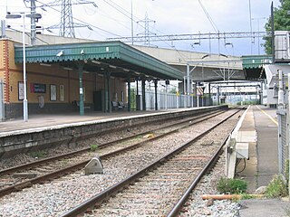
Dagenham Dock is a National Rail station in the Dagenham Dock neighbourhood of Dagenham in the London Borough of Barking and Dagenham, east London. The station is on the Tilbury loop of the London, Tilbury and Southend line, located 10 miles 45 chains (17.0 km) down the line from London Fenchurch Street between Barking to the west and Rainham to the east. The station was opened in 1908 by the London, Tilbury and Southend Railway. The station serves a primarily industrial area adjacent to the River Thames, including the Ford Dagenham site, that is now going through redevelopment as a commercial and residential district. Its three-letter station code is DDK and it is in London fare zone 5. The station and all trains serving it are currently operated by c2c. It is an interchange with the East London Transit bus service.

<span class="mw-page-title-main">Wennington, London</span> Human settlement in England

Wennington is a small village in the London Borough of Havering, in east London. It is situated 14.8 miles (23.8 km) east of Charing Cross. Wennington was an ancient parish in the county of Essex that was abolished for civil purposes in 1934. It is peripheral to London, forming a ribbon development extending from the eastern edge of the urban sprawl and surrounded by the Metropolitan Green Belt. Wennington was added to Hornchurch Urban District in 1934 and has formed part of Greater London since 1965.

<span class="mw-page-title-main">A127 road</span> Road in Essex, England

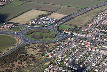
The A127, also known as the Southend Arterial Road, is a major road in Essex, England. It was constructed as a new arterial road project in the 1920s, linking Romford with Southend-on-Sea, replacing the older A13. Formerly classified as a trunk road, it was "de-trunked" in 1997. It is known as the Southend Arterial Road except for part of its length in Southend-on-Sea. It is also streetlit for its whole length despite its majority coverage through rural land.

<span class="mw-page-title-main">London Riverside</span>

The London Riverside is a redevelopment area on the north side of the River Thames in East London, England. The area was identified as a zone of change following the introduction of the Thames Gateway policy in 1995. Proposals for improvements in the area were at first developed by Havering and Barking and Dagenham councils, with a London Riverside Urban Strategy published in 2002. This was incorporated into the first London Plan published by the Mayor of London in 2004. Between 2004 and 2013 the planning powers in London Riverside and the Lower Lea Valley were the responsibility of the London Thames Gateway Development Corporation. Planning powers have now reverted to the local councils. Much of the land available for redevelopment is now owned by GLA Land and Property. There is also a London Riverside business improvement district, which covers a smaller area.

<span class="mw-page-title-main">A130 road</span> Road in Essex, England

The A130 is a major road in England linking Little Waltham, near Chelmsford, the county town of Essex, with Canvey Island in the south of that county. It is a primary route for most of its length, only losing that status south of the A13 junction at Sadlers Farm roundabout as it nears its terminus on Canvey Island. It was originally a much longer cross-country route.

There are various formal and informal subdivisions of London Borough of Barking and Dagenham and of parts of that borough.

<span class="mw-page-title-main">Rainham, London</span> Suburb of East London, England

Rainham is a suburb of East London, England, in the London Borough of Havering. Historically an ancient parish in the county of Essex, Rainham is 13.6 miles (21.9 km) east of Charing Cross and is surrounded by a residential area, which has grown from the historic village, to the north and a commercial area, fronting the River Thames, to the south. As part of the suburban growth of London in the 20th century, Rainham significantly expanded and increased in population, becoming part of Hornchurch Urban District in 1934, and has formed part of Greater London since 1965. The economic history of Rainham is underpinned by a shift from agriculture to industry and manufacture and is now in a period of regeneration, coming within the London Riverside section of the Thames Gateway redevelopment area.

<span class="mw-page-title-main">Rainham railway station (London)</span> Railway station in London, United Kingdom

Rainham railway station is on the London, Tilbury and Southend line, serving the town of Rainham in the London Borough of Havering, east London. Historically in the county of Essex, in official literature the station is sometimes shown as Rainham (Essex) in order to distinguish it from the station of the same name in Kent.

<span class="mw-page-title-main">Castle Green railway station</span> Proposed Railway Station

Castle Green is a proposed railway station in the London Borough of Barking and Dagenham. Plans for a station at the site, initially called Renwick Road, have been in development since at least 2002. The new station was first proposed to be between Barking and Dagenham Dock on the London, Tilbury and Southend line. In 2017 a station was safeguarded on the extension of the Gospel Oak to Barking line between Barking and Barking Riverside. The station would serve the communities of Castle Green, Thames View Estate and new housing developments in the area.

References

  1. 1 2 "Engineer Rana Educare, Whitechapel High St, London E1 7RA, United Kingdom to 11 E India Dock Rd, London E14 0NP, UK to Thames Gateway South Essex, Castle Point Council Offices, Kiln Rd, Thundersley, Benfleet SS7 1TF, United Kingdom to 186 London Rd, Westcliff-on-Sea, Southend-on-Sea SS1 1PJ, UK to A13, Southend-on-Sea SS2 4UY, UK to Campfield Road, Southend-on-Sea SS3 9DA, United Kingdom". Google Maps . Alphabet Inc. Retrieved 11 February 2023.
  2. http://www.british-history.ac.uk/report.aspx?compid=46475 British History Online - "Pennyfields", Survey of London: volumes 43 and 44: Poplar, Blackwall and Isle of Dogs (1994), pp. 111-113. Date accessed: 14 November 2007
  3. http://www.british-history.ac.uk/report.aspx?compid=46478 British History Online - "East India Dock Road: Introduction", Survey of London: volumes 43 and 44: Poplar, Blackwall and Isle of Dogs (1994), pp. 120-126. Date accessed: 14 November 2007
  4. "The Iron Bridge Over The River Lea, 1810 (p. 126)", Survey of London vol=43 and 44: Poplar, Blackwall and Isle of Dogs (1994), pp. XI–XX, retrieved 14 February 2011
  5. http://www.british-history.ac.uk/report.aspx?compid=42748 British History Online - "West Ham: Introduction", A History of the County of Essex: Volume 6 (1973), pp. 43-50. Date accessed: 16 November 2007.
  6. http://www.sabre-roads.org.uk/forum/viewtopic.php?t=7223&postdays=0&postorder=asc&start=0 This thread on the SABRE forums includes a letter from TfL setting out their reasons for reducing the limit from 50 to 40 mph (64 km/h). Letter dated 5 January 2006.
  7. "Benaim - About us - Awards". Archived from the original on 11 February 2008. Retrieved 2008-02-01. Benaim Group webpage listing Concrete Society awards for 2000
  8. "Barking & Dagenham Local History | Where History is in the Past". Archived from the original on 15 November 2007. Retrieved 2007-11-02. Barking and Dagenham Local History website: Barking & Dagenham Post, 22 December 1999
  9. "House of Commons Hansard Debates for 27 Jan 1995". Archived from the original on 16 July 2011. Retrieved 2007-11-07. Parliamentary debate on the A13 on 27 January 1995, first part
  10. "House of Commons Hansard Debates for 27 Jan 1995". Archived from the original on 16 July 2011. Retrieved 2007-11-07. Parliamentary debate on the A13 on 27 January 1995, second part
  11. "Barking & Dagenham Local History | Where History is in the Past". Archived from the original on 15 November 2007. Retrieved 2007-11-02. Barking and Dagenham Local History website: Barking & Dagenham Post, 2 July 1997,
  12. "Litmus Towers — Studio of Cinematic Architecture". Archived from the original on 9 October 2018. Retrieved 9 October 2018.
  13. "Barking & Dagenham Local History | Where History is in the Past". Archived from the original on 15 November 2007. Retrieved 2007-11-02. Barking and Dagenham Local History website: Barking & Dagenham Post, 16 December 1998.
  14. "Ten-year transport programme for Eastern region". Department for Transport (East). Archived from the original on 18 May 2015. Retrieved 19 November 2008.
  15. "Sadlers Farm Junction - CC/BAS/105/07" (PDF). Essex County Council . Retrieved 19 November 2008.
  16. "Thames Gateway Commercial Market Report - Winter 2007" (PDF). Knight Frank LLP. Archived from the original (PDF) on 16 March 2008. Retrieved 2008-11-19.
  17. 1 2 "1923 MOT Two Inch Map (extract)". Ordnance Survey . Retrieved 2 August 2012.
  18. "Barking & Dagenham Local History | Where History is in the Past". Archived from the original on 15 November 2007. Retrieved 2007-11-02. Barking and Dagenham Local History website: Dagenham Post & Barking Rainham Guardian, 1 June 1928
  19. http://www.british-history.ac.uk/report.aspx?compid=42722 British History Online - "The ancient parish of Barking: introduction", A History of the County of Essex: Volume 5 (1966), pp. 184-190. Date accessed: 14 November 2007.
  20. http://www.british-history.ac.uk/report.aspx?compid=42731 British History Online - "Dagenham: Introduction and manors", A History of the County of Essex: Volume 5 (1966), pp. 267-281. Date accessed: 14 November 2007.
  21. http://www.british-history.ac.uk/report.aspx?compid=42835 British History Online - "Wennington", A History of the County of Essex: Volume 7 (1978), pp. 180-190. Date accessed: 16 November 2007.
  22. http://www.british-history.ac.uk/report.aspx?compid=63837 British History Online - "Parishes: Aveley", A History of the County of Essex: Volume 8 (1983), pp. 1-16. Date accessed: 16 November 2007
  23. http://www.npemap.org.uk/tiles/map.html#569,183,1 Both original route (yellow) and old by-pass (red) can be seen in this New Popular Edition Map dated 1946
  24. http://www.sabre-roads.org.uk/forum/viewtopic.php?t=16466 This thread on the SABRE website forums discusses opening dates for roads built in the 1970s, based on contemporary maps (The Atlas Dating Project). The A13 between the A176 and A130 was deemed to have been built some time between 1975 and 1978; no firm date, however, was arrived at.
  25. http://www.sabre-roads.org.uk/forum/viewtopic.php?t=16467 This thread on the SABRE website forums discusses opening dates for roads built in the 1980s, based on contemporary maps (The Atlas Dating Project). The A13 between the M25 and A128 was deemed to have opened in 1982, and the section between A128 and A1014 in 1985.
  26. http://www.sabre-roads.org.uk/forum/viewtopic.php?t=16468 This thread on the SABRE website forums discusses opening dates for roads built in the 1990s, based on contemporary maps (The Atlas Dating Project). The A13 between the A1014 and A176 was deemed to have been complete in 1993, largely taking over the old Stanford-le-Hope Bypass.
  27. "1923 MOT Half Inch Map Sheet 30 (Colchester)". Ordnance Survey . Retrieved 2 August 2012.
  28. "Third London Airport: Maplin Project; final and draft report; motorway/highspeed rail access ringway 3 to Maplin - corridor study. With plans". The National Archives. Retrieved 2 August 2012.
  29. "M13". Steven Jukes (using data from The National Archives file AT 56/98). Retrieved 2 August 2012.
  30. "Man jailed over dumper truck chase that left police "petrified" | Crime | the Guardian".
  31. "AMEC - Press releases". Archived from the original on 16 October 2006. Retrieved 2007-11-16. AMEC (parent co. of RMS) press release, 11 April 2000.
  32. http://webarchive.nationalarchives.gov.uk/20081107152248/http://www.highways.gov.uk/roads/2745.aspx Highways Agency DBFO Project List
  33. http://news.bbc.co.uk/1/hi/in_depth/uk_politics/2000/london_mayor/534814.stm BBC News Online article: "In Depth - London Mayor - What does the Mayor get to do?", 16 May 2000.
  34. "Network Management" (PDF). Archived from the original (PDF) on 17 July 2013. Retrieved 22 June 2013.
  35. 1 2 "Cycle". Transport for London (TfL). Retrieved 9 May 2020.
  36. "Relation: Cycle Superhighway 3". OpenStreetMap . Retrieved 9 May 2020.
  37. "Route 13". Sustrans . Archived from the original on 9 May 2020. Retrieved 9 May 2020.
  38. "Relation: NCN National Route 13". OpenStreetMap . Retrieved 9 May 2020.
  39. 1 2 "Regional Funding Allocation - A13 Passenger Transport Corridor". East of England Regional Assembly. Archived from the original on 6 June 2011. Retrieved 2008-12-03.
  40. 1 2 "A13 widening works set to move a step closer". 29 October 2014. Retrieved 1 December 2015.
  41. http://www.sabre-roads.org.uk/forum/viewtopic.php?p=115409 This thread on the SABRE website forums includes a letter from Barking & Dagenham Council outlining plans for the Renwick Road junction, dated 22 November 2005.
  42. https://www.webarchive.org.uk/wayback/archive/20100107054500/http://www.london.gov.uk/mayor/planning_decisions/strategic_dev/2007/20070328/barking_riverside_report.rtf Transport for London planning decisions: Barking Riverside, London Borough of Barking and Dagenham planning application no. 04/01230/OUT, planning report PDU/0150/02, dated 28 March 2007.
  43. "Barking & Dagenham Local History | Where History is in the Past". Archived from the original on 15 November 2007. Retrieved 2007-11-02. Barking and Dagenham Local History website: Ilford & Barking Independent, 17 December 1987
  44. "Thames Gateway Bridge | Transport for London". Archived from the original on 18 October 2007. Retrieved 2007-11-01. TfL Thames Gateway Bridge webpage
  45. http://www.transportbriefing.co.uk/strategyandprojects.php?id=2201 [ permanent dead link ] Transport Briefing (9 November 2008) - "Mayor culls projects"
  46. "Highways Agency - A13 (London to Tilbury)". Archived from the original on 9 August 2007. Retrieved 2007-11-02. Highways Agency A13 Route Management webpage
  47. A13 Trunk Road to the Sea
  48. McKay, Sinclair McKay (18 April 2004). "At the end of the A13 at the end of the A13 at the end of the A13". The Telegraph. Retrieved 28 February 2012.
  49. Newman, Mike (18 August 2018). Adverse Camber: An Incomplete walk to the seaside. ISBN   9780244102821 . Retrieved 8 May 2020.

51°30′39″N0°23′54″E / 51.51072°N 0.39847°E / 51.51072; 0.39847