The North York Moors is an upland area in north-eastern Yorkshire, England. It contains one of the largest expanses of heather moorland in the United Kingdom. The area was designated as a National Park in 1952, through the National Parks and Access to the Countryside Act 1949. Covering an area of 554 sq mi (1,430 km2), the National Park has a population of 23,380. It is administered by the North York Moors National Park Authority, which is based in Helmsley.
Guisborough is a market town and civil parish in the borough of Redcar and Cleveland, North Yorkshire, England. It lies north of the North York Moors National Park. Roseberry Topping, midway between the town and Great Ayton, is a landmark in the national park. At the 2011 census, the civil parish with outlying Upleatham, Dunsdale and Newton under Roseberry had a population of 17,777, of which 16,979 were in the town's built-up area. It was governed by an urban district and rural district in the North Riding of Yorkshire.
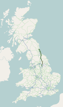
The A19 is a major road in England running approximately parallel to and east of the A1 road. Although the two roads meet at the northern end of the A19, the two roads originally met at the southern end of the A19 in Doncaster, but the old route of the A1 was changed to the A638. From Sunderland northwards, the route was formerly the A108. In the past the route was known as the East of Snaith-York-Thirsk-Stockton-on-Tees-Sunderland Trunk Road. Most traffic joins the A19, heading for Teesside, from the A168 at Dishforth Interchange.

Robin Hood's Bay is a village in North Yorkshire, England. It is 6 miles (10 km) south of Whitby and 15 miles (24 km) north of Scarborough on the Yorkshire Coast.

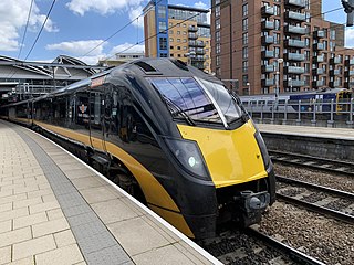
The Esk Valley Line is a railway line located in the north of England, covering a total distance of approximately 35 miles (56 km), running from Middlesbrough to Whitby. The line follows the course of the River Esk for much of its eastern half.
Scalby, a village on the north edge of Scarborough, North Yorkshire, England, is part of the civil parish of Newby and Scalby. From 1902 to 1974, Scalby was an urban district in the North Riding of Yorkshire.

The A165 is a road that links Scarborough and Kingston upon Hull, both in Yorkshire, England. The road is designated as a Primary Route from its junction with the A64 in Scarborough to its southern terminus in Hull.

The Cleveland Way is a National Trail in the historic area of Cleveland in North Yorkshire, Northern England. It runs 110 miles (177 km) between Helmsley and the Brigg at Filey, skirting the North York Moors National Park.

The A172 is a major road in North Yorkshire, and the unitary authority of Middlesbrough, England. It runs from Ingleby Arncliffe to Middlesbrough. The road derives its adumbrated number from 1969 when a thoroughfare link connected South Teesside with the Lackenby Docks in Middlesbrough. Since further urban infrastructure development it has been extended into the North Yorkshire Moors, when it transforms into A174.
The A170 is an A road in North Yorkshire, England that links Thirsk with Scarborough through Hambleton, Helmsley, Kirkbysmoorside, Pickering. The road is 47 miles (76 km); a single carriageway for almost its totality.

Lockwood is a civil parish in the unitary authority of Redcar and Cleveland with ceremonial association with North Yorkshire, England. The population of Lockwood ward in the Redcar and Cleveland Unitary authority taken at the 2011 census was 2,022.

United Automobile Services was a bus company, which operated local and regional bus services in County Durham, Cumbria, Northumberland, North Yorkshire and Tyne & Wear, England. It provided bus services across a wide geographical area, stretching from the border town of Berwick-upon-Tweed in the north, Filey in the south, and Carlisle in the west.
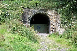
The Whitby, Redcar and Middlesbrough Union Railway (WRMU), a.k.a. the Whitby–Loftus Line, was a railway line in North Yorkshire, England, built between 1871 and 1886, running from Loftus on the Yorkshire coast to the Esk at Whitby, and connecting Middlesbrough to Whitby along the coast.
Transport in Leeds consists of extensive road, bus and rail networks in Leeds, West Yorkshire, England. Public transport in the Leeds area is coordinated and developed by West Yorkshire Metro. The city has good rail and road links to the rest of the country. Leeds railway station is one of the busiest in Britain, and Leeds is connected to the national road network via the A1(M) motorway, M1 motorway and M62 motorway. The city is served by Leeds Bradford Airport.

The A174 is a major road in North Yorkshire, England. It runs from the A19 road at Thornaby-on-Tees, across South Teesside and down the Yorkshire Coast to Whitby. The A174 is the coastal route between Teesside and Whitby; the alternative road, the A171, is described as being the moorland route.
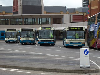
Middlesbrough Bus Station serves the town of Middlesbrough in North Yorkshire, England. It is located around 1⁄4 mi (400 m) from the town's railway station.

Stainsacre is a village in the civil parish of Hawsker-cum-Stainsacre in the Scarborough district of North Yorkshire on the edge of the North York Moors National Park. It lies 2 miles (3.2 km) south-east of Whitby, near the A171 road.

The A169 is an A road in North Yorkshire, England. It runs from the A64 at Malton on the edge of the Yorkshire Wolds through the Vale of Pickering and across the North York Moors to join the A171 just west of Whitby. It is a single carriageway for all of its 25-mile (40 km) route. Whilst it is not considered a Primary Route nationally, the Ryedale Local Transport Plan lists it as part of its Major Road Network alongside the A64, A166 and A171.

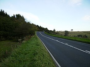
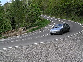
Hawsker is the name for the combined villages of High and Low Hawsker that straddle the A171 road 2.5 miles (4 km) southeast of Whitby, in North Yorkshire, England.
Slapewath is a hamlet in the borough of Redcar and Cleveland and the ceremonial county of North Yorkshire, England. Whilst the name of the hamlet is recorded as far back as the 13th century, it was developed due to the alum and ironstone industries of the North-Eastern part of Yorkshire in the 16th and 19th centuries respectively. The hamlet lies on the A171 road.