Alameda is a city in Alameda County, California, United States, located in the East Bay region of the Bay Area. The city is built on an informal archipelago in San Francisco Bay, consisting of Alameda Island, Bay Farm Island and Coast Guard Island, along with other smaller islands. As of the 2020 census, the city's population was 78,280.

Oakland is the most populous city in and the county seat of Alameda County, California, United States. A major West Coast port, Oakland is the largest city in the East Bay region of the San Francisco Bay Area, and the third-largest city overall in the Bay Area. With a population of 440,646 in 2020, it serves as the Bay Area's trade center: the Port of Oakland is the busiest port in Northern California, and the fifth- or sixth-busiest in the United States. A charter city, Oakland was incorporated on May 4, 1852, in the wake of the state's increasing population due to the California gold rush.

Alameda County is a county located in the U.S. state of California. As of the 2020 census, the population was 1,682,353, making it the 7th-most populous county in the state and 21st most populous nationally. The county seat is Oakland. Alameda County is in the San Francisco Bay Area, occupying much of the East Bay region.

Lake Merritt is a large tidal lagoon in the center of Oakland, California, just east of Downtown. It is named after Samuel Merritt, Oakland's mayor in 1867–1869, who had the lagoon dammed turning the tidal lagoon into a salt water lake. It is surrounded by parkland and city neighborhoods. It is historically significant as the United States' first official wildlife refuge, designated in 1870, and has been listed as a National Historic Landmark since 1963.

Telegraph Avenue is a street that begins, at its southernmost point, in the midst of the historic downtown district of Oakland, California, and ends, at its northernmost point, at the southern edge of the University of California, Berkeley campus in Berkeley, California. It is approximately 4.5 miles (7.2 km) in length.

East Oakland is a geographical region of Oakland, California, United States, that stretches between Lake Merritt in the northwest and San Leandro in the southeast. As the southeastern portion of the city, East Oakland takes up the largest portion of the city's land area.

The Chinatown neighborhood in Oakland, California, is traditionally Chinese which reflects Oakland's diverse Chinese American, and more broadly Asian American community. It is frequently referred to as "Oakland Chinatown" in order to distinguish it from nearby San Francisco's Chinatown. It lies at an elevation of 39 feet.
Oakland Unified School District is a public education school district that operates a total of 80 elementary schools (TK–5), middle schools (6–8), and high schools (9–12). There are also 28 district-authorized charter schools in Oakland, California, United States, serving a total of 48,704 students across both district-run and district-authorized charter schools.

Grand Lake, or the Grand Lake District, is a neighborhood in Oakland, California, United States. The neighborhood is located in the northeast corner of Lake Merritt, where Grand Avenue and Lakeshore Avenue pass under Interstate 580. It borders Adams Point to the west, Trestle Glen/Crocker Highlands to the east, and the city of Piedmont to the north. It lies at an elevation of 52 feet.

The Civic Center neighborhood of Los Angeles, California, is the administrative core of the City of Los Angeles, County of Los Angeles, and a complex of city, county, state, and federal government offices, buildings, and courthouses. It is located on the site of the former business district of the city during the 1880s and 1890s, since mostly-demolished.

West Oakland is a neighborhood situated in the northwestern corner of Oakland, California, United States, situated west of Downtown Oakland, south of Emeryville, and north of Alameda. The neighborhood is located along the waterfront at the Port of Oakland and at the eastern end of the San Francisco–Oakland Bay Bridge. It lies at an elevation of 13 feet.
The Lakeside Apartments District neighborhood, also known as The Gold Coast, and simply as The Lakeside, is one of Oakland's historic residential neighborhoods between the Downtown district and Lake Merritt. In the context of a Cultural Heritage Survey, the City of Oakland officially named most of the blocks of the neighborhood "The Lakeside Apartments District," and designated it as a local historic district with architecturally significant historic places, and Areas of Primary Importance (APIs). The greater neighborhood includes the interior blocks officially designated as a local historic district and the 'Gold Coast' peripheral areas along Lakeside Drive, 20th Street, and the west edge of Lake Merritt, areas closer to 14th Street and the Civic Center district, and blocks adjacent to downtown along Harrison Street.
Oaksterdam is a cultural district on the north end of Downtown Oakland, California, where medical cannabis is available for purchase in cafés, clubs, and patient dispensaries. Oaksterdam is located between downtown proper, the Lakeside, and the financial district. It is roughly bordered by 14th Street on the southwest, Harrison Street on the southeast, 19th Street on the northeast, and Telegraph Avenue on the northwest. The name is a portmanteau of "Oakland" and "Amsterdam," due to the Dutch city's cannabis coffee shops and the drug policy of the Netherlands.

The station complex of Amtrak's Oakland Coliseum station and Bay Area Rapid Transit (BART)'s Coliseum station is located in the East Oakland area of Oakland, California, United States. The two stations, located about 600 feet (180 m) apart, are connected to each other and to the Oakland Coliseum/Oakland Arena sports complex with an accessible pedestrian bridge. The BART station is served by the Orange, Green, and Blue lines; the Amtrak station is served by the Capitol Corridor service.

Downtown Oakland is the central business district of Oakland, California, United States. It is located roughly bounded by both the Oakland Estuary and Interstate 880 on the southwest, Interstate 980 on the northwest, Grand Avenue on the northeast, and Lake Merritt on the east.

Uptown Oakland is a neighborhood in Oakland, California, located in the northern end of Downtown. It is located roughly between West Grand Avenue to the north, Interstate 980 to the west, City Center and 14th Street to the south, and Broadway to the east. The neighborhood has become an important entertainment district in recent years.
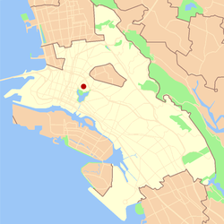
Oakland's Civic Center neighborhood is a residential and public building district on the east side of Oakland's Central Business District. Its borders are roughly Downtown and Harrison Street to the west, the East Lake Neighborhood and Lakeshore Avenue to the east, the Lakeside Apartments District and 14th Street to the North, and Chinatown and 11th Street to the South.

Oaklandish is a fashion line and retail store located in Oakland, California, in the United States. The company logo is a modified version of the city logo, an oak tree with wide outspread roots. 10% of the proceeds from the sales of Oaklandish items goes to local non-profit community groups through the "Oakland Innovators Award" grant program. Everything sold in the store is screen-printed in Oakland. In 2016, the store was named the 38th fastest growing inner city business in the United States by Fortune.

The history of Oakland, a city in the county of Alameda, California, can be traced back to the founding of a settlement by Horace Carpentier, Edson Adams, and Andrew Moon in the 19th century. The area now known as Oakland had seen human occupation for thousands of years, but significant growth in the settlements that are now incorporated into the city did not occur until the Industrial Revolution. Oakland was first incorporated as a town in 1852.