Glenview, Oakland, California

Last updated
Glenview
Location map Oakland.png
Red pog.svg
Glenview
Coordinates: 37°48′22.0566″N122°13′17.3742″W / 37.806126833°N 122.221492833°W / 37.806126833; -122.221492833 Coordinates: 37°48′22.0566″N122°13′17.3742″W / 37.806126833°N 122.221492833°W / 37.806126833; -122.221492833
CountryUnited States
State California
County Alameda
City Oakland
Government
   Councilman Noel Gallo
   Supervisor Keith Carson
Area
  Total0.66 sq mi (1.7 km2)
  Land0.66 sq mi (1.7 km2)
  Water0 sq mi (0 km2)  0%
Elevation
272 ft (83 m)
Population
 (1 April 2010)
  Total5,599
  Density8,500/sq mi (3,300/km2)
ZIP code
94602

Glenview is a neighborhood in Oakland, California developed in the early decades of the 20th century, mostly with mid-sized 2 and 3-bedroom craftsman bungalows. The neighborhood lies in the Oakland foothills, bordering Dimond Park on the eastern side of the district, and Park Boulevard on the northwestern side. The upper portion of the neighborhood sits on the west side of Park Boulevard and is bordered by the Trestle Glen neighborhood as well as the City of Piedmont. Park Boulevard, as the neighborhood spine, also serves as the local shopping node, with a number of convenience shops and several restaurants stretching a few blocks. To the south, the neighborhood is delimited by MacArthur Blvd and the I-580 freeway.

Contents

The compact street grid along with a good number of amenities in the vicinity (a park, grocery stores, a library, and a number of restaurants) makes the neighborhood highly walkable, with the site walkscore.com rating it "Very Walkable: Most errands can be accomplished on foot.". [1] Per VisitOakland, "Glenview feels more like a very quiet Rockridge with a couple of good restaurants and well-manicured gardens. [2] For trips further afield, AC Transit offers local and transbay bus service mainly from Park Boulevard and MacArthur Boulevard.

The neighborhood school, Glenview Elementary School, built 1927, was found to be seismically inferior by the State Architect and was demolished in 2017, except for the historic art deco facade. It is currently being rebuilt and is expected to open following the 2019 winter break. Since the academic year 2016/2017, the school has been operating in the Santa Fe neighborhood, at the Santa Fe campus. [3]

Demographics

Per the 2010 Census, [4] there were 2,576 households in the neighborhood. Of these, 1,074 rented their unit, and 1,502 owned it. The neighborhood overall contained 5,599 residents of which 3,106 were female and 2,493 male. Relative to Oakland as a whole, there were fewer teenagers and young adults, while members of the baby boomer generation born from the mid-1940s and 20 years hence were heavily represented (as of 2010). With a size of 0.66 square miles (1.7 km2), Glenview has a population density of 8,500 persons per square mile, slightly higher than the citywide average of 7,500.

Glenview age census 2010.svg Glenview Oakland race and ethnic breakdown US Census 2010.svg

The neighborhood is more affluent than Oakland as a whole, with a median household income of $84,375 (versus $57,778 for Oakland) per 2016 data. [5] Yet, an until recently relatively affordable neighborhood with many good family starter homes and ease of commuting to San Francisco, the neighborhood, along with large swaths of the East Bay, has seen its prices increase rapidly, to the point where Redfin, the real estate broker site, featured the area on a national list of "10 Hottest Neighborhoods to Close out the Year [2017]." [6]

History

The neighborhood was subdivided around 1910 by the developer Wickham Havens Inc (in which Walter Leimert, builder of Leimert Bridge was an executive [7] ), and initially referred to as Fourth Avenue Terrace (east of Park Blvd) and Fourth Avenue Terrace Extension (west of Park Blvd). [8] In the early subdivision maps, which doubled as marketing materials, the company attempted to entice would-be-owners with the prospects of good access to the city ("residence sites so close to the heart of Oakland that they should be classed as City, NOT suburban--It is but fifteen minutes from the center of Oakland by car line"). [9] Not only could buyers get to the city via Park Blvd lines, but the early maps shows a second wider right-of-way for Key System streetcar route extension running between Wellington St and Hampel St. While this must have been part of the attraction for early buyers, this extension was never realized.

The district was largely built out by the mid 1930s. Seven out of 10 units in existence today were built before 1939. [10] By the mid-1930s, in a report on creditworthiness of the neighborhood written for the Federal Government's Home Owners' Loan Corporation program which would later earn notoriety for fostering the practice known as red-lining or denying home loans to African American neighborhoods, local officials described the neighborhood approvingly as a "[h]omogeneous district of semi-modern and modern homes and cottages. Convenient to local transportation, excellent schools, and shopping district, in demand by better class people of moderate income." [11]

See also

Related Research Articles

Richmond District, San Francisco Neighborhood in San Francisco, California, United States

The Richmond District is a neighborhood in the northwest corner of San Francisco, California, developed initially in the late 19th century. It is sometimes confused with the city of Richmond, which is 20 miles (32 km) northeast of San Francisco.

Pico-Union, Los Angeles Neighborhood of Los Angeles in California, United States of America

Pico-Union is a neighborhood in Central Los Angeles, California. The name "Pico-Union" refers to the neighborhood that surrounds the intersection of Pico Boulevard and Union Avenue. Located immediately west of Downtown Los Angeles, it is home to over 40,000 residents.

Leimert Park, Los Angeles Neighborhood of Los Angeles in California, United States

Leimert Park is a neighborhood in the South Los Angeles region of Los Angeles, California.

Crenshaw, Los Angeles Neighborhoods of Los Angeles in California, United States

Crenshaw, or the Crenshaw District, is a neighborhood in South Los Angeles, California.

Crenshaw Boulevard Major street in Los Angeles

Crenshaw Boulevard is a north-south thoroughfare in Los Angeles, California, that runs through Crenshaw and other neighborhoods along a 23-mile route in the west-central part of the city.

Jefferson Park, Los Angeles Neighborhood of Los Angeles in California, United States

Jefferson Park is a neighborhood in the South region of the City of Los Angeles, California.

Leimert Bridge

Leimert Bridge is located in the Oakmore neighborhood of Oakland, California. It spans 357 ft (109 m) and is 117 ft (36 m) high above Sausal Creek. It is a cement and steel arch bridge. When it was built in 1926, it was the largest single-span bridge on the West Coast.

Montclair, Oakland, California Neighborhood of Oakland in Alameda, California, United States

Montclair is an affluent neighborhood in Oakland, California, United States. Montclair is located along the western slope of the Oakland Hills from a valley formed by the Hayward Fault to the upper ridge of the hills. In terms of real estate prices, levels of education, collective social capital, and name recognition, Montclair is one of Oakland's most prestigious neighborhoods.

Fruitvale, Oakland, California Neighborhood of Oakland in Alameda, California, United States

Fruitvale is a neighborhood in Oakland, California, United States. It is located approximately 4 miles (6.44 km) southeast of Downtown, and is home to the city's largest Hispanic population, with Hispanics constituting 53.8% of Fruitvale's population. Fruitvale's ZIP code is 94601. It lies at an elevation of 49 feet.

Los Angeles Railway

The Los Angeles Railway was a system of streetcars that operated in Central Los Angeles and surrounding neighborhoods between 1895 and 1963. The system provided frequent local services which complimented the Pacific Electric "Red Car" system's largely commuter-based interurban routes. The company carried many more passengers than the Red Cars, which served a larger and sparser area of Los Angeles.

Dimond District, Oakland, California Neighborhood of Oakland in Alameda, California, United States

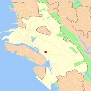
The Dimond District is a neighborhood centered on the intersection of MacArthur Boulevard and Fruitvale Avenue in East Oakland, California, in the United States. It is located about two miles east of Lake Merritt, north of the Fruitvale District, and west of the Laurel District. It lies at an elevation of 213 feet. Dimond's ZIP code is 94602. It is a multicultural neighborhood where the hills meet the flatlands and is a unique melting pot of cultures and social classes. Dimond Park is located in the district.

Oakmore is a neighborhood in Oakland, California located east of Park Boulevard and north of Dimond Park. This neighborhood was built in the 1920s and 1930s for people who worked in San Francisco and took the Key Route to work. The Key System was a primary user of the Leimert Bridge, which connects Oakmore to Park Boulevard.

Old Fourth Ward Neighborhoods of Atlanta in Fulton County, Georgia, United States

The Old Fourth Ward, often abbreviated O4W, is an intown neighborhood on the eastside of Atlanta, Georgia, United States. The neighborhood is best known as the location of the Martin Luther King Jr. historic site.

Sausal Creek (Alameda County)

Sausal Creek, 3.1 miles (5.0 km) long, is one of the principal creeks in Oakland, California.

Sedgefield is a neighborhood of Charlotte, North Carolina, United States. It is situated between Park Rd. and South Blvd and belongs to popular South End.

San Antonio, Oakland, California Neighborhood of Oakland in Alameda, California, United States

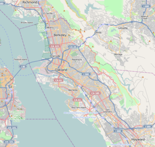
San Antonio is a large district in Oakland, California, encompassing the land east of Lake Merritt to Sausal Creek. It is one of the most diverse areas of the city. It takes its name from Rancho San Antonio, the name of the land as granted to Luís María Peralta by the last Spanish governor of California.

South Los Angeles Regions of Los Angeles County in California, United States

South Los Angeles, formerly South Central Los Angeles, is an area in southern Los Angeles County, California, lying mostly within the city limits of Los Angeles, south of downtown. It is "defined on Los Angeles city maps as a 16-square-mile rectangle with two prongs at the south end.” In 2003, the Los Angeles City Council renamed this area "South Los Angeles".

Los Angeles City Council District 10 is one of the 15 districts of the Los Angeles City Council.

References

  1. "Living in Glenview Oakland". Walkscore.com. Retrieved 1 May 2018.
  2. "VisitOakland". Glenview. Retrieved 1 May 2018.
  3. "Oakland Unified School District Glenview Reconstruction project update" (PDF). The Glenview Project. Oakland Unified School District. Retrieved 1 May 2018.
  4. "US Census Bureau, Census Block level data". US Census Bureau. Archived from the original on 18 January 2015. Retrieved 1 May 2018.
  5. "B19013 Median Household Income in the past 12 months". United States Census Bureau . Retrieved 1 May 2018.
  6. "Hot or Not? Redfin Reviews its Hottest Neighborhood Predictions and Identifies 10 Areas that are Just Heating Up". Redfin.com. Retrieved 1 May 2018.
  7. California. State Real Estate Commissioner's Dept (1918). California Real Estate Directory-bulletin of Licensed Real Estate Brokers and Salesmen. California State Printing Office. p. 72.
  8. "Maps of Fourth Avenue Terrace and Fourth Avenue Terrace Extension". Earth Sciences & Map Library. Wickham Havens, Inc. Retrieved 2 May 2018.
  9. "Fourth Avenue Heights, Oakland : on sale by Wickham Havens Incorporated". Earth Sciences & Map Library. Wickham Havens, Inc. Retrieved 2 May 2018.
  10. "Table B25034 YEAR STRUCTURE BUILT". American Factfinder. Archived from the original on 14 February 2020. Retrieved 1 May 2018.
  11. "T-RACES: a Testbed for the Redlining Archives of California's Exclusionary Spaces" (PDF). salt.umd.edu/T-RACES. Retrieved 2 May 2018.

37°48′22″N122°13′31″W / 37.80609°N 122.22532°W / 37.80609; -122.22532