Adlington, Lancashire

Last updated

Adlington
St Paul's CE Church, Adlington.jpg
Location map United Kingdom Borough of Chorley.svg
Red pog.svg
Adlington
Shown within Chorley Borough
Lancashire UK location map.svg
Red pog.svg
Adlington
Location within Lancashire
Population6,010 (2011)
OS grid reference SD605135
Civil parish
  • Adlington
District
Shire county
Region
Country England
Sovereign state United Kingdom
Post town CHORLEY
Postcode district PR6, PR7
Dialling code 01257
Police Lancashire
Fire Lancashire
Ambulance North West
UK Parliament
List of places
UK
England
Lancashire
53°37′00″N2°35′55″W / 53.616546°N 2.598583°W / 53.616546; -2.598583

Adlington is a village [1] and civil parish in the Borough of Chorley in Lancashire, England, near the West Pennine Moors. It is 3 miles (5 kilometres) south of Chorley. It became a separate parish in 1842 then grew into a township around the textile and coal mining industries until these closed in the 1960s. It had a population of 5,270 at the 2001 census, [2] and risen to 6,010 at the 2011 census. [3] The Leeds and Liverpool Canal runs through the village and is host to White Bear Marina which is the largest marina on the Leeds and Liverpool Canal.

Contents

History

Toponymy

The last element 'ington' indicates that Adlington was an Anglo-Saxon settlement from about A.D. 650, while the first element is either a personal name, Eadwulf, or the aetheling or prince. Recorded spellings include, in 1190 Edeluinton, in 1202 Adelventon, in 1246 Adelinton and, in 1288 Adlington. [4] [5]

Manor

Adlington was part of the Penwortham barony granted to Randle de Marsey and later held by the Ferrers. In 1184 Hugh Gogard granted land to Cockersand Abbey. [6] In 1202 Walter de Adlington granted six oxgangs of land to Siward de Duxbury. In 1230, Roger de Maresheya sold the township to the Earl of Chester. [6] In 1288, Hugh de Adlington and Adam de Duxbury each held a moiety of the manor of William de Ferrers. [7] The Duxbury portion was sold early in the 14th century and subdivided; several local families holding fractions. [7] Land belonging to the St. Nicholas chantry in Standish Church was acquired by William Heaton, who died in 1619. [7] John Pilkington, who had taken up arms for the king, but later took the side of Parliament in the civil war, had his estate sequestered. [7]

In 1307, John Adlington paid rent to Sir Gilbert Standish. In 1374, Robert le Norreys of Burton quitclaimed his share to Hugh of Standish. [6] In 1378, Sir Nicholas de Harrington held land subsequently held by Lord Ferrers of Groby and Thomas Harrington. There was a partition as some land was held of Lord Mounteagle, the Harringtons' successor. [7]

In 1469, Hugh de Adlington gave the manor to his son, Robert who conveyed it to John Tarleton and Hugh Culcheth. Adlington fell in and out of the Adlington family ownership for over five centuries. [6] Hugh Adlington died in 1525 holding messuages of Lord Mounteagle. His son Hugh died in 1556 holding the same estate which he left to his son John. Hugh Adlington died in 1640 holding the manor of Lord Morley and Mounteagle. His son Hugh was predeceased by his eldest son, John, who was killed fighting for the king at the Siege of Chester in 1644. Hugh was succeeded by Peter who had no surviving children and the manor descended to John's daughter Eleanor, who married Samuel Robinson of Chester in 1664. [7]

Before 1700, the manor was bought by Thomas Clayton, who died in 1722. The estate descended to his grandson Richard Clayton and in 1770, to his nephew, Sir Richard, who was created a baronet in 1774 and built Adlington Hall in 1771. Richard, consul at Nantes, died in 1828 and was succeeded by his daughter Henrietta, wife of General Robert Browne, who assumed the Clayton name. Their son, Richard Clayton Browne Clayton, died in November 1886. His only son died at Sevastopol and Adlington Hall passed to James Robert Browne Clayton Dawbeny. [7] Wigan council bought the 129-acre estate in 1921 to safeguard the village's water supply.

Adlington Hall, built on rising ground in 1771 by Sir Richard Clayton, was a Georgian mansion of brick and stone, and replaced an ancient timber and plaster house on the same site. [7] It was demolished in the 1960s.

Industrial Revolution

Coal was mined in the area for centuries, first outcrops of coal and bell pits and then deeper shafts to the Arley mine (seam) at 137 feet. The Adlington Coal Company sank Ellerbeck Colliery in 1876. The company went bankrupt in 1932. The mine was run privately during the 1930s and in 1947 was nationalised. As part of the National Coal Board in 1958, Ellerbeck Colliery employed 411 men and women who worked as pit brow lasses , it closed in 1965. In the late 1970s and early '80s Ellerbeck was open cast and has been landscaped.

In 1891 Davies and Eckersley operated the Huyton Bleachworks and the Pin Croft Dyeing and Printing Company were bleachers and finishers. The largest mill was Adlington Mill, Thomas Gerrard and Sons spinning and weaving mill, which had 43,000 spindles and 900 looms. Springfield Mill operated by Thomas Middeton & Company had 700 looms and Unsworth's Brook Mill had 2,700 spindles and 96 looms. [8]

Governance

In the Middle Ages Adlington was in the ecclesiastical parish of Standish in the Leyland Hundred of Lancashire. In 1837, Adlington joined with other townships (or civil parishes) in the area to form the Chorley Poor Law Union which took responsibility for the administration and funding of the Poor Law in that area. [9] A local board was formed in 1872 was replaced by an urban district council of twelve members in 1894. [7]

The village forms part of Chorley Borough which has headquarters at the town hall in Chorley. The village is represented on the council by three Labour Party councillors elected for the Adlington and Anderton ward. Adlington is part of the Chorley parliamentary constituency, which elected Lindsay Hoyle as Member of Parliament for the Labour party at the 2010 General Election. [10]

Geography

Adlington covers an area of 1,064 acres. [11] Its south-east boundary is the River Douglas and Buckow Brook separates the village from Worthington to the west. The Ellerbeck is the boundary with Duxbury. [7]

Economy

Adlington's economy was based on cotton mills and coal pits but the majority of these traditional industries have disappeared. The construction company Leonard Fairclough & Son was founded and based in the village before becoming part of the bigger AMEC group. [12]

Transport

Adlington railway station AdlingtonLancashire.JPG
Adlington railway station

Adlington's main road is the A6 from Manchester via Blackrod to Chorley and Preston. It has a junction with the B6227 towards Rivington. The M61 motorway passes the eastern fringe of the village.

Adlington railway station is on the Manchester to Preston Line. Another station, White Bear railway station in Station Road, was on the Lancashire Union Railway between Wigan and Blackburn. It closed in 1960 (the line remained in use for goods until 1974) with the ticket office remaining as a local café. Evidence can be found throughout Adlington of the villages lost line.

The Leeds and Liverpool Canal passes through Adlington where the White Bear Marina is the largest marina on the canal. [13]

Religion

The village has three active churches; St. Paul's, which is the Church of England parish church, St. Joseph's a Roman Catholic church and the United Reformed and Methodist church on Railway Road.

Christ Church was built in 1839 but was used as a chapel of ease after St. Paul's Church was built in 1884, [14] but is no longer used for worship and has been converted to a restaurant. In the past there was an iron mission church dedicated to St Philip and there were Wesleyan, Primitive Methodist and Congregational churches. [7]

Sports and recreation

White Bear Marina, Leeds and Liverpool Canal, Adlington White Bear Marina, on the Leeds and Liverpool Canal, Adlington, Chorley, Lancashire. - geograph.org.uk - 370555.jpg
White Bear Marina, Leeds and Liverpool Canal, Adlington
Elephant & Castle pub, Upper Adlington Elephant and Castle, Adlington - geograph.org.uk - 122912.jpg
Elephant & Castle pub, Upper Adlington

Adlington has two large recreational areas, the King George's Field [15] in the centre of the village and the Lower Playing Fields adjacent to the canal in lower Adlington. The King George's Field plays host to the village's amateur rugby league club Adlington Rangers and the village's football pub teams. Adlington also has a junior football club with a variety of age groups including an open age team. Meadow Road is home to Adlington Cricket Club which plays in the local Lancashire and Bolton leagues.

Notable people

Construction magnate Leonard Fairclough was born and lived in Adlington and has a memorial garden dedicated to him in the village. Sir Lindsay Hoyle, Speaker of the House of Commons, was born and raised in the village. John Christopher Bradshaw, a New Zealand organist and university professor, was born in Adlington.

See also

Related Research Articles

<span class="mw-page-title-main">Chorley</span> Town in Lancashire, England

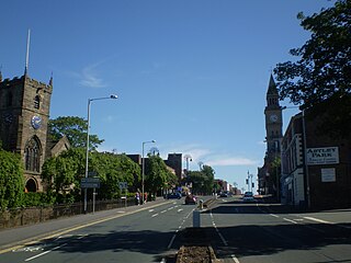
Chorley is a town and the administrative centre of the wider Borough of Chorley in Lancashire, England, 8 miles (13 km) north of Wigan, 11 miles (18 km) south west of Blackburn, 11 miles (18 km) north west of Bolton, 12 miles (19 km) south of Preston and 20 miles (32 km) north west of Manchester. The town's wealth came principally from the cotton industry.

<span class="mw-page-title-main">Borough of Chorley</span> Borough and non-metropolitan district in England

The Borough of Chorley is a local government district with borough status in Lancashire, England. It is named after the town of Chorley, which is an unparished area. The borough extends to several villages and hamlets including Adlington, Buckshaw Village, Croston, Eccleston, Euxton and Whittle-le-Woods.

<span class="mw-page-title-main">Coppull</span> Human settlement in England

Coppull is a village and civil parish in Lancashire, England. It is part of the Borough of Chorley, lies around 300 feet (91 m) above sea level. Its population is around 8,000, having been counted at 7,959 in the 2011 Census. It is bounded by Whittle Brook, Clancutt Brook, the River Yarrow, Eller Brook, Hic-Bibi Brook and Stars Brook. Coppull is located between Chorley and Standish, Greater Manchester, to the east of the A49 road near Charnock Richard.

<span class="mw-page-title-main">Standish, Greater Manchester</span> Human settlement in England

Standish is a village in the Metropolitan Borough of Wigan, Greater Manchester, England. Within the boundaries of the historic county of Lancashire, it is on the A49 road between Chorley and Wigan, near Junction 27 of the M6 motorway. The population of the village was 13,278 in the 2011 census.

<span class="mw-page-title-main">Chorley (UK Parliament constituency)</span> Parliamentary constituency in the United Kingdom, 1885 onwards

Chorley is a constituency in Lancashire represented in the House of Commons of the UK Parliament since 1997 by Lindsay Hoyle. Hoyle was originally elected for the Labour Party, but in 2019 became the Speaker, making him unaffiliated.

<span class="mw-page-title-main">Haigh, Greater Manchester</span> Village in Greater Manchester, England

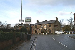
Haigh is a village and civil parish in the Metropolitan Borough of Wigan, Greater Manchester, England. Historically part of Lancashire, it is located next to the village of Aspull. The western boundary is the River Douglas, which separates the township from Wigan. To the north, a small brook running into the Douglas divides it from Blackrod. At the 2001 census it had a population of 594.

<span class="mw-page-title-main">Shevington</span> Village and civil parish in Greater Manchester, England

Shevington is a village and civil parish within the Metropolitan Borough of Wigan, Greater Manchester, England. The population of the Wigan ward called Shevington and Lower Ground had increased to 11,482 at the 2011 Census.

<span class="mw-page-title-main">Anglezarke</span> Human settlement in England

Anglezarke is a sparsely populated civil parish in the Borough of Chorley in Lancashire, England. It is an agricultural area used for sheep farming and is also the site of reservoirs that were built to supply water to Liverpool. The area has a large expanse of moorland with many public footpaths and bridleways. The area is popular with walkers and tourists; it lies in the West Pennine Moors in Lancashire, sandwiched between the moors of Withnell and Rivington, and is close to the towns of Chorley, Horwich and Darwen. At the 2001 census it had a population of 23, but at the 2011 census the population was included within Heapey civil parish. The area was subjected to depopulation after the reservoirs were built.

<span class="mw-page-title-main">Anderton, Lancashire</span> Human settlement in England

Anderton is a civil parish in the Borough of Chorley in Lancashire, England. It is now a suburb of Adlington, 5 miles (8 km) northwest of Bolton. Within its boundaries are the Rivington Reservoirs. Grimeford village is in the parish. In 2001, the parish had a population of 1,206, increasing to 1,316 at the 2011 census.

<span class="mw-page-title-main">Bretherton</span> Human settlement in England

Bretherton is a small village and civil parish in the Borough of Chorley, Lancashire, England, situated to the south west of Leyland and east of Tarleton. The population of the civil parish at the 2011 census was 669. Its name suggests pre-conquest origins and its early history was closely involved with the manor house Bank Hall and the families who lived there. Bretherton remained a rural community and today is largely residential with residents commuting to nearby towns.

<span class="mw-page-title-main">Duxbury Woods</span>

Duxbury Woods is an area of woodland and parkland situated in Chorley, Lancashire, at the foot of the West Pennine Moors. The area originally existed as a township with the council meeting at the Yarrow Bridge pub; this was absorbed into Chorley Rural District in the early 20th century.


Chorley Interchange is a bus station in Chorley, England.

<span class="mw-page-title-main">Heath Charnock</span> Human settlement in England

Heath Charnock is a small village and civil parish of the Borough of Chorley in Lancashire, England. According to the United Kingdom Census 2001 it has a population of 2,065, reducing to 2,026 at the 2011 Census.

<span class="mw-page-title-main">Frank Hall Standish</span>

Frank Hall Standish was an English landowner and an art and book collector.

<span class="mw-page-title-main">Mavis Mill</span> Cotton mill in Lancashire, England

Mavis Mill was a cotton spinning mill in Coppull, Chorley, Lancashire

<span class="mw-page-title-main">Thomas Standish</span> English politician

Thomas Standish of Duxbury Hall, Lancashire was an English politician who sat in the House of Commons between 1640 and 1642. Standish was a zealous Parliamentarian.

<span class="mw-page-title-main">Ellerbeck Colliery</span> Coal mine in Lancashire, England

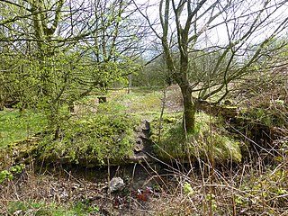
Ellerbeck Colliery was a coal mine located on the border of Coppull and Adlington in the Borough of Chorley in Lancashire, England. The Hilton House and Red Moss Coal Company sank the first shaft in 1876 and the colliery closed in 1928.

<span class="mw-page-title-main">Duxbury Hall</span> Country house in Lancashire, England

Duxbury Hall was a 19th-century country house in Duxbury Park estate in Duxbury Woods, Duxbury, Lancashire that has been demolished.

The Standish family is an ancient English feudal manorial family and one of the oldest Anglo-Norman noble lineages. This Norman-roots family has been settled in Lancashire from the Conquest of England in 1066. The known history of the Standish family begins at the end of the twelfth century.

References

  1. "About". Adlington Town Council. Retrieved 31 December 2023.
  2. "Parish headcount" (PDF). Lancashire County Council. Archived from the original (PDF) on 10 December 2006. Retrieved 21 October 2008.
  3. UK Census (2011). "Local Area Report – Adlington Parish (E04005139)". Nomis. Office for National Statistics . Retrieved 27 May 2019.
  4. Mills (1998), p. 3
  5. Adlington History, Adlington Info, archived from the original on 9 January 2002, retrieved 14 August 2010
  6. 1 2 3 4 Adlington.info History section Archived 9 January 2002 at the Wayback Machine
  7. 1 2 3 4 5 6 7 8 9 10 11 Farrer & Brownbill 1911 , pp. 217–220
  8. Cotton Mills in Adlington 1891, Grace's Guide, archived from the original on 16 January 2010, retrieved 29 December 2010
  9. Workhouse, Workhouses.org, archived from the original on 5 June 2011, retrieved 7 December 2010
  10. Election Results 2010, bbc.co.uk, archived from the original on 5 September 2017, retrieved 7 December 2010
  11. Adlington Township Boundaries, GenUKI, archived from the original on 6 December 2010, retrieved 28 December 2010
  12. "Industry and Business: Leonard Fairclough". adlington.info. Archived from the original on 6 March 2009. Retrieved 9 November 2008.
  13. White Bear Marina, British Waterways Marinas, archived from the original on 13 September 2010, retrieved 10 September 2010
  14. Adlington St Paul, archived from the original on 25 May 2011, retrieved 10 September 2010
  15. Recreation in Adlington Archived 22 June 2007 at the Wayback Machine

Bibliography