Arcadia Lakes, South Carolina

Last updated

Arcadia Lakes, South Carolina
Arcadia Lakes, SC Town Flag.jpg
Arcadia Lakes, SC Town Seal.png
Richland County South Carolina incorporated and unincorporated areas Arcadia Lakes highlighted.svg
Location in Richland County and the state of South Carolina.
Coordinates: 34°3′1″N80°57′51″W / 34.05028°N 80.96417°W / 34.05028; -80.96417
Country United States
State South Carolina
County Richland
Area
[1]
  Total0.67 sq mi (1.74 km2)
  Land0.56 sq mi (1.44 km2)
  Water0.11 sq mi (0.29 km2)
Elevation
[2]
220 ft (70 m)
Population
 (2020) [3]
  Total865
  Density1,552.96/sq mi (599.57/km2)
Time zone UTC-5 (EST)
  Summer (DST) UTC-4 (EDT)
ZIP code
29206
Area codes 803, 839
FIPS code 45-02125 [4]
GNIS feature ID1231010 [2]
Website arcadialakes.net

Arcadia Lakes is a town in Richland County, South Carolina, United States. The population was 861 at the 2010 census. [5] It is part of the Columbia, South Carolina, Metropolitan Statistical Area.

Contents

Geography

According to the United States Census Bureau, the town has a total area of 0.66 square miles (1.7 km2), of which 0.54 square miles (1.4 km2) is land and 0.12 square miles (0.3 km2), or 18.40%, is water. [5]

Demographics

Historical population
CensusPop.Note
1960 316
1970 741134.5%
1980 611−17.5%
1990 89947.1%
2000 882−1.9%
2010 861−2.4%
2020 8650.5%
U.S. Decennial Census [3]

2020 census

Arcadia Lakes racial composition [6]
RaceNum.Perc.
White (non-Hispanic)73284.62%
Black or African American (non-Hispanic)566.47%
Native American 10.12%
Asian 242.77%
Pacific Islander 10.12%
Other/Mixed 293.35%
Hispanic or Latino 222.54%

As of the 2020 United States census, there were 865 people, 370 households, and 225 families residing in the town.

2000 census

As of the census [4] of 2000, there were 882 people, 379 households, and 278 families residing in the town. The population density was 1,685.6 inhabitants per square mile (650.8/km2). There were 389 housing units at an average density of 743.4 per square mile (287.0/km2). The racial makeup of the town was 94.90% White, 3.63% African American, 0.79% Asian, 0.23% from other races, and 0.45% from two or more races. Hispanic or Latino of any race were 0.79% of the population.

There were 379 households, out of which 24.8% had children under the age of 18 living with them, 66.8% were married couples living together, 4.7% had a female householder with no husband present, and 26.6% were non-families. 22.7% of all households were made up of individuals, and 10.8% had someone living alone who was 65 years of age or older. The average household size was 2.33 and the average family size was 2.72.

In the town, the population was spread out, with 20.2% under the age of 18, 3.1% from 18 to 24, 18.5% from 25 to 44, 34.6% from 45 to 64, and 23.7% who were 65 years of age or older. The median age was 49 years. For every 100 females, there were 97.3 males. For every 100 females age 18 and over, there were 89.2 males.

The median income for a household in the town was $66,382, and the median income for a family was $79,179. Males had a median income of $56,125 versus $35,682 for females. The per capita income for the town was $37,762. About 0.7% of families and 2.9% of the population were below the poverty line, including 2.1% of those under age 18 and none of those age 65 or over.

Related Research Articles

<span class="mw-page-title-main">Mount Ayr, Indiana</span> Town in Indiana, United States

Mount Ayr is a town in Jackson Township, Newton County, in the U.S. state of Indiana. The population was 122 at the 2010 census.

<span class="mw-page-title-main">Eagle Lake, Maine</span> Town in the state of Maine, United States

Eagle Lake is a town in Aroostook County, Maine, United States. The population was 772 at the 2020 census. The town was named by a body of troops heading from Bangor to the Aroostook War for the many eagles that they saw around the lake. A total of 49.0% of the population speaks French, reflecting a trend in Northeastern Maine.

Garland is a town in Penobscot County, Maine, United States. The population was 1,026 at the 2020 census.

Lake Emma Township is a township in Hubbard County, Minnesota, United States. The population was 900 at the 2000 census.

Rush Lake Township is a township in Otter Tail County, Minnesota, United States. The population was 966 at the 2000 census.

<span class="mw-page-title-main">Silver Lake, Minnesota</span> City in Minnesota, United States

Silver Lake is a city in McLeod County, Minnesota, United States. The population was 866 at the 2020 census.

<span class="mw-page-title-main">Walton Park, New York</span> CDP in New York, United States

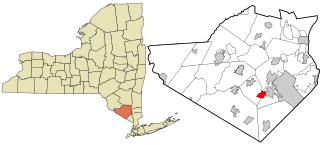
Walton Park is a census-designated place (CDP) in Orange County, New York, United States. As of the 2020 census, the CDP had a total population of 3,907. Walton Park is on the town line separating the towns of Chester and Monroe. Street addresses within Walton Park are usually assigned to Monroe, not Chester.

<span class="mw-page-title-main">East Arcadia, North Carolina</span> Town in North Carolina, United States

East Arcadia is a town in Bladen County, North Carolina, United States. The population was 487 at the 2010 census.

<span class="mw-page-title-main">White Lake, North Carolina</span> Town in North Carolina, United States

White Lake is a town in Bladen County, North Carolina, United States. The population was 802 at the 2010 census, up from 529 in 2000.

<span class="mw-page-title-main">Belwood, North Carolina</span> Town in North Carolina, United States

Belwood is a town in Cleveland County, North Carolina, United States. The population was 950 at the 2010 census.

<span class="mw-page-title-main">Lawndale, North Carolina</span> Town in North Carolina, United States

Lawndale is a town in Cleveland County, North Carolina, United States, situated along the First Broad River. The population was 606 at the 2010 census.

<span class="mw-page-title-main">Waco, North Carolina</span> Town in North Carolina, United States

Waco is a town in Cleveland County, North Carolina, United States. The population was 321 at the 2010 census.

<span class="mw-page-title-main">Cooleemee, North Carolina</span> Town in North Carolina, United States

Cooleemee is a town in Davie County, North Carolina, United States. The population was 940 at the 2020 census.

<span class="mw-page-title-main">Conetoe, North Carolina</span> Town in North Carolina, United States

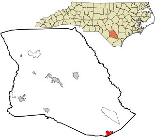
Conetoe is a 246-square-mile (640-square-kilometer) is a town in Edgecombe County, North Carolina, United States. It is part of the Rocky Mount, North Carolina Metropolitan Statistical Area. The population was 294 at the 2010 census.

<span class="mw-page-title-main">Saratoga, North Carolina</span> Town in North Carolina, United States

Saratoga is a town in Wilson County, North Carolina, United States. The population was 408 at the 2010 census.

<span class="mw-page-title-main">Lake View, South Carolina</span> Town in South Carolina, United States

Lake View is a town in Dillon County, South Carolina, United States. The population was 807 at the 2010 census.

<span class="mw-page-title-main">Humboldt, South Dakota</span> Town in South Dakota, United States

Humboldt is a town in Minnehaha County, South Dakota, United States. The population was 579 at the 2020 census.

<span class="mw-page-title-main">Calamus, Wisconsin</span> Town in Wisconsin, United States

Calamus is a town in Dodge County, Wisconsin, United States. The population was 1,005 at the 2000 census. The unincorporated community of South Beaver Dam is located in the town. The unincorporated community of Lost Lake is also located partially in the town.

Arcadia is a town in Trempealeau County, Wisconsin, United States. The population was 3,737 at the 2020 census. The unincorporated communities of Dewey Corners, North Creek, and Tamarack are located in the town. The ghost towns of Cortland and Williamsburg were also located in the town.

Arcadia Township is a civil township of Manistee County in the U.S. state of Michigan. As of the 2020 census, the township population was 657.

References

  1. "ArcGIS REST Services Directory". United States Census Bureau. Retrieved October 15, 2022.
  2. 1 2 U.S. Geological Survey Geographic Names Information System: Arcadia Lakes, South Carolina
  3. 1 2 "Census Population API". United States Census Bureau. Retrieved October 15, 2022.
  4. 1 2 "U.S. Census website". United States Census Bureau . Retrieved January 31, 2008.
  5. 1 2 "Geographic Identifiers: 2010 Demographic Profile Data (G001): Arcadia Lakes town, South Carolina". U.S. Census Bureau, American Factfinder. Archived from the original on February 12, 2020. Retrieved January 14, 2013.
  6. "Explore Census Data". data.census.gov. Retrieved December 13, 2021.