
Richland County is located in the U.S. state of South Carolina. As of the 2020 census, its population was 416,147, making it the second-most populous county in South Carolina, behind only Greenville County. The county seat and largest community is Columbia, the state capital. The county was established on March 12, 1785. Richland County is part of the Columbia, SC Metropolitan Statistical Area. In 2020, the center of population of South Carolina was located in Richland County, in the city of Columbia. The county is also the location of the geographic center of South Carolina, southeast of Columbia.
Evans is an unincorporated community and census-designated place (CDP) in Columbia County, Georgia, United States. It is a suburb of Augusta and is part of the Augusta metropolitan area. The population was 29,011 at the 2010 census, up from 17,727 at the 2000 census.
Long Lake is an unincorporated community and census-designated place (CDP) in Lake County, Illinois, United States. Per the 2020 census, the population was 3,663.
Seven Oaks is a census-designated place (CDP) in Lexington County, South Carolina, United States, 8 miles (13 km) northwest of downtown Columbia, the state capital. The population of the CDP was 15,144 at the 2010 census. It is part of the Columbia Metropolitan Statistical Area.
Brandywine Bay is a planned community and census-designated place (CDP) in Carteret County, North Carolina, United States. It was first listed as a CDP in the 2020 census with a population of 1,153.
New Hope is an unincorporated area and census-designated place (CDP) in Wayne County, North Carolina, United States. It was first listed as a CDP in the 2020 census with a population of 1,588.
Dovesville is an unincorporated community and census-designated place (CDP) in Darlington County, South Carolina, United States. It was first listed as a CDP prior to the 2020 census. Per the 2020 census, the population was 827.
Pine Ridge is an unincorporated community and census-designated place (CDP) in Darlington County, South Carolina, United States. It was first listed as a CDP prior to the 2020 census with a population of 807.
Ashwood is an unincorporated community and census-designated place (CDP) in Lee County, South Carolina, United States. It was first listed as a CDP prior to the 2020 census which showed a population of 116.
Keowee Key is a lakeside community and census-designated place (CDP) in Oconee County, South Carolina, United States. It is considered part of the Salem community. It was first listed as a CDP prior to the 2020 census with a population of 2,716.
South Union is an unincorporated community and census-designated place (CDP) in Oconee County, South Carolina, United States. It was first listed as a CDP prior to the 2020 census with a population of 341.
Cateechee is an unincorporated community and census-designated place (CDP) in Pickens County, South Carolina, United States. It was first listed as a CDP prior to the 2020 census. The population as of 2020 was 321.
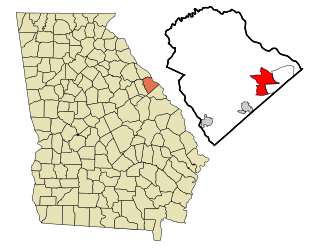
Arthurtown is an unincorporated community and census-designated place (CDP) in Richland County, South Carolina, United States. It was listed appeared as a CDP prior to the 2020 census. Its population in 2020 was 2,294.
Olympia is an urban unincorporated area and census-designated place (CDP) in Richland County, South Carolina, United States. It was first listed as a CDP prior to the 2020 census with a population of 1,087.
Ben Avon is an unincorporated area and census-designated place (CDP) adjacent to the city of Spartanburg in Spartanburg County, South Carolina, United States. It was first listed as a CDP prior to the 2020 census. The population as of 2020 was 2,428.
The Cliffs Valley is a resort community and census-designated place (CDP) in Greenville County, South Carolina, United States. It was first listed as a CDP prior to the 2020 census with a population of 736.
Camp Croft is an unincorporated area and census-designated place (CDP) in Spartanburg County, South Carolina, United States. It was first listed as a CDP prior to the 2020 census. The 2020 census lists a population of 2,110.
Hilltop is an unincorporated area and census-designated place (CDP) adjacent to the city of Spartanburg in Spartanburg County, South Carolina, United States. It was first listed as a CDP prior to the 2020 census with a population of 3,273.
Whitney is an unincorporated area and census-designated place (CDP) adjacent to the city of Spartanburg in Spartanburg County, South Carolina, United States. It was first listed as a CDP prior to the 2020 census with a population of 4,409.
Baxter Village is a planned community and census-designated place (CDP) in York County, South Carolina, United States. It was first listed as a CDP prior to the 2020 census which showed a population of 4,217.


