Bandipore district

Last updated

Bandipore
Bandpur
Bandipora, Bandipur
District of Jammu and Kashmir administered by India
Bandipora
Wular2.jpg
Wular Lake, largest freshwater lake in India
Bandipore district
Interactive map of Bandipore district
Kashmir region. LOC 2003626427 - showing Kashmir division administered by India in neon blue.jpg
Bandipore district is in Indian-administered Jammu and Kashmir in the disputed Kashmir region [1] It is in the Kashmir division (bordered in neon blue).
Coordinates(Bandipore): 34°25′12″N74°39′00″E / 34.42000°N 74.65000°E / 34.42000; 74.65000
Administering country India
Union Territory Jammu and Kashmir
Division Kashmir Division
Seat Bandipore
Government
   MLA Vacant (NA)
   District Development Council Chairman: Abdul Gani Bhat, V.C: Kaunser Shafeeq
Area
  Total345 km2 (133 sq mi)
  Urban
49.6 km2 (19.2 sq mi)
  Rural
295.4 km2 (114.1 sq mi)
Population
 (2011) [2]
  Total392,232
  Density1,100/km2 (2,900/sq mi)
Demonym(s) Bandiporia, Bandipuriya, Bandiporiyan, Bandporuek
Languages
  Official Kashmiri, Urdu, Hindi, Dogri, English [3] [4]
Time zone Indian Standard Time
Deputy commissioner Shakeel Ul Rehman Rather
Superintendent of Police Lakshya Sharma, IPS
Website bandipore.nic.in

Bandipore district (also spelt as Bandipora or Bandipur) is an administrative district of Indian-administered Jammu and Kashmir in the disputed Kashmir region. [1] It is one of the 20 districts in the Jammu and Kashmir. Bandipore town is the administrative headquarters of the district. Bandipore is located in the foothills of the snow-clad peaks of Harmukh overlooking the shores of Wular Lake and has produced hundreds of scholars and intellectuals.[ citation needed ] The district is known for its tourist places such as Wular Vintage Park, Athwatoo and Gurez valley. Before 1947, this town was a big trade and literary centre of Kashmir. This district was carved out from the erstwhile Baramulla district in 2007. The district is bounded by Kupwara district from the north, Baramulla district from west and Kargil district in Ladakh and Ganderbal district from the east. This district occupies an area of 398 km2. [5] The district has a population of 392,232 as per 2011 census.

Contents

Education

Some of the institutions and colleges of Bandipur which provide quality education to the students of district Bandipore.

Divisions

The district comprises seven tehsils: Ajas, Aloosa, Bandipore, Sumbal, Hajin, Gurez and Tulail. The district has three Vidhan Sabha constituencies: Gurez, Bandipore and Sonawari. All of these are part of Baramulla Lok Sabha constituency. The district comprises twelve community development blocks: Aloosa, Arin, Baktoor, Bandipore, Bonkoot, Ganastan, Gurez, Hajin, Naidkhai, Nowgam, Sumbal and Tulail.

Demographics

Religion in Bandipore district (2011) [6]
ReligionPercent
Islam
97.39%
Hinduism
2.15%
Other or not stated
0.46%
Sex Ratio in Bandipore District in 2011 Census. [6]
(no. females per 1,000 males)
Religion (and population)Sex Ratio
Muslim (pop 382,006)
926
Hindu (pop 8,439)
47
Other (pop 1,787)
378
Total (pop 392,232)
889

Languages of Bandipore district (2011) [7]

   Kashmiri (82.39%)
   Gojri (8.82%)
   Shina (4.18%)
   Pahari (1.91%)
   Urdu (1.27%)
  Others (1.43%)

According to the 2011 census Bandipore district has a population of 392,232, [8] roughly equal to the nation of Maldives. [9] This gives it a ranking of 561st in India (out of a total of 640). [8] The district has a population density of 1,117 inhabitants per square kilometre (2,890/sq mi) . [8] Its population growth rate over the decade 2001–2011 was 26.31%. [8] Bandipore has a sex ratio of 899 females for every 1000 males [8] (this varies with religion), and a literacy rate of 57.82%. [8]

Bandipore district: religion, gender ratio, and % urban of population, according to the 2011 Census. [6]
HinduMuslimChristianSikhBuddhistJainOtherNot statedTotal
Total8,439382,00657255544172597392,232
2.15%97.39%0.15%0.14%0.01%0.00%0.00%0.15%100.00%
Male8,061198,3223805204080349207,680
Female378183,68419235492248184,552
Gender ratio (% female)4.5%48.1%33.6%6.3%9.1%52.9%100.0%41.5%47.1%
Sex ratio
(no. of females per 1,000 males)
4792650567711889
Urban2,54962,557915018229265,361
Rural5,890319,44948150526150505326,871
 % Urban30.2%16.4%15.9%9.0%40.9%11.8%100.0%15.4%16.7%

At the time of the 2011 census, 82.39% of the population spoke Kashmiri, 8,82% Gojri, 4.18% Shina, 1.91% Pahari and 1.27% Hindi as their first language. [7]

See also

Related Research Articles

<span class="mw-page-title-main">Srinagar district</span> District of Jammu and Kashmir, India

The Srinagar District is an administrative district of Indian-administered Jammu and Kashmir in the disputed Kashmir region. It is one of the 20 districts of Jammu and Kashmir. Situated in the centre of the Kashmir Valley, it is the second-most populous district of the union territory after Jammu District as per the 2011 national census, and is home to the summer capital city of Srinagar. Likewise, the city of Srinagar also serves as the Srinagar District's headquarters.

<span class="mw-page-title-main">Anantnag district</span> District of Jammu and Kashmir, India

Anantnag district is an administrative district of Indian-administered Jammu and Kashmir in the disputed Kashmir region. It is one of ten districts which make up the Kashmir Valley. The district headquarters is Anantnag city. As of 2011, it was the third most populous district of Jammu and Kashmir, after Jammu and Srinagar.

<span class="mw-page-title-main">Baramulla district</span> District in Jammu and kashmir, India

Baramulla district or Varmul is one of the 20 districts in the Indian-administered union territory of Jammu and Kashmir in the disputed Kashmir region. Baramulla town is the administrative headquarters of this district. The district covered an area of 4,588 km2 (1,771 sq mi) in 2001, but it was reduced to 4,243 km2 (1,638 sq mi) at the time of 2011 census. In 2016, the district administration said that the area was 4,190 km2 (1,620 sq mi). Muslims constitute about 98% of the population.

<span class="mw-page-title-main">Pulwama district</span> District of Jammu and Kashmir administered by India

The Pulwama district is an administrative district of Indian-administered Jammu and Kashmir in the disputed Kashmir region. It is located to the south of Srinagar. Its district headquarters are situated in the city of Pulwama. It is located in the central part of the Kashmir Valley.

<span class="mw-page-title-main">Bagh District</span> District of Azad Kashmir administered by Pakistan

Bagh District is a district of Pakistan-administered Azad Kashmir in the disputed Kashmir region. It is one of the ten districts of Azad Jammu and Kashmir. Previously part of Poonch District, Bagh was established as a separate district in 1988.

<span class="mw-page-title-main">Poonch District, Pakistan</span> District of Azad Kashmir administered by Pakistan

Poonch District is a district of Pakistan-administered Azad Kashmir in the disputed Kashmir region. It is one of the 10 districts of this Pakistan-administered territory. It is bounded on the north by Bagh District, on the north-east by Haveli District, on the south-east by the Poonch District of Indian-administered Kashmir, on the south by Azad Kashmir's Sudhanoti and Kotli districts, and on the west by Rawalpindi District of Pakistan's Punjab Province. The Poonch District is part of the greater Kashmir dispute between India and Pakistan. The district headquarters is the city of Rawalakot. It is the third most populous district of Azad Kashmir.

<span class="mw-page-title-main">Baramulla</span> District in Jammu & Kashmir, India

Baramulla, also known as Varmul in Kashmiri, is a City and municipality of the Baramulla district of the Indian-administered Jammu and Kashmir in the disputed Kashmir region. It is also the administrative headquarters of the Baramulla district, located on the banks of the River Jhelum downstream from Srinagar, the summer capital of Jammu and Kashmir. The town is known as gateway of Kashmir, serving as the major distribution centre for goods arriving in Kashmir valley through the Jhelum valley cart road.

Pulwama is a city and notified area council in the Pulwama district of Indian-administered Jammu and Kashmir in the disputed Kashmir region. It is located approximately 25 kilometres (16 mi) south of the summer capital of the state, Srinagar.

<span class="mw-page-title-main">Anantnag</span> City administered by India. in Jammu and Kashmir

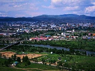
Anantnag, also called Islamabad, is the administrative headquarters of Anantnag district of Indian-administered Jammu and Kashmir in the disputed Kashmir region. It is located at a distance of 53 kilometres from the union territory's capital Srinagar. It is the third largest city in Jammu and Kashmir after Srinagar and Jammu with an urban agglomerate population of 159,838 and a municipal limit population of 109,433.

Bandipore or Bandipora is the headquarters of district of Bandipore in the union territory of Jammu and Kashmir, India. It is located on the northern banks of Wullar Lake—the second-largest freshwater lake in Asia. Bandipora has a terraced garden similar to that of Nishat Bagh in Srinagar. Bandipora is bound by mountains on three sides and by Wular Lake on the fourth. As per folklore, the name of Bandipora originated either from Bund of Wular as Bund e pur, from the local folk-singing bands (bāṇd) as Baand e pur or from the enclosed (band) geographical location as Bandh e pur.

<span class="mw-page-title-main">Kupwara district</span> District of Jammu and Kashmir administered by India

Kupwara district is an administrative district of Indian-administered Jammu and Kashmir in the disputed Kashmir region. It is one of the 10 districts located in the Kashmir Valley Division of Indian administered Kashmir. The Pohru River and Mawar river are two main rivers in the district. Both of them meet Jhelum river in Baramulla district.

<span class="mw-page-title-main">Budgam district</span> District of Jammu and Kashmir administered by India

Budgam district is an administrative district of Indian-administered Jammu and Kashmir in the disputed Kashmir region. Created in 1979 with its headquarters at the town of Budgam, it is the district with the largest population of Shia Muslims in the Kashmir valley.

<span class="mw-page-title-main">Neelum District</span> District of Azad Kashmir, Pakistan

Neelum is a district of Pakistan-administered Azad Kashmir in the disputed Kashmir region. It is the northernmost of 10 districts located within the Pakistani-administered territory of Azad Kashmir. Taking up the larger part of the Neelum Valley, the district had a population of around 191,000 people. It was among the worst-hit areas of Pakistan during the 2005 Kashmir earthquake.

<span class="mw-page-title-main">Hattian Bala District</span> District of Azad Kashmir, administered by Pakistan

Hattian Bala District is a district of Pakistan-administered Azad Kashmir in the disputed Kashmir region. The town of Hattian Bala is where the district headquarters are located. The Hattian Bala District was a part of the Muzaffarabad District until 2009 when it was made a separate district.

<span class="mw-page-title-main">Kashmir division</span> Administrative division in Indian-administered Jammu and Kashmir

The Kashmir division is a revenue and administrative division of the Indian-administered Jammu and Kashmir in the disputed Kashmir region. It comprises the Kashmir Valley, bordering the Jammu Division to the south and Ladakh to the east. The Line of Control forms its boundary with the Pakistani-administered territories of Gilgit−Baltistan and Azad Jammu and Kashmir to the north and west and west, respectively.

<span class="mw-page-title-main">Kharmang District</span> Administrative unit of Gilgit-Baltistan, Pakistan

Kharmang District is a district of Pakistan-administered Gilgit-Baltistan in the disputed Kashmir region. It is bounded on the north by the Skardu District, on the north-east by the Ghanche District, on the south by the Indian-administered Kargil and Leh districts, and on the west by the Astore District. Its district headquarters is at Tolti. Located in the district is the Kharmang Valley, which is one of the five main valleys in the Baltistan Division.

<span class="mw-page-title-main">Gilgit Division</span> Administrative division of Pakistan-administered Gilgit-Baltistan

Gilgit Division is an administrative division of Pakistan-administered Gilgit-Baltistan in the disputed Kashmir region. Gilgit is the divisional headquarters of Gilgit Division. Since divisions were restored as an administrative structure in 2008, the division currently consists of six districts:

<span class="mw-page-title-main">Sheeri, Baramulla</span> Village Block in Jammu & Kashmir, India

Sheeri is a village located in Baramulla district of Jammu and Kashmir, India. The village has two adjoining areas namely "Sheeri Bala" and "Sheeri Payeen". It is located ~10 km towards west from District headquarters Baramulla 52 km from State capital Srinagar. Sheeri is surrounded by Singhpora Tehsil towards East, Rohama Tehsil towards North, Kralpora Tehsil towards East, Boniyar Tehsil towards west.

Ajas is a village and tehsil located in Bandipora district of the Indian administered union territory of Jammu and Kashmir. The village is located at a distance of 21 kilometres from the district headquarters Bandipore. The village is situated on the banks of the famous and largest freshwater lake of India, the Wular Lake. Its circumference is partly bound by huge mountains and dense green forests. The is one of the wildlife area and only one wildlife range in Bandipora. There are hundreds of Wild Animals like, Leopard, Black Bear, Mask Dear and many other Wild Animals. A large stream flows through the village and is called the "BudKul".

<span class="mw-page-title-main">Patushay</span> Subarea in Qazipora Patushi in Jammu and Kashmir, India

Patushay, alternatively known as Potshai, stood as an independent village within the scenic Bandipora district of Jammu and Kashmir, India. Its fate intertwined with Qazipora, leading to the emergence of a consolidated community named Qazipora Patushi. Situated at a distance of 4 km from the bustling Bandipora town and 59 km from the vibrant city of Srinagar, Patushay owes its name to the amalgamation of "Poàt," signifying antiquity, and "Shay," representing a site rich in historical significance.

References

  1. 1 2 The application of the term "administered" to the various regions of Kashmir and a mention of the Kashmir dispute is supported by the tertiary sources (a) through (d), reflecting due weight in the coverage. Although "controlled" and "held" are also applied neutrally to the names of the disputants or to the regions administered by them, as evidenced in sources (f) through (h) below, "held" is also considered politicized usage, as is the term "occupied," (see (i) below).
    (a) Kashmir, region Indian subcontinent, Encyclopaedia Britannica, retrieved 15 August 2019 (subscription required) Quote: "Kashmir, region of the northwestern Indian subcontinent ... has been the subject of dispute between India and Pakistan since the partition of the Indian subcontinent in 1947. The northern and western portions are administered by Pakistan and comprise three areas: Azad Kashmir, Gilgit, and Baltistan, the last two being part of a territory called the Northern Areas. Administered by India are the southern and southeastern portions, which constitute the state of Jammu and Kashmir but are slated to be split into two union territories.";
    (b) Pletcher, Kenneth, Aksai Chin, Plateau Region, Asia, Encyclopaedia Britannica, retrieved 16 August 2019 (subscription required) Quote: "Aksai Chin, Chinese (Pinyin) Aksayqin, portion of the Kashmir region, at the northernmost extent of the Indian subcontinent in south-central Asia. It constitutes nearly all the territory of the Chinese-administered sector of Kashmir that is claimed by India to be part of the Ladakh area of Jammu and Kashmir state.";
    (c) "Kashmir", Encyclopedia Americana, Scholastic Library Publishing, 2006, p. 328, ISBN   978-0-7172-0139-6 C. E Bosworth, University of Manchester Quote: "KASHMIR, kash'mer, the northernmost region of the Indian subcontinent, administered partlv by India, partly by Pakistan, and partly by China. The region has been the subject of a bitter dispute between India and Pakistan since they became independent in 1947";
    (d) Osmańczyk, Edmund Jan (2003), Encyclopedia of the United Nations and International Agreements: G to M, Taylor & Francis, pp. 1191–, ISBN   978-0-415-93922-5 Quote: "Jammu and Kashmir: Territory in northwestern India, subject to a dispute betw een India and Pakistan. It has borders with Pakistan and China."
    (e) Talbot, Ian (2016), A History of Modern South Asia: Politics, States, Diasporas, Yale University Press, pp. 28–29, ISBN   978-0-300-19694-8 Quote: "We move from a disputed international border to a dotted line on the map that represents a military border not recognized in international law. The line of control separates the Indian and Pakistani administered areas of the former Princely State of Jammu and Kashmir.";
    (f) Kashmir, region Indian subcontinent, Encyclopaedia Britannica, retrieved 15 August 2019 (subscription required) Quote: "... China became active in the eastern area of Kashmir in the 1950s and has controlled the northeastern part of Ladakh (the easternmost portion of the region) since 1962.";
    (g) Bose, Sumantra (2009), Kashmir: Roots of Conflict, Paths to Peace, Harvard University Press, pp. 294, 291, 293, ISBN   978-0-674-02855-5 Quote: "J&K: Jammu and Kashmir. The former princely state that is the subject of the Kashmir dispute. Besides IJK (Indian-controlled Jammu and Kashmir. The larger and more populous part of the former princely state. It has a population of slightly over 10 million, and comprises three regions: Kashmir Valley, Jammu, and Ladakh.) and AJK ('Azad" (Free) Jammu and Kashmir. The more populous part of Pakistani-controlled J&K, with a population of approximately 2.5 million. AJK has six districts: Muzaffarabad, Mirpur, Bagh, Kodi, Rawalakot, and Poonch. Its capital is the town of Muzaffarabad. AJK has its own institutions, but its political life is heavily controlled by Pakistani authorities, especially the military), it includes the sparsely populated "Northern Areas" of Gilgit and Baltistan, remote mountainous regions which are directly administered, unlike AJK, by the Pakistani central authorities, and some high-altitude uninhabitable tracts under Chinese control."
    (h) Fisher, Michael H. (2018), An Environmental History of India: From Earliest Times to the Twenty-First Century, Cambridge University Press, p. 166, ISBN   978-1-107-11162-2 Quote: "Kashmir’s identity remains hotly disputed with a UN-supervised “Line of Control” still separating Pakistani-held Azad (“Free”) Kashmir from Indian-held Kashmir.";
    (i) Snedden, Christopher (2015), Understanding Kashmir and Kashmiris, Oxford University Press, p. 10, ISBN   978-1-84904-621-3 Quote:"Some politicised terms also are used to describe parts of J&K. These terms include the words 'occupied' and 'held'."
  2. "Archived copy" (PDF). www.censusindia.gov.in. Archived from the original (PDF) on 19 September 2013. Retrieved 9 August 2022.{{cite web}}: CS1 maint: archived copy as title (link)
  3. "The Jammu and Kashmir Official Languages Act, 2020" (PDF). The Gazette of India. 27 September 2020. Retrieved 27 September 2020.
  4. "Parliament passes JK Official Languages Bill, 2020". Rising Kashmir. 23 September 2020. Archived from the original on 24 September 2020. Retrieved 23 September 2020.
  5. Srivastava, Dayawanti; et al., eds. (2010). India 2010, A Reference Annual (PDF). New Delhi: Publications Division, Ministry of Information and Broadcasting, Government of Indiaand. p. 1142. ISBN   978-81-230-1617-7. Archived from the original (PDF) on 29 December 2010. Retrieved 21 January 2011.
  6. 1 2 3 C-1 Population By Religious Community – Jammu & Kashmir (Report). Office of the Registrar General & Census Commissioner, India. Retrieved 28 July 2020.
  7. 1 2 C-16 Population By Mother Tongue – Jammu & Kashmir (Report). Office of the Registrar General & Census Commissioner, India. Retrieved 18 July 2020.
  8. 1 2 3 4 5 6 "District Census 2011". Census2011.co.in. 2011. Retrieved 30 September 2011.
  9. US Directorate of Intelligence. "Country Comparison:Population". Archived from the original on 13 June 2007. Retrieved 1 October 2011. Maldives 394,999 July 2011 est.