Planning for Metro began with the Mass Transportation Survey in 1955, which attempted to forecast both freeway and mass transit systems sufficient to meet the needs of 1980.[1] In 1959, the study's final report included two rapid transit lines that anticipated downtown Washington subways.[2] Because the plan called for extensive freeway construction in Washington, D.C., alarmed residents lobbied for federal legislation creating a moratorium on freeway construction through July 1, 1962.[3] The National Capital Transportation Agency's 1962 Transportation in the National Capital Region report anticipated much of the present Blue Line route in Virginia with the route following the railroad right-of-way inside Arlington and Alexandria to Springfield.[4] It did not include a route in Prince George's County.[4] The route continued in rapid transit plans until the formation of WMATA.
With the formation of WMATA in October 1966, planning of the system shifted from federal hands to a regional body with representatives of Washington, D.C., Maryland, and Virginia. Congressional route approval was no longer a key consideration.[5] Instead, routes had to serve each local suburban jurisdiction to assure that they would approve bond referendums to finance the system.[6]
In March 1968, the WMATA board approved its 98-mile (158km) Adopted Regional System (ARS), which included the Blue Line from Huntington to Addison Road, with a possible extension to Largo.[11] The ARS contained a Blue Line/Orange Line station at Oklahoma Avenue between Stadium/Armory and the Anacostia River Bridge. Residents objected to a proposed 1,000-car commuter parking lot at that station and the traffic it would generate in the neighborhood. In reaction to their lobbying, the DC government insisted that the station be removed, and the tunnel for the line be extended through the neighborhood.Schrag 2006, p.161 This then made the line the only one to have a station canceled due to neighborhood opposition.[12] To be constructed as an above ground station in the parking lot north of RFK Stadium near Oklahoma Avenue, the station was canceled saving Metro $12million and the alignment of the line was shifted slightly to the east to address neighbor concerns.[12] To better accommodate tourists, a Smithsonian station exit was added to the Mall, and the federal government requested in 1972 that the Arlington Cemetery station be added to the Blue Line. The federal government paid the cost of both design changes.[13]
From its opening on November 20, 1978, until December 11, 1979, the Orange Line was co-aligned with the Blue Line from National Airport to Stadium-Armory, with the Orange Line continuing east from Stadium-Armory to New Carrollton.[20] Beginning December 1, 1979, the Orange Line diverged westward from Rosslyn to Ballston–MU when that extension opened.[21] The Blue and Orange Lines remain co-aligned from Rosslyn to Stadium-Armory and the Silver Line is co-signed along the same route as well.[22]
The Blue Line was originally planned to follow a slightly different route. The plan would have sent Blue Line trains to Huntington, with Yellow Line trains serving Franconia–Springfield. This was changed due to a shortage of rail cars at the time of the completion of the line to Huntington. Because fewer rail cars were required to operate the Yellow Line service than would be required to run the Blue Line service out to Huntington, the line designations were switched due to the Yellow Line's shorter route.[23] From 1999 to 2008, the Blue Line operated to Huntington on July 4, as part of Metro's special Independence Day service pattern.[24]
The ARS had the Blue Line end at Addison Road. However, sports fans continually argued for a three-mile (4.8km) extension to the Capital Centre sports arena in Largo, Maryland. On February 27, 1997, the WMATA board approved the construction of the extension.[15] By the time the extension opened in 2004, professional basketball and hockey had relocated to a new arena atop the Gallery Place station, and the Capital Centre was replaced with a shopping mall. However, the extension still drew considerable sports spectator traffic because it is within walking distance of the FedExField football stadium.[25] The extension cost $456million.[26]
In 1998, Congress changed the name of the Washington National Airport station to Ronald Reagan Washington National Airport, with the law specifying that no money be spent to implement the name change. As a result, WMATA did not change the name of the National Airport station (which never included the full name of the airport). In response to repeated inquiries from Republican congressmen that the station be renamed, WMATA stated that stations are renamed only at the request of the local jurisdiction. Because both Arlington County and the District of Columbia were controlled by Democrats, the name change was blocked. Not until 2001 did Congress make changing the station's name a condition of further federal funding.[27][28][29][30]
In May 2018, Metro announced an extensive renovation of platforms at twenty stations across the system. Blue and Yellow Lines south of Ronald Reagan Washington National Airport would be closed from May to September 2019, the most extended line closure in Metro's history to accommodate these platform reconstructions. All trains terminated at Ronald Reagan Airport as a result.[31][32][33][34]
Beginning on November 27, 2020, until March 14, 2021, Blue Line trains began serving Huntington and Eisenhower Avenue stations during most weekends due to Metro modernizing the signal system at Alexandria Rail Yard causing both Franconia–Springfield and Van Dorn Street stations to be closed. Additionally, trains operated to Huntington between December 20, 2020, and January 3, 2021, due to a complete closure at Alexandria Rail Yard. Metro chose to do a total shutdown instead of single tracking because completing the same work with weekend single tracking could more than double the time for completion while providing severely limited rail service with waits of up to 36 minutes between trains.[39] However work was completed three weeks earlier.
On June 15, 2022, WMATA announced that an additional Blue Line service called the Blue Plus will operate between Huntington and New Carrollton stations beginning on September 10, 2022, due to the 14th Street Bridge shutdown that suspended all Yellow Line service until May 7, 2023.[41][42] The Yellow Line resumed service on this date, but with its northeastern terminus truncated from Greenbelt to Mount Vernon Square.[43]
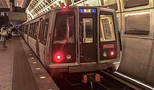
The southwestern terminal of the Blue Line is the Franconia–Springfield station located at the intersection of Frontier Drive and the Franconia-Springfield Parkway (Virginia Route 289). The line travels above ground along the CSX right of way, where it joins the Yellow Line just south of King Street in Old Town Alexandria. The joint line continues north along the CSX Railroad until it curves to the east on an elevated bridge adjacent to the National Airport terminal. The Blue Line (along with the Yellow Line) then enters a subway tunnel under 15th Street South in Crystal City and bends north under Hayes Street and then The Pentagon parking lots. The Blue Line separates from the Yellow Line in this tunnel and emerges on surface tracks that parallel Virginia Route 110 and serve Arlington Cemetery before entering a tunnel south of Rosslyn, where it merges with the Orange Line and Silver Line. The tunnel travels under North Lynn Street and then the Potomac River, where it bends east and travels under I Street NW. There is a non-revenue branch track on the westbound track that connects to the Northwest bound track before Farragut North on the Red Line between the Farragut West and McPherson Square stations. The tunnel bends south under 12th Street NW and crosses underneath the Red Line in the Metro Center station. The tunnel then turns east under D Street SW, passing under the Green and Yellow Lines at the L'Enfant Plaza station. The tunnel continues east under Pennsylvania Avenue SE, G Street SE, and Potomac Avenue SE. The Blue Line along with the Orange and Silver lines) bends north under 19th Street SE and transitions to an elevated line in the Robert F. Kennedy Memorial Stadium parking lot near Oklahoma Avenue NE. The Blue Line (along with the Orange and Silver Lines) crosses the Anacostia River on a bridge adjacent to Benning Road NE near RFK Stadium. At this point, the Blue and Silver Lines stay together but both would proceed to part ways with the Orange Line and enters a tunnel under Benning Road and East Capitol Street. The Blue Line (along with the Silver Line) become a surface or elevated route with short tunnels parallel to Central Avenue from Addison Road to the Eastern terminal at Largo, where it ends adjacent to the parking lots of "The Blvd" shopping center.[46]
In terms of WMATA's internal route designations, the Blue Line service travels along the entirety of the J Route (from the terminus at Franconia-Springfield to the C & J junction just south of King Street), part of the C Route (from the C & J junction just south of King Street to Metro Center), part of the D Route (from Metro Center to the D & G Junction just east of Stadium-Armory) and the entire G Route (from the D & G junction past Stadium-Armory to the terminus at Largo Town Center).[47] The Blue Line needs 23 six-car trains (138 rail cars) to run at peak capacity.[48]
Rush Plus
On June 18, 2012, Metro initiated its "Rush+" service plan, which had been under consideration for some time. This plan was intended to clear congestion at Rosslyn station, where the Blue and Orange lines meet and ultimately prepare the tracks to accommodate the Silver Line.[49] Under the plan, Blue Line trains continued on the usual route but some Yellow Line trains originated at Franconia–Springfield and were routed over the Fenwick Bridge to Greenbelt.[50] During rush hour, there were fewer Blue Line trains on the tracks which could mean potentially increased wait times for regular Blue Line customers. Furthermore, some Orange Line trains were routed to Largo Town Center until the Silver Line opened in 2014.[51]
Future
A second improvement project involves building a pedestrian tunnel to interconnect the Gallery Place station with Metro Center. A July 2005 study proposed connecting the eastern mezzanine of Metro Center with the western mezzanine of Gallery Place that are only one block apart. The proposed connection would reduce the number of passengers that use the Red Line to transfer between the Yellow Line and the Blue and Orange lines at Metro Center. As of 2011, the project remained unfunded.[52]
Built as a multi-level station due to geographic constraints, with trains heading south towards Huntington (Yellow Line) and Franconia–Springfield (Blue Line) on the lower level, and trains heading north towards Mount Vernon Square (Yellow Line) and Downtown Largo (Blue Line) on the upper level.
Out of station interchange (OSI) to the Red Line'sFarragut North station, which is located just one block away. There have been proposals to connect up the two stations through an underground passageway, though it has not been financed.
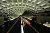
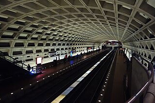
The Washington Metro, often abbreviated as the Metro and formally the Metrorail, is a rapid transit system serving the Washington metropolitan area of the United States. It is administered by the Washington Metropolitan Area Transit Authority (WMATA), which also operates the Metrobus service under the Metro name. Opened in 1976, the network now includes six lines, 98 stations, and 129 miles (208 km) of route.
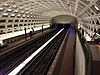
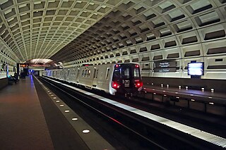
Foggy Bottom–GWU station is a Washington Metro station in the Foggy Bottom neighborhood of Washington, D.C., United States. The island-platformed station was opened on July 1, 1977, and is operated by the Washington Metropolitan Area Transit Authority (WMATA). Providing service for the Blue, Orange, and Silver Lines, the station is located on I Street on the George Washington University (GWU) campus. It is the last westbound station in the District of Columbia on these lines before they dive under the Potomac River to Virginia.
The Orange Line is a rapid transit line of the Washington Metro system, consisting of 26 stations in Fairfax County and Arlington in Northern Virginia; Washington, D.C.; and Prince George's County, Maryland, United States. The Orange Line runs from Vienna in Virginia to New Carrollton in Maryland. Half of the line's stations are shared with the Blue Line and over two thirds are shared with the Silver Line. Orange Line service began on November 20, 1978.
The Yellow Line is a rapid transit line of the Washington Metro system that runs between Huntington in Virginia and Mount Vernon Square in Washington, D.C. It consists of 13 stations in Fairfax County, the city of Alexandria, and Arlington County in Virginia, and Washington, D.C. It is the shortest line in the system, and since its truncation to Mount Vernon Square, it is the only line that does not enter Maryland.
East Falls Church station is an island platformed Washington Metro station in Arlington County, Virginia, on the Orange and Silver Lines. East Falls Church station is the last aboveground, at-grade, or open-cut station for eastbound trains. East of this station, the trains enter tunnels.
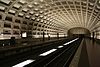
Rosslyn station is the westernmost station on the shared segment of the Blue, Orange, and Silver lines of the Washington Metro. It is located in the Rosslyn neighborhood of Arlington County, Virginia. Rosslyn is the first station in Virginia heading westward from Washington, D.C. on the Orange and Silver Lines and southward on the Blue Line. It is one of four interchange points on the Metrorail system west of the Potomac River and located in a growing business district.
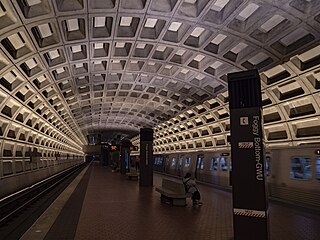
Farragut West station is a Washington Metro station in Downtown Washington, D.C., United States. The side-platformed station was opened on July 1, 1977, and is operated by the Washington Metropolitan Area Transit Authority (WMATA). Providing service for the Blue, Orange and Silver Lines, the station is located just west of Farragut Square with two entrances on I Street at 17th and 18th Streets NW.
Federal Triangle station is a Washington Metro station in Washington, D.C., United States. The island-platformed station was opened on July 1, 1977, and is operated by the Washington Metropolitan Area Transit Authority (WMATA). Providing service for the Blue, Orange, and Silver Lines, the station's entrance is beneath the William Jefferson Clinton Federal Building.
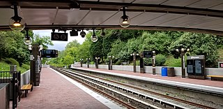
Franconia–Springfield station is a Washington Metro rapid transit station and Virginia Railway Express commuter rail station located in Springfield, Virginia, United States. The station is the southwestern terminus of the Metro Blue Line and an intermediate station on the VRE Fredericksburg Line. It is also a major bus terminal for Fairfax Connector buses, plus other local and intercity bus routes. The station has one island-platform serving the two Metro tracks, plus two side platforms serving the RF&P Subdivision on which the Fredericksburg Line runs.
Ronald Reagan Washington National Airport station is a Washington Metro station in Arlington, Virginia on the Blue and Yellow Lines. The station platform is elevated and covered and is the last above-ground station on the Yellow Line in Virginia, heading into Washington, D.C. It is one of only two stations in the system to have three tracks. The station is located across Smith Boulevard from Terminal 2 at Ronald Reagan Washington National Airport; the mezzanine is directly connected to Level 2 of the terminal by two pedestrian bridges. Airport shuttle buses or a walkway connect the station and Terminal 1. The airport's Abingdon Plantation historical site is near the station.
Pentagon station is a split platform station on the Washington Metro located adjacent to The Pentagon in Arlington, Virginia. The station was opened on July 1, 1977, and is operated by the Washington Metropolitan Area Transit Authority. Providing service for both the Blue and Yellow Lines, the station is where the two lines diverge and thus acts as a transfer point. Northbound, both lines rise above ground, with the Blue Line serving the Arlington Cemetery station, and the Yellow Line crossing the Potomac River into the District of Columbia.
Arlington Cemetery station is a side platformed Washington Metro station in Arlington, Virginia, United States. The station was opened on July 1, 1977, and is operated by the Washington Metropolitan Area Transit Authority (WMATA). The station provides service for only the Blue Line, and is located at the entrance to Arlington National Cemetery, underneath Memorial Drive. There is no public parking near the station except at the cemetery, which is reserved for cemetery visitors. It is the only station that closes earlier than the rest of the system, closing at 7 PM from October to March, and 10 PM from April to September.
Capitol South station is a Washington Metro station in the Capitol Hill neighborhood of Washington, D.C., United States. The island-platformed station was opened on July 1, 1977, and is operated by the Washington Metropolitan Area Transit Authority (WMATA). The station currently provides service for the Blue, Orange, and Silver Lines.
Stadium–Armory station is a Washington Metro station in Southeast, Washington, D.C. It is located at the border of the Barney Circle and Kingman Park neighborhoods. The station was opened on July 1, 1977, and is operated by the Washington Metropolitan Area Transit Authority (WMATA). Stadium–Armory serves the Blue, Orange and Silver Lines.
The Richmond, Fredericksburg, and Potomac Railroad was a railroad connecting Richmond, Virginia, to Washington, D.C. The track is now the RF&P Subdivision of the CSX Transportation system; the original corporation is no longer a railroad company.
The Silver Line is a rapid transit line of the Washington Metro system, consisting of 34 stations in Loudoun County, Fairfax County and Arlington County, Virginia, Washington, D.C., and Prince George's County, Maryland. The Silver Line runs from Ashburn in Virginia to Downtown Largo in Maryland. Five stations, from both lines' eastern terminus at Downtown Largo to Benning Road, are shared with the Blue Line alone; thirteen stations, from Stadium–Armory to Rosslyn, with both the Orange Line and Blue Lines; and five stations from Court House to East Falls Church with the Orange Line alone. Only the five stations of Phase 1, which began service on July 26, 2014, and the six stations of Phase 2, which began service on November 15, 2022, are exclusive to the Silver Line.
The Alexandria Canal was a canal in the United States that connected the city of Alexandria to Georgetown in the District of Columbia.
Metroway is a bus rapid transit (BRT) line operated by the Washington Metropolitan Area Transit Authority (WMATA) as part of their Metrobus system. It consists of a single line operating in Arlington and Alexandria, Virginia. It opened on August 24, 2014. It was the first bus rapid transit line to open in Virginia and in the Washington metropolitan area.
Van Dorn Street station is a Washington Metro station straddling the boundary between Fairfax County and the independent city of Alexandria in Virginia, United States. The station’s island platform lies in unincorporated Rose Hill in Fairfax County, while the station’s entrance and parking facilities are in Alexandria. The station was opened on June 15, 1991, and is operated by the Washington Metropolitan Area Transit Authority (WMATA). Providing service for only the Blue Line, the station is located at South Van Dorn Street and Eisenhower Avenue, next to the Capital Beltway. From 1991 to 1997 it was the southwestern terminus of the Blue Line.
↑ (1) Frank IBC (July 26, 2014). "Comments". The Metro plan has changed a lot since 1968. Greater Greater Washington. Archived from the original on June 28, 2017. Retrieved June 28, 2017. There used to be a rail line from Rosslyn to the Long Bridge, but that was replaced by the Blue Line. (2) 1942 map showing the Rosslyn Connecting Railroad, the planned route of Virginia State Route 110 (below the railroad), The Pentagon building and Arlington National Cemetery: "Plate 22". Plat Book of Arlington County, Virginia. Philadelphia, Pennsylvania: Franklin Survey Company. 1943. Retrieved October 25, 2019– via Historic Map Works, LLC. Residential Genealogy. (3) Maps and images of the area near the former route of the Rosslyn Connecting Railroad at the Arlington Cemetery Station of Metrorail's Blue Line (Coordinates: 38°53′03″N77°03′46″W / 38.884224°N 77.062888°W / 38.884224; -77.062888 (Arlington Cemetery Station of Metrorail's Blue Line in Arlington County, Virginia))
1 2 (1) "Certificate: Rosslyn Connecting Railroad Company - Virginia 1944". Scripophily.com. Archived from the original on June 28, 2017. Retrieved June 27, 2017. Continuing south in Virginia was the Alexandria and Washington Railroad, opened in 1857. The Baltimore and Potomac acquired this line after reaching it, operating it until 1901, when the Washington Southern Railway (the successor of the Alexandria and Washington) was taken over by the Richmond, Fredericksburg and Potomac Railroad, an independent bridge line owned equally by the PRR and five other railroads. Soon after, in 1904, the line from the Long Bridge to Rosslyn, built by the Washington Southern, was split off into the Rosslyn Connecting Railroad, owned by the PRR. (2) CSXvet (July 26, 2003). "Re: W&OD Railroad - Adjacent to Pentagon?". Nostalgia & History > W&OD Railroad. Trainorders.com. Archived from the original on July 1, 2017. Retrieved July 1, 2017– via Digicert.com. The railroad that ran past the Pentagon was the onetime Pennsylvania RR Rosslyn branch. This branch left the mainline at RO (for Rosslyn) tower at the south end of the bridge over the Potomac and basically followed the Potomac northwest to Rosslyn. Part of it was built on the bed of the old canal that connected Alexandria with the C&O Canal in Georgetown. (3) The Commission (1926). "Valuation Docket No. 160: Rosslyn Connecting Railroad Company: Appendix 1". Interstate Commerce Commission Reports: Decisions of the Interstate Commerce Commission of the United States (Valuation Reports): October 1925 — February 1926. 106. Washington, D.C.: Government Printing Office: 678. ISSN0083-1530. OCLC6392128. Retrieved October 26, 2019– via HathiTrust Digital Library. The grading is rather light. The most of the line follows along the route of an old disused canal and in constructing the roadbed the carrier used the canal grading as far as possible.
↑ (1) Wilson, William Bender (1899). History of the Pennsylvania Railroad Company: with Plan of Organization, Portraits of Officials and Biographical Sketches. Vol.1. Philadelphia: Henry T. Coates & Co. p.332. OCLC671596804. Retrieved June 27, 2017– via Google Books. The Washington Southern Railway extends from the junction of the Baltimore and Potomac Railroad at the south end of the Long Bridge, opposite Washington, D. C., to Quantico, Virginia, a distance of 32.12 miles. It has three branches — ....; and the Rosslyn branch from the south end of the Long Bridge to the south end of the Aqueduct at the village of Rosslyn, Va., opposite Georgetown, D. C., a distance of 1.13 miles. This latter branch was opened for business April 2, 1896. (2) 1900 map showing the Washington Southern Division of the Pennsylvania Railroad (formerly the Washington Southern Railway) inside the route of the "Old Alexandria Canal" within the "Arlington Reservation", between the Potomac River and the "National Cemetery": "Map of Alexandria County, Virginia for the Virginia Title Co". Alexandria, Virginia: The Company. 1900. Retrieved October 7, 2019– via Library of Congress website.
↑ Feaver, Douglas B. (July 1, 1977). "Today, Metro could be U.S. model". The Washington Post. p.A1. Archived from the original on July 1, 2017. Retrieved July 1, 2017. With the opening today of its 12-mile-long Blue Line from National Airport to RFK Stadium, Washington's Metro subway grows from a downtown demonstration line into the spine of a regional transportation system that could rival the Capital Beltway in its effect on Washington.
↑ Cooke, Janet (November 23, 1980). "Three new Metro stations have a festive first day". The Washington Post. p.D1.
↑ Staff Reporters (June 15, 1991). "Van Dorn Station to open". The Washington Post. p.B5.
↑ Tousignant, Marylou (June 27, 1997). "At last, Metro reaches end of the Blue Line; Franconia-Springfield station to begin service on Sunday". The Washington Post. p.B1.
↑ Dana, Rebecca (December 19, 2004). "Metro, Prince George's extend their reach; Two new Blue Line stations open, bringing passengers and economic potential". The Washington Post. p.C2.
↑ Eisen, Jack; John Feinstein (November 18, 1978). "City-County fanfare opens Orange Line; Ceremonies open new Orange Line". The Washington Post. p.D1.
↑ Feaver, Douglas B.; Sandra G. Boodman (December 2, 1979). "Area celebrates extension of Metrorail in Arlington". The Washington Post. p.C1.
↑ (1) Sun, Lena H. (February 11, 2008). "Metro Explores Rerouting Blue Line". The Washington Post. p.B-01. Retrieved June 2, 2011. (2) Graphic (February 12, 2008). "A New Direction for the Blue Line". The Washington Post. Retrieved June 2, 2011. (3) "Metro unveils new system map in preparation for Rush Plus: New rush service pattern begins June 18, 2012". Metro News Release. Washington Metropolitan Area Transit Authority. March 19, 2012. Rush Plus is designed to ease crowding, improve the commuting experience for Metrorail riders on the Orange, Blue, Green and Yellow lines, and prepare for the future Silver Line. .... Every third existing Blue Line train (three trains per hour in each direction) will now operate between Franconia-Springfield and Greenbelt via the Yellow Line bridge. These trains will be identified as Yellow Line trains. As a result, customers at Franconia-Springfield, Van Dorn Street, and stations from L'Enfant Plaza to Greenbelt will have new transfer-free trip options between certain stations.
↑ (1) "Metro unveils new system map in preparation for Rush Plus: New rush service pattern begins June 18, 2012". Metro News Release. Washington Metropolitan Area Transit Authority. March 19, 2012. Archived from the original on July 5, 2017. Retrieved July 5, 2017. Rush Plus is designed to ease crowding, improve the commuting experience for Metrorail riders on the Orange, Blue, Green and Yellow lines, and prepare for the future Silver Line. .... During each rush hour period, 18 new Orange Line trains — three per hour in each direction — will operate between Vienna and Largo Town Center. (2) Washington Metropolitan Area Transit Authority (May 22, 2014). "Gaining Momentum: FY2015 Approved Budget: Effective July 1, 2014"(PDF). p.IV-33. Archived from the original(PDF) on July 5, 2017. Retrieved June 5, 2017.
This page is based on this Wikipedia article Text is available under the CC BY-SA 4.0 license; additional terms may apply. Images, videos and audio are available under their respective licenses.